Hidden fault beneath Canada could trigger massive earthquake after 12,000 years of silence
Advanced satellite and lidar mapping has uncovered signs that the Tintina fault in Canada's Yukon may be primed for a powerful earthquake.

Breaking space news, the latest updates on rocket launches, skywatching events and more!
You are now subscribed
Your newsletter sign-up was successful
Want to add more newsletters?

Delivered daily
Daily Newsletter
Breaking space news, the latest updates on rocket launches, skywatching events and more!

Once a month
Watch This Space
Sign up to our monthly entertainment newsletter to keep up with all our coverage of the latest sci-fi and space movies, tv shows, games and books.

Once a week
Night Sky This Week
Discover this week's must-see night sky events, moon phases, and stunning astrophotos. Sign up for our skywatching newsletter and explore the universe with us!

Twice a month
Strange New Words
Space.com's Sci-Fi Reader's Club. Read a sci-fi short story every month and join a virtual community of fellow science fiction fans!
A long-overlooked geologic fault in Canada's remote north may be capable of producing a massive earthquake, according to new research.
The Tintina Fault, stretching about 620 miles (1,000 kilometers) from British Columbia to Alaska, was once thought to be inactive for at least 40 million years. Now scientists say it has a history of large ruptures within the last 2.6 million years and could do so again.
The study, led by researchers at the University of Victoria (UVic) identified an 81-mile (130-km) section of the fault near Dawson City where multiple past quakes have left their mark on the landscape. The team used high-resolution topographic data from satellites, aircraft and drones to detect fault scarps, narrow ridges formed when the ground shifts during an earthquake, that were previously hidden under dense forest and glacial deposits.
"Lidar and satellite data are incredibly important for this kind of work, and have revolutionized the field of paleoseismology," lead author Theron Finley told Space.com in an email. "There are many other cases in Canada and beyond where previously unrecognized faults have been discovered thanks to this technology."
Evidence of ancient, powerful earthquakes
By measuring how far landforms have been displaced, scientists pieced together the fault's recent activity. Glacial features 2.6 million years old have shifted sideways by about 0.62 miles (1 km), while features 132,000 years old are offset by 246 feet (75 meters). Significantly, features just 12,000 years old show no displacement at all.
This long, quiet period is not necessarily good news. Based on tectonic strain rates of about 0.008 to 0.03 inches (0.2 to 0.8 millimeters) per year, researchers estimate the fault has built up about 20 feet (6 meters) of slip deficit since its last major earthquake.
"Though our observations indicate a substantial slip deficit, we don't yet have a good sense of how frequently large ruptures occur on the Tintina fault," Finley said. "At this point we can't really say whether another rupture is likely in the short term, or in thousands of years."
To gain a better understanding of how often large earthquakes strike the Tintina fault, Finley said they plan to excavate a paleoseismic trench across it. This would allow the team to examine offset sediment layers and date past quakes, providing a clearer picture of the fault's recurrence rate.
How the fault moves
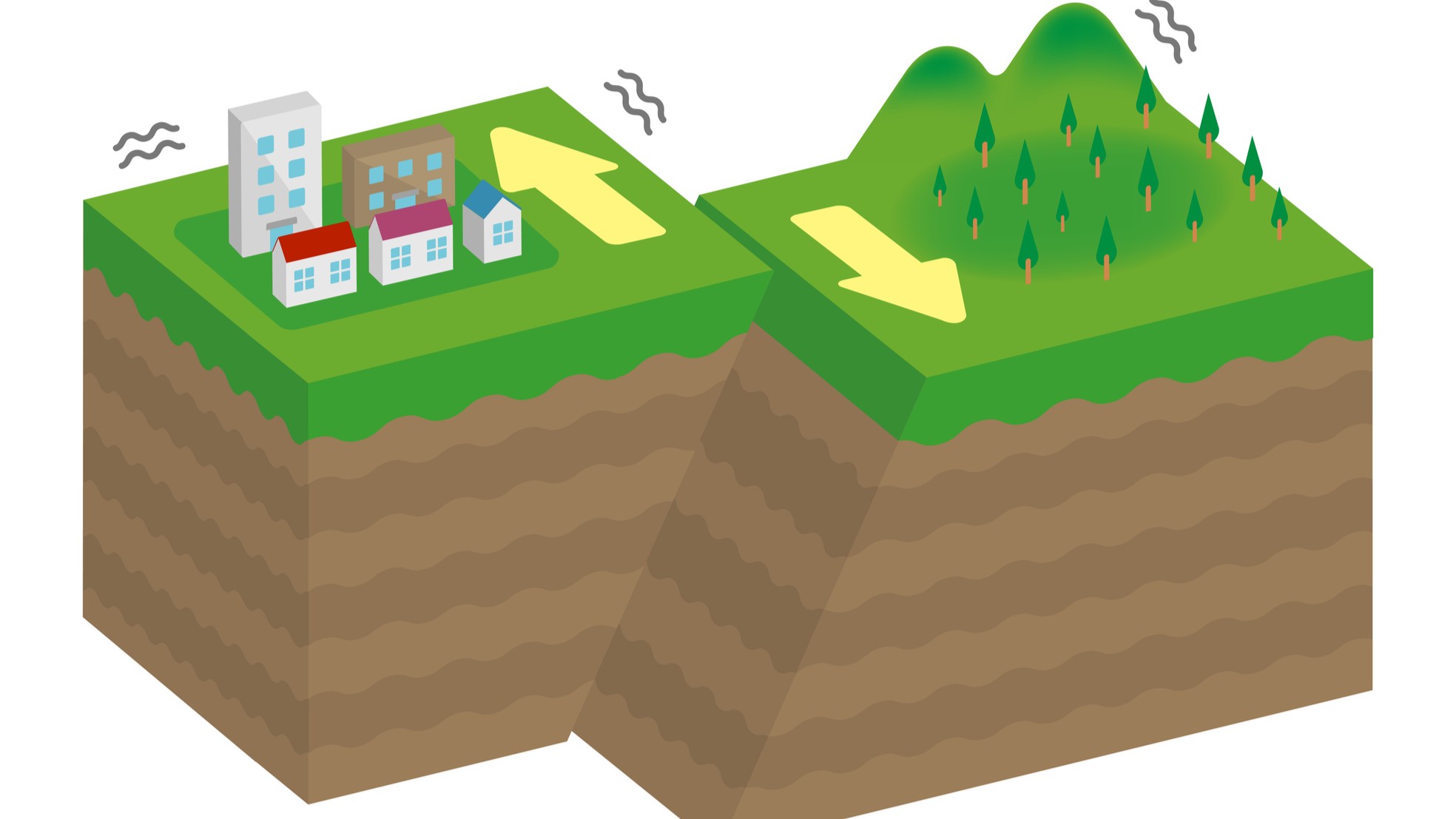
The Tintina fault is a right-lateral strike-slip fault, the same type as California's San Andreas fault, meaning the two sides of the fault grind past each other horizontally. This kind of fault can produce sudden, powerful shifts of several meters in a single event, releasing enormous amounts of stored energy.
But Finley stressed that while the Tintina fault extends about 620 miles (1,000 kilometers), the largest strike-slip ruptures in the world rarely exceed 186 miles (300 kilometers). "The entire length of the fault would not rupture all at once," he said. "However, our findings do motivate further scrutiny on other sections of the Tintina fault that might also prove to be active."
Breaking space news, the latest updates on rocket launches, skywatching events and more!
Risk to the Yukon and beyond
The team's analysis suggests a rupture on this section of the Tintina fault could exceed magnitude 7.5, strong enough to cause severe shaking in Dawson City, damage highways and mining operations, and trigger landslides. The Moosehide and Sunnydale landslides near Dawson City already show signs of instability.
Despite this, the Tintina fault is not currently listed as a separate seismic source in Canada's National Seismic Hazard Model (NSHM), which informs earthquake building codes and engineering standards. These findings will be incorporated into future updates and shared with local governments to improve emergency planning, according to the press release.
This study was published July 15, 2025, in the journal Geophysical Research Letters.

Daisy Dobrijevic joined Space.com in February 2022 having previously worked for our sister publication All About Space magazine as a staff writer. Before joining us, Daisy completed an editorial internship with the BBC Sky at Night Magazine and worked at the National Space Centre in Leicester, U.K., where she enjoyed communicating space science to the public. In 2021, Daisy completed a PhD in plant physiology and also holds a Master's in Environmental Science, she is currently based in Nottingham, U.K. Daisy is passionate about all things space, with a penchant for solar activity and space weather. She has a strong interest in astrotourism and loves nothing more than a good northern lights chase!
You must confirm your public display name before commenting
Please logout and then login again, you will then be prompted to enter your display name.

