Total Solar Eclipse 2017: Path, Viewing Maps and Photo Guide
Tennessee
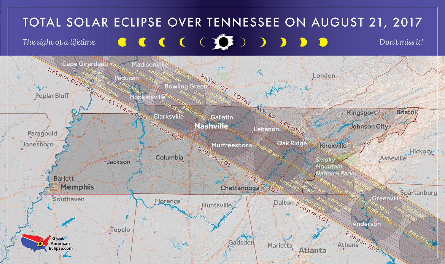
This map shows the path of the total solar eclipse through Tennessee on Aug. 21, 2017.
Georgia
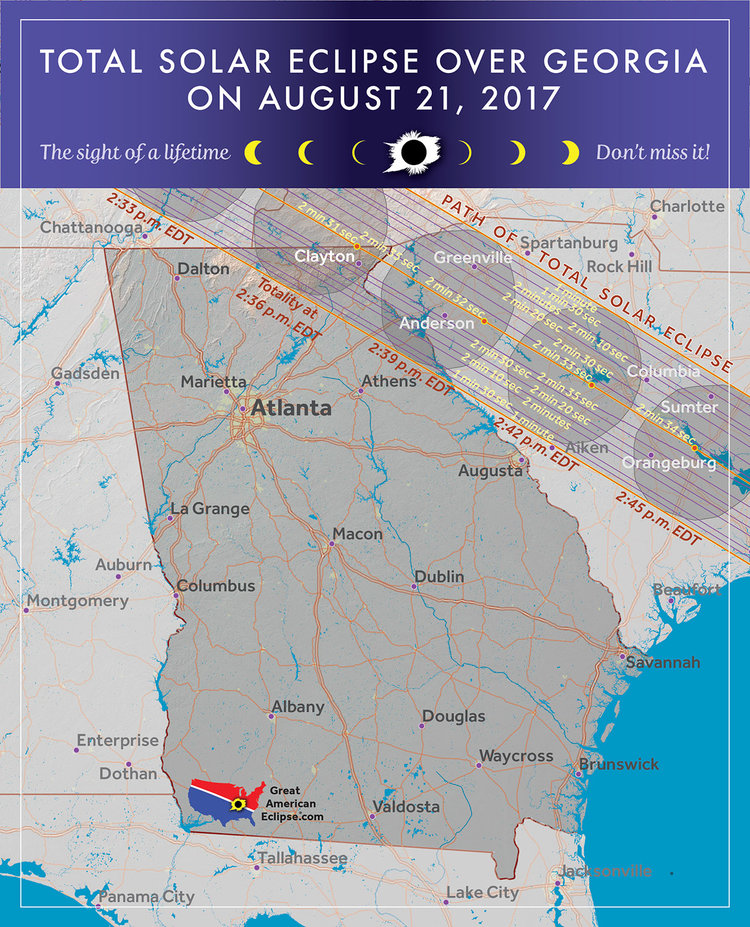
This map shows the path of the total solar eclipse through Georgia on Aug. 21, 2017.
South Carolina
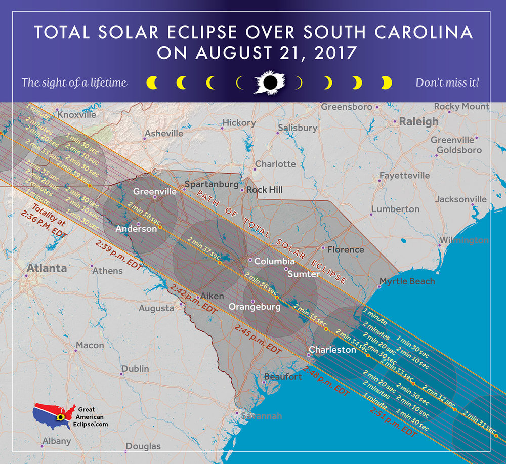
This map shows the path of the total solar eclipse through South Carolina on Aug. 21, 2017.
North Carolina
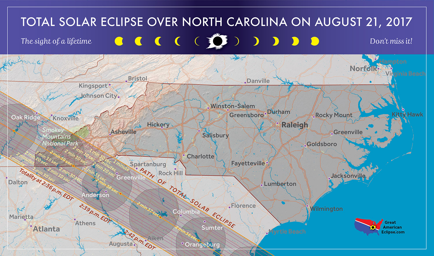
This map shows the path of the total solar eclipse through North Carolina on Aug. 21, 2017.
Total Solar Eclipse of Aug. 21, 2017
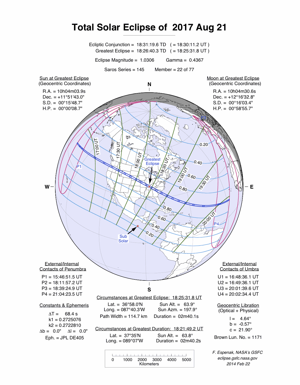
This map of the Great American total solar eclipse of 2017 shows the entire viewing range of the eclipse (including the partial eclipse), with the path of totality marked in blue. [Total Solar Eclipse 2017: When, Where and How to See It (Safely)]
Commemorative Eclipse Glasses & Poster
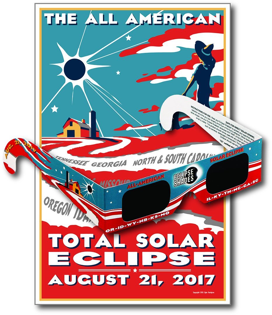
Eclipse glasses for the Great American Eclipse of Aug. 21, 2017 (5 Pack) with commemorative poster. These CE-certified glasses provide safe viewing of the solar eclipse. Buy on Amazon.
Guide to Solar Eclipses (Infographic)
How Solar Eclipses Work: When the moon covers up the sun, skywatchers delight in the opportunity to see a rare spectacle. See how solar eclipses occur in this Space.com infographic.
Breaking space news, the latest updates on rocket launches, skywatching events and more!
Great American Solar Eclipse of 2017 Map
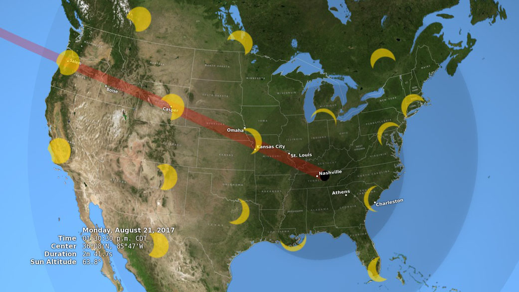
A view of the United States during the total solar eclipse of Aug. 21, 2017, showing the moon's central shadow, called the umbra (black oval) and outer shadow, the penumbra (concentric shaded ovals). Viewers in the umbra will see a total solar eclipse; those in the umbra will only see a partial eclipse. The path of the umbra is known as the path of totality (red). This maps includes images of the sun, showing the star's appearance during the eclipse in a number of locations, each oriented to the local horizon. [NASA Wants You To Get Set for the Great American Solar Eclipse of 2017]
Solar Eclipse Geometry
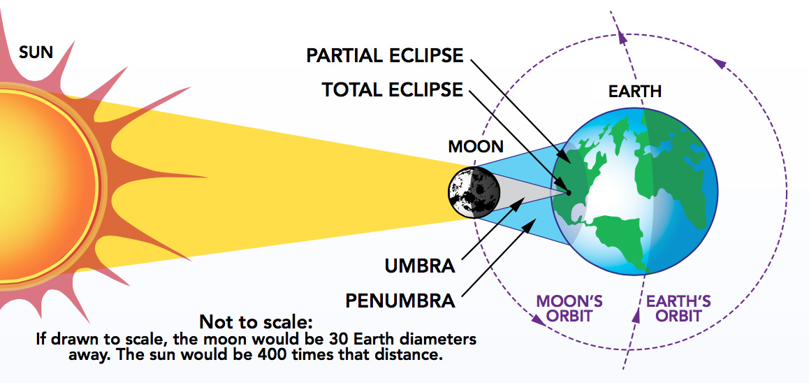
Graphic depicting the geometry of a total solar eclipse

Hanneke Weitering is a multimedia journalist in the Pacific Northwest reporting on the future of aviation at FutureFlight.aero and Aviation International News and was previously the Editor for Spaceflight and Astronomy news here at Space.com. As an editor with over 10 years of experience in science journalism she has previously written for Scholastic Classroom Magazines, MedPage Today and The Joint Institute for Computational Sciences at Oak Ridge National Laboratory. After studying physics at the University of Tennessee in her hometown of Knoxville, she earned her graduate degree in Science, Health and Environmental Reporting (SHERP) from New York University. Hanneke joined the Space.com team in 2016 as a staff writer and producer, covering topics including spaceflight and astronomy. She currently lives in Seattle, home of the Space Needle, with her cat and two snakes. In her spare time, Hanneke enjoys exploring the Rocky Mountains, basking in nature and looking for dark skies to gaze at the cosmos.
