An Australian start-up has launched two computers on small satellites to test in-orbit processing of Earth-observation images in hopes of making insights from space more accessible.
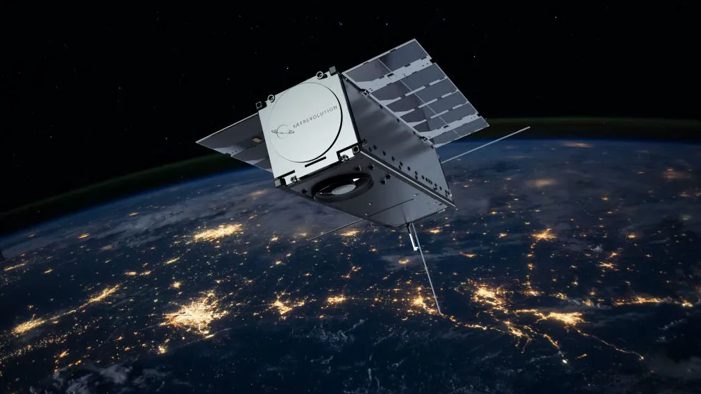
Sydney-based Spiral Blue launched two Space Edge Zero computers into low Earth orbit as part of Virgin Orbit's Tubular Bells Part One mission on June 30. The company's founders believe the technology could lead to ground-breaking applications that could in the future automatically track rogue ships in remote ocean areas, find lost planes and enable even the poorest farmers to benefit from views from above.
At the heart of the Space Edge Zero technology are powerful Jetson Nano chips built by the company Nvidia that are capable of running complex artificial-intelligence algorithms. About $120 each and barely 2.7 by 1.7 inches (7 by 4.5 centimeters) in size, the chips are lightweight enough yet sufficiently powerful to enable Spiral Blue to test space-based image processing for the first time.
Spiral Blue's CEO Taofiq Huq told Space.com that the computers, which were launched aboard two cubesats of Polisth company SatRevolution, could expand the use of Earth-observation data and bring down the cost of insights from space to make that knowledge affordable even for users in developing countries.
Related: Photos: Amazing images of Earth from space
Wasted images
"Today, satellites can't send down as much data as they can collect," Huq said. "It's like being in the middle of the countryside, not having a good mobile phone connection, and trying to upload photos somewhere."
The "photos uploaded by satellites" these days are processed by powerful computers on the ground. Intelligent algorithms can detect and count various features, such as the number of cars, the amount of solar panels or even cracks in water pipes. The problem is that a lot of images get wasted. Earth observation companies give priority to images of areas that sell well, Huq said, which leaves the less sought-after areas without access to data.
"If you're out in the middle of the countryside or in a second-tier city, you won't have access to those images," he said. "You will have to ask them to take an image especially for you, and that does get quite expensive."
Instead of sending down the large image files, Spiral Blue wants to send to the ground only the information the user actually needs.
"If you were sent to the countryside to, let's say, count sheep, you wouldn't try to take photos of each sheep and then send that back," Huq said. "You would just count them using your brain and then send that one number back. That's the idea."
Computers fit for space
Processing Earth-observation images in space has not been possible before because technology simply wasn't ready for the task. It's not just the size and weight of the computer hardware that has only gone down fairly recently, Huq said. Computers in space are exposed to extreme radiation that quickly damages electronic components. The electronics inside satellites also have to deal with high mechanical forces during launch and may need to survive temperature swings from 140 to minus 250 degrees Fahrenheit (60 to minus 160 degrees Celsius).
"Computers have always been difficult in space because of radiation effects," Huq said. "You can't just buy an Nvidia computer on Amazon and put it in space. It has to be radiation hardened, you need to have hardware that can handle the thermal problems — all these things can make it quite expensive and limit the processing power."
Spiral Blue will test how well the technology they built to protect their Nvidia-based computer works during the next few months after SatRevolution completes the commissioning of their satellites.
Apps in space
Huq said that ultimately, Blue Spiral would offer their platforms to developers of Earth-observation data-processing software to upload their apps onto the satellites, just like people put apps on their phones and computers.
Users could, for example, count solar panels in an area of interest or ships in remote regions of the ocean. Instead of downloading entire image sets, the satellite would only report the actual information. As a result, the satellite would be turning a higher number of images into marketable insights.
"The main advantage is that it should make the insights a lot cheaper," Huq said. "If we are able to massively increase the capacity of the satellites, we will spread the upfront cost across a larger amount of products, which would allow us to offer it at a much lower cost while still making money."
Now an Australian citizen, Huq was born in Bangladesh, a South Asian country that has struggled with extreme poverty. His vision is to make Earth-observation products so affordable that even small-scale farmers in his country of birth could take advantage of them.
"Whenever I visit Bangladesh, I go to the countryside and see all the subsistence farmers," Huq said. "And I think, you know, the U.S. Landsat or the European Sentinel program, these were all designed for Western countries. They're really not applicable for use in developing countries. If this works out, I want to be at a price point where even the poorest farmer can actually either use the information directly himself or herself or an agronomist can come in and provide that as a service in order to increase their prosperity."
Finding lost planes and tracking rogue ships
Spiral Blue has recently received a $416,250 grant from the Australian Space Agency to develop their space-based image processing technology. Previously, the company started working with Australian authorities on software called Vessel Detect that would autonomously find ships and other vessels in Australia's vast maritime territory.
"Australia has a massive maritime border," Huq said. "Something like 10% of the Earth's surface is inside of Australia's maritime domain. As a result, the country has massive problems with illegal fishing and drug smuggling."
While satellites regularly fly over the vast Australian waters, downloading the imagery they acquire during these passes is not effective.
"We've been doing some manual image processing for the project, going over images of the ocean to find ships," Huq said. "I think we looked at something like 400,000 images, and only 8,000 of those had actual ships in them. There is no money in taking pictures of the empty ocean. But there might be the one little ship somewhere that might be doing something unusual, or they might be in trouble, and you just miss them."
The app Spiral Blue hopes to develop would detect ships automatically aboard the satellites and send the data down for further processing to see which of the vessels might be operating illegally or off-course. The application could also help if another plane in the future goes missing in the vast ocean areas around the continent, as the Malaysia Airlines Flight 370 likely did in 2014. Even after an extensive search campaign that involved the use of cutting-edge subsea robots, no trace of the aircraft was found in the several-miles-deep ocean waters.
"Satellites definitely flew over the area where that plane landed," Huq said. "But at that time, no one could do anything about it."
Huq hopes that if the technology works, a whole constellation of small satellites fitted with Space Edge Computers could soon be circling Earth, not just constantly keeping an eye on the planet as other Earth-observation companies do, but also quickly providing insights without the burden of having to compete for scarce opportunities to download data.
Spiral Blue plans to send its next payload to space in December this year, again on a SatRevolution cubesat, Huq said The company has also signed a contract with Argentine-based Satellogic to launch a more powerful computer, based on the Nvidia Jetson Xavier NX chip, to space on a satellite with a 28-inch-per-pixel (70 cm) resolution in March 2022. The current payload aboard the two SatRevolution cubesats will process images with 16-feet-per-pixel (5 m) resolution.
Follow Tereza Pultarova on Twitter @TerezaPultarova. Follow us on Twitter @Spacedotcom and on Facebook.