Satellite captures destructive power of Hurricane Melissa | Space photo of the day for Nov. 17, 2025
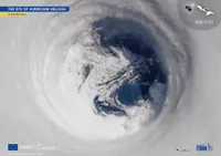
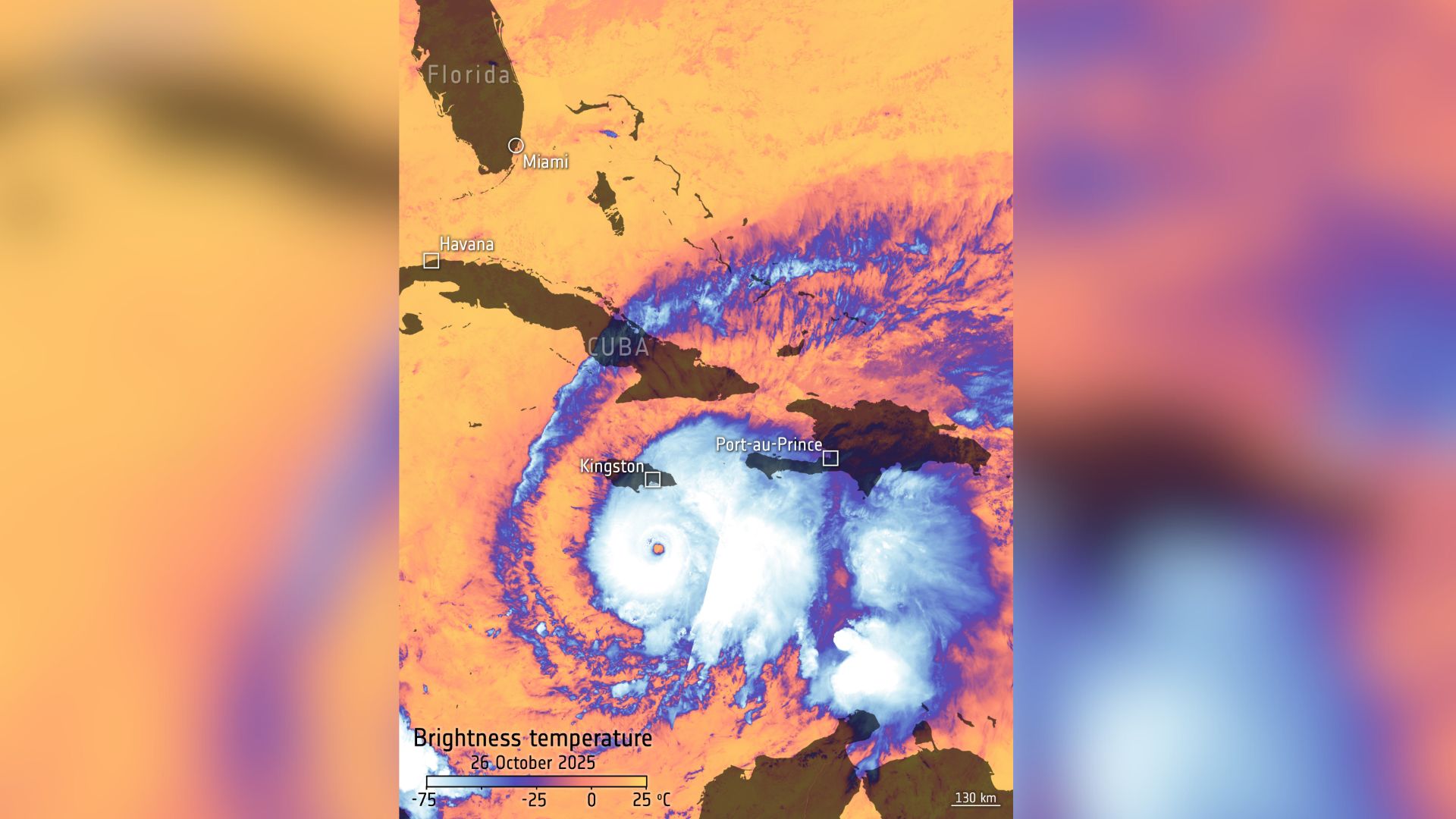
The image shows the difference in temperature between the top of a hurricane and the bottom.
Breaking space news, the latest updates on rocket launches, skywatching events and more!
You are now subscribed
Your newsletter sign-up was successful
Want to add more newsletters?

Delivered daily
Daily Newsletter
Breaking space news, the latest updates on rocket launches, skywatching events and more!

Once a month
Watch This Space
Sign up to our monthly entertainment newsletter to keep up with all our coverage of the latest sci-fi and space movies, tv shows, games and books.

Once a week
Night Sky This Week
Discover this week's must-see night sky events, moon phases, and stunning astrophotos. Sign up for our skywatching newsletter and explore the universe with us!

Twice a month
Strange New Words
Space.com's Sci-Fi Reader's Club. Read a sci-fi short story every month and join a virtual community of fellow science fiction fans!
Recently, Hurricane Melissa roared ashore in Jamaica, leaving behind a trail of destruction that is still being tallied. The storm struck as a Category 5 hurricane, bringing winds exceeding 185 mph (295 kph), torrential rainfall, and widespread flooding that crippled power grids and cut off communities across the island.
For scientists tracking storms like Melissa, the data suggests that modern hurricanes are getting stronger and more destructive. A primary cause seems to be human-driven global warming, which is increasing ocean temperatures, providing more fuel to monstrous hurricanes in the Atlantic.
What is it?
To understand how hurricanes are becoming more destructive, scientists use satellites and temperature maps, like this one taken by the European Space Agency's Copernicus Sentinel-3 to see the temperature differences in these powerful storms.
Hurricanes form over warm ocean surfaces, drawing immense energy from the heat and moisture of the sea. As these storms intensify, the difference between sea surface temperature and cloud-top temperature becomes more extreme, which Sentinel-3 can see as various thermal bands.
Where is it?
This image was taken above Jamaica in the Atlantic Ocean.
Why is it amazing?
The Copernicus program, created by the European Union and run by the European Space Agency, scans Earth with Sentinel satellites to study coastal changes, ocean temperature and other variables.
In this Sentinel-3 image, the stark temperature difference between the top of Hurricane Melissa and its bottom shows how it formed and how it continued to grow into a Category 5 storm. High-resolution images like this one can help explain why studying these storms is essential in forecasting, preparedness and looking ahead in our changing climate.
Breaking space news, the latest updates on rocket launches, skywatching events and more!
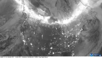
A powerful geomagnetic storm created a series of brilliant auroras recently for observers across North America.
The images reveal the storm's incredible power and offer vital insights into how such hurricanes form.
This satellite image reveals not only geological beauty but also the deep ties between landscape, climate and history in one of the world's driest deserts.
Want to learn more?
You can learn more about the Copernicus program and hurricanes.
Kenna Hughes-Castleberry is the Content Manager at Space.com. Formerly, she was the Science Communicator at JILA, a physics research institute. Kenna is also a freelance science journalist. Her beats include quantum technology, AI, animal intelligence, corvids, and cephalopods.
You must confirm your public display name before commenting
Please logout and then login again, you will then be prompted to enter your display name.
