Black Marble: Amazing Earth at Night Photos from Space
Breaking space news, the latest updates on rocket launches, skywatching events and more!
You are now subscribed
Your newsletter sign-up was successful
Want to add more newsletters?

Delivered daily
Daily Newsletter
Breaking space news, the latest updates on rocket launches, skywatching events and more!

Once a month
Watch This Space
Sign up to our monthly entertainment newsletter to keep up with all our coverage of the latest sci-fi and space movies, tv shows, games and books.

Once a week
Night Sky This Week
Discover this week's must-see night sky events, moon phases, and stunning astrophotos. Sign up for our skywatching newsletter and explore the universe with us!

Twice a month
Strange New Words
Space.com's Sci-Fi Reader's Club. Read a sci-fi short story every month and join a virtual community of fellow science fiction fans!
Moon Phases Over the Persian Gulf - Oct. 15
amount of moonlight decreases, some land surface features become harder to detect, but the lights from cities and ships become more obvious.
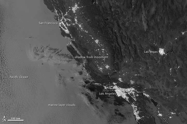
Marine Layer Clouds off the California Coast
On Sept. 27, 2012, the Visible Infrared Imaging Radiometer Suite (VIIRS) on the Suomi NPP satellite captured this nighttime view of low-lying marine layer clouds along the coast of California.
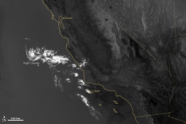
Marine Layer Clouds off the California Coast in Thermal Imaging
An irregularly-shaped patch of high clouds hovered off the coast of California, and moonlight caused the high clouds to cast distinct shadows on the marine layer clouds below. This image was acquired Sept. 27, 2012.
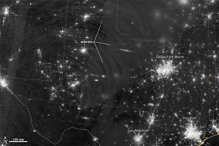
Waves in Airglow
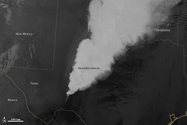
In April 2012, waves in Earth’s “airglow” spread across the nighttime skies of northern Texas like ripples in a pond. In this case, the waves were provoked by a massive thunderstorm.
Waves in Airglow
On April 15, 2012, waves in Earth’s “airglow” spread across the nighttime skies of northern Texas. Airglow is a layer of nighttime light emissions caused by chemical reactions high in Earth’s atmosphere. A variety of reactions involving oxygen, sodium, ozone and nitrogen result in the production of a very faint amount of light.
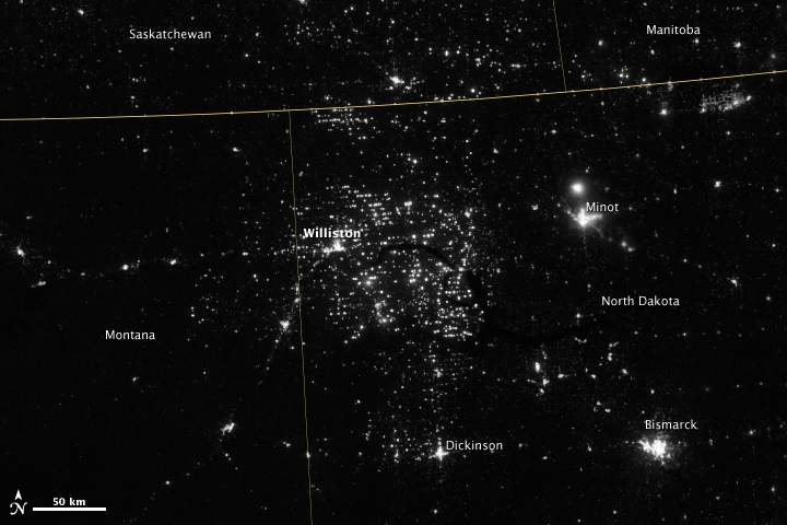
Gas Drilling, North Dakota
Northwestern North Dakota is one of the least-densely populated parts of the United States. Cities and people are scarce, but satellite imagery shows the area has been aglow at night in recent years. This image was taken Nov. 12, 2012.
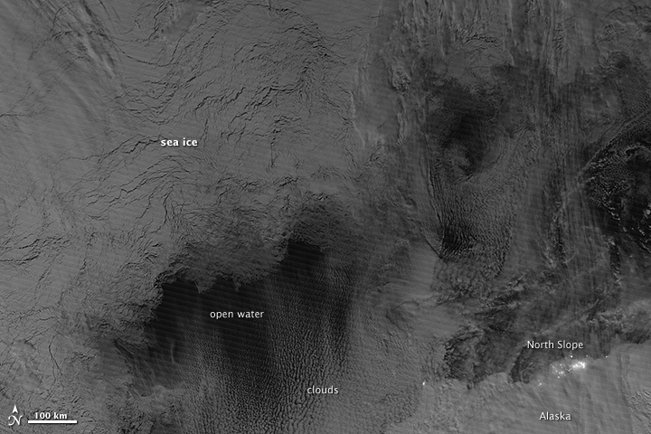
Monitoring the Arctic during Polar Darkness
Scientists watched the Arctic with particular interest in the summer of 2012, when Arctic sea ice set a new record low. VIIRS acquired this nighttime view of sea ice north of Russia and Alaska on October 30, 2012.
Breaking space news, the latest updates on rocket launches, skywatching events and more!
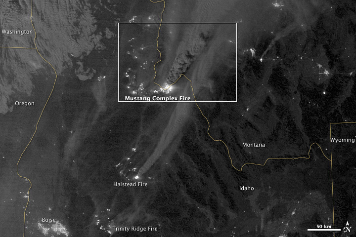
Mustang Complex Fires in Idaho
On Aug. 29, 2012, the Visible Infrared Imaging Radiometer Suite (VIIRS) on the Suomi NPP satellite captured this nighttime view of wildfires burning in Idaho and Montana.
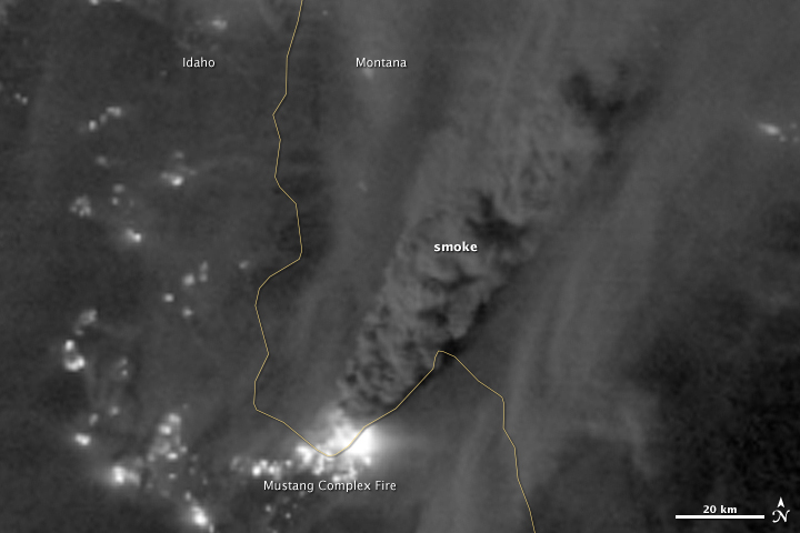
Mustang Complex Fires in Idaho Hot Spots
On Aug. 29, 2012, the Visible Infrared Imaging Radiometer Suite (VIIRS) on the Suomi NPP satellite captured this nighttime view of wildfires burning in Idaho and Montana. Numerous hot spots from the Mustang Complex Fire are visible in northern Idaho.
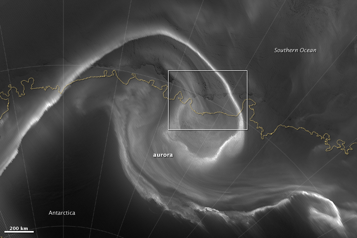
Auroras Light up the Antarctic Night
On July 15, 2012, the Visible Infrared Imaging Radiometer Suite (VIIRS) on the Suomi NPP satellite captured this nighttime view of the aurora australis, or “southern lights,” over Antartica’s Queen Maud Land and the Princess Ragnhild Coast.

Space.com is the premier source of space exploration, innovation and astronomy news, chronicling (and celebrating) humanity's ongoing expansion across the final frontier. Originally founded in 1999, Space.com is, and always has been, the passion of writers and editors who are space fans and also trained journalists. Our current news team consists of Editor-in-Chief Tariq Malik; Editor Hanneke Weitering, Senior Space Writer Mike Wall; Senior Writer Meghan Bartels; Senior Writer Chelsea Gohd, Senior Writer Tereza Pultarova and Staff Writer Alexander Cox, focusing on e-commerce. Senior Producer Steve Spaleta oversees our space videos, with Diana Whitcroft as our Social Media Editor.

