Black Marble: Amazing Earth at Night Photos from Space
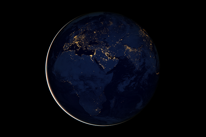
Africa, Europe &the Middle East
This new image of Europe, Africa, and the Middle East at night is a composite assembled from data acquired by the Suomi NPP satellite in April and October 2012. The new data was mapped over existing Blue Marble imagery of Earth to provide a realistic view of the planet.
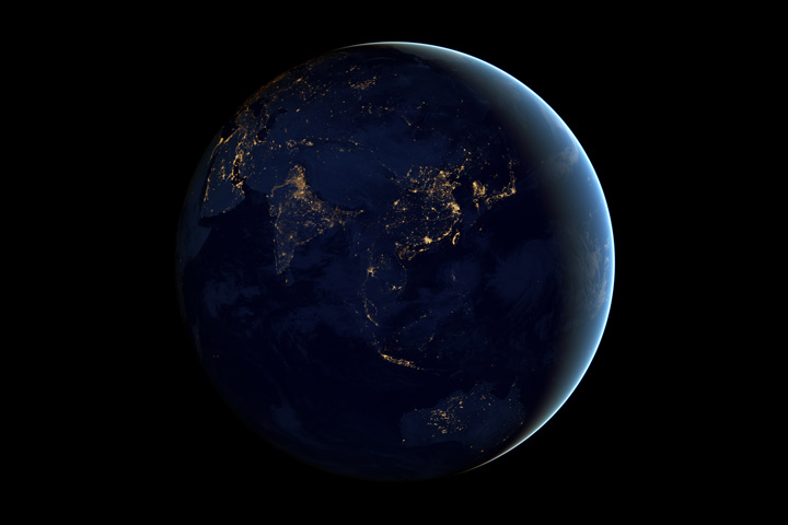
City Lights of Asia and Australia
This image of Asia and Australia at night is a composite assembled from data acquired by the Suomi NPP satellite in April and October 2012. The new data was mapped over existing Blue Marble imagery of Earth to provide a realistic view of the planet.
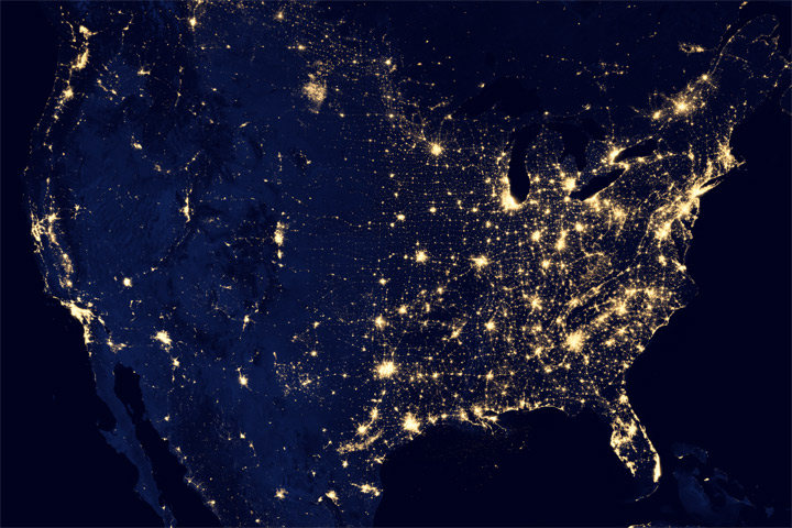
City LIghts of the United States
The image, taken April 18, 2012, was made possible by the new satellite’s “day-night band” of the Visible Infrared Imaging Radiometer Suite (VIIRS), which detects light in a range of wavelengths from green to near-infrared and uses filtering techniques to observe dim signals such as city lights, gas flares, auroras, wildfires, and reflected moonlight.
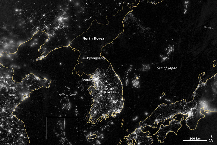
Korea and the Yellow Sea
As of July 2012, South Korea’s population was estimated at roughly 49 million people, and North Korea’s population was estimated at about half that number. But where South Korea is gleaming with city lights, North Korea has hardly any lights at all—just a faint glimmer around Pyongyang. This image was acquired Sept. 24, 2012.
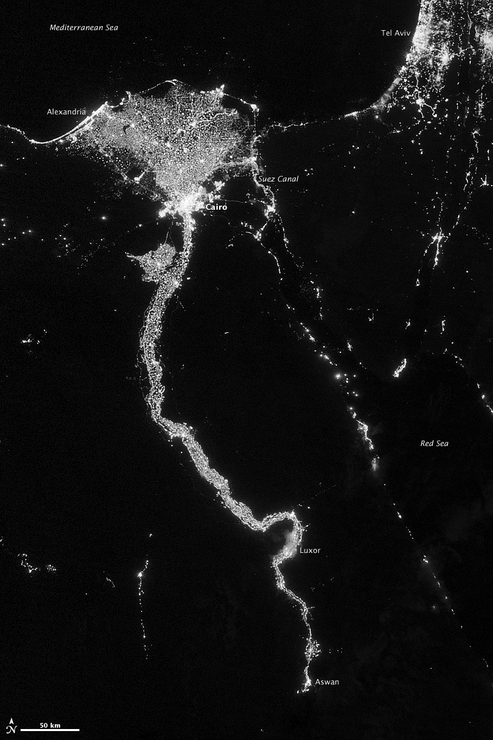
City Lights Illuminate the Nile
On Oct.13, 2012, the Visible Infrared Imaging Radiometer Suite (VIIRS) on the Suomi NPP satellite captured this nighttime view of the Nile River Valley and Delta.
Korea and the Yellow Sea at Night
On Sept. 24, 2012, the Visible Infrared Imaging Radiometer Suite (VIIRS) on the Suomi NPP satellite captured this nighttime view of the Korean Peninsula.
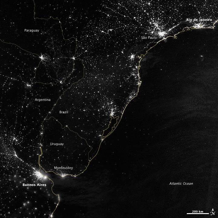
City Lights of South America’s Atlantic Coast
This image of part of the Atlantic coast of South America was acquired by the Suomi NPP satellite on the night of July 20, 2012.
Breaking space news, the latest updates on rocket launches, skywatching events and more!
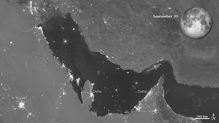
Moon Phases Over the Persian Gulf - September
The Visible Infrared Imaging Radiometer Suite (VIIRS) on the Suomi NPP satellite captured this nighttime view of the Persian Gulf region on Sept. 30, 2012.
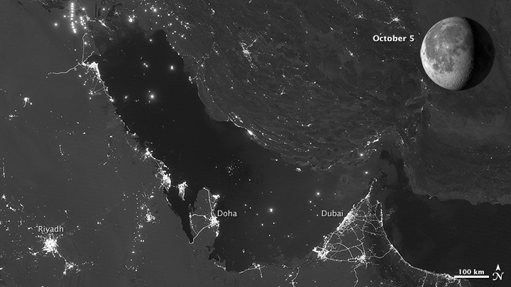
Moon Phases Over the Persian Gulf - Oct. 5
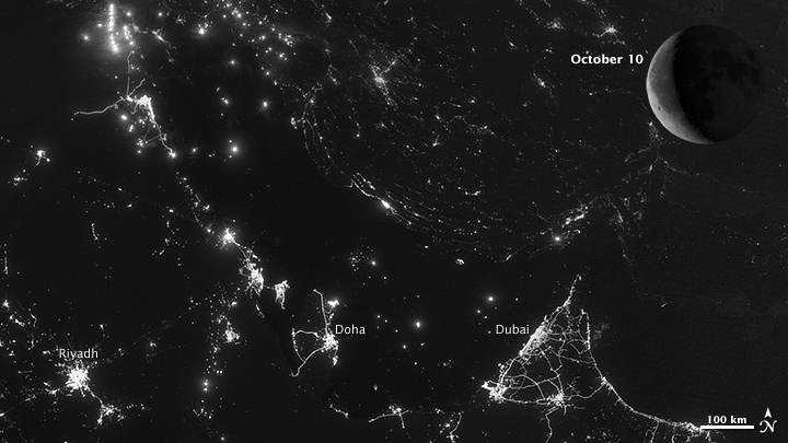
The Suomi NPP satellite captured these nighttime views of the Persian Gulf region on Oct. 5, 2012. As the amount of moonlight decreases, some land surface features become harder to detect, but the lights from cities and ships become more obvious.
Moon Phases Over the Persian Gulf - Oct. 10
The Visible Infrared Imaging Radiometer Suite (VIIRS) on the Suomi NPP satellite captured this nighttime view of the Persian Gulf region on Oct. 10, 2012.

Space.com is the premier source of space exploration, innovation and astronomy news, chronicling (and celebrating) humanity's ongoing expansion across the final frontier. Originally founded in 1999, Space.com is, and always has been, the passion of writers and editors who are space fans and also trained journalists. Our current news team consists of Editor-in-Chief Tariq Malik; Editor Hanneke Weitering, Senior Space Writer Mike Wall; Senior Writer Meghan Bartels; Senior Writer Chelsea Gohd, Senior Writer Tereza Pultarova and Staff Writer Alexander Cox, focusing on e-commerce. Senior Producer Steve Spaleta oversees our space videos, with Diana Whitcroft as our Social Media Editor.
