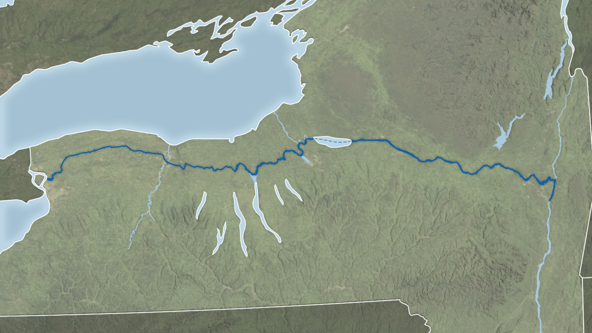
Erie Canal seen from space, is now 200 years old | Space photo of the day for Oct 1. 2025
Two centuries later, the canal is still one of the greatest engineering feats in American history.

Breaking space news, the latest updates on rocket launches, skywatching events and more!
You are now subscribed
Your newsletter sign-up was successful
Want to add more newsletters?

Delivered daily
Daily Newsletter
Breaking space news, the latest updates on rocket launches, skywatching events and more!

Once a month
Watch This Space
Sign up to our monthly entertainment newsletter to keep up with all our coverage of the latest sci-fi and space movies, tv shows, games and books.

Once a week
Night Sky This Week
Discover this week's must-see night sky events, moon phases, and stunning astrophotos. Sign up for our skywatching newsletter and explore the universe with us!

Twice a month
Strange New Words
Space.com's Sci-Fi Reader's Club. Read a sci-fi short story every month and join a virtual community of fellow science fiction fans!
2025 marks the bicentennial of the Erie Canal, and NASA's Earth Observatory commemorated the milestone with a satellite-based image tracing the canal's historic route across New York State.
What is it?
According to NASA's Earth Observatory, the image combines shoreline data with the "Blue Marble: Next Generation" base map, which is constructed from imagery collected by NASA's Moderate Resolution Imaging Spectroradiometer (MODIS) aboard Earth-scanning satellites.
Where is it?
This image was taken from orbit above the Erie Canal.
Why is it amazing?
The Erie Canal was one of the defining projects of early America. Construction was completed in 1825, despite the lack of trained engineers at the time. Builders, often self-taught and guided by trial and error, created what was dubbed the "Erie School of Engineering." They devised solutions to challenges such as the Niagara Escarpment near Lockport, where 83 locks were needed to manage the elevation changes, and they built aqueducts to carry the canal over rivers and streams.
Beyond its engineering feats, the canal spurred growth and settlement along its route. Cities like Rochester, Syracuse and Buffalo flourished, transforming from small towns into the industrial and commercial hubs they are today.
Want to learn more?
You can read more about NASA's Earth-scanning satellites and waterways across our globe.
Breaking space news, the latest updates on rocket launches, skywatching events and more!
Kenna Hughes-Castleberry is the Content Manager at Space.com. Formerly, she was the Science Communicator at JILA, a physics research institute. Kenna is also a freelance science journalist. Her beats include quantum technology, AI, animal intelligence, corvids, and cephalopods.
You must confirm your public display name before commenting
Please logout and then login again, you will then be prompted to enter your display name.

