Hurricane Irma in Photos: Space Views of a Monster Storm
Breaking space news, the latest updates on rocket launches, skywatching events and more!
You are now subscribed
Your newsletter sign-up was successful
Want to add more newsletters?

Delivered daily
Daily Newsletter
Breaking space news, the latest updates on rocket launches, skywatching events and more!

Once a month
Watch This Space
Sign up to our monthly entertainment newsletter to keep up with all our coverage of the latest sci-fi and space movies, tv shows, games and books.

Once a week
Night Sky This Week
Discover this week's must-see night sky events, moon phases, and stunning astrophotos. Sign up for our skywatching newsletter and explore the universe with us!

Twice a month
Strange New Words
Space.com's Sci-Fi Reader's Club. Read a sci-fi short story every month and join a virtual community of fellow science fiction fans!
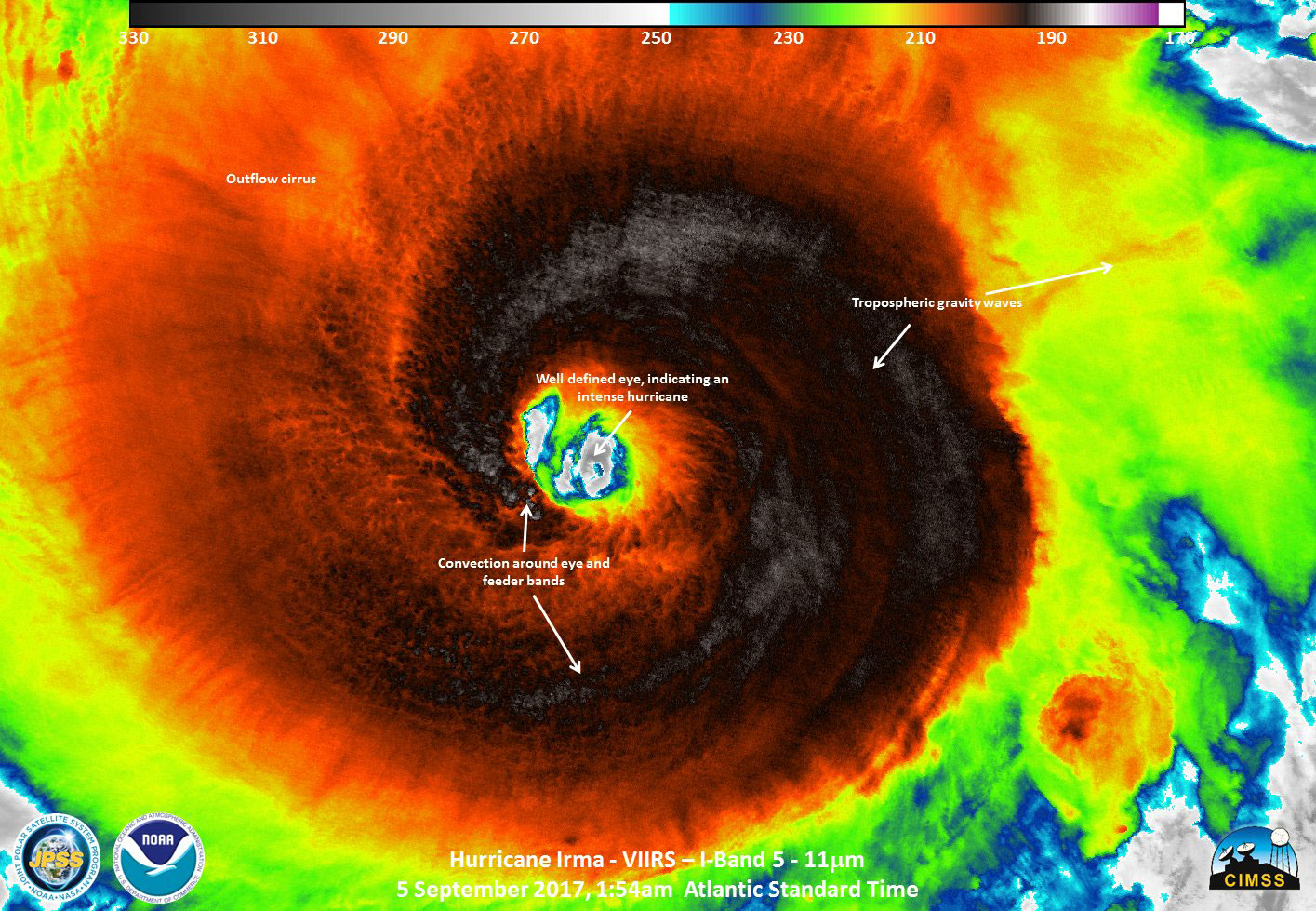
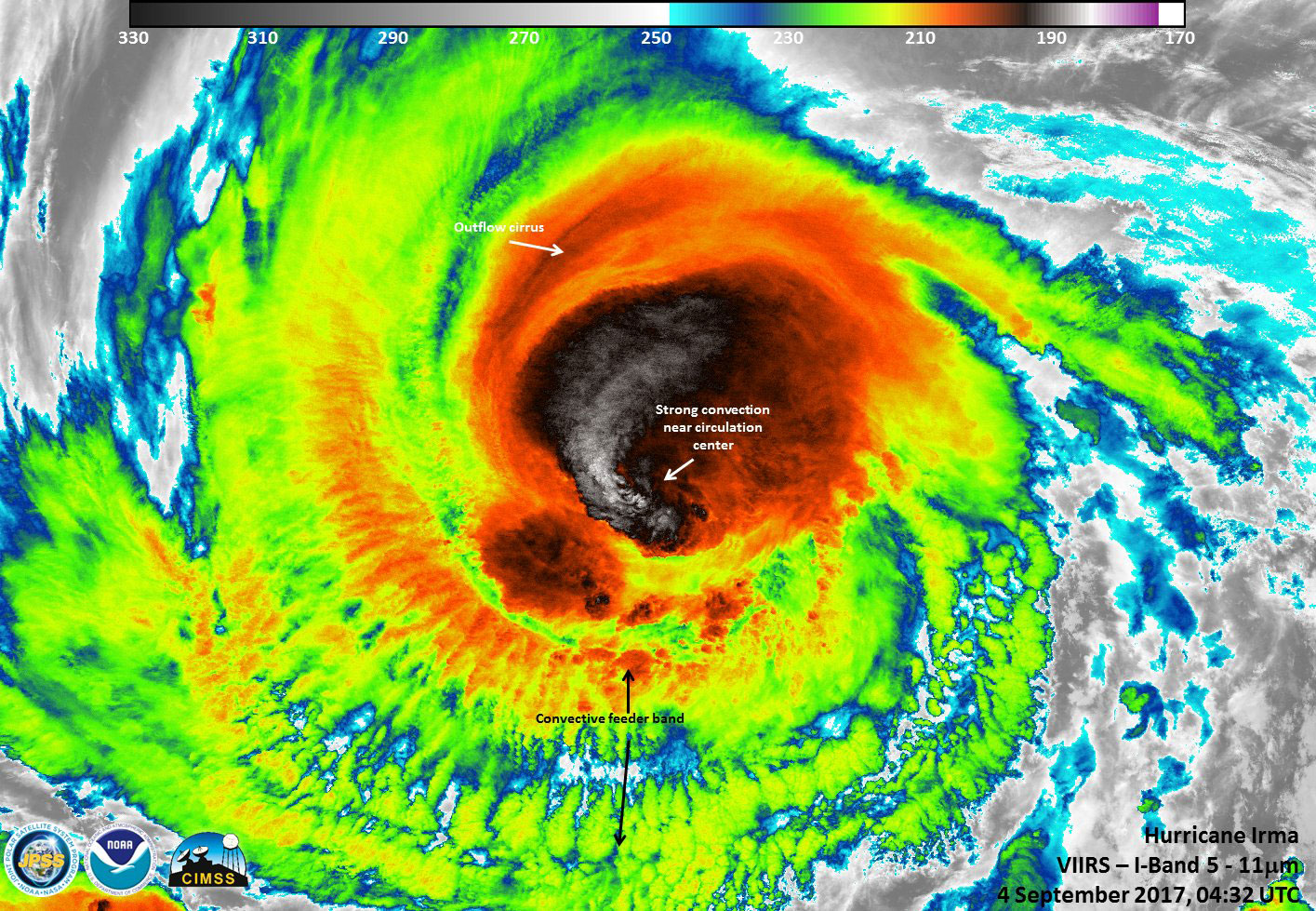
Power in Infrared
Hurricane Irma develops into an intense storm in this image by the NPP Suomi satellite on Sept. 4, 2017.
Growing in Strength
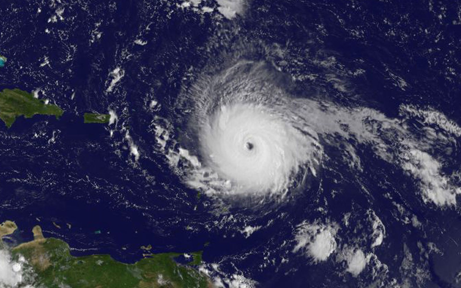
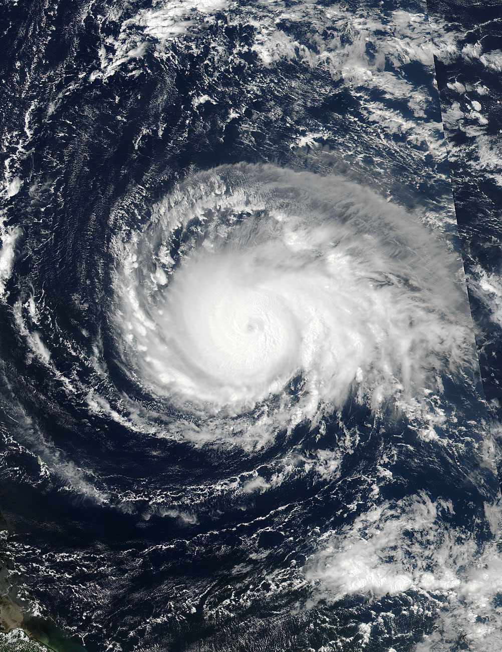
By 7:45 a.m. EDT on Sept. 5, Hurricane Irma was over the Central Atlantic Ocean and had grown into a Category 5 Hurricane.
Nasa-noaa-suomi-irma
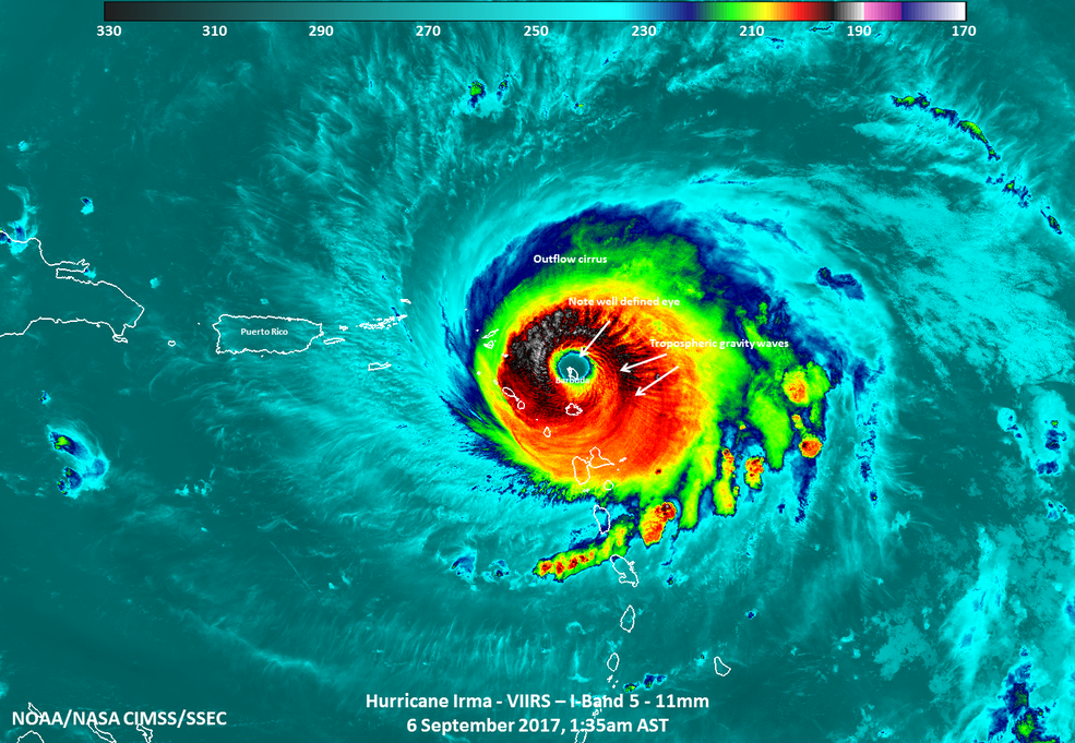
When NASA-NOAA's Suomi NPP satellite took this image of Hurricane Irma on Wednesday morning, the eye of the category 5 storm was directly over the Caribbean island of Barbuda.
Preparing for Possibiities
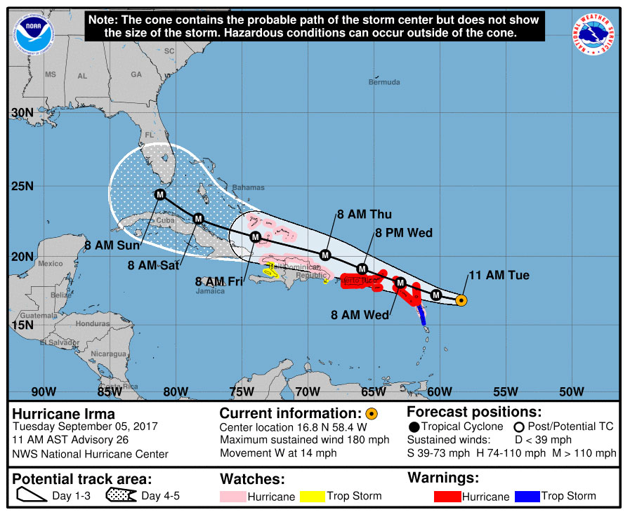
As of September 5, 2017, the National Weather Service has issued coastal watches for Hurricane Irma.
Upping the Ante
By Sept. 4, 2017, around 1:30 a.m. EDT, Hurricane Irma had developed into a Category 4 storm and is approaching the Leeward Islands.
Hurricane Irma
The Suomi NPP satellite captured this still image of Hurricane Irma on the morning of September 4, 2017.
Category 3 Storm
On September 4, 2017, around midnight, Hurricane Irma was a Category 3 storm as seen by the VIIRS instrument on Suomi.
Breaking space news, the latest updates on rocket launches, skywatching events and more!
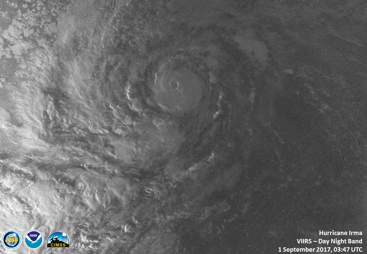
Savage Storm
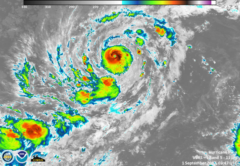
Overnight on Sept. 1, 2017, the Suomi NPP satellite's VIIRS instrument caught this image of Hurricane Irma showing a tight circulation in the eye of the storm.
Birth of a Monster
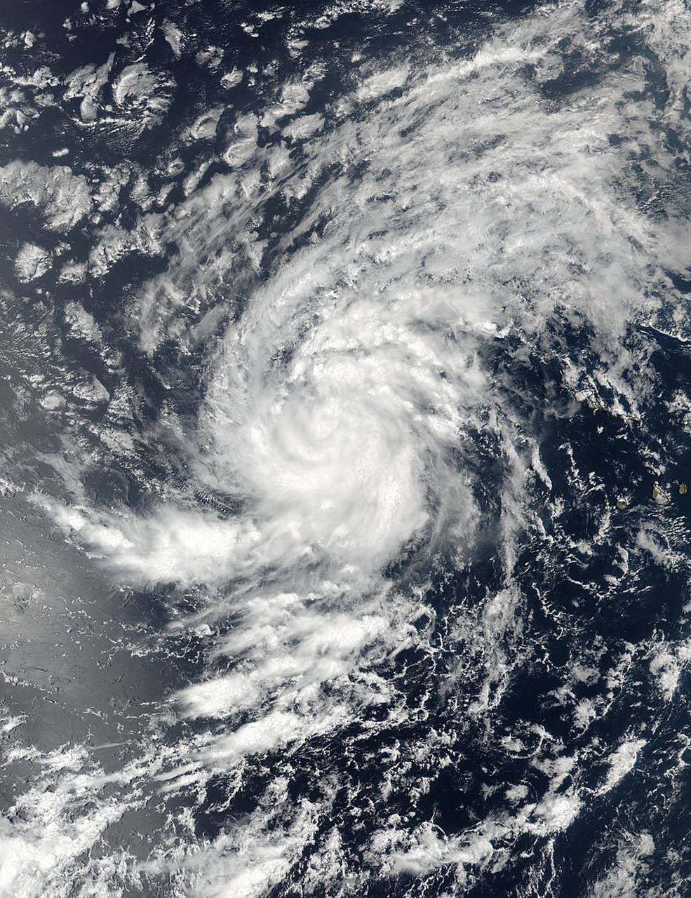
In the Eastern Atlantic Ocean on Aug. 30, 2017, NASA-NOAA's Suomi NPP satellite imaged a young Tropical Storm Irma.
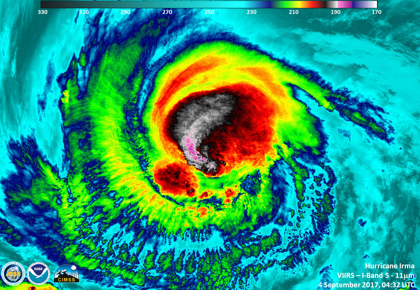
Storm of Storms
An image of Hurricane Irma in infrared displays the powerful storms around the eye of the storm.

Christine Lunsford joined the Space.com team in 2010 as a freelance producer and later became a contributing writer, covering astrophotography images, astronomy photos and amazing space galleries and more. During her more than 10 years with Space.com, oversaw the site's monthly skywatching updates and produced overnight features and stories on the latest space discoveries. She enjoys learning about subjects of all kinds.
