Hurricane Irma in Photos: Space Views of a Monster Storm
Breaking space news, the latest updates on rocket launches, skywatching events and more!
You are now subscribed
Your newsletter sign-up was successful
Want to add more newsletters?
Irma's Rainfall
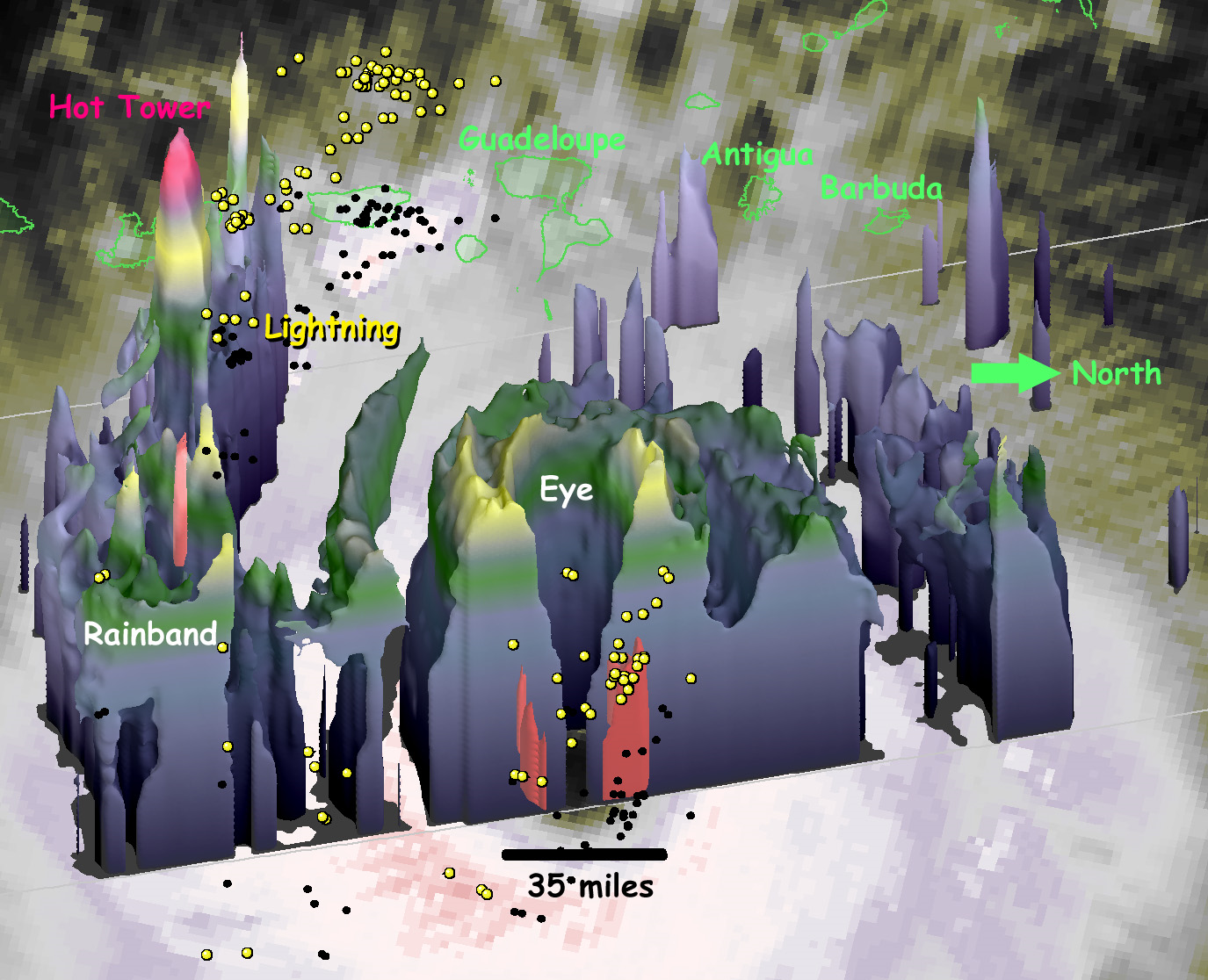
On Tuesday (Sept. 5) at 1 p.m. EDT (1700 UTC), the radar on the Global Precipitation Measurement (GPM) satellite captured this 3D view of the heat engine inside Hurricane Irma. The blue-gray region contains light precipitation, while the small, red regions at the base of the storm contain the heaviest precipitation.
Breaking space news, the latest updates on rocket launches, skywatching events and more!

Christine Lunsford joined the Space.com team in 2010 as a freelance producer and later became a contributing writer, covering astrophotography images, astronomy photos and amazing space galleries and more. During her more than 10 years with Space.com, oversaw the site's monthly skywatching updates and produced overnight features and stories on the latest space discoveries. She enjoys learning about subjects of all kinds.

