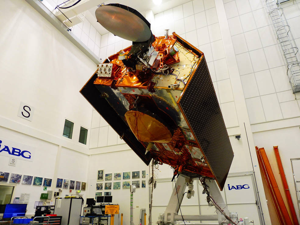
Two new satellites will launch this year to track Earth's rising oceans
Two new satellites will provide more detailed information about rising sea levels and other ocean changes on Earth.
Launching in November, the Sentinel-6/Jason Continuity of Service mission (Jason-CS) will be the longest-running Earth observation mission dedicated to studying the rising oceans. The spacecraft will provide the most sensitive water level measurements as it reveals details about rising oceans, helping to build nearly 40 years of sea level records.
A joint U.S.-European satellite mission, S6 follows in the footsteps of a trio of missions (TOPEX/Poseidon and Jason-1, Ocean Surface Topography/Jason-2, and Jason-3) that have measured how sea levels have risen over the past 30 years. The preceding spacecraft revealed that Earth's oceans rose by an average of 0.1 inches (3 millimeters) in the 1990s, increasing to 0.13 inches (3.4 mm) today.
Related: Earth Observing System: Monitoring the Planet's Climate
S6 will use two identical satellites (Sentinel-6A and Sentinel-6B) to continue that work by studying changes in ocean circulation, climate variability such as El Niño and La Niña, and weather patterns, including hurricanes and storms, in addition to rising oceans.
"Global sea level is, in a way, the most complete measure of how humans are changing the climate," Josh Willis, the mission's project scientist at NASA's Jet Propulsion laboratory in Pasadena, California, said in a statement.
"If you think about it, global sea level rise means that 70% of the Earth's surface is getting taller—70 % of the planet is changing its shape and growing. So it's the whole planet changing. That's what we're really measuring," Willis said.
Breaking space news, the latest updates on rocket launches, skywatching events and more!
Generations of change
Since the Industrial Revolution, widespread fossil fuel usage has dumped significant amounts of carbon dioxide and other greenhouse gases into Earth's atmosphere. Together, these gases have heated the planet's atmosphere to increasingly high levels.
As they cover the bulk of Earth's surface, the oceans help to stabilize the climate by absorbing over 90% of the heat trapped on the planet by excess greenhouse gas. As the water heats, it expands, increasing the volume of water. Trapped atmospheric heat also melts ice sheets and glaciers, contributing to the rising sea levels. Over the last 25 years, the rate at which the ocean levels rise has continued to increase.
Sentinel-6/Jason-CS consists of two spacecraft, Sentinel-6A and Sentinel-6B, which will launch five years apart. Sentinel-6A will launch next year from Vandenberg Air Force Base in California aboard a SpaceX Falcon 9 rocket. Its sister craft will launch in 2025.
Hovering 800 miles above the planet , the spacecraft will send pulses to Earth's surface and measure how long they take to return to the satellite, a process that will measure how much water vapor is present along the spacecraft's path. At the same time, Sentinel-6/Jason-CS will use GPS and ground-based lasers to find its position, along with a special network known as the Doppler Orbitography and Radiopositioning Integrated by Satellite (DORIS). Combined, the technology will measure the height of the ocean with an accuracy of about an inch.
Sentinel-6/Jason-CS will gather global ocean data every 10 days, which will help it to provide insights into large ocean features like El Niño events. Unlike its predecessors, the spacecraft will also be able to provide insights into smaller ocean features such as complex currents that will benefit navigation and fishing communities.
"Global sea level rise is one of the most expensive and disruptive impacts of climate change that there is," said Willis. "In our lifetimes, we're not going to see global sea level fall by a meaningful amount. We're literally charting how much sea level rise we're going have to deal with for the next several generations."
"Fossil fuel production and consumption began with coal – its first reported uses date as far back as 4000 B.C. in China where carving took place out of black lignite (one of the several forms of coal).1. However, large-scale combustion of coal is typically correlated with the period around the beginning of the Industrial Revolution."
"most of the emissions of human-caused (anthropogenic) greenhouse gases (GHG) come primarily from burning fossil fuels—coal, hydrocarbon gas liquids, natural gas, and petroleum—for energy use"
" In 2017, carbon dioxide (CO2) emissions from burning fossil fuels for energy were equal to about 76% of total U.S. anthropogenic GHG emissions (based on global warming potential) and about 93% of total U.S. anthropogenic CO2 emissions."
- Which Melting Glacier Threatens Your City the Most? NASA Tool Can Tell You
- New Sea-Level Rise Projection Raises Threat to World's Coasts
- How High Will Sea Levels Go by 2100?
Follow Nola on Facebook and on Twitter at @NolaTRedd. Follow us on Twitter @Spacedotcom and on Facebook.


Nola Taylor Tillman is a contributing writer for Space.com. She loves all things space and astronomy-related, and always wants to learn more. She has a Bachelor's degree in English and Astrophysics from Agnes Scott College and served as an intern at Sky & Telescope magazine. She loves to speak to groups on astronomy-related subjects. She lives with her husband in Atlanta, Georgia. Follow her on Bluesky at @astrowriter.social.bluesky

