Thanksgiving Nor'easter Seen from Space (Photos, Video)

Breaking space news, the latest updates on rocket launches, skywatching events and more!
You are now subscribed
Your newsletter sign-up was successful
Want to add more newsletters?
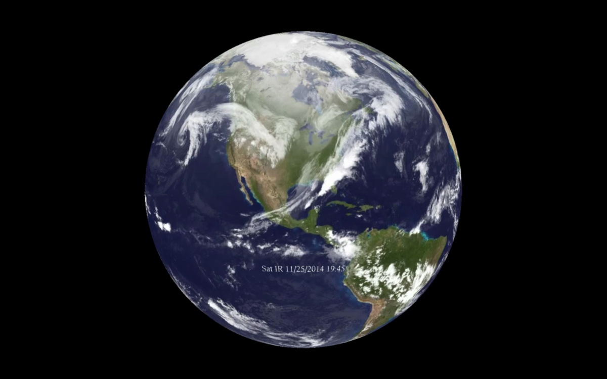
The National Oceanic and Atmospheric Administration's weather satellites captured the beginning of the nor'easter that is expected to wreak havoc for Thanksgiving travelers today (Nov. 26) with rain and snow.
In the satellite video, clouds can be seen forming along the path of the storm on Monday evening (Nov. 24; the date and time are displayed on the lower half of the screen). The video shows another group of clouds blowing over the Northeast on Sunday (Nov. 23) and Monday, but the Thanksgiving storm starts to take shape farther south, following a curved path that dips all the way down to Mexico.
The National Weather Association said in a statement that this will be a rapidly moving storm, and that most of the precipitation will fall in a 12-hour time frame. The storm is already dropping rain on Florida and will reach Canada's eastern provinces by Thanksgiving morning (Nov. 27).
Article continues belowRain and snow are expected to fall on all major East Coast cities, including Washington, D.C., Baltimore, Philadelphia, New York and Boston. NOAA reports that it expects 3 to 6 inches (7.6 to 15.2 centimeters) of snow in the Interstate 95 corridor, and 6 to 12 inches (15.2 to 30.5 cm) "further inland and over higher terrain, particularly in the southern Poconos and northwest New Jersey."
Nor'easters earn their name because "the winds over coastal areas blow from a northeasterly direction," according to NOAA's website. Nor'easters are cyclonic storms (meaning they rapidly spin in toward a central spot) that move up the East Coast of the United States. "Nor'easters may occur any time of the year, but are most frequent and strongest between September and April. These storms usually develop between Georgia and New Jersey within 100 miles of the coastline and generally move north or northeastward."
"The East Coast of North America provides an ideal breeding ground for nor'easters," according to NOAA. In winter, Arctic air is transported south and then east across the plains of the United States and Canada. The cold air bumps into warm air from the Gulf of Mexico and the Atlantic trying to move north. "This difference in temperature between the warm air over the water and cold Arctic air over the land is the area where nor'easters are born," the NOAA website said.
Follow Calla Cofield @callacofield. Follow us @Spacedotcom, Facebook and Google+. Original article on Space.com.
Breaking space news, the latest updates on rocket launches, skywatching events and more!

Calla Cofield joined Space.com's crew in October 2014. She enjoys writing about black holes, exploding stars, ripples in space-time, science in comic books, and all the mysteries of the cosmos. Prior to joining Space.com Calla worked as a freelance writer, with her work appearing in APS News, Symmetry magazine, Scientific American, Nature News, Physics World, and others. From 2010 to 2014 she was a producer for The Physics Central Podcast. Previously, Calla worked at the American Museum of Natural History in New York City (hands down the best office building ever) and SLAC National Accelerator Laboratory in California. Calla studied physics at the University of Massachusetts, Amherst and is originally from Sandy, Utah. In 2018, Calla left Space.com to join NASA's Jet Propulsion Laboratory media team where she oversees astronomy, physics, exoplanets and the Cold Atom Lab mission. She has been underground at three of the largest particle accelerators in the world and would really like to know what the heck dark matter is. Contact Calla via: E-Mail – Twitter
