


Eastern US Winter Storm Captured in Satellite Photo
The latest images from an Earth-watching satellite show frigid clouds veiling the eastern United States in a frightening sign of the snowstorm unfurling the region.
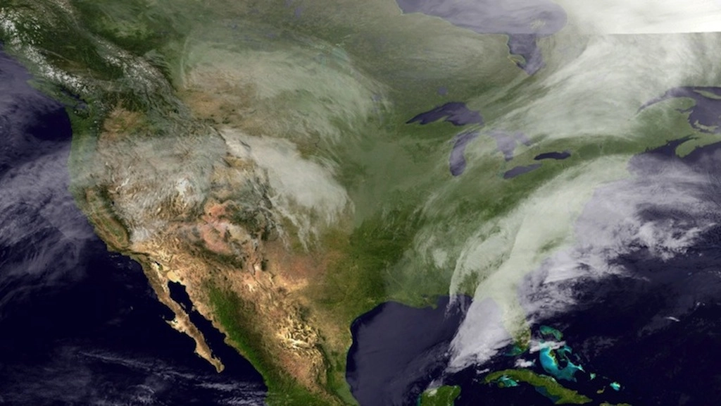
The GOES-East spacecraft, operated by the National Oceanic and Atmospheric Administration, captured this shot of the continental United States Wednesday (Feb. 12), as freezing rain, sleet, snow and strong winds, paralyzed travel across the Southeast.
Forecasters have warned that an inch of ice could coat parts of Georgia and South Carolina. In addition to creating dangerous driving conditions, those accumulations could be heavy enough to bring down trees and power lines. Already as of Wednesday afternoon, around 400,000 customers were without power in Georgia due to the storm, according to news reports.
Perched in a geostationary orbit, the GOES-East satellite keeps a constant watch over the same part of the globe. The spacecraft takes images of the Northern Hemisphere every half hour and then snaps a shot of the entire Western Hemisphere every three hours, according to NOAA. [Time Lapse Video: Major Winter Storm from Space]
The GOES-East satellite captured a foreboding image of the clouds dumping rain, sleet and snow over the South yesterday (Feb. 11) in the first blow of the storm, but conditions have worsened since then.
Traffic came to a halt and some people even abandoned their cars as snow fell on streets in North Carolina cities like Charlotte and Raleigh, according to local news reports. The scenes looked eerily similar to the epic traffic jams in Atlanta that left residents stranded on the roads for hours just two weeks ago when a bout of winter weather crippled the South.
The storm is expected to intensify as it barrels up the East Coast Wednesday night, dumping up several inches of snow in the areas around Washington, Baltimore, Philadelphia, New York, and Boston. Parts of the Northeast could see more than a foot of snow.
Winter storm warnings are in effect for much of the Eastern Seaboard. President Barack Obama has already declared a state of emergency in Georgia, which will give the state access to federal funds for response effects. Officials in Alabama, South Carolina, Maryland, Virginia and North Carolina have made state-level emergency declarations.
Follow Megan Gannon on Twitter and Google+. Follow us @livescience, Facebook & Google+. Original article on Live Science.
