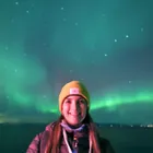
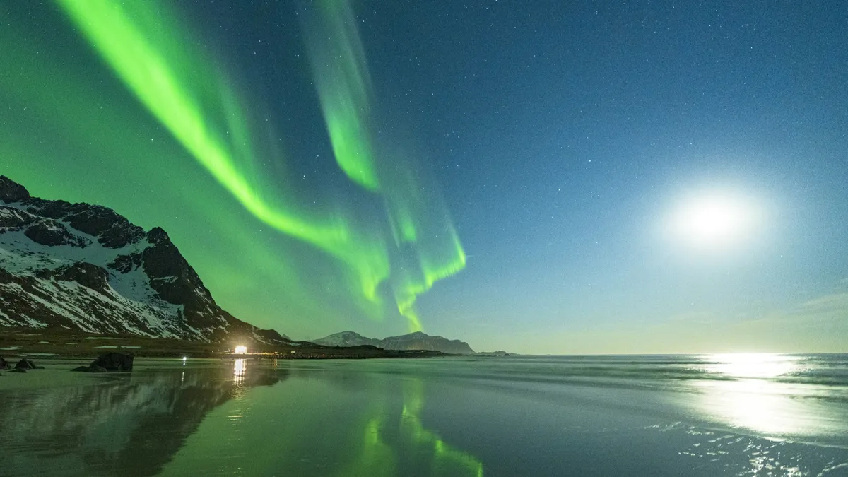
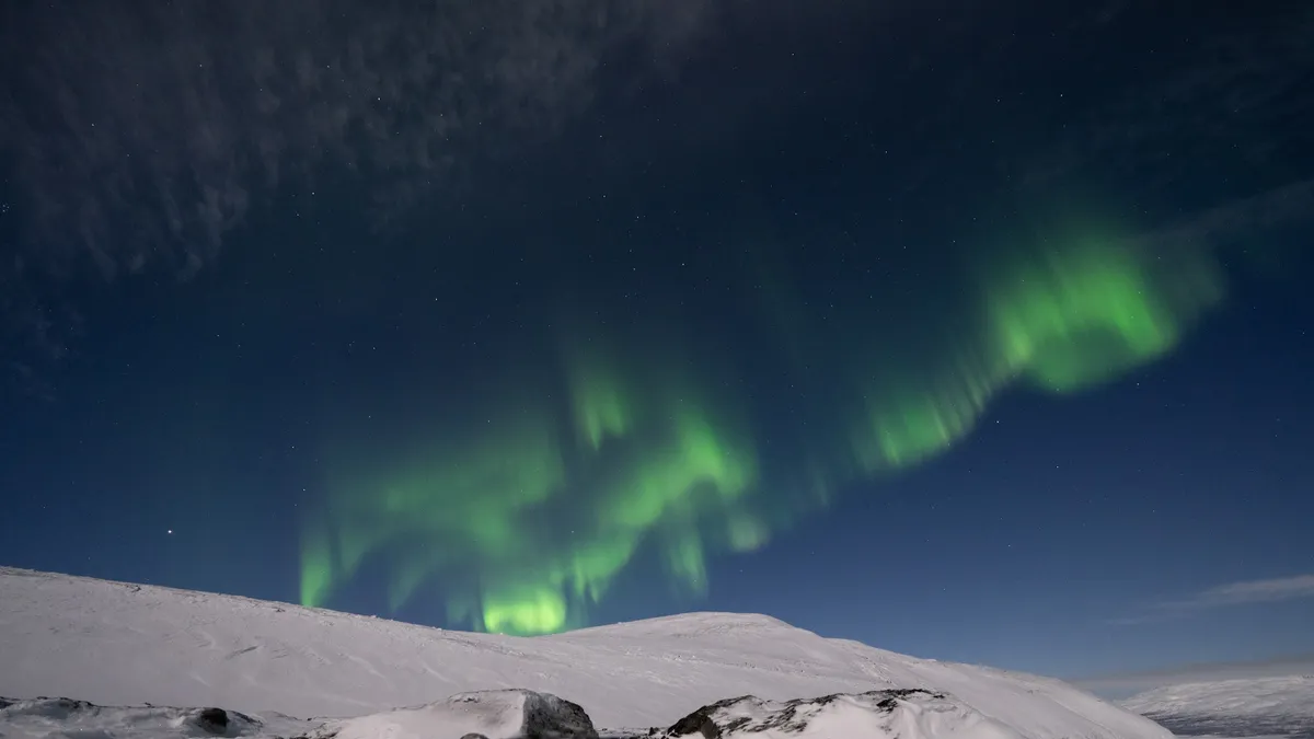
The northern lights, also known as the aurora borealis, are one of nature's most spectacular displays.
Auroras occur when charged particles from the sun collide with gases in Earth's upper atmosphere. These ghostly glows are most visible near the magnetic poles. But thanks to increasing solar activity, they're now appearing farther south and more frequently than usual.
Whether you're planning a trip to see the northern lights or just curious about the science behind them, here's everything you need to know about what causes the northern lights, when and where to see them, and how to spot them from your own backyard.
Related: Where to see the northern lights: 2025 aurora borealis guide

Daisy Dobrijevic is an experienced writer and aurora enthusiast, having authored numerous guides on the northern lights, including "Where are the best places to see them?" and "What causes their colors" while also ensuring the aurora forecast live blog is always up to date. Her expertise is rooted in firsthand experience from multiple aurora-chasing adventures. She has explored the Arctic Circle extensively, including Norway's dramatic coastline with Hurtigruten, Sweden's renowned Abisko National Park, and the stunning Vesterålen archipelago in Norway. Driven by a deep passion for the northern lights, Dobrijevic describes the experience of seeing them in person as nothing short of magical — an awe-inspiring phenomenon that every person should witness at least once in their lifetime.
What causes the northern lights?
The northern lights occur when electrically charged particles from the sun — mostly electrons and protons — slam into Earth's upper atmosphere at speeds of up to 45 million mph (72 million kph), but our planet's magnetic field protects us from the onslaught.
As Earth's magnetic field redirects the particles toward the poles — there are southern lights, too, which you can read about below — they interact with atmospheric gases like oxygen and nitrogen. The result is a glowing light show that appears in waves, curtains or arcs across the sky.
The Northern Lights are most visible near the Arctic Circle, but during times of high solar activity, they can stretch far beyond their usual range.


Different gases and altitudes produce different colors:
- Green: Oxygen, about 60 to 190 miles (100 to 300 kilometers)
- Red: Oxygen, higher than 150 miles (generally 180 to 250 miles (300 to 400 km)
- Blue/Purple: Nitrogen, at lower altitudes

Related: Aurora colors: What causes them and why do they vary?
"These particles are deflected towards the poles of Earth by our planet's magnetic field and interact with our atmosphere, depositing energy and causing the atmosphere to fluoresce," Billy Teets, the director of Dyer Observatory at Vanderbilt University in Nashville, Tennessee told Space.com.
The bright colors of the northern lights are dictated by the chemical composition of Earth's atmosphere.
"Every type of atom or molecule, whether it's atomic hydrogen or a molecule like carbon dioxide, absorbs and radiates its own unique set of colors, which is analogous to how every human being has a unique set of fingerprints," Teets told Space.com.
"Some of the dominant colors seen in aurorae are red, a hue produced by the nitrogen molecules, and green, which is produced by oxygen molecules." Teet continued.
Why are the northern lights so active right now?
We're currently experiencing solar maximum, the peak of the sun's approximately 11-year cycle of magnetic activity. This means the sun is producing more sunspots, solar flares and coronal mass ejections (CMEs) — massive bursts of solar material that can supercharge auroras on Earth.
During this period, the northern lights can appear brighter, more colorful and be visible farther south than usual. The best part? Things don't immediately drop off as soon as solar maximum is over, in fact, the few years after solar maximum are actually the best for aurora hunting
If you're planning an aurora hunting trip now is the time as "the next 4-5 years will be the most favorable for auroral sightings," Frédéric Clette, solar physicist, World Data Center Sunspot Index and Long-term Solar Observations (SILSO) and Solar Influence Data analysis Center (SIDC) told Space.com in an email.
When and where can you see the northern lights?

The best time to see the northern lights is during the darkest months of the year — from September to April.
A 75-year study from retired NASA solar physicist David Hathaway shows that March has more geomagnetically active days than any other month of the year (with October a close second), according to Spaceweather.com. On average, Earth sees six days of high geomagnetic activity in March, compared to just three in December.
The best time to hunt for the northern lights is between 9 p.m. and 3 a.m., as that's when most of the aurora action occurs, according to the Geophysical Institute of the University of Alaska Fairbanks.
"The northern lights are happening 24 hours a day, seven days a week, 365 days a year," said photographer Chad Blakely, owner of the northern lights tour company Lights Over Lapland. But that doesn't mean they're easy to spot; you need to be at the right place at the right time.
Top destinations include:
- Tromsø, Norway
- Fairbanks, Alaska
- Yellowknife, Canada
- Abisko, Sweden
- Reykjavík, Iceland
During strong geomagnetic storms, auroras can also dip farther south into the continental U.S., the U.K. and central Europe.
Related: Northern lights webcams: Watch the aurora borealis online for free
The best place to see the northern lights is any destination in the "auroral zone," the area within an approximately 1,550-mile (2,500 kilometers) radius of the North Pole, according to the Tromsø Geophysical Observatory in Norway. That's where the aurora most frequently occurs, though the phenomenon can creep farther south during particularly strong solar storms.
If planning a trip to see the northern lights, we recommend Hurtigruten's Astronomy Voyage, which combines northern lights viewing, astronomy lectures and the beautiful Norwegian coastline. You can read all about what it's like onboard in our article "What it's like to chase the northern lights along Norway's dramatic coastline".
And don't forget the southern hemisphere! The southern lights, or aurora australis, occur around the South Pole and are best seen from southern parts of New Zealand, Tasmania, and Antarctica. They're caused by the same solar processes as the northern lights.
How to see the northern lights
To maximize your chances of seeing the northern lights:
- Check the aurora forecast: You can stay up to date with significant aurora alerts and geomagnetic storm warnings with our northern lights forecast live blog. Websites and apps like NOAA's Space Weather Prediction Center, SpaceWeatherLive and AuroraWatch UK provide real-time alerts.
- Find dark skies: Get far from city lights. National parks, dark-sky reserves, or rural areas work best.
- Look north (or south if you're in the Southern Hemisphere): Auroras tend to appear near the magnetic poles.
- Be patient and dress warm: It can take hours to catch a glimpse of the northern lights, but believe me, the show is more than worth the wait.
- Use a camera: Faint auroras can be hard to spot with the naked eye, but a camera with a long exposure, especially a modern smartphone, can reveal subtle hints of color that might otherwise go unnoticed. Try scanning the sky with your camera to see if anything pops. That way, you'll know where to focus your attention when the show kicks off. And when it does, trust your eyes too—despite what some people say, strong northern lights can display vivid colors, incredible depth, and mesmerizing movement in real time. It's one of nature's greatest performances
You might also spot a mysterious phenomenon known as STEVE (Strong Thermal Emission Velocity Enhancement). It appears as a narrow, purplish arc of light, sometimes with green picket-fence structures, and is linked to auroral activity—though it's driven by slightly different atmospheric processes.
Can you see the northern lights from where you live?
Maybe! During strong geomagnetic storms, auroras have been seen as far south as Texas, Spain and even Mexico! Your best chance is during a G3 or stronger geomagnetic storm, rated on a scale from G1 (minor) to G5 (extreme).
To check if auroras might be visible near you, look at:
- Aurora KP index: A KP value of 7 or higher is often needed to see them in lower latitudes.
- Local conditions: Clear, dark skies are a must.
- Real-time social media reports: Many aurora chasers post live updates on platforms like X (formerly Twitter).
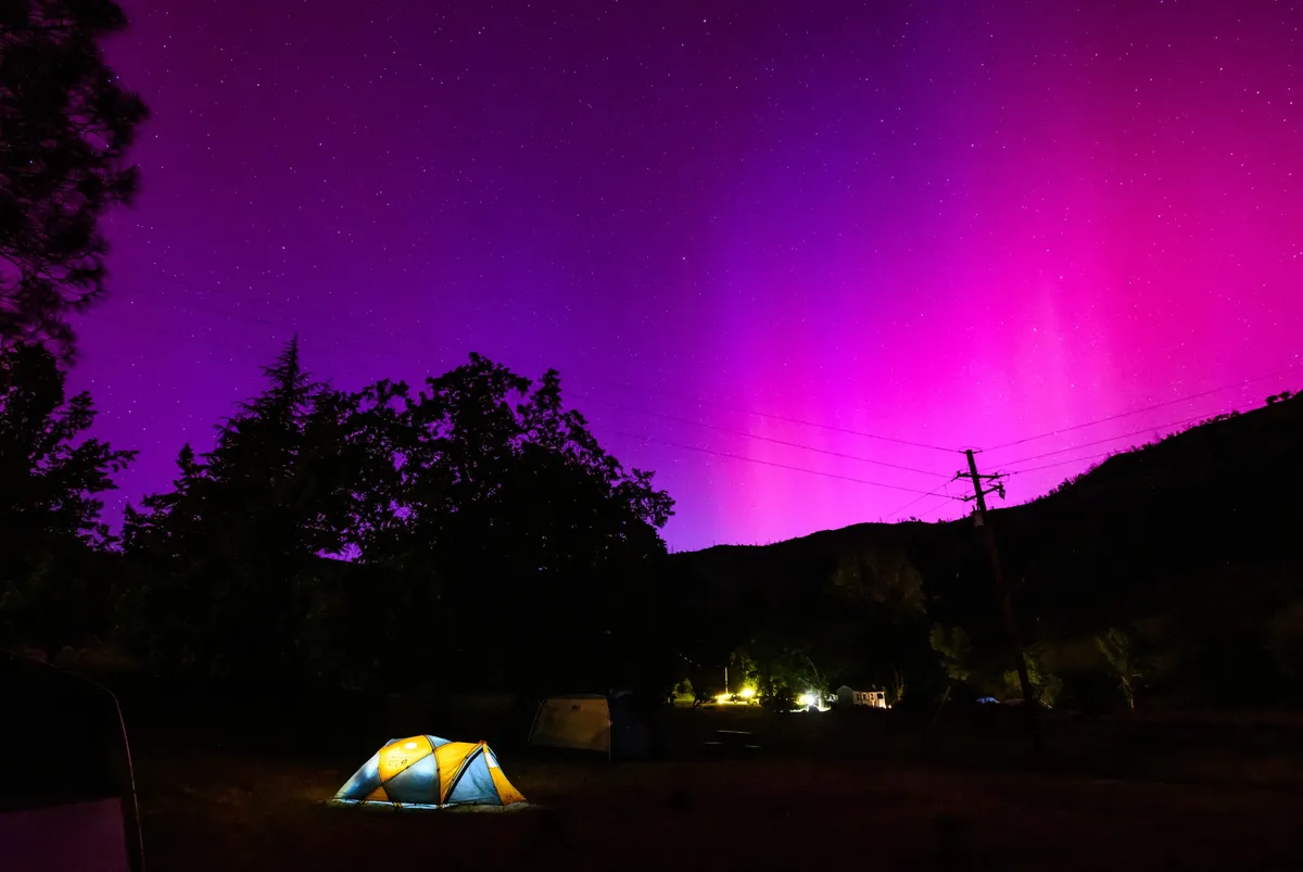
I have been fortunate enough to witness the northern lights throughout Norway and Sweden, but I have to say the most dramatic and colorful display was viewed from my own backyard in Nottingham, U.K. (approx. 52.9 degrees North!) during the colossal G5 May 2024 storm that saw auroras stretch deep into mid-latitudes.
The photos below were taken with my iPhone 13 mini, without a tripod, and with a shaky hand from all the excitement! It was a truly spectacular night.

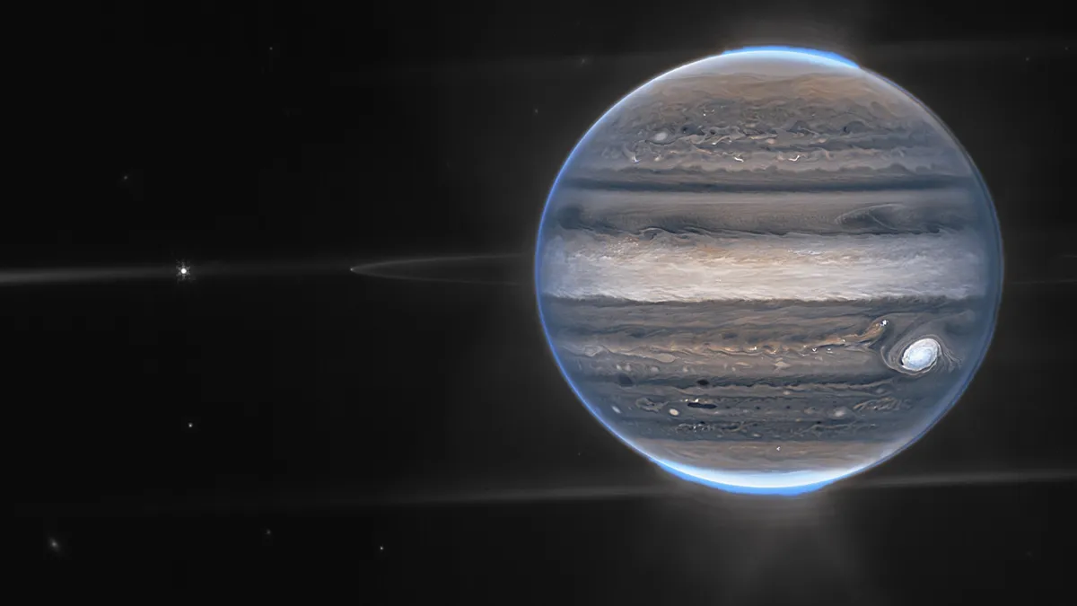
Are there northern lights on other planets?
Yes! Auroras aren't unique to Earth. They also appear on other planets with magnetic fields and atmospheres. For example:
- Jupiter has the most powerful auroras in the solar system, driven not only by the solar wind but also by its volcanic moon Io.
- Saturn experiences auroras near its poles, influenced by the planet's strong magnetic field.
- Uranus and Neptune also show auroral activity, although these are harder to observe and are less understood.
- Even Mars, which has no global magnetic field, experiences faint auroras in localized magnetic regions of its crust.
These planetary auroras help scientists study space weather across the solar system and better understand how magnetic fields and solar activity interact on different worlds.
Common northern lights questions answered by an aurora scientist
We asked Dr. Elizabeth MacDonald a few frequently asked questions about auroras.
Dr. Elizabeth MacDonald is a space physicist at NASA Goddard Space Flight Center and one of the founders of the citizen science site Aurorasaurus.
What causes the movement and shape of auroras?
Constantly changing input from the sun, varying responses from the Earth's upper atmosphere, and the motion of the planet and particles in near-Earth space all conspired to cause different auroral motions and shapes. From these motions and shapes, we can learn about the physics happening further out in space along the Earth's magnetic field lines.
What do auroras tell us about Earth's atmosphere?
Auroras tell us many things about Earth's upper atmosphere, including its density, composition, flow speeds, and the strength of electrical currents flowing in the upper atmosphere. These in turn tell us about the Earth's magnetic field, how it extends into space, and how it changes dynamically. All of this is important for protecting Earth and space-borne technologies from hazards of "space weather" of which aurora is one part.
Do we have auroras on other planets?
Yes! Aurora indicates planets with magnetic fields and atmospheres, which vary a lot compared to Earth.
Southern lights

On Earth, the northern lights' counterpart in the Southern Hemisphere is the southern lights — they are physically the same and differ only in their location. As such, scientists expect them to occur simultaneously during a solar storm, but sometimes the onset of one lags behind the other.
"One of the more challenging aspects of nightside aurorae involves the comparison of the aurora borealis with the aurora australis," said Steven Petrinec, a physicist at the aerospace company Lockheed Martin who specializes in magnetospheric and heliospheric physics, told Space.com.
"While some auroral emissions occur in both hemispheres at the same magnetic local time, other emissions appear in opposing sectors in the two hemispheres at different times — for example, pre-midnight in the Northern Hemisphere and post-midnight in the Southern Hemisphere," Petrinec told Space.com.
The hemispheric asymmetry of the aurora is due in part to the sun's magnetic field interfering with Earth's magnetic field, but research into the phenomenon is ongoing.
What is STEVE?

Another aurora-like occurrence on Earth is STEVE ("Strong Thermal Emission Velocity Enhancement"). Like the northern and southern lights, STEVE is a glowing atmospheric phenomenon, but it looks slightly different from its undulating auroral counterparts. "These emissions appear as a narrow and distinct arc, are typically purple in color and often include a green picket-fence structure that slowly moves westward," Petrinec said.
STEVE is also visible from lower latitudes, closer to the equator, than the auroras.
A 2019 study published in the journal Geophysical Research Letters discovered that STEVE is the result of two mechanisms: The mauve streaks are caused by the heating of charged particles in the upper atmosphere, while the picket-fence structure results from electrons falling into the atmosphere. The latter process is the same driver of the aurora, making STEVE a special kind of aurora hybrid.

History of the northern lights


Though it was Italian astronomer Galileo Galilei who coined the name "aurora borealis" in 1619 — after the Roman goddess of dawn, Aurora, and the Greek god of the north wind, Boreas — the earliest suspected record of the northern lights is in a 30,000-year-old cave painting in France.
Since that time, civilizations around the world have marveled at the celestial phenomenon, ascribing all sorts of origin myths to the dancing lights. One North American Inuit legend suggests that the northern lights are spirits playing ball with a walrus head, while the Vikings thought the phenomenon was light reflecting off the armor of the Valkyrie, the supernatural maidens who brought warriors into the afterlife.
Related: Aurora myths, legends and misconceptions
Early astronomers also mentioned the northern lights in their records. A royal astronomer under Babylon's King Nebuchadnezzar II inscribed his report of the phenomenon on a tablet dated to 567 B.C., for example, while a Chinese report from 193 B.C. also notes the aurora, according to NASA.
The science behind the northern lights wasn't theorized until the turn of the 20th century. Norwegian scientist Kristian Birkeland proposed that electrons emitted from sunspots produced the atmospheric lights after being guided toward the poles by Earth's magnetic field. The theory would eventually prove correct, but not until long after Birkeland's 1917 death.
Photographing the northern lights
The northern lights are a popular target for budding photographers and it's easy to see why. Their colorful ribbons of light, dancing to the whims of Earth's magnetic field are a truly stunning sight. But aurora photography is not without its challenges. Low light, cold temperatures and the unpredictable nature of auroras make them a rather tricky subject. That's why we have created a "Where and how to photograph the aurora" guide that includes the best techniques and camera settings to help you get started.
Speaking from experience, it is one of the most rewarding photography targets you can set your sights on. When the ribbons of light start dancing for you, the feeling of awe and wonder is truly extraordinary. I recommend using a remote camera trigger to capture your photos, that way you can line up your camera for the perfect shot, sit back, relax and enjoy. It also means you can keep your hands nice and warm in your pockets, poised on the trigger, rather than fumbling around in the cold with the camera's shutter button.
While it's so tempting to stand and take hundreds of photographs at a time, it's important to take a step back from your camera, look up, and just enjoy the wonders of the northern lights or southern lights as they dance above you. The depth and movement that your eyes can capture are second to none.
Additional resources
You can learn more about the northern lights at NASA's aurora page. NOAA's Space Weather Prediction Center provides a 30-minute aurora forecast. You can watch livestreams of the northern lights via Explore.org and Lights over Lapland's webcam page
If you're an avid aurora chaser or want to learn more about sightings all over the world, Aurorasaurus is a citizen science site where you can report your aurora sightings and also learn more about auroras with their informative blog.
If you want to read more about Kristian Birkeland, check out "The Northern Lights: The True Story of the Man Who Unlocked the Secrets of the Aurora Borealis" (Vintage, 2002), by Lucy Jago. And you can keep up to date on NASA's sun-kissing Parker Solar Probe mission by following its blog.
Bibliography
Barton, K. "Legends of the northern lights," CBC News, Dec. 10, 2019. https://newsinteractives.cbc.ca/longform/legends-of-the-northern-lights
Callingham J. et al. "The population of M dwarfs observed at low radio frequencies," Nature Astronomy, Vol. 5, December 2021. https://doi.org/10.1038/s41550-021-01483-0
NASA, "FAQ: How does the solar cycle affect Earth's climate?" https://www.nasa.gov/mission_pages/sunearth/solar-events-news/Does-the-Solar-Cycle-Affect-Earths-Climate.html
NASA, "The history of auroras," 2006. https://www.nasa.gov/mission_pages/themis/auroras/aurora_history.html
Nishimura Y. et al. "Magnetospheric signatures of STEVE: Implications for the magnetospheric energy source and interhemispheric conjugacy," Geophysical Research Letters, Vol. 46, Issue 11, April 2019. https://doi.org/10.1029/2019GL082460
Schroeder, J.W.R. et al. "Laboratory measurements of the physics of auroral electron acceleration by Alfvén waves," Nature Communications 12, 3103, June 2021. https://doi.org/10.1038/s41467-021-23377-5