Ernesto's Heavy Rainfall Measured from Space

Tropical Storm has been drenching parts of Central America and Mexico as it has swirled over the region, and a NASA satellite has measured just how hard the rain is falling.
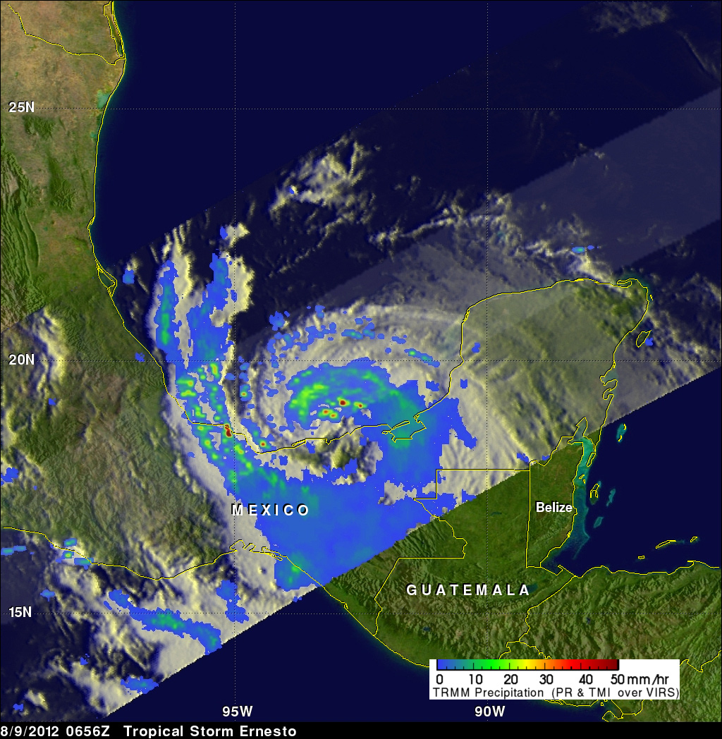
From its orbit in space, NASA's Tropical Rainfall Measuring Mission (TRMM) satellite spied Ernesto at 2:36 a.m. EDT (0656 UTC) today (Aug. 9), as it moved from the Yucatan Peninsula into the Gulf of Mexico. Analysis of the data it gathered shows that powerful convective thunderstorms were dropping rain at a rate greater than about 2 inches (50 millimeters) per hour north of the storm's center.
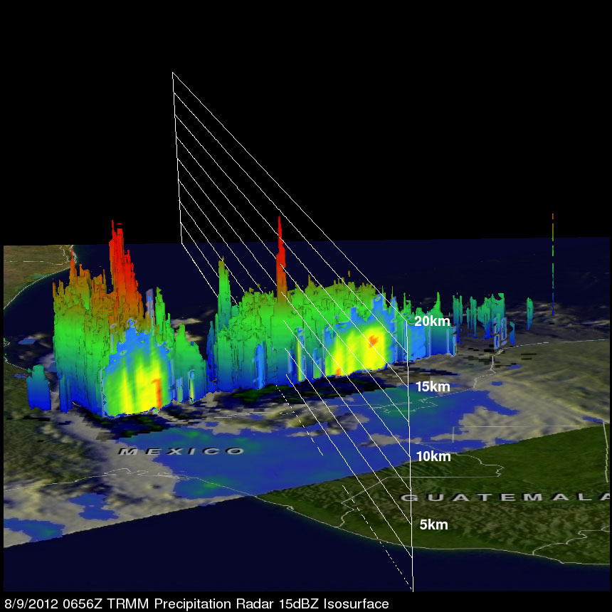
A 3D view created from the data shows that a few of the powerful convective storms near Ernesto's center were pushing to heights of over about 10 miles (16 kilometers). The energy released by these storms near Ernesto's center can be a sign of intensification, according to a NASA release.
Article continues belowObservations from the surface and air suggest that Ernesto has made its second landfall — or is very close to it — near Coatzacoalcos, Mexico, according to the latest update from the U.S. National Hurricane Center (NHC). It currently has winds of 60 mph (95 kph) and is moving westward at about 5 mph (7 kph).
Ernesto is expected to keep moving westward over southern Mexico, weakening as it goes because it will be cut off from the warm waters that fuel tropical cyclones (the generic term for tropical storms and hurricanes). A tropical storm warning is currently in effect from Veracruz to Chilitepec.
The storm is expected to drop 5 to 10 inches (130 to 250 mm) of rain on affected areas, with potential for isolated areas to see 15 inches (38 mm). The NHC warns that these rains could produce flash floods and mud slides in higher terrain areas.
Ernesto was the second hurricane and is the fifth named of the 2012 Atlantic hurricane season. So far six named storms and two hurricanes have formed in the basin this season.
Forecasters today announced an updated outlook for the season, calling for 12 to 17 named storms, including the storms that have already occurred. Of these, five to eight are expected to become hurricanes. These numbers were an upward shift from the forecast at the beginning of the season; the change was made in part because of the formation of Ernesto and Tropical Storm Florence so quickly and so early in August.
August and September are typically the busiest months of the hurricane season. Forecasters are currently monitoring another system out in the Atlantic that they think is likely to become a tropical depression. If it strengthens from there into a tropical storm, it will be named Gordon.
Follow OurAmazingPlanet on Twitter @OAPlanet. We're also on Facebook and Google+.

Andrea Thompson is an associate editor at Scientific American, where she covers sustainability, energy and the environment. Prior to that, she was a senior writer covering climate science at Climate Central and a reporter and editor at Live Science, where she primarily covered Earth science and the environment. She holds a graduate degree in science health and environmental reporting from New York University, as well as a bachelor of science and and masters of science in atmospheric chemistry from the Georgia Institute of Technology.

