Water and
Evidence
"If
Martian
Berman and
The craters
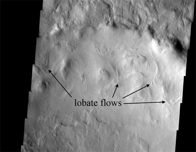
Here are
Sun
The
This
Unlike
"This
Berman and his colleagues have estimated the ages of some of these crater features using a technique known as crater counting, finding they range from 1 million to 10 million years old --relatively young, geologically speaking.
