Mars Odyssey has been circling the Red Planet since 2001. It broke a record in 2010 for being the longest-serving piece of machinery to work at Mars, and it continues to operate at the Red Planet in good health in mid-2018. (The previous record was Mars Global Surveyor, which flew around Mars from Sept. 11, 1997, to Nov. 2, 2006.)
Mars Odyssey has been making discoveries of its own — such as finding extensive water ice under the surface of Mars — but it also plays an important part in the ever-growing network of Martian rovers. It has served as a communications relay for the now-dead Spirit rover and current Opportunity and Curiosity rovers. Odyssey is also expected to assist with the 2020 European-Russian ExoMars rover mission.
Like any aging piece of machinery, Mars Odyssey has its cranky moments. It has entered "safe mode" temporarily several times during its mission, but NASA recovered it every time. In 2018, NASA said it would do its best to extend the missions of older orbiters (such as Mars Odyssey) for as long as possible, because the agency's funds are focused on putting together a sample-return mission at the Red Planet.
Science goals
Mars Odyssey is a part of NASA's Mars exploration program, which today includes a network of orbiters and rovers around the Red Planet. Members of this group include the Curiosity rover, the Opportunity rover, the Mars Reconnaissance Orbiter (MRO) and MAVEN (Mars Atmosphere and Volatile EvolutioN mission). Europe also has an ExoMars spacecraft called the Trace Gas Orbiter, and India has a spacecraft called Mars Orbiter Mission.
The overall goals of the Mars exploration program (according to NASA) are:
- Determine whether life ever arose on Mars.
- Characterize the climate of Mars.
- Characterize the geology of Mars.
- Prepare for human exploration.
To contribute to those goals, Mars Odyssey has these objectives:
- Globally map the elemental composition of the surface.
- Determine the abundance of hydrogen in the shallow subsurface (an indicator of water).
- Acquire high-resolution images of the surface mineralogy.
- Provide information on the morphology of the Martian surface.
- Characterize the Martian near-space radiation environment to determine the radiation risk to human explorers.
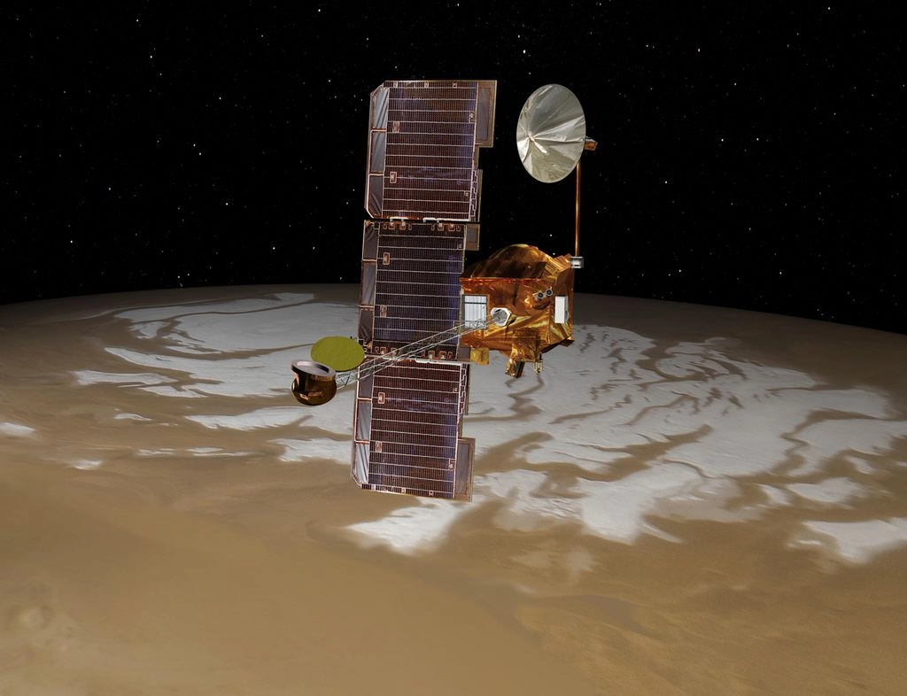
Mars Odyssey has three main science instruments:
- THEMIS (Thermal Emission Imaging System), which looks at the visible and infrared parts of the spectrum to determine the distribution of minerals on the surface of Mars.
- GRS (Gamma Ray Spectrometer), which measures the abundance and distribution of elements. Knowing what elements are at or near the surface gives detailed information about how Mars has changed over time.
- MARIE (Mars Radiation Environment Experiment), which measures radiation hitting Mars from cosmic rays emitted by the sun and other stars.
Channeling Clarke and sailing to Mars
Because Mars Odyssey was launching in 2001, NASA chose to name its orbiter after the book "2001: A Space Odyssey," which also spawned a movie in 1968 just ahead of the Apollo moon landings that began a year later. According to NASA, author Arthur C. Clarke (who was still alive at the time) "enthusiastically endorsed" the name for the mission.

Mapping was one of the main goals for the $297-million spacecraft. Odyssey was supposed to look at the chemical and mineralogical composition of Mars' surface in visual and infrared wavelengths. Additionally, it was supposed to keep an eye out for hydrogen (a likely indicator of water ice) and serve as a communications relay for the Spirit and Opportunity rovers that would land on Mars in 2004.
The 1,600-pound Odyssey launched April 7, 2001, without major incident and reached Mars on Oct. 23, 2001. To finalize its orbit, Odyssey used an "aerobraking" technique pioneered at the Red Planet by Mars Global Surveyor in 1997.
Essentially, Odyssey gradually used the friction of the Martian atmosphere to slow itself down. That maneuver saves on fuel and overall mission cost. This process, which took several weeks, put Odyssey into its final orbit in January.
Surface science
One of the benefits of an older spacecraft is it allows for long-term science observations. Researchers can track subtle changes on the Martian surface using the same equipment, allowing for consistent data gathering that helps them draw science conclusions. Mars Odyssey features several high-power cameras that examine the surface, as well as global weather conditions on Mars.
In 2010, NASA released a global map from Mars Odyssey stitched together from 21,000 THEMIS images taken over eight years. This map showed features of as small as 330 feet (100 meters) in size, although NASA said Odyssey has mapped certain areas at an even higher resolution. [Gallery: Pictures from Longest Mars Mission]
Odyssey's eyes on the planet also contributed to spectacular discoveries in smaller regions. In 2008, Odyssey spotted evidence of salt deposits across about 200 places in the south of Mars. NASA considers these areas to be signs of where abundant water used to sit. Scientists theorized the deposits could come from groundwater, which evaporated and left deposits of mineral behind. Since the sites are not connected with each other, they are unlikely to be signs of an ancient global ocean, NASA added.
In 2007, NASA sent out pictures of seven possible caves snapped by Mars Odyssey. The find, dubbed the "Seven Sisters," excited researchers because the caves could contain underground hiding spots for life. Scientists spotted the caves through THEMIS, which saw unusually warm spots that showed up at night.
Odyssey found evidence of water ice lying beneath Mars' surface, a finding that was confirmed by NASA's Phoenix when it arrived on Mars. Mars Odyssey also finished a radiation safety study with an eye to helping future astronauts walking on the Red Planet.
Odyssey also tracks the weather over large swaths of Martian territory. One example is in tracking dust storms. Odyssey tracked the movements of large Martian dust storms in 2007 and 2009, as well as a global dust storm in 2018. In fact, one of its early roles in orbit was to act as an early warning system to NASA mission planners concerned about protecting Spirit and Opportunity from any dust storms coming their way.
Older Mars Odyssey data (from 2002 to 2009) helped scientists discover possible water ice at the equator of Mars, a finding announced in 2017. They found a hydrogen signature in that region, in a zone where scientists previously thought water couldn't exist. But more follow-up observations will be required to learn if the signature is indeed one of water, NASA cautioned.
In November 2015, Odyssey was maneuvered into a new orbit to observe the "terminator," or the day-night line. This was expected to provide information on fog, haze, clouds and especially frosts that could disappear when the sun gets higher.
Mars Odyssey took its first images of the Martian moon Phobos in 2017, which will usher in more photos of Phobos and the other moon (Deimos) in future years. Previously, the spacecraft was focused on Martian observations, but NASA shifted its work to include the moons to better map their composition with THEMIS. A follow-up video of Phobos and Deimos was issued in 2018, based on Mars Odyssey imagery.

Working with other spacecraft
The spacecraft sometimes teams up with other spacecraft to perform work. One case was the search for a signal from the Phoenix Mars lander after a cold Martian winter.
NASA did not expect the lander to survive, but just in case, it spent weeks hailing the lander with Mars Odyssey. MRO then took a picture of the Phoenix landing site and spotted damage using its High Resolution Imaging Science Experiment (HiRISE) camera. At that point, NASA declared Phoenix dead.
The rovers Spirit, Opportunity and Curiosity all used Mars Odyssey to send data back to Earth. The orbiter can send information back much more quickly than the rovers. Having Odyssey handle the data transfer frees up more time for the rovers to wander around the surface and perform science experiments.
Additionally, Mars Odyssey's high-flying eyes can provide global context for any local findings the rovers scoop up. This is especially important for long-term investigations such as Mars Curiosity's search for habitable conditions. If Curiosity spots an environment on the ground that could sustain life, Mars Odyssey can search for the same phenomenon from up above.
Odyssey worked with MAVEN and MRO to examine Comet Siding Spring. The comet passed within close reach of Mars in October 2014, providing a unique opportunity for spacecraft in that area to look at the visitor from the outer solar system.
The spacecraft made optical observations with its Thermal Emission Imaging System (THEMIS) and also looked for effects on Mars' atmosphere (particularly regarding the dust) with the neutron spectrometer and high-energy neutron instruments on board. Along with MAVEN observations, NASA concluded there was a possible Martian meteor shower when the comet went by, and the dust created vaporized metal in the planet's atmosphere.
