


Satellite Image Reveals Spread of a Megacity
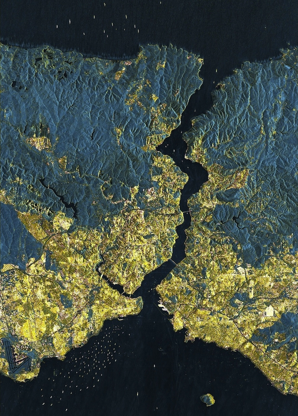
A newly released satellite image reveals Istanbul, the largest city in Turkey at 15 million inhabitants, is quickly becoming a "megacity" covering almost 700 square miles (1,800 square kilometers).
"Megacities let us take a look into our future, when we have to expect that cities that today have 'only' two to five million inhabitants will grow at an explosive rate," Hannes Taubenböck, of DLR's German Remote Sensing Data Center, said in a statement.
In this image, acquired by the German Aerospace Agency's TerraSAR-X radar satellite, the populated urban areas are colored yellow because the city's buildings reflect the satellite's signals, giving an accurate view of its immensity.
The city's airport is clearly visible in the bottom left corner of the image — the darker blue color indicates where there are few buildings around the runways. Even the boats are visible dotting the city's surrounding seas.

The Bosphorus Suspension Bridge and the Fatih Sultan Mehmet Bridge, built in 1973 and 1988, respectively, have enabled its population to expand across the Bosphorus Strait, the stretch of water extending from the Black Sea at the top to the Sea of Marmara at the bottom.
"These connections to the city center on the European side have generated enormous growth on the Asian side," Taubenböck said. "Over the last 35 years, the area of Istanbul has tripled."
Radar satellites like TerraSAR-X, which was launched in 2007, are useful because they can "see" through clouds and darkness, while typical remote-sensing instruments rely on visible light.
This story was provided by LiveScience, a sister site to LiveScience. You can follow LiveScience staff writer Jennifer Welsh on Twitter @microbelover. Follow LiveScience for the latest in science news and discoveries on Twitter @livescience and on Facebook.