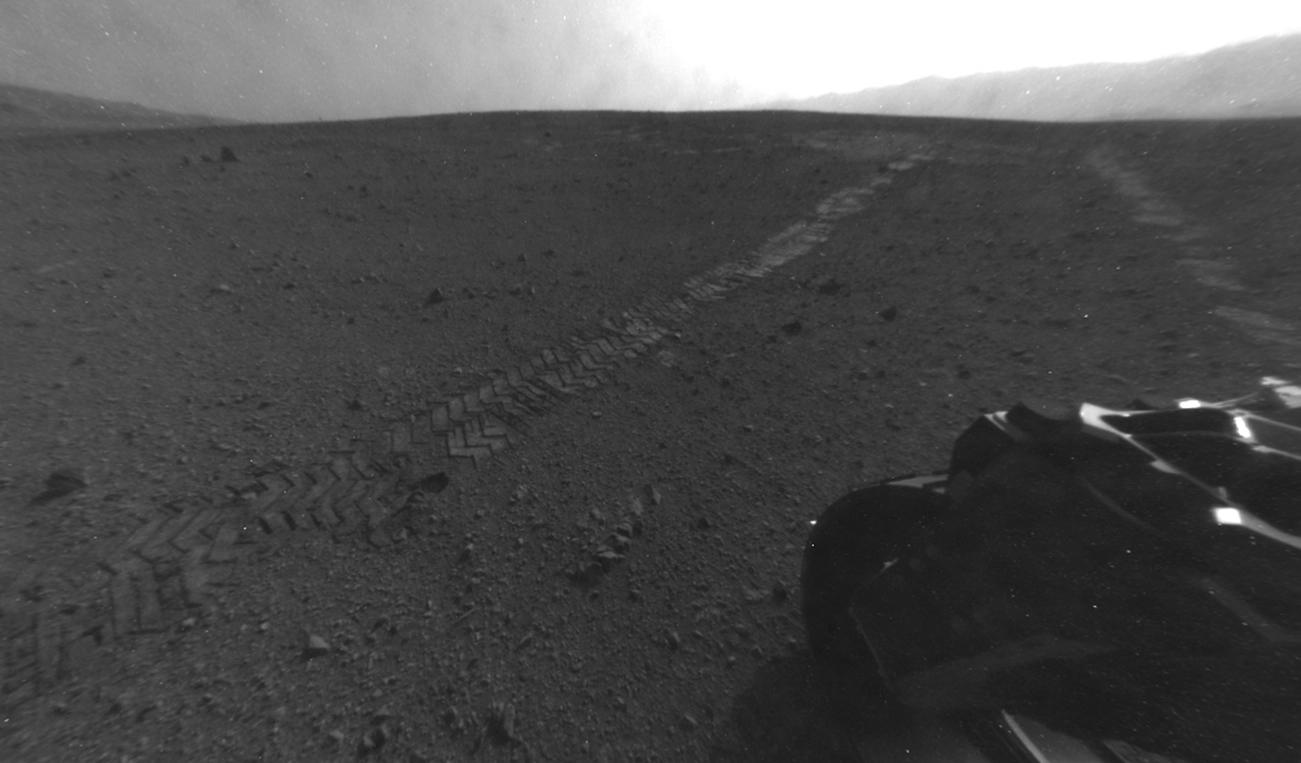
Curiosity Rover Leaves Its Landing Site

Curiosity's rear Hazard Avoidance Camera (Hazcam) took this image on Aug. 28, 2012, after the rover made a 52-foot (16-meter) drive away from its landing site.
Curiosity Rover's Dirty Martian Wheels

Martian dirt clings to the wheels of NASA's Curiosity rover in this photo taken Aug. 28, 2012, after the rover's first long drive, a 52-foot trek.
Curiosity Landing Site Panorama, with the Heights of Mount Sharp

This color panorama shows a 360-degree view of the landing site of NASA's Curiosity rover, including the highest part of Mount Sharp visible to the rover. That part of Mount Sharp is approximately 12 miles (20 kilometers) away from the rover. Scientists enhanced the color in one version to show the Martian scene as it would appear under the lighting conditions we have on Earth, which helps in analyzing the terrain. Photo released August 27, 2012.
Curiosity Rover's View of Mount Sharp Layers

This photo from NASA's Mars rover Curiosity shows the layered geologic history of the base of Mount Sharp, the 3-mile-high mountain rising from the center of Gale Crater. Image taken on Aug. 23, 2012.
will.i.am Tweets About 1st Song from Mars

With students and NASA space shuttle astronaut Leland Melvin looking on, musical artist will.i.am posts a tweet soon after his song "Reach for the Stars" was beamed back from the Curiosity Mars rover and broadcast to a live audience at NASA's Jet Propulsion Laboratory in Pasadena, Calif.
will.i.am Discusses 1st Song from Mars

Musical artist will.i.am addresses a crowd of students at NASA's Jet Propulsion Laboratory in Pasadena, Calif., where his new single, "Reach for the Stars," was beamed down from the Curiosity Mars rover and broadcast to the live audience on Aug. 28, 2012.
Getting to Know Mount Sharp

This image taken by the Mast Camera (MastCam) on NASA's Curiosity rover highlights the interesting geology of Mount Sharp, a mountain inside Gale Crater, where the rover landed. Photo released August 27, 2012.
Getting to Know Mount Sharp (Annotated)

This image taken by the Mast Camera (MastCam) on NASA's Curiosity rover highlights the interesting geology of Mount Sharp, a mountain inside Gale Crater, where the rover landed. Image released August 27, 2012.
Mars Rover Curiosity Sees Martian Gravel

This photo by NASA's Mars rover Curiosity shows a color-enhanced view of gravel-like terrain near the rover during Mastcam calibration tests performed on Aug. 23, 2012. The color has been enhanced to appear as the scene would look on Earth.
Focusing Curiosity Rover's 100-Millimeter Mastcam

This image is from a test series used to chacterize the 100-millimeter Mast Camera on NASA's Curiosity rover. It was taken on Aug. 23, 2012, and looks south-southwest from the rover's landing site.
Mars Rover Curiosity's Mount Sharp View (Inset)

This photo from the Mars rover Curiosity shows the base of Mount Sharp, the rover's destination. The black rock enlarged in the inset is as large as the 1-ton Curiosity, which is the size of car. Photo taken on Aug. 23, 2012.
