The first satellite specifically designed to conduct a global survey of Earth's surface water has taken to the skies.
A SpaceX Falcon 9 rocket launched the Surface Water and Ocean Topography (SWOT) satellite before dawn on Wednesday (Dec. 16) from Space Launch Complex-4E at Vandenberg Space Force Base in California.
Liftoff occurred at 6:46 a.m. EST (1146 GMT; 3:46 a.m. local California time), lightning up the early-morning sky as the Falcon 9 carried the SWOT payload toward a non-sun-synchronous orbit with a final altitude of 553 miles (857 kilometers). The rocket's first stage booster returned to Vandenberg and successfully touched down at the facility's Landing Zone-4, just a quarter-mile (0.4 kilometers) downrange from the launch pad, about 7.5 minutes after liftoff. SWOT will be deployed into low Earth orbit about 52 minutes after launch.
"What a spectacular launch," said Nadya Vinogradova Shiffer, NASA's director of ocean physics, just after launch. "Welcome to the era of SWOT."
Related: SWOT satellite a 'game changer' for understanding climate change


Monitoring water levels like never before
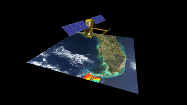
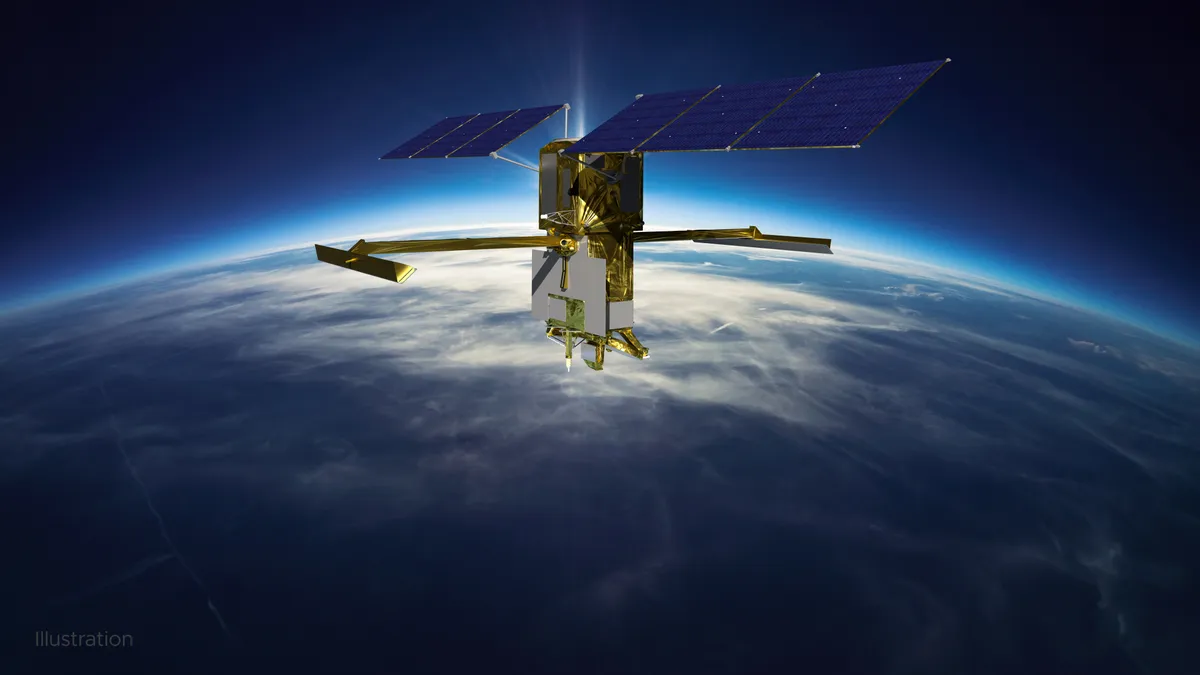
SWOT was developed by NASA and the French Space Agency (CNES), with contributions from the Canadian and U.K. space agencies. It was included as a recommended mission in the 2007 U.S. National Research Council Decadal Survey. The satellite is designed to study changes in global water levels and provide, in unprecedented detail, 3D volumetric data for Earth's oceans and millions of lakes and rivers across 90% of the globe every 21 days.
SWOT's primary instruments are its nadir altimeter and the Ka-band Radar Interferometer, or KaRIn for short. KaRIn consists of two antennas separated across a 33-foot-long (10 meters) boom, which independently receive readings the satellite takes of Earth's surface. Using the satellite's position data and subsequent phase differences in signal reception, SWOT is capable of measuring water elevations with a mere 0.4-inch (1 centimeter) margin of error.
In a prelaunch press briefing on Wednesday (Dec. 14), NASA Earth Science Division Director Karen St. Germain explained the upgrade that SWOT will bring to orbit.
"We've been doing satellite altimetry measuring sea surface height for 30 years, and that's a big part of the record we rely on to understand climate change," she said in response to a question asked by Space.com. "What SWOT will do is give us a 10-fold improvement in the spatial resolution of our measurement of water height."
"If we really want to understand [the water cycle] in ways that are important for us, we need to be able to think about it not just conceptually, but in terms of volumes," SWOT hydrology science lead Tamlin Pavelsky explained during a SWOT science briefing on Tuesday (Dec. 13). "How much water is there, and how is it flowing from place to place? SWOT is going to allow us to do that."
According to Pavelsky, before SWOT, the bulk of satellite data available to scientists studying Earth's surface water has been derived from other experiments' readings.
"We're constantly having to come up with ways of using data from satellites that weren't designed for what we want to do," he said. "We're repurposing other people's data, and we're able to do cool things with that. But SWOT is the first satellite that's specifically designed to study rivers and lakes, and it's going to be a real game changer."
SWOT will be responsible for tracking nearly 1.3 million miles (2.1 million km) of rivers and millions of lakes, and it will be capable of monitoring coastal sea levels to provide oceanic data in corroboration with other on-orbit sources. To help sort through the incredible amount of data, NASA plans to make the mission's information publicly available and is developing tools to make it easier to access.

"With the SWOT data, we can give really important information to a wide variety of stakeholders," Benjamin Hamlington, research scientist for the Sea Level and Ice Group at NASA's Jet Propulsion Laboratory in Southern California, said during Tuesday's briefing. "Really, anyone who cares about water should be concerned about what SWOT can provide."
Hamlington predicts that SWOT data will be useful for coastal communities, civil engineers, water resource professionals, scientists researching flooding and drought, and more.
"Some locations have too much water; others don't have enough," he said. "We're seeing more extreme droughts, more extreme floods; precipitation patterns are changing. It's really important that we try to understand exactly what is happening using the SWOT data."
Related: 10 devastating signs of climate change satellites can see from space
From launch to science operations
Following separation from the Falcon 9's second stage, SWOT will spend three hours undergoing instrument checks as its solar panels deploy and telemetry is transferred to satellite controllers in France. In four days, SWOT will begin a multi-part deployment of the KaRIn antenna, which will take another four days to complete. Nominally, eight days from now, spacecraft controllers will orient SWOT toward the sun and begin powering up the remaining onboard components.
SWOT will spend six months at its 532.5-mile (857 km) altitude undergoing a vehicle calibration phase. After that, the satellite will raise its orbit just over 20 miles to 554 miles (891 km) and begin its mission to survey the planet's surface water every 21 days.
The satellite's scheduled lifespan is three years, but SWOT project manager Thierry Lafon thinks it's likely to be extended. "Our system will not limit the lifetime if everything is OK on board," he remarked before the launch. "Five years is completely reasonable, and [perhaps] many more years, as we've been doing for 30 years," Lafon added, noting that many of NASA's satellites have far exceeded their life expectancy over three decades of Earth science research.
SpaceX and NASA originally intended to launch SWOT on Thursday morning (Dec. 15). Shortly before the planned liftoff, however, technicians noticed moisture in two of the Falcon 9's nine first-stage Merlin engines, and the company pushed the liftoff back a day to investigate the issue.
Follow us on Twitter @Spacedotcom or Facebook.