Hurricane Florence Looks Like a Giant Cotton Ball in This Astronaut Photo from Space

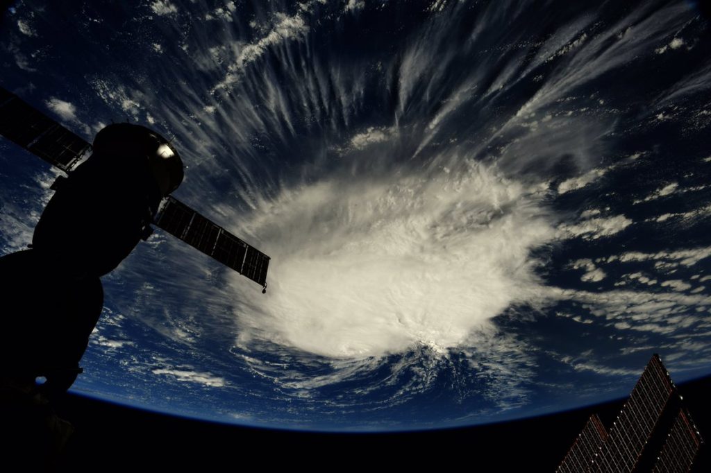
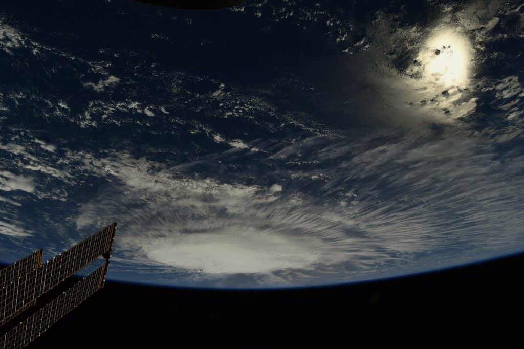
Hurricane Florence looks like a giant cotton ball in new photos snapped from the International Space Station by NASA astronaut Ricky Arnold.
"#HurricaneFlorence strengthens in the early morning hours over the Atlantic," Arnold wrote on Twitter yesterday (Sept. 6) in a description of the two images.
Florence is currently a Category 2 hurricane, with maximum sustained winds of around 105 mph (169 km/h), according to the latest update from the National Hurricane Center (NHC), which is run by the National Oceanic and Atmospheric Administration (NOAA).
Article continues below(The Saffir-Simpson scale researchers use to classify hurricanes has five categories, with 1 being the weakest and 5 the strongest. Category 5 hurricanes have maximum sustained wind speeds of at least 157 mph, or 253 km/h.)
As of Thursday morning, Florence was about 1,100 miles (1,770 kilometers) east-southeast of Bermuda and was moving northwest at roughly 10 mph (16 km/h), the update added.
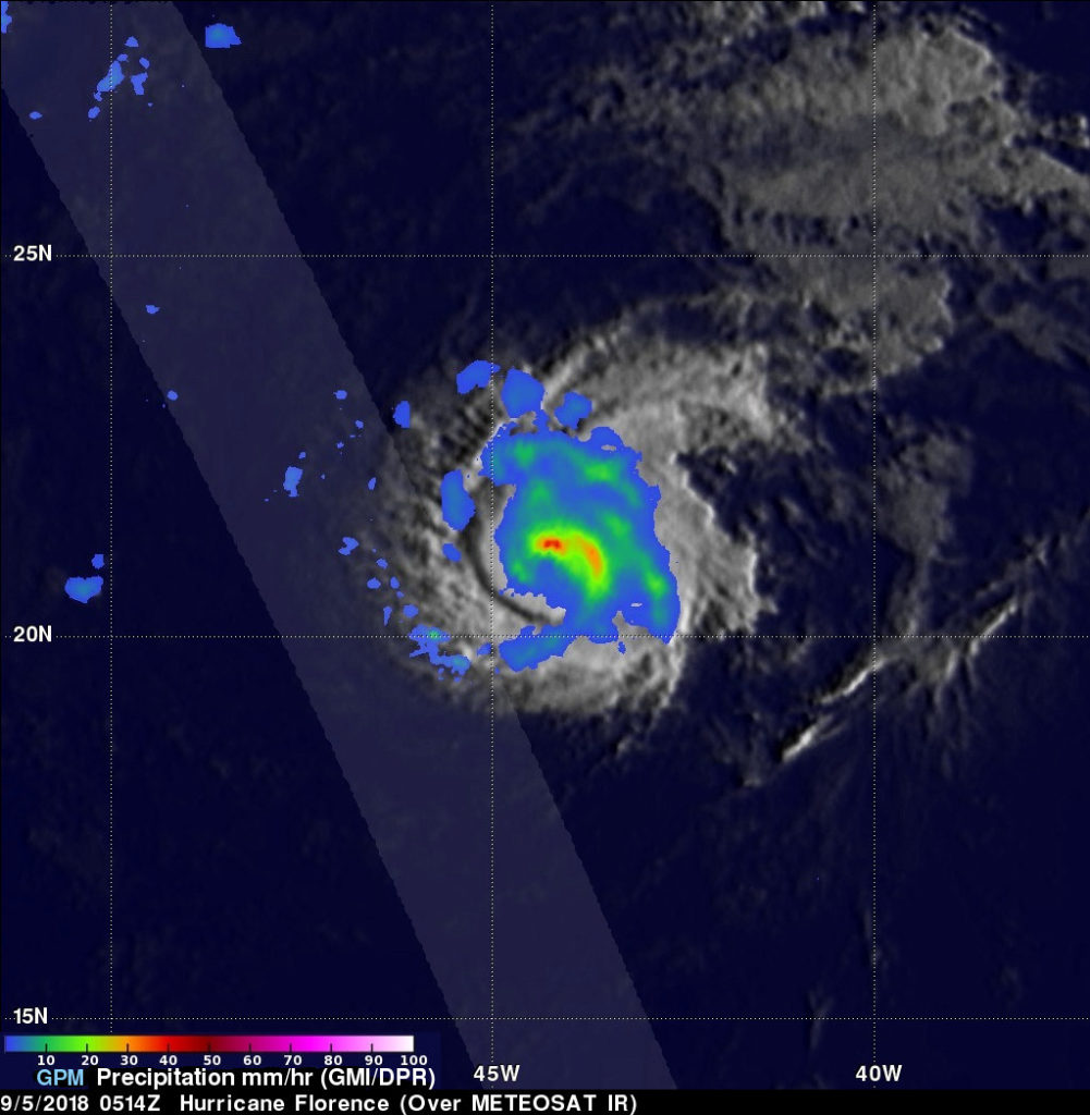
Arnold isn't the only one monitoring Florence from above. For example, measurements by the Global Precipitation Measurement (GPM) Core Observatory, a satellite operated jointly by NASA and the Japan Aerospace Exploration Agency, revealed that storms north of Florence's eye were dumping rain Wednesday (Sept. 5) at a rate of 2 inches (5 centimeters) per hour.
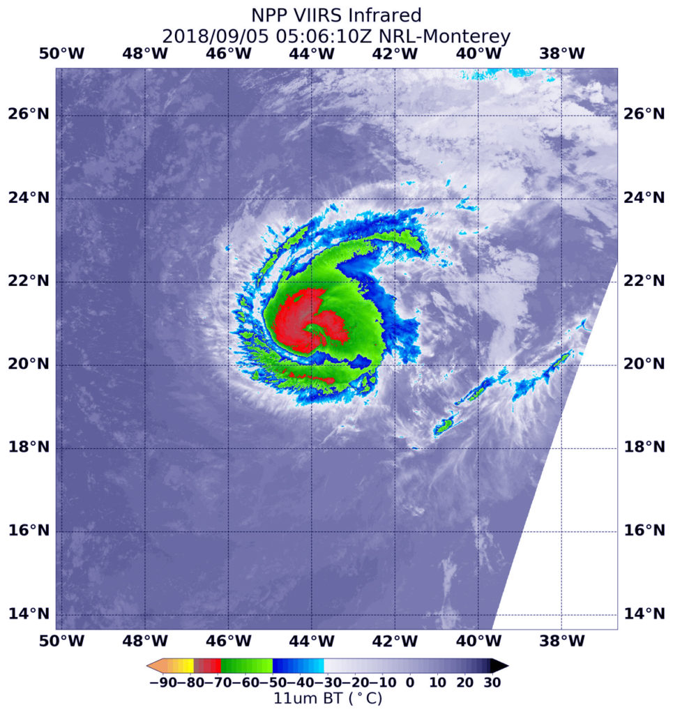
And that same day, the NASA-NOAA Suomi-NPP satellite captured infrared images of Florence showing where the strongest storms were swirling within the hurricane. (Storms with colder cloud tops are more powerful and tend to produce greater rainfall, NASA officials explained in an update.)
Florence officially strengthened from a tropical storm into a hurricane on Tuesday (Sept. 4). To get the latest updates, go to the NHC's Florence site.
Florence is the third hurricane of the 2018 Atlantic Ocean hurricane season, which officially runs from June 1 through Nov. 30. However, most of the powerful storms rear up from August through October.
Follow Mike Wall on Twitter @michaeldwall and Google+. Follow us @Spacedotcom, Facebook or Google+. Originally published on Space.com.

Michael Wall is the Spaceflight and Tech Editor for Space.com and joined the team in 2010. He primarily covers human and robotic spaceflight, military space, and exoplanets, but has been known to dabble in the space art beat. His book about the search for alien life, "Out There," was published on Nov. 13, 2018. Before becoming a science writer, Michael worked as a herpetologist and wildlife biologist. He has a Ph.D. in evolutionary biology from the University of Sydney, Australia, a bachelor's degree from the University of Arizona, and a graduate certificate in science writing from the University of California, Santa Cruz. To find out what his latest project is, you can follow Michael on Twitter.


