Lava View from Space

Hawaii's Kilauea volcano erupted in May 2018, creating a vast ash cloud visible from space and sending lava spewing from fissures to devastate homes. See photos of the volcano's ash and destruction from space.
This infrared photo from DigitalGlobe's WorldView-3 satellite shows the heat from Kilauea's lava as it approaches Kapoho Bay.
Hawaii Kilauea Volcano Lava Glow

The lava glow from Hawaii's erupting Kilauea volcano shines an eerie orange in this nighttime photo taken by NASA astronaut Ricky Arnold on the International Space Station on June 20, 2018. Read the full story.
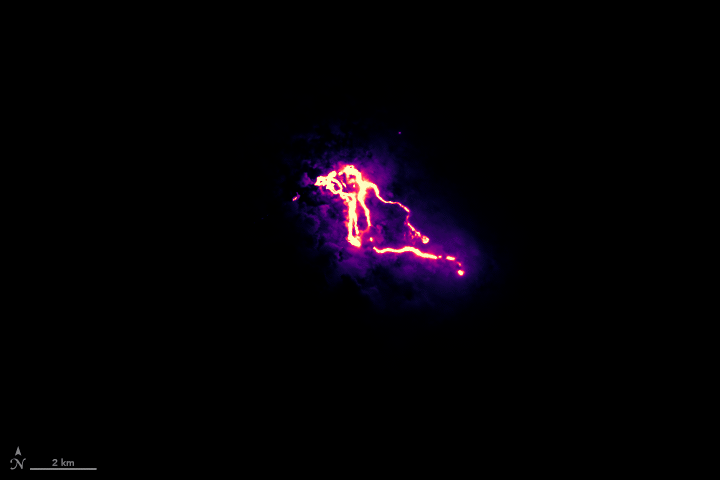
Lava Rivers
The Copernicus Sentinel-2 satellite captured the changing paths that the bright-orange lava rivers took to enter the Pacific Ocean between May 23 and June 8.
Astronaut View of Kilauea's Lava

NASA astronaut Drew Feustel, commander of Expedition 56 on the International Space Station, captured this view of lava from Hawaii's Kilauea volcano entering the sea on Sunday, June 10, 2018.
Lava Approaches Kapoho Bay

A visible-light view from of the lava flow (dried in black) from Hawaii's Kilauea volcano is seen here by DigitalGlobe's WorldView-3 satellite.
Tracking Kilauea's Lava

This SWIR (infrared) view of Kilauea's lava shows the flow in black, with vegetation in red, as seen by DigitalGlobe's WorldView-3 satellite.
Eruption on the Globe

Russian cosmonaut Oleg Artemyev posted this view of Hawaii's erupting Kilauea volcano from space on Twitter May 13 - the larger Mauna Loa volcano can also be seen. (This gallery was updated with new images on June 4, 2018.)
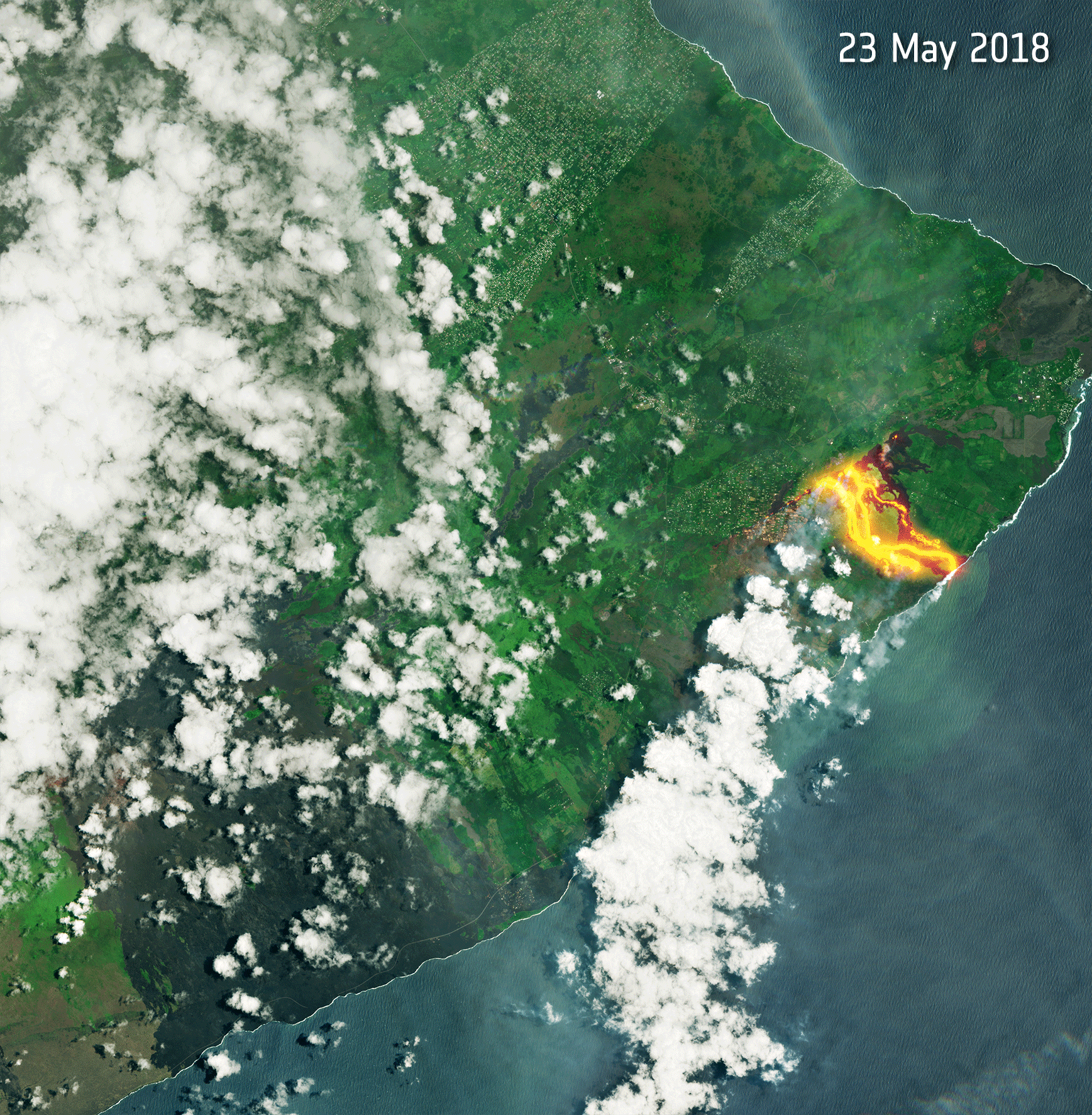
Lava Flow Animation
The Operational Land Imager (OLI) instrument on the Landsat 8 satellite acquired the data for this false-color view of the Kilauea lava flow as it appeared on the night of May 23, 2018. The purple areas surrounding the flows are clouds lit from below. This animation also features OLI daytime information about the location of roads and coastlines.
Kilauea Hotspots

This Visible Infrared Imaging Radiometer Suite (VIIRS) image from May 22, 2018, shows the extension of the hotspots toward the ocean, indicating that lava is moving toward the ocean and warming the water upon contact.
Hawaii's Kilauea Volcano

At 10:41 a.m. local time (20:41 Universal Time) on May 14, 2018, the Operational Land Imager (OLI) on Landsat 8 acquired a natural-color image of Hawaii's Kilauea volcano.
Zeroing In

Russian cosmonaut Oleg Artemyev also shared this view on Twitter, writing: "#Kilauea volcano destroyed dozen homes and forced thousands of people to evacuate." [Read about the science behind the eruption here]
