Satellites Track Huge Snow Storm's Approach to US East Coast (Video)

Breaking space news, the latest updates on rocket launches, skywatching events and more!
You are now subscribed
Your newsletter sign-up was successful
Want to add more newsletters?
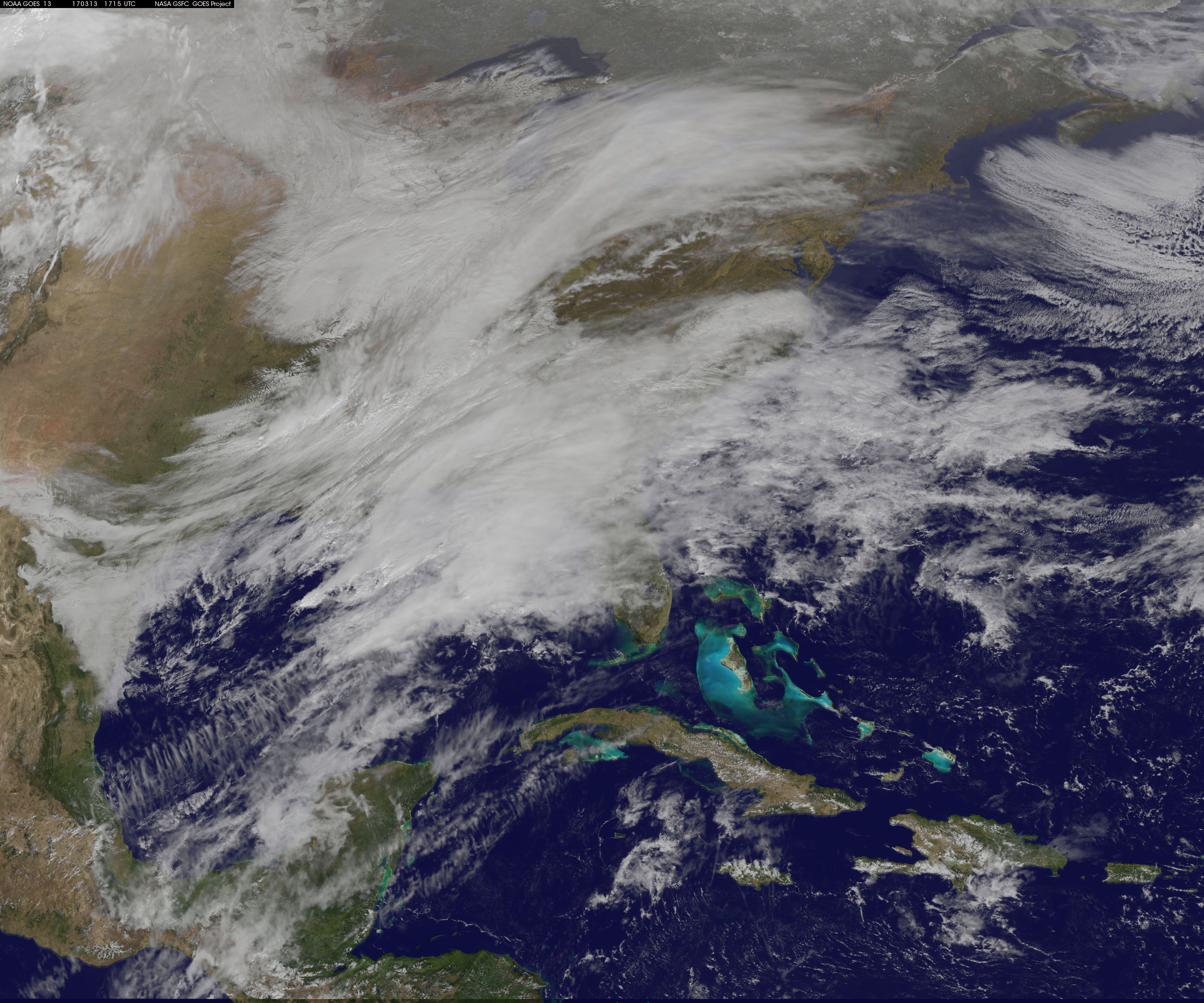
As a winter storm prepares to wallop the East Coast tonight and tomorrow (March 13 and 14), NASA and the National Oceanic and Atmospheric Administration (NOAA) are keeping a close eye on the region with multiple satellites.
The latest predictions from the National Weather Service say a low-pressure system crossing the Midwest states and the Ohio Valley will merge with another low-pressure system off the southeast coast of the U.S. You can see a video of the storm as seen by the GOES-16 satellite here.
"This will allow for a strong nor'easter to develop near the coast and cause a late-season snowstorm from the central Appalachians to New England, including many of the big cities in the Northeast U.S.," according to forecasters from the National Weather Service Weather Prediction Center (WPC) quoted in a statement from NASA.
"The heaviest snowfall is expected to occur from the northern Middle Atlantic to southern New England, where 12 to 18 inches [30 to45 centimeters] can be expected with localized amounts up to two feet [0.6 meters]," according to the WPC. "Strong winds could down trees and cause power outages."
From southern New Jersey to the Carolinas, residents can expect more than an inch of rain, according to the statement.
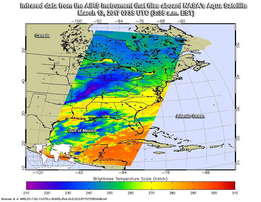
NASA's Aqua Satellite has already gathered infrared data — or heat data — on the storm, showing cloud top and ground temperatures. As cloud tops get higher, they also get colder and can strengthen a storm, the NASA statement said.
Aqua took measurements as it flew over the eastern U.S. today (March 13) at 3:35 a.m. EDT (0735 GMT). The satellite found that some cloud top temperatures were as cold as minus 63 degrees Fahrenheit (minus 53 Celsius) over a large area that included parts of Michigan, Illinois, Missouri and Arkansas. The satellite's findings suggest that snow will also stick on the ground, since East Coast temperatures on the ground were only 26 degrees Fahrenheit (minus 3 degrees Celsius).
Breaking space news, the latest updates on rocket launches, skywatching events and more!
"Those storms have the capability to produce heavy precipitation, which in this case would be heavy snowfall rates," NASA said in the statement.
Meanwhile, NOAA's GOES-East (Geostationary Operational Environmental-East) satellite provided information in both infrared and visible wavelengths showing the path of the low-pressure system. NASA created an animation using the GOES-East data, which was collected between March 11 and 13.
The animation was created by overlaying cloud data from the satellite onto a true-color image of the ground and ocean. The true-color image came from data from MODIS, or the Moderate Resolution Imaging Spectroradiometer, an instrument that flies aboard NASA's Aqua and Terra satellites.
Follow Elizabeth Howell @howellspace, or Space.com @Spacedotcom. We're also on Facebookand Google+. Original article on Space.com.

Elizabeth Howell (she/her), Ph.D., was a staff writer in the spaceflight channel between 2022 and 2024 specializing in Canadian space news. She was contributing writer for Space.com for 10 years from 2012 to 2024. Elizabeth's reporting includes multiple exclusives with the White House, leading world coverage about a lost-and-found space tomato on the International Space Station, witnessing five human spaceflight launches on two continents, flying parabolic, working inside a spacesuit, and participating in a simulated Mars mission. Her latest book, "Why Am I Taller?" (ECW Press, 2022) is co-written with astronaut Dave Williams.

