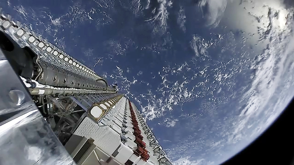
SpaceX's Starlink broadband satellites could be used for GPS navigation

SpaceX's Starlink satellites may be used for navigation and global positioning in addition to their core function of broadband Internet, a new research study suggests.
Engineering researchers external to SpaceX found a way to use the Starlink constellation signals for navigation similar to the capabilities provided by global positioning satellites (GPS), which are used in the United States and several other countries. The study represents the first time Starlink was used for navigation by researchers outside of SpaceX, the team members stated.
Researchers triangulated the signals from six Starlink satellites to fix upon a location on Earth with less than 27 feet (eight meters) of accuracy, the team reported in a statement. That's pretty comparable to the typical GPS capabilities of a smartphone, which typically pinpoints your spot on Earth to within 16 feet (4.9 m), depending on the conditions.
Related: Russian startup tests tech that filters SpaceX Starlink passes from astronomical observations
"We eavesdropped on the signal, and then we designed sophisticated algorithms to pinpoint our location, and we showed that it works with great accuracy," study author Zak Kassas, director of the Center for Automated Vehicles Research with Multimodal Assured Navigation (CARMEN) at Ohio State University, said in the statement.
"Even though Starlink wasn't designed for navigation purposes, we showed that it was possible to learn parts of the system well enough to use it for navigation," Kassas said.
The researchers developed their navigation system with no help from SpaceX, nor any access to data being shared over the broadband connection. Rather, they used the signals from several satellites and developed an algorithm to locate a position on Earth.
Breaking space news, the latest updates on rocket launches, skywatching events and more!
Next, they placed an antenna on the University of California, Irvine campus in an attempt to find its location using Starlink. Their experiment placed the estimated position of the antenna, using Starlink signals, within 25 feet (7.7 m) of its actual position.
The algorithm and Starlink working together are comparably accurate compared to past projects the team has worked on, Kassas said. Other low Earth orbit satellite constellations zeroed in on locations to within about 75 feet (23 meters). An unrelated project with the U.S. Air Force, to pinpoint locations of high-altitude aircraft, produced an accuracy of 16.5 feet (5 meters).
Kassas noted that Starlink's accuracy, using this methodology, will increase as more satellites in the fleet fly to orbit. SpaceX has about 1,700 working satellites today, the team stated, but the company hopes to launch more than 40,000 into orbit. (Recent launches have been delayed due to a liquid oxygen shortage induced by higher medical needs during the COVID-19 pandemic.)
The researchers suggested this method of using Starlink navigation could supplement traditional GPS navigation, the latter of which has vulnerabilities. Since GPS has been around for a generation (more than 30 years) and has a well-known signal, it is easy to use on smartphones or vehicles — but also more "vulnerable to attacks", the team stated.
Starlink also has an advantage with its altitude, orbiting at roughly 750 miles (1,200 km), much closer to Earth than GPS in medium-Earth orbit. Starlink satellites are also launched more frequently — once every few weeks, typically — than GPS (once every few months or years), allowing Starlink to have more frequent hardware upgrades.
Coincidentally, in recent years SpaceX has launched several GPS satellites for the U.S. Space Force. Founder Elon Musk has so far offered no comment about the new study on Twitter in recent days.
Editor's note: This article has been updated to fix an error in GPS satellite orbit altitudes.
Follow Elizabeth Howell on Twitter @howellspace. Follow us on Twitter @Spacedotcom and on Facebook.

Elizabeth Howell (she/her), Ph.D., was a staff writer in the spaceflight channel between 2022 and 2024 specializing in Canadian space news. She was contributing writer for Space.com for 10 years from 2012 to 2024. Elizabeth's reporting includes multiple exclusives with the White House, leading world coverage about a lost-and-found space tomato on the International Space Station, witnessing five human spaceflight launches on two continents, flying parabolic, working inside a spacesuit, and participating in a simulated Mars mission. Her latest book, "Why Am I Taller?" (ECW Press, 2022) is co-written with astronaut Dave Williams.
