
Satellites are watching closely as the world's largest volcano erupts for the first time in decades.
Hawaii's Mauna Loa began erupting on Sunday (Nov. 27), the massive volcano's first eruption since 1984. So far, Mauna Loa's lava has remained fairly contained and isn't threatening any property, according to a statement from the United States Geological Survey (USGS). As the situation evolves, several satellites are gathering key data — and snapping stunning images.
Satellites operated by the Colorado-based company Maxar captured a nighttime view on Monday (Nov. 28) that shows the volcano's caldera, now full of lava, as a fiery gash, with intricate flows of molten rock glowing bright to the northeast of the summit.
Related: ATLAS observatory atop Hawaii's Mauna Loa volcano watching eruption closely
Maxar also shared a striking daylight view of Mauna Loa from July, showing the summit and historic lava flows; a third image layers the nighttime lava view atop the view from before the eruption began.
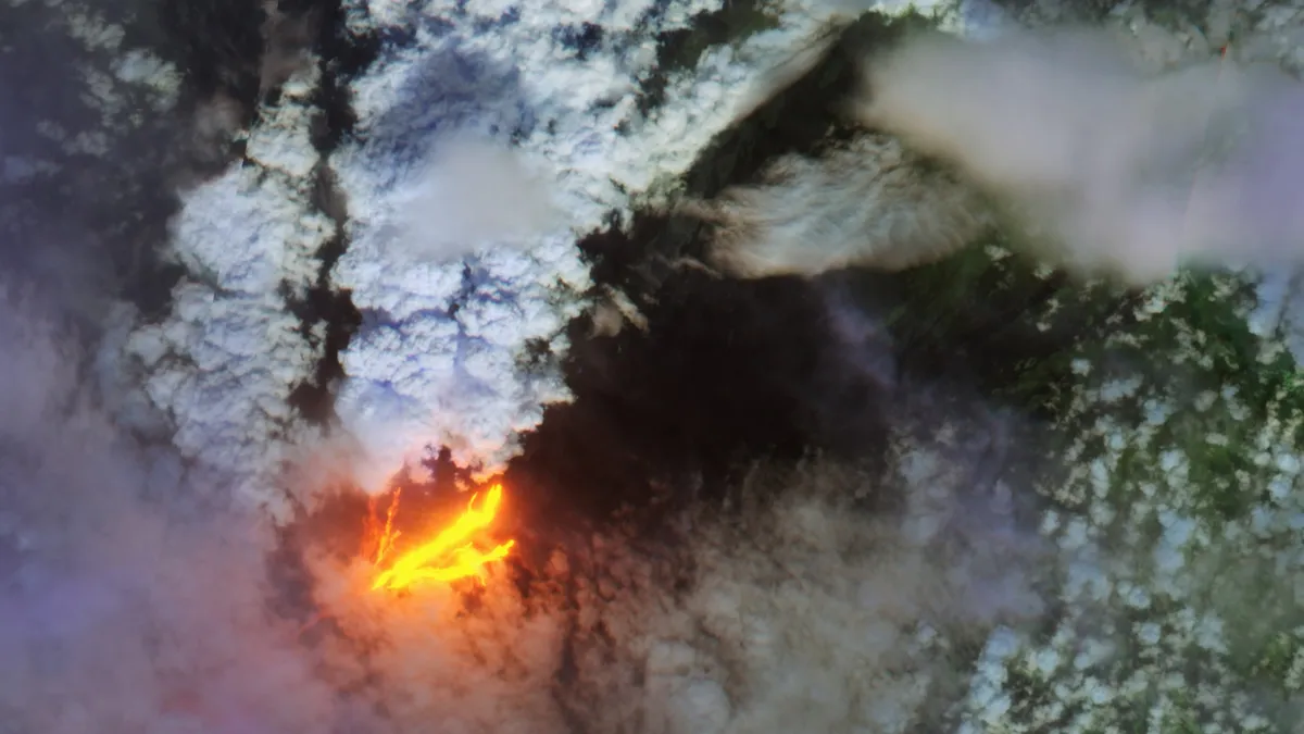
Government satellites are also keeping an eye on the eruption. The European Space Agency (ESA) released a composite view from Copernicus Sentinel-2 satellite data, also captured on Monday. Clouds of gas billow off the eruption, while infrared data highlights the heat of the flowing lava.


NASA also released a view of sulfur dioxide in the atmosphere as seen on Monday by ESA's Sentinel-5P satellite and its Tropospheric Monitoring Instrument (TROPOMI) sensor. Sulfur dioxide is one of the gases being released by the eruption. TROPOMI and similar sensors on NASA and U.S. National Oceanic and Atmospheric Administration (NOAA) satellites can also measure how high in Earth's atmosphere the sulfur dioxide reaches, which reflects how energetic an eruption is.
Meanwhile, early Monday morning, the Suomi-NPP satellite, a partnership between NASA and the NOAA, flew over Hawaii. The satellite used its Visible Infrared Imaging Radiometer Suite (VIIRS) instrument to spot the glowing lava far outshining the island's night lights as seen in October.
Lava has poured out of several fissures in Mauna Loa's Northeast Rift Zone, some spraying fountains as high as 160 feet (50 meters). USGS officials expect the eruption to remain within the Northeast Rift Zone; the volcano has a similar rift zone to the southwest.
Email Meghan Bartels at mbartels@space.com or follow her on Twitter @meghanbartels. Follow us on Twitter @Spacedotcom and on Facebook.
