Astronauts on the International Space Station captured the aftermath of the massive volcanic eruption that tore up a small island in the Pacific Ocean and sent tons of ash into the atmosphere on Saturday (Jan. 15).
Several weather satellites captured the eruption as it happened, revealing the massive cloud resembling a nuclear explosion that engulfed the entire Polynesian Kingdom of Tonga immediately after the blast.
The volcanic ash stirred up by the blast was later detected at altitudes of up to 24 miles (39 kilometers), providing a frightening spectacle to astronauts aboard the orbital outpost.
Related: 10 incredible volcanoes in our solar system
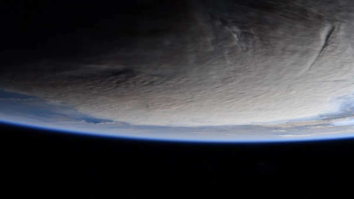
NASA astronaut Kayla Barron captured four photos of the ash plumes as the station passed over New Zealand, some 1,200 miles (2,000 km) south of the volcano, on Sunday (Jan. 16), one day after the eruption. The photos show darkened skies above Earth blanketed by thick ash clouds.
"Ash from Saturday's underwater volcanic eruption in the remote Pacific nation of Tonga made its way thousands of feet into the atmosphere & was visible from @Space_Station. During a pass over New Zealand on Sunday, Kayla Barron opened the window & saw the effects of the eruption," NASA said in a Tweet.
The eruption of the underwater volcano destroyed the Hunga-Tonga-Hunga-Ha'apai island, which was fortunately uninhabited. The tsunami triggered by the eruption, however, caused considerable damage to the surrounding islands of the remote kingdom, which straddles the tectonically active boundary between the Pacific and Australian plates.


The volcano was showing signs of intensifying activity over the preceding weeks, having already erupted in December. That eruption, however, was seven times less powerful. Volcanologists said the Saturday blast was the most powerful volcanic eruption Earth experienced since that of Mount Pinatubo in the Philipines in 1991.
Satellites operated by Maxar Technologies captured the devastation caused by the tsunamis and ashfall after the eruption on the surrounding islands, including the Kingdom of Tonga's main island Tongatapu. Disaster mitigation teams are still assessing the damage as the tsunami disrupted communication networks in the region.
The tsunami triggered by the eruption reached way beyond Polynesia. Alerts were in place for parts of the Pacific coast of both Americas, the relatively nearby New Zealand as well as Japan. While those advisories have since been lifted, local authorities warned further eruptions of the volcano may occur, along with subsequent tsunamis.
Follow Samantha Mathewson @Sam_Ashley13. Follow us on Twitter @Spacedotcom and on Facebook.