
Two wildfires in Northern Arizona, sparked from lightning, have burned at least 60,000 acres in a little over a week — and, while firefighters work around the clock trying to contain the fires, National Oceanic and Atmospheric Administration (NOAA)'s satellites are aiding the fight from space. The fires have also spread to the Grand Canyon.
The first wildfire to directly impact Grand Canyon National Park was the Dragon Bravo Fire, which began on July 4. Dragon Bravo has already scorched thousands of acres and continues to destroy a number of structures, including the monumental Grand Canyon Lodge, along its path within the park’s North Rim. Five days after the Dragon Bravo Fire began, another thunderstorm resulted in the creation of the White Sage Fire, which rapidly grew and expanded during a period of dry and hot weather accompanied by powerful wind gusts.
In order to fight the fires from all angles, firefighters, weather forecasters and community leaders depend on information gathered in space from satellites. Some satellites are equipped with instruments that can monitor a wildfire's progression and growth, as well as provide high-resolution photos of both the fire itself and the associated smoke plume. There are two satellite constellations from NOAA that particularly tag-team with wildfire updates: the Geostationary Operational Environmental Satellite (GOES) and the Joint Polar Satellite System (JPSS). Together, the satellites can paint a picture using tools they're equipped with, with JPSS tracking the United States in a non-geosynchronous orbit while 512 miles (824 kilometers) above us and GOES orbiting around the Earth at the same speed in a geosynchronous orbit while 22,236 miles (35,786 kilometers) above.
So, how do satellites gather information that's crucial in the fight to contain a wildfire?
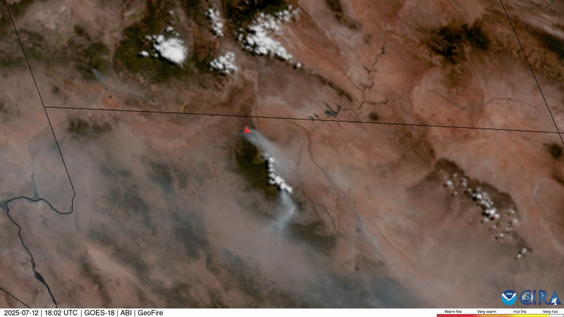
There are different filters and spectral bands that can be used to get that information., and tools on the satellites are able to analyze just those two things. These tools capture high-resolution images of the growth and expansion of a wildfire in almost real-time. They can also show, via time-lapse, the direction that fire and smoke are moving. If we look at the time-lapse of images taken by the Advanced Baseline Imager (ABI) aboard NOAA's GOES-18 satellite, you can see where the fire originated, its rapid growth and expansion, and how the direction of the wind steered the flames over time (in this view, the winds were blowing from the north/northwest).
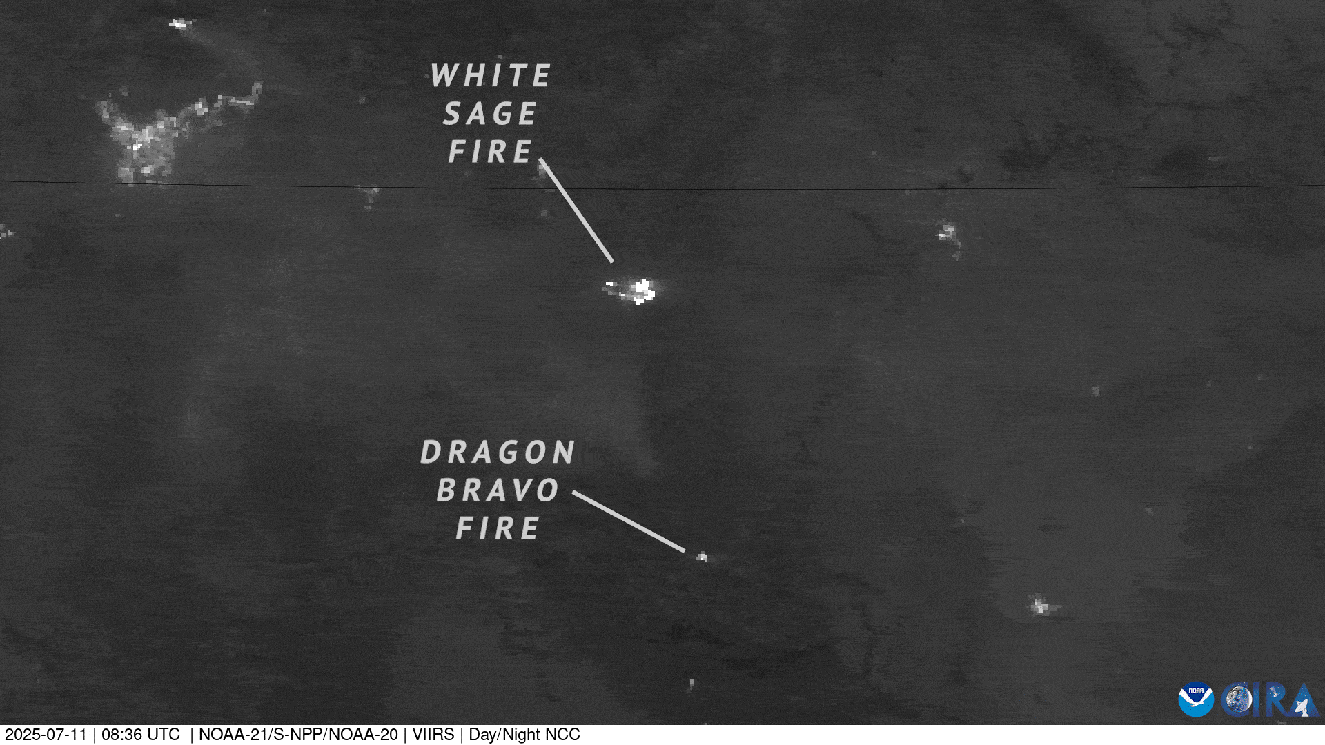
Another instrument that regularly provides important information about wildfires lives on NOAA's JPSS satellites, NOAA-20 and NOAA-21. Even after the sun goes to sleep, the Visible Infrared Imaging Radiometer Suite (VIIRS) can continue to snap photos of the wildfire. These details keep first responders and community leaders aware of the fire's behavior — and alert them if any growth, new hot spots, or updates critical with fighting the wildfire can be seen. These monitoring tools thus remain of extreme importance, continuously providing information to help us understand a wildfire with a level of accuracy and precision that ground reports alone cannot offer.
You can find more information on both the Dragon Bravo and White Sage fires through the InciWeb site and any closure details from Grand Canyon National Park are located here.
