Gorgeous NASA photo shows a volcano eruption in Iceland at night
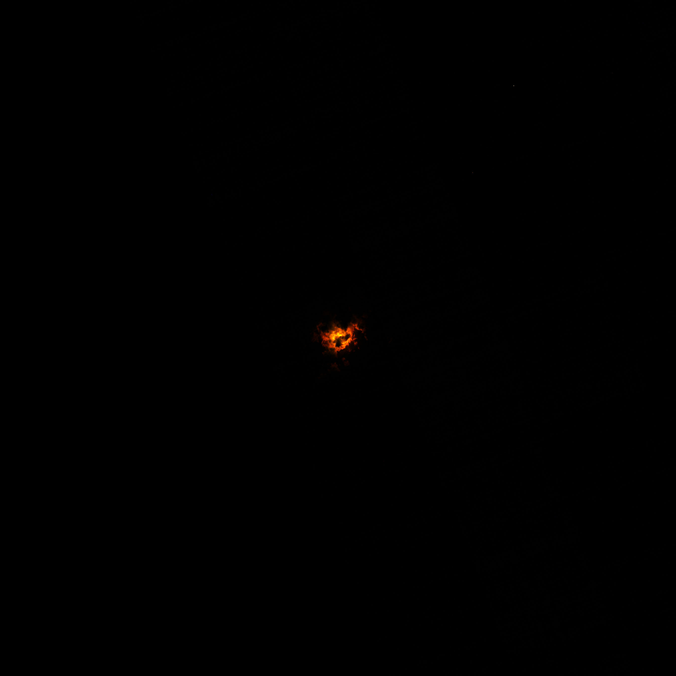
Using data from NASA's Landsat satellite, NASA Earth Observatory visualizers have revealed how lava from a recent volcano eruption lights up the clouds from below.

Breaking space news, the latest updates on rocket launches, skywatching events and more!
You are now subscribed
Your newsletter sign-up was successful
Want to add more newsletters?

Delivered daily
Daily Newsletter
Breaking space news, the latest updates on rocket launches, skywatching events and more!

Once a month
Watch This Space
Sign up to our monthly entertainment newsletter to keep up with all our coverage of the latest sci-fi and space movies, tv shows, games and books.

Once a week
Night Sky This Week
Discover this week's must-see night sky events, moon phases, and stunning astrophotos. Sign up for our skywatching newsletter and explore the universe with us!

Twice a month
Strange New Words
Space.com's Sci-Fi Reader's Club. Read a sci-fi short story every month and join a virtual community of fellow science fiction fans!
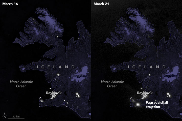
The eruption of Iceland's Fagradalsfjall volcano is so vibrant it can be seen from space, and satellites orbiting hundreds of miles above the ground have captured images of the eruption from orbit.
Using data from the Operational Land Imager on NASA and the U.S. Geological Survey's Landsat 8 satellite, NASA data visualizer Joshua Stevens pieced together a false-color image of the eruption. The image shows the eruption at 10:25 p.m. local time (2225 GMT) on March 22, three days after it started on March 19.
Related: Mount Etna's fiery eruptions seen from space (satellite photos)

The ominous, nighttime image was made from a combination of shortwave and near-infrared data (bands 7, 6, 5), according to NASA. It shows how the lava lit up the clouds from below. Because lava is so hot, it can "glow" in the shortwave-infrared part of the electromagnetic spectrum.
Although the image looks like a ball of fire in the sky, and the volcano can be seen more than 20 miles (30 kilometers) away in the nation's capital of Reykjavik, there's very little danger to people in the surrounding area, the NASA statement said.
In fact, people are traveling to see the eruption, rather than fleeing from it. One brave tourist even flew a drone slightly above the lava path, leading to the vent of the erupting volcano. The resulting video is breathtaking.
This eruption comes after three weeks of earthquakes in the area, with the nation recording more than 50,000. Currently, experts predict that the eruption will be a "long-hauler."
Breaking space news, the latest updates on rocket launches, skywatching events and more!
As the eruption continues, we can likely expect to see more images of the impressive lava flow, both from Earth and from satellites. In fact, Planet Labs has already posted a daytime view of the eruption on Twitter, taken from the labs' SkySat satellites.
After days of ☁️ with a chance of ❄️ one of Planet’s high-resolution SkySats captured a glimpse of Iceland’s Fagradalsfjall volcano. Imagery including near-infrared light (second image) highlights the path of the molten lava. pic.twitter.com/xniab0qbdKMarch 26, 2021
Follow Kasandra Brabaw on Twitter @KassieBrabaw. Follow us on Twitter @Spacedotcom and on Facebook.

Kasandra Brabaw is a freelance science writer who covers space, health, and psychology. She's been writing for Space.com since 2014, covering NASA events, sci-fi entertainment, and space news. In addition to Space.com, Kasandra has written for Prevention, Women's Health, SELF, and other health publications. She has also worked with academics to edit books written for popular audiences.

