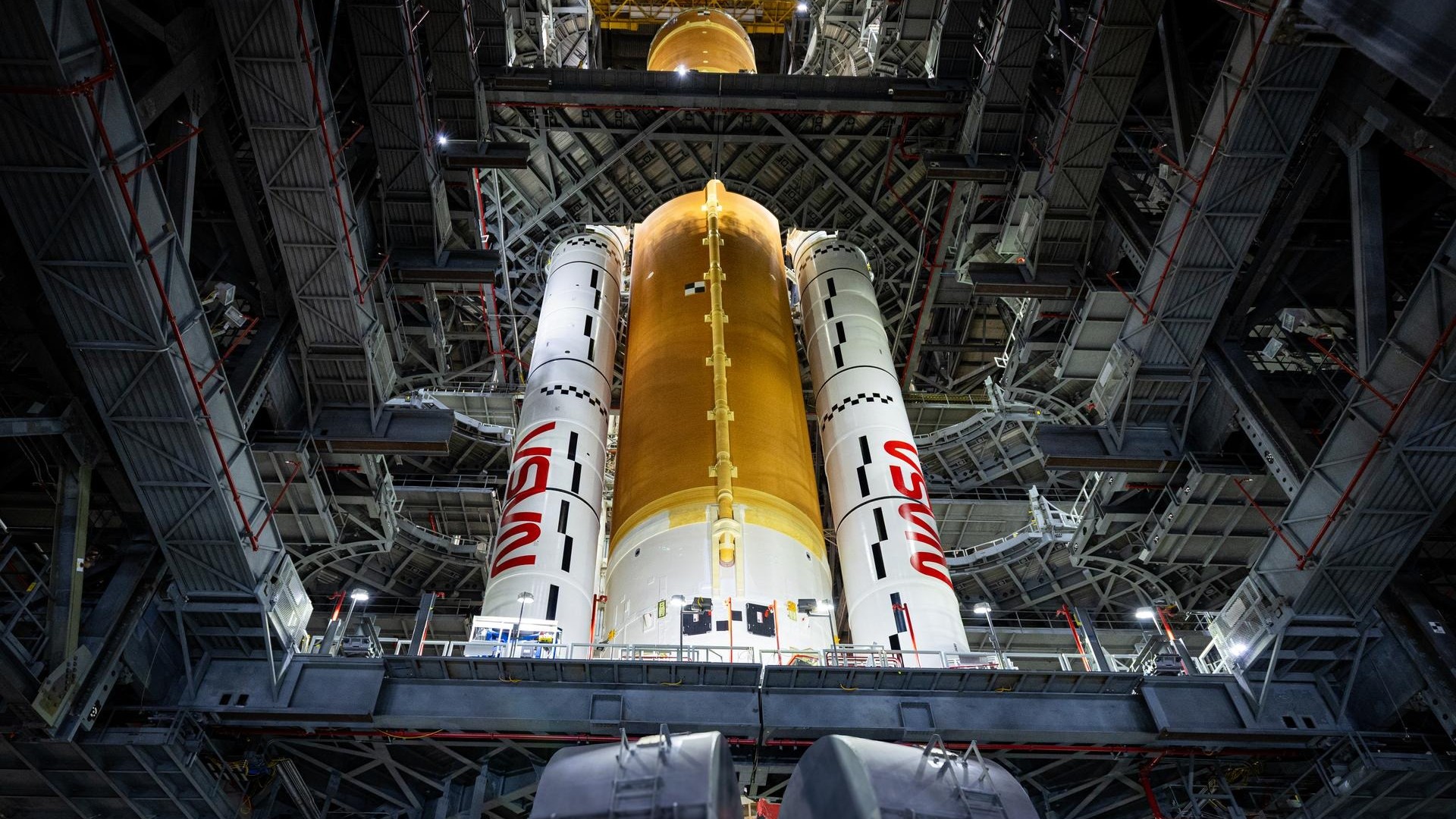
In Photos: Hurricane Dorian from Space in Astronaut and Satellite Views
Here's what Hurricane Dorian looks like from space.
As Hurricane Dorian pummels the Caribbean and the U.S. East Coast, NASA satellites and space station astronauts are keeping an eye on the epic storm from space.
In the gallery below, you can see how Dorian strengthened from a tropical storm into a dangerous Category 5 hurricane during the last week of August. The hurricane has since been downgraded to a Category 2 storm (as of Sept. 3), and it's currently crawling northward near the east coast of Florida. It's not yet clear where the storm will make landfall next, but it appears to be heading for North and South Carolina.
Related: Watch Hurricane Dorian in Action in these Gifs from Space
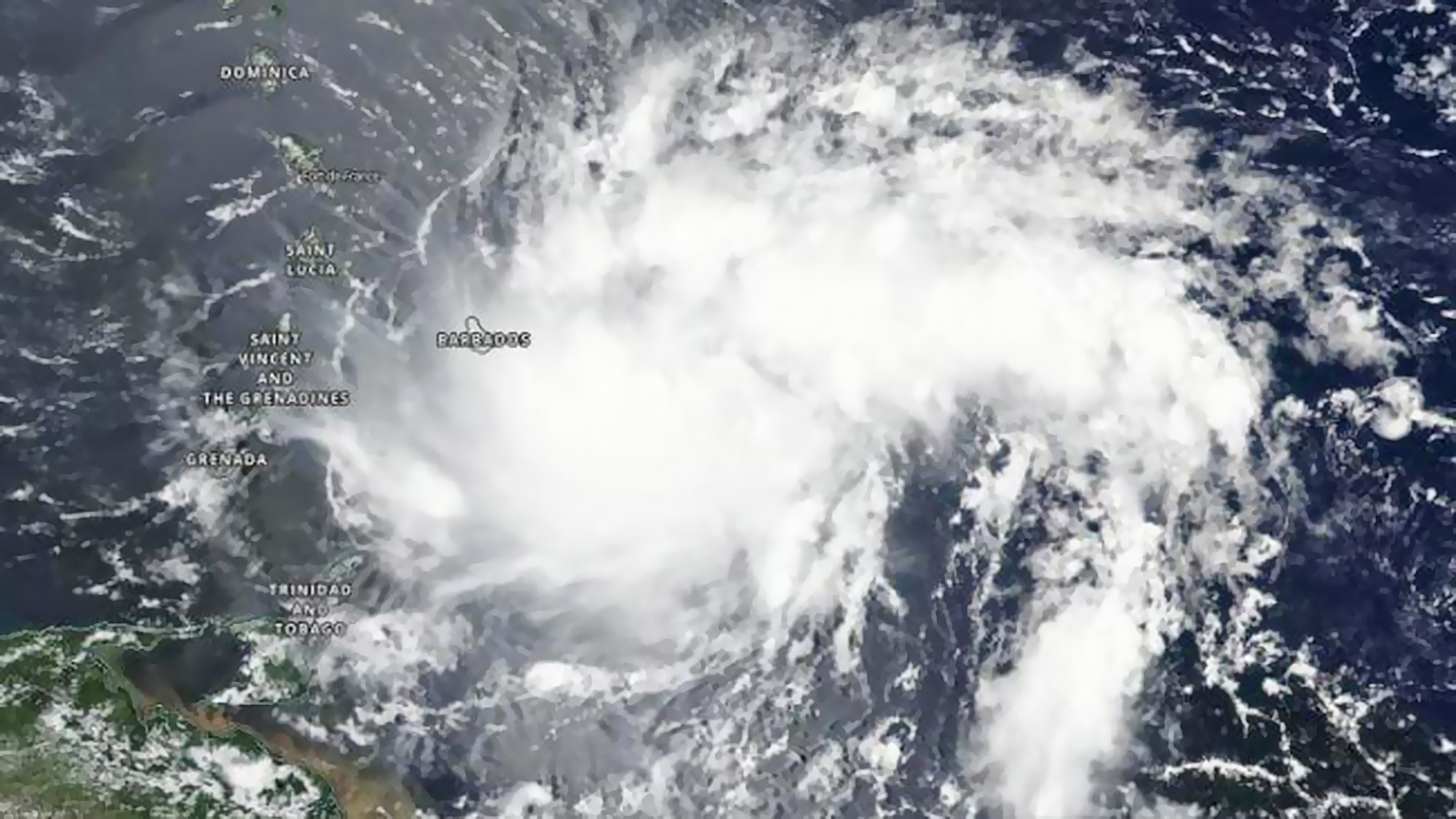
The NASA/NOAA Suomi NPP satellite captured this image of Tropical Storm Dorian on Aug. 26, 2019. At the time, the tropical storm was approaching the Leeward Islands in the eastern Caribbean Sea.
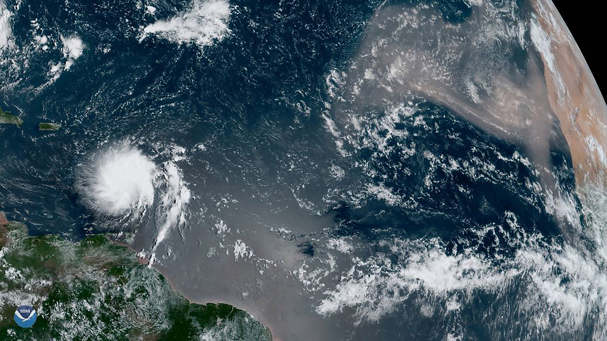
NOAA's GOES-East satellite spotted Tropical Storm Dorian over the Caribbean Sea on Aug. 27, 2019. At the time, it was approaching Puerto Rico and the U.S. and British Virgin Islands.
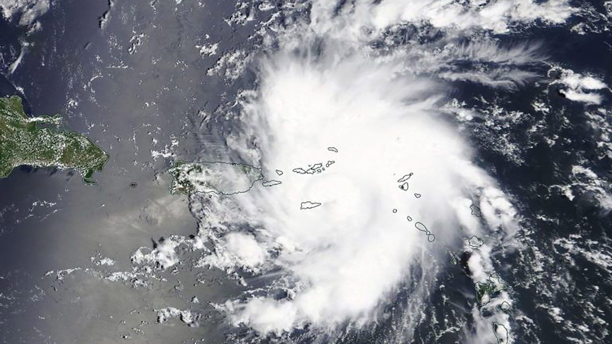
NASA's Terra satellite captured this view of Dorian on Aug. 28, 2019 at at 1:30 p.m. EDT (1730 GMT), shortly before the tropical storm strengthened into a hurricane.
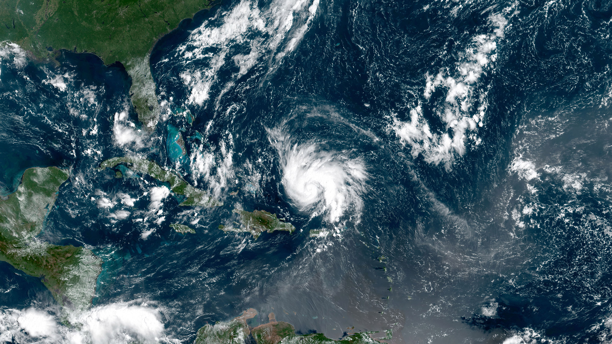
NASA's GOES-16 weather satellite acquired data for this natural-color image of Hurricane Dorian on Aug. 29, 2019 at 11 a.m. EDT (1500 GMT). Hurricane Dorian was a Category 1 storm at the time, and it strengthened to a Category 2 later that night.
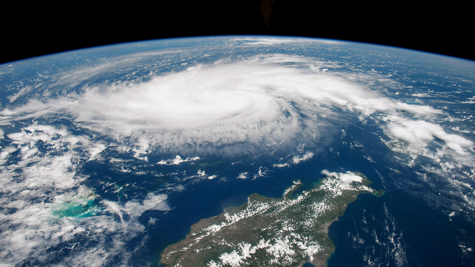
This photograph was shot by an astronaut at the International Space Station on Aug. 29, 2019 at 1:12 p.m. EDT (1712 GMT), when the Category 1 hurricane had maximum sustained winds of 85 miles (135 km) per hour.
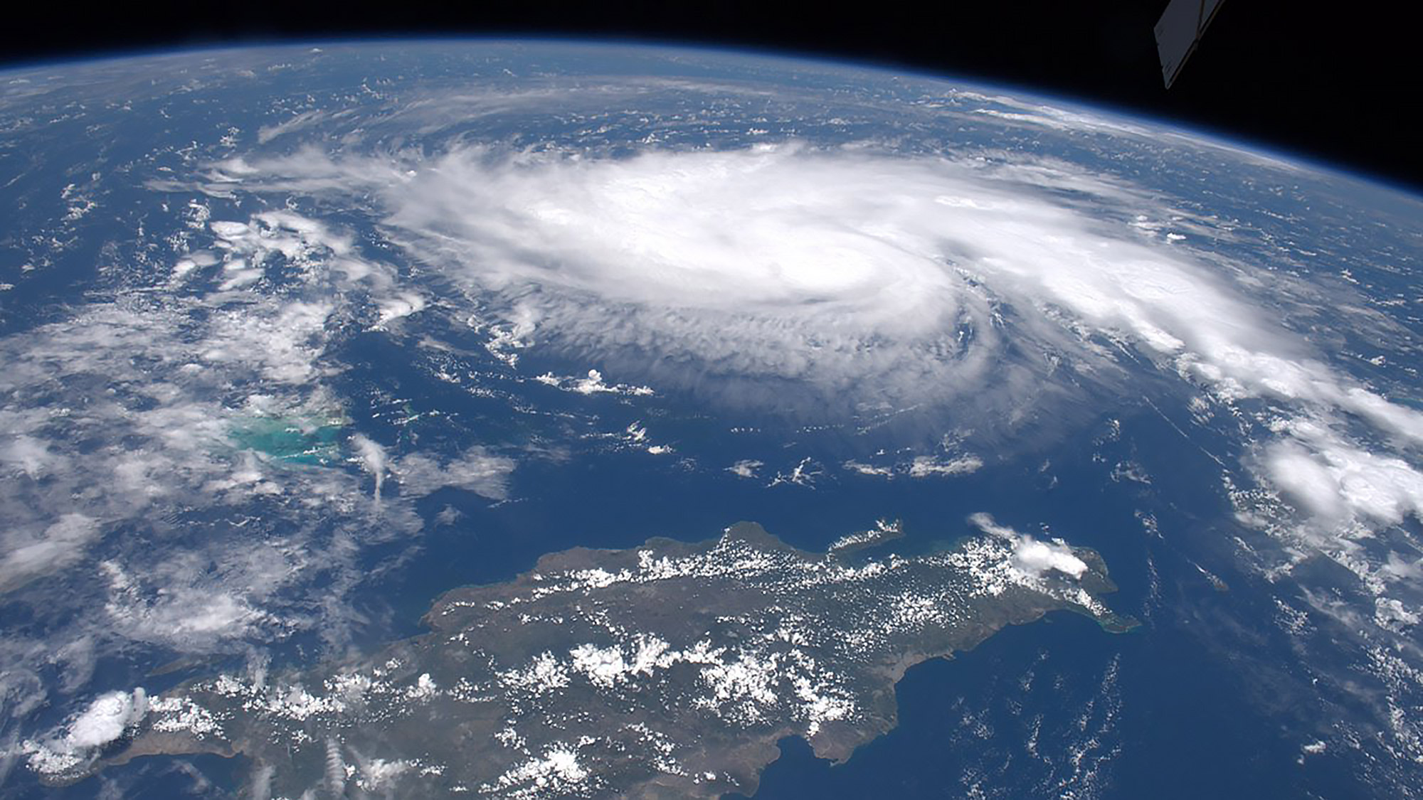
NASA astronaut Drew Morgan took this photo of Hurricane Dorian from the International Space Station on Aug. 29, 2019, as the storm traveled across the Caribbean north of Haiti and the Dominican Republic.
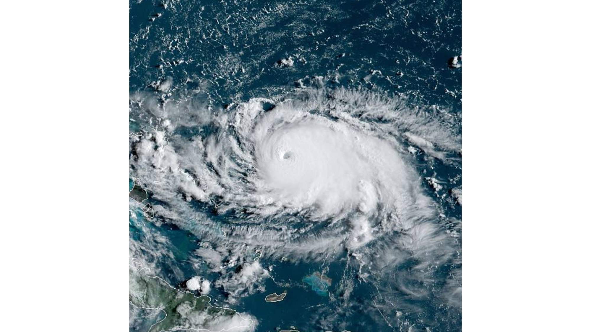
Hurricane Dorian's eye is clearly visible from space in this view from NOAA's GOES-East satellite, taken on Aug. 31, 2019. At the time, Dorian was a Category 4 hurricane.
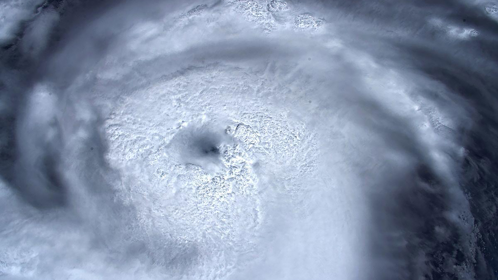
European Space Agency astronaut Luca Parmitano shared this view of Category 4 Hurricane Dorian from the International Space Station on Aug. 31, 2019. "Staring into the eye of the storm," he wrote on Twitter.
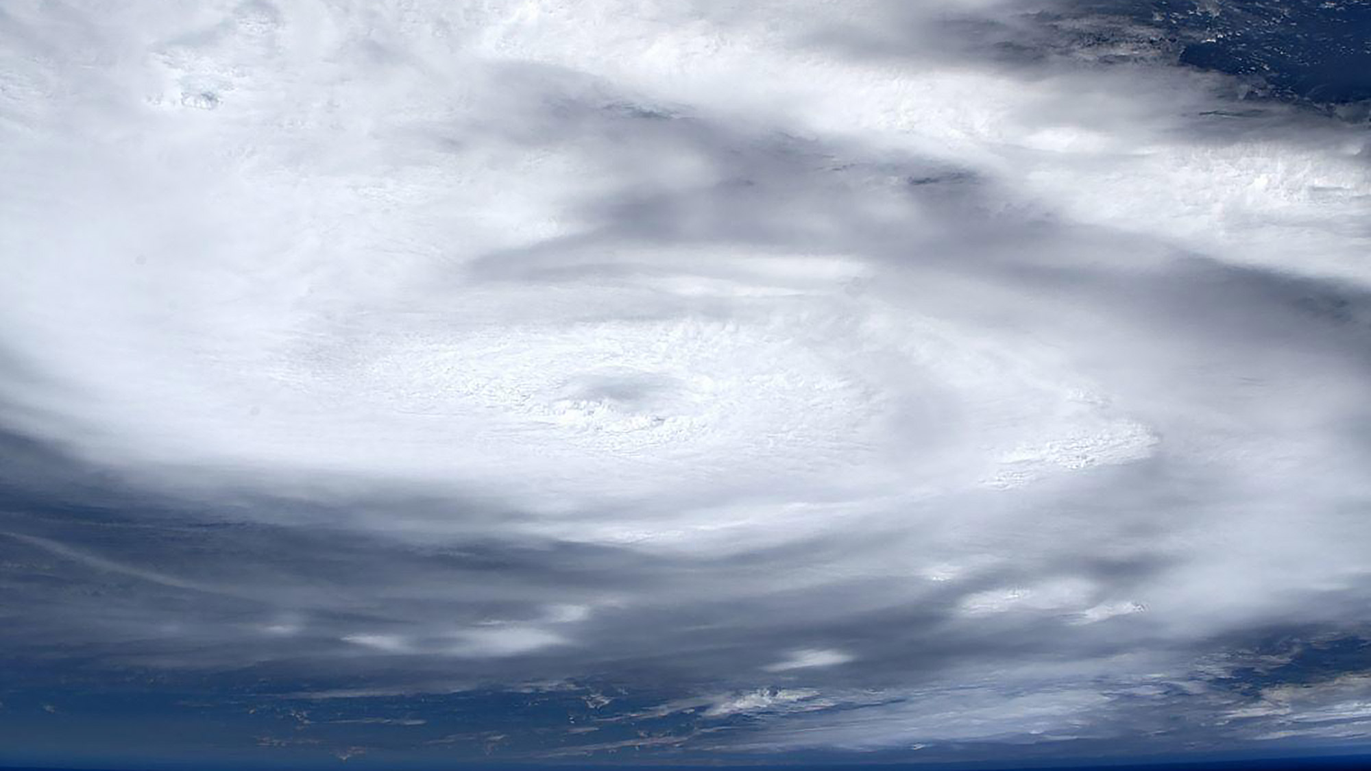
European Space Agency astronaut Luca Parmitano shared this view of Hurricane Dorian from the International Space Station on Sept. 1, 2019.
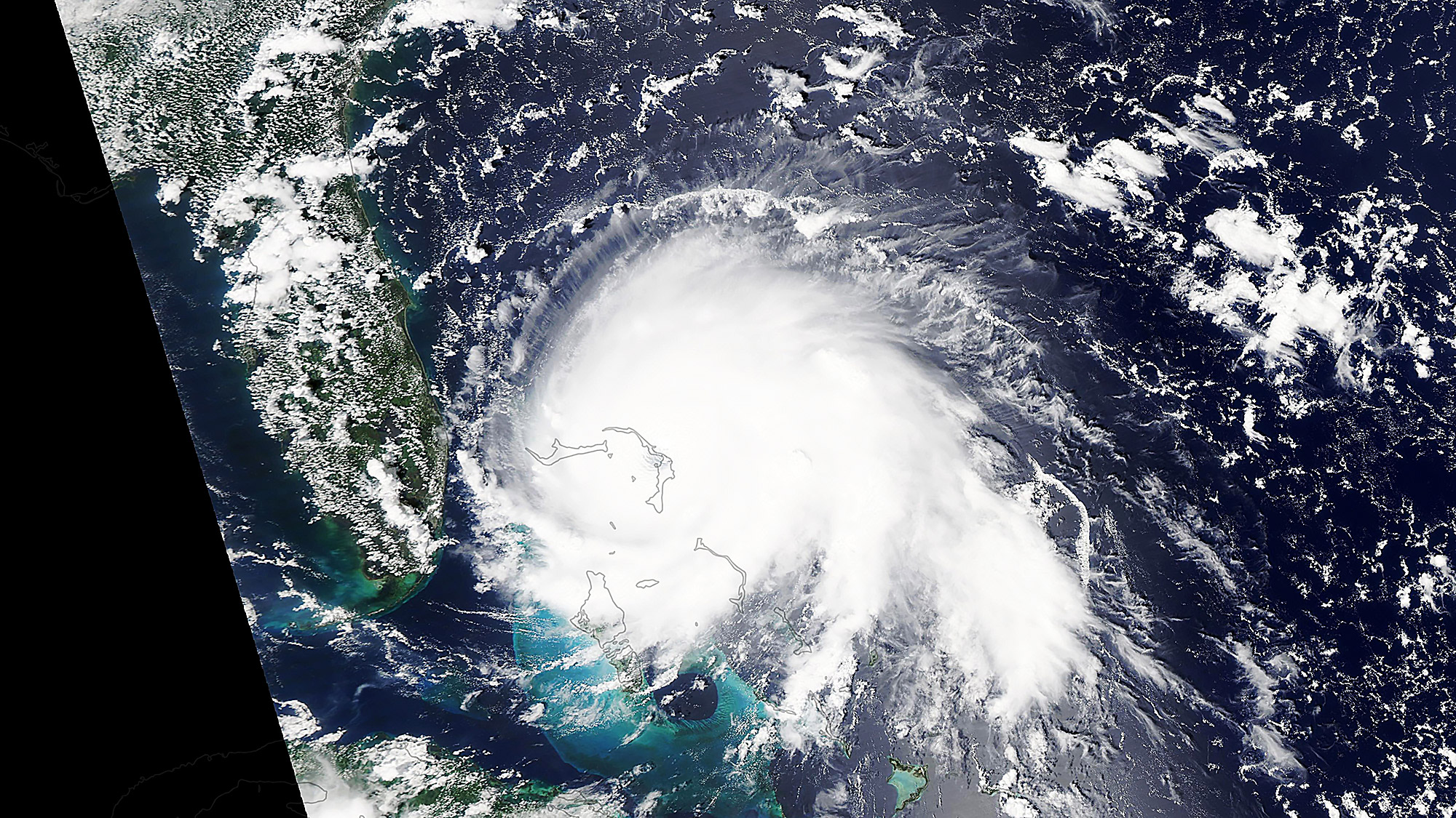
NASA's Aqua satellite captured this natural-color image of Hurricane Dorian on Sept. 1, 2019 at 2:05 p.m. EDT (1805 GMT), when it was a Category 5 storm. The eye of the storm was directly over the island of Great Abaco in the northern Bahamas.
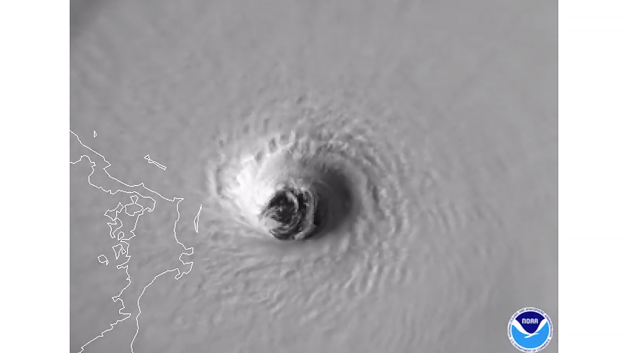
The eye of Hurricane Dorian, a Category 5 storm, dominates this view from NOAA's GOES-East satellite as the storm approached the Abaco Islands in the Atlantic Ocean on Sept. 1, 2019.
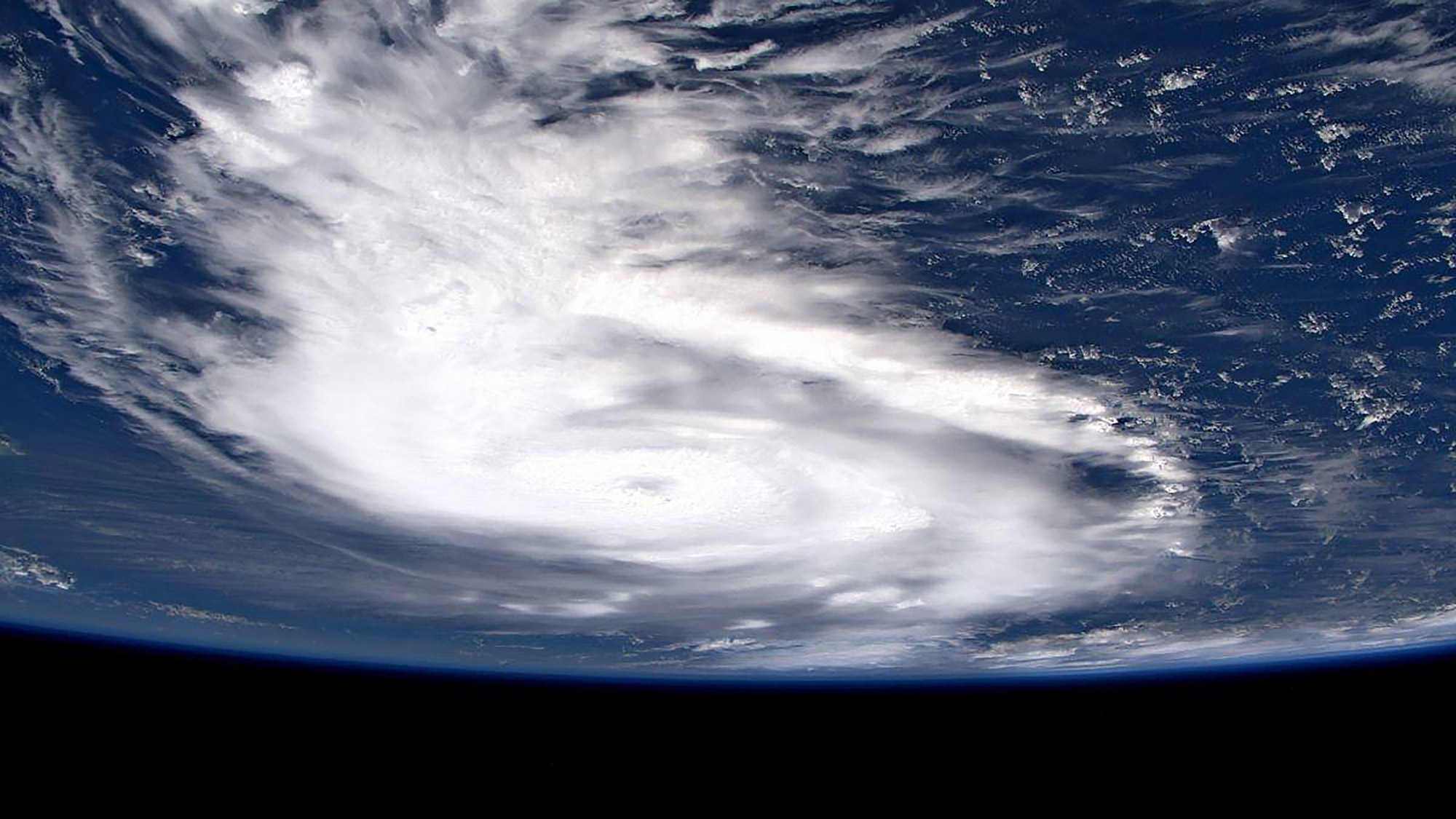
European Space Agency astronaut Luca Parmitano shared this view of Hurricane Dorian from the International Space Station on Sept. 1, 2019.
Full Story: Astronaut Zooms In on Hurricane Dorian, Now a Category 4 Storm, in These Space Station Photos
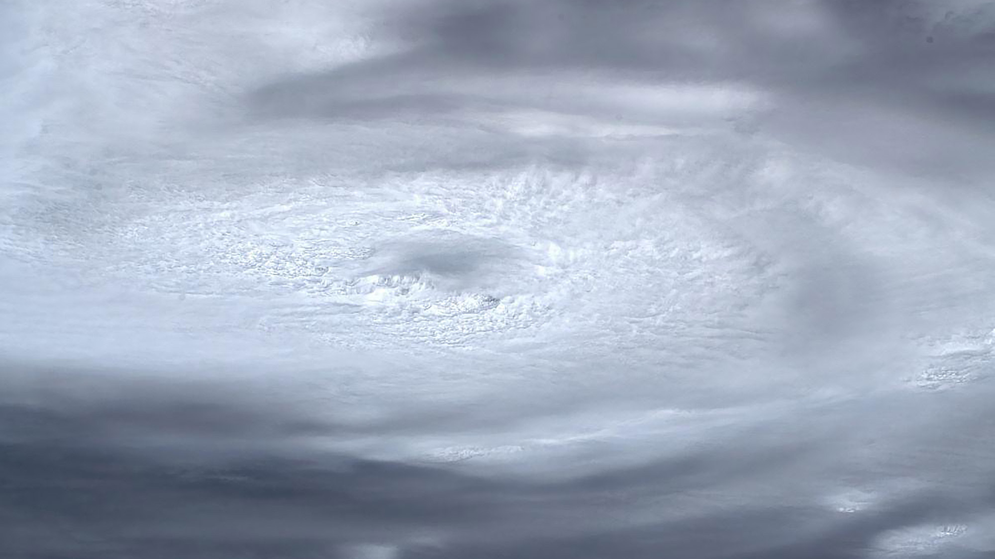
European Space Agency astronaut Luca Parmitano shared this close-up view of Hurricane Dorian from the International Space Station on Sept. 1, 2019.
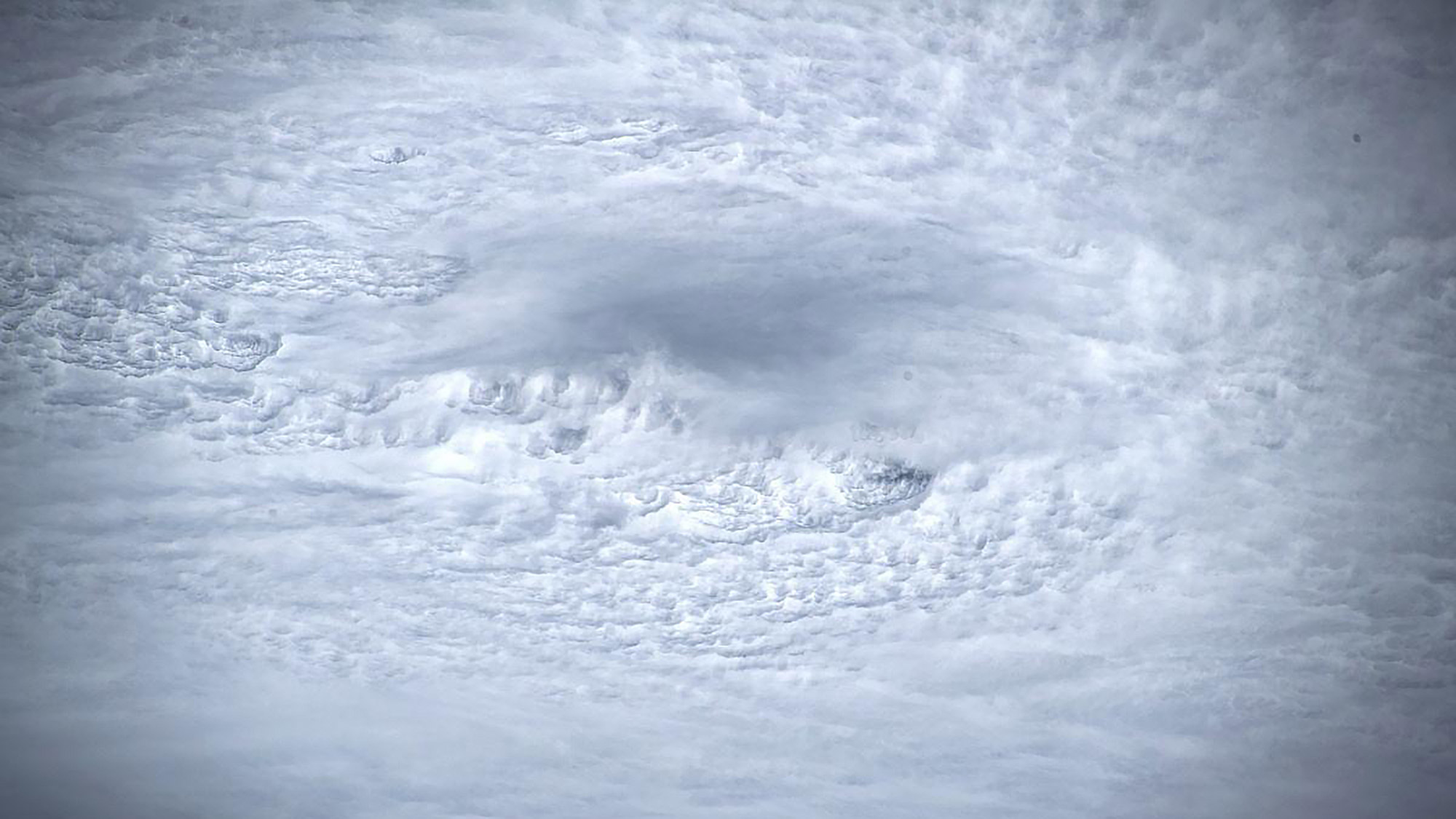
European Space Agency astronaut Luca Parmitano shared this close-up view of the eye of Hurricane Dorian as seen from the International Space Station on Sept. 1, 2019.
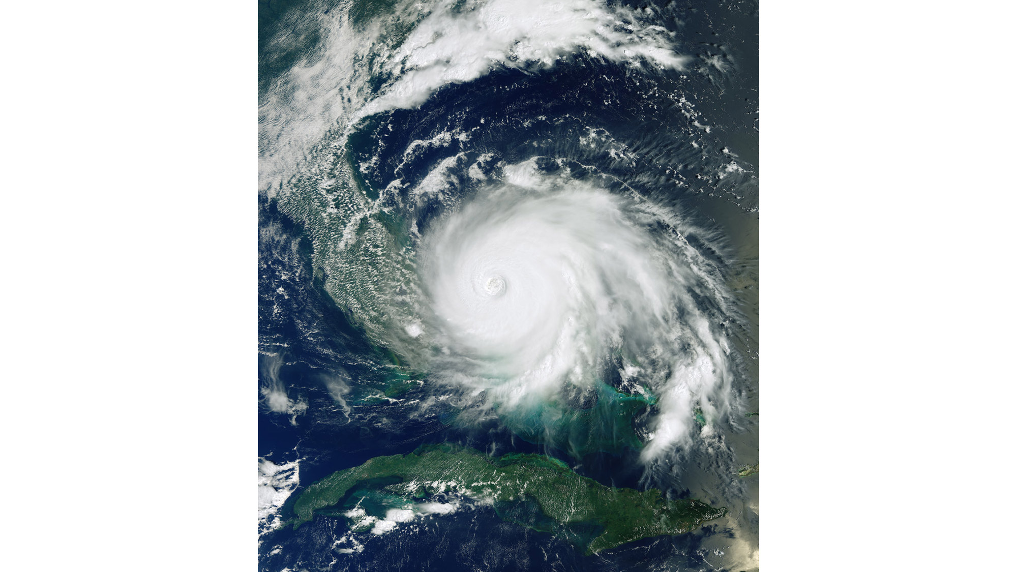
An image from the European Space Agency's Copernicus Sentinel-3 satellite features Hurricane Dorian as it pummels the Bahamas as a Category 4 storm, on Sept. 2, 2019 at 11:16 a.m. EDT (15:16 GMT).
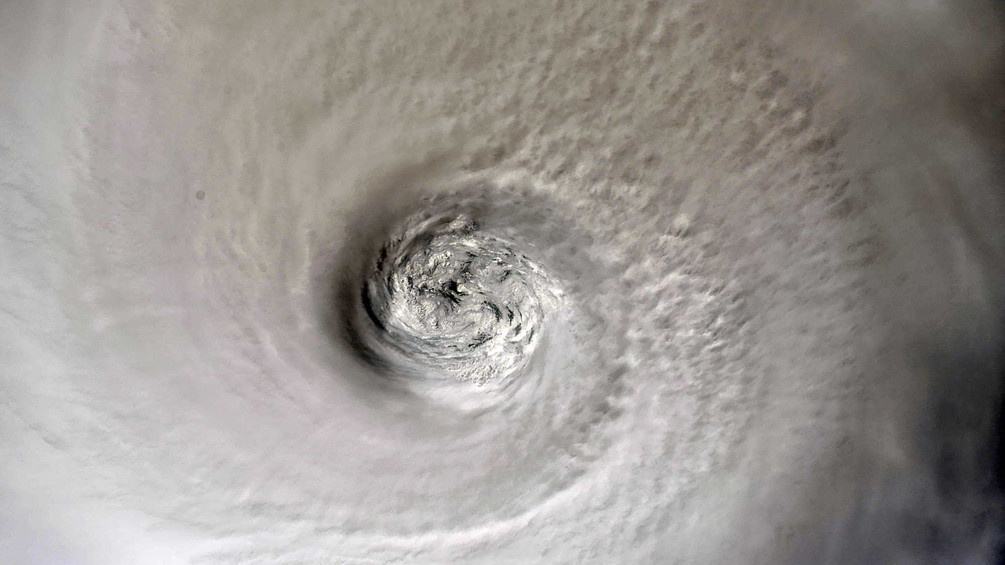
NASA astronaut Christina Koch captured this view of Hurricane Dorian from the International Space Station on Sept. 2, 2019.
Full Story: Astronauts in Space 'Feel the Power' of Hurricane Dorian as NASA's Florida Spaceport Braces for the Storm
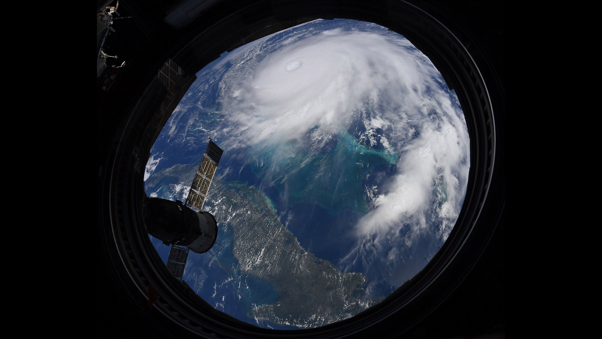
NASA astronaut Christina Koch shared this photo of Hurricane Dorian as seen from the International Space Station on Sept. 2, 2019.
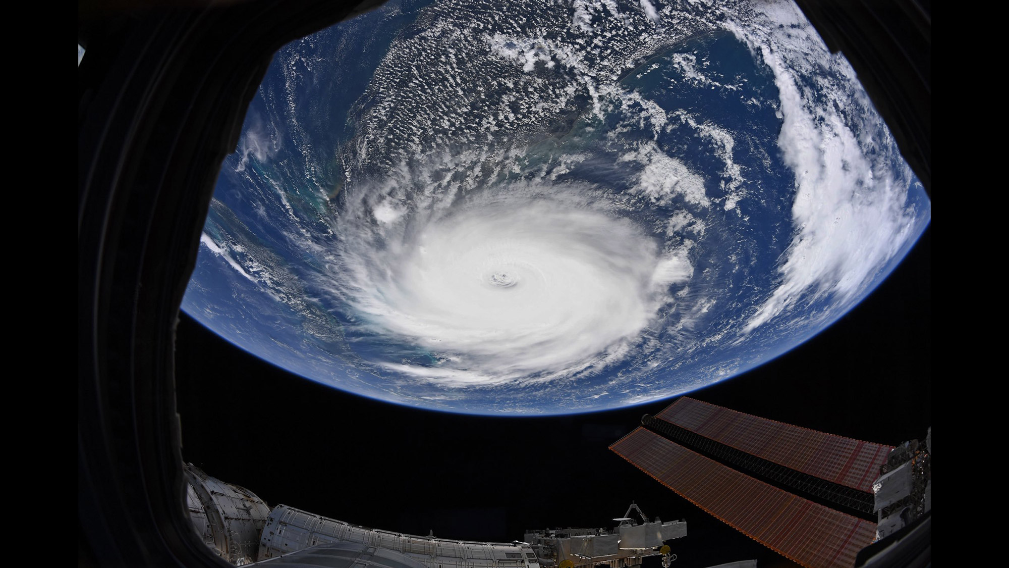
NASA astronaut Christina Koch shared this view of Hurricane Dorian from the International Space Station on Sept. 2, 2019.
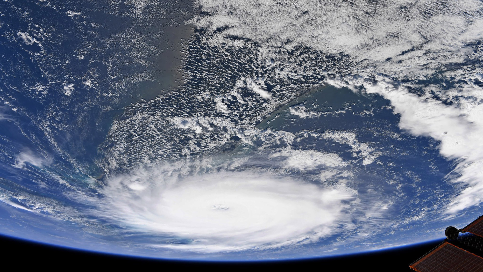
NASA astronaut Christina Koch captured this photo of Hurricane Dorian from the International Space Station on Sept. 2, 2019.
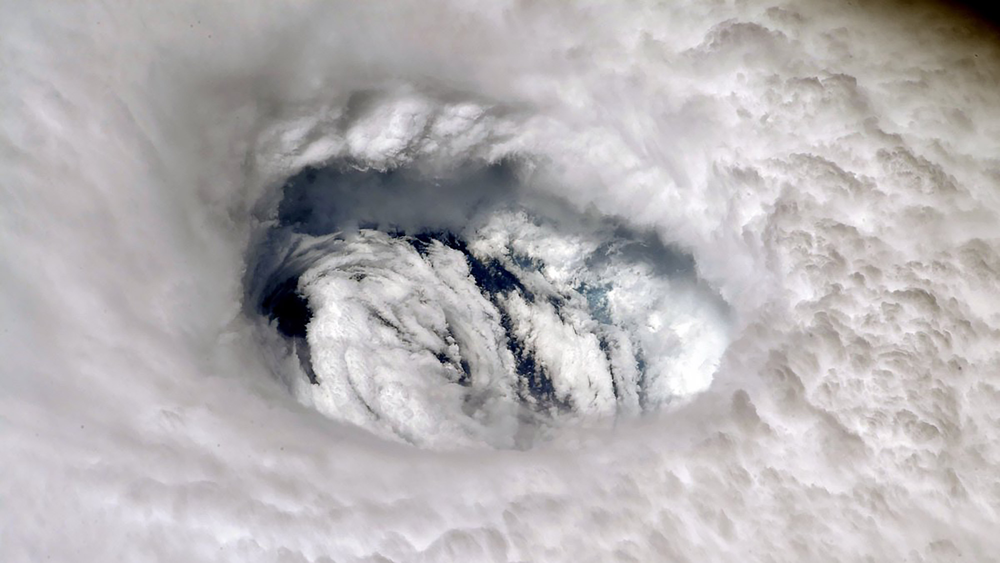
NASA astronaut Nick Hague shared this view of Hurricane Dorian from the International Space Station on Sept. 2, 2019. "You can feel the power of the storm when you stare into its eye from above," Hague tweeted.
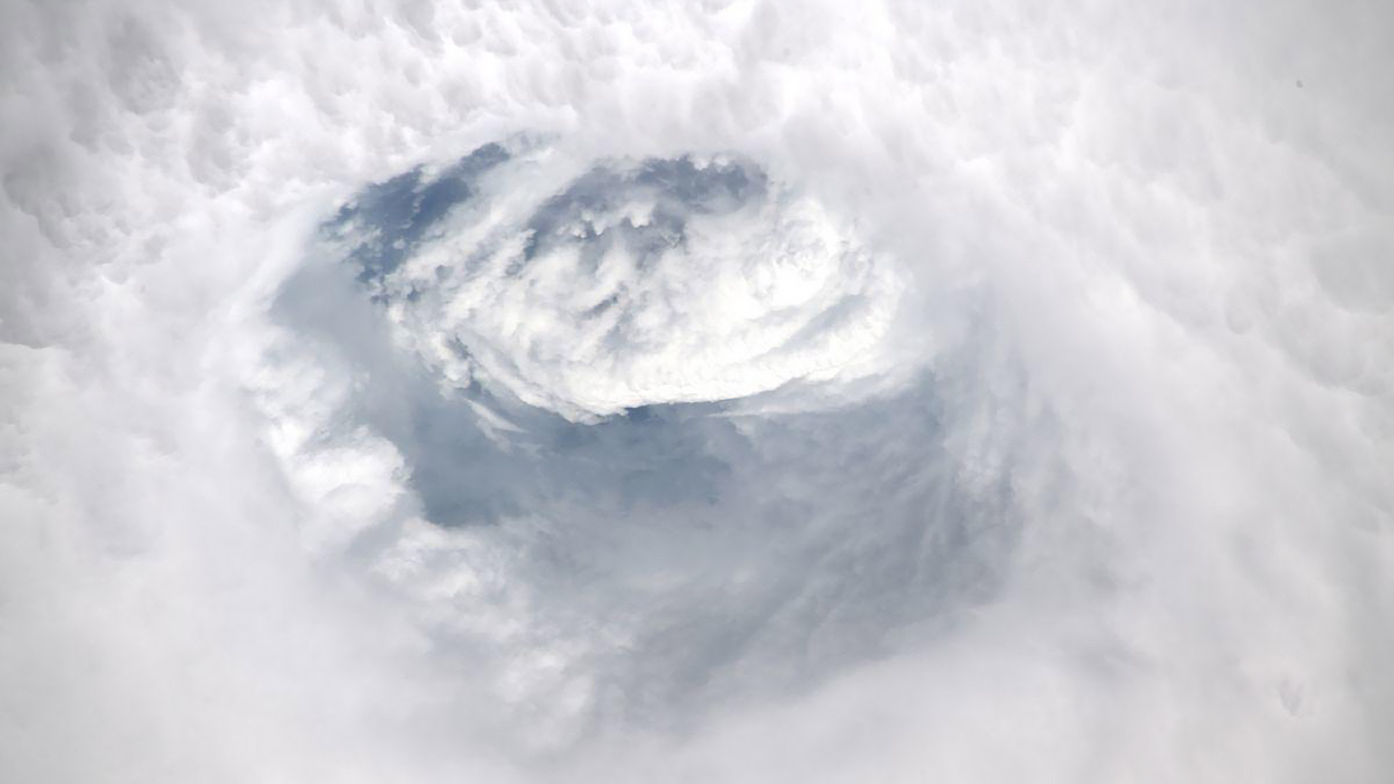
European Space Agency astronaut Luca Parmitano tweeted this view of Hurricane Dorian from the International Space Station on Sept. 2, 2019.
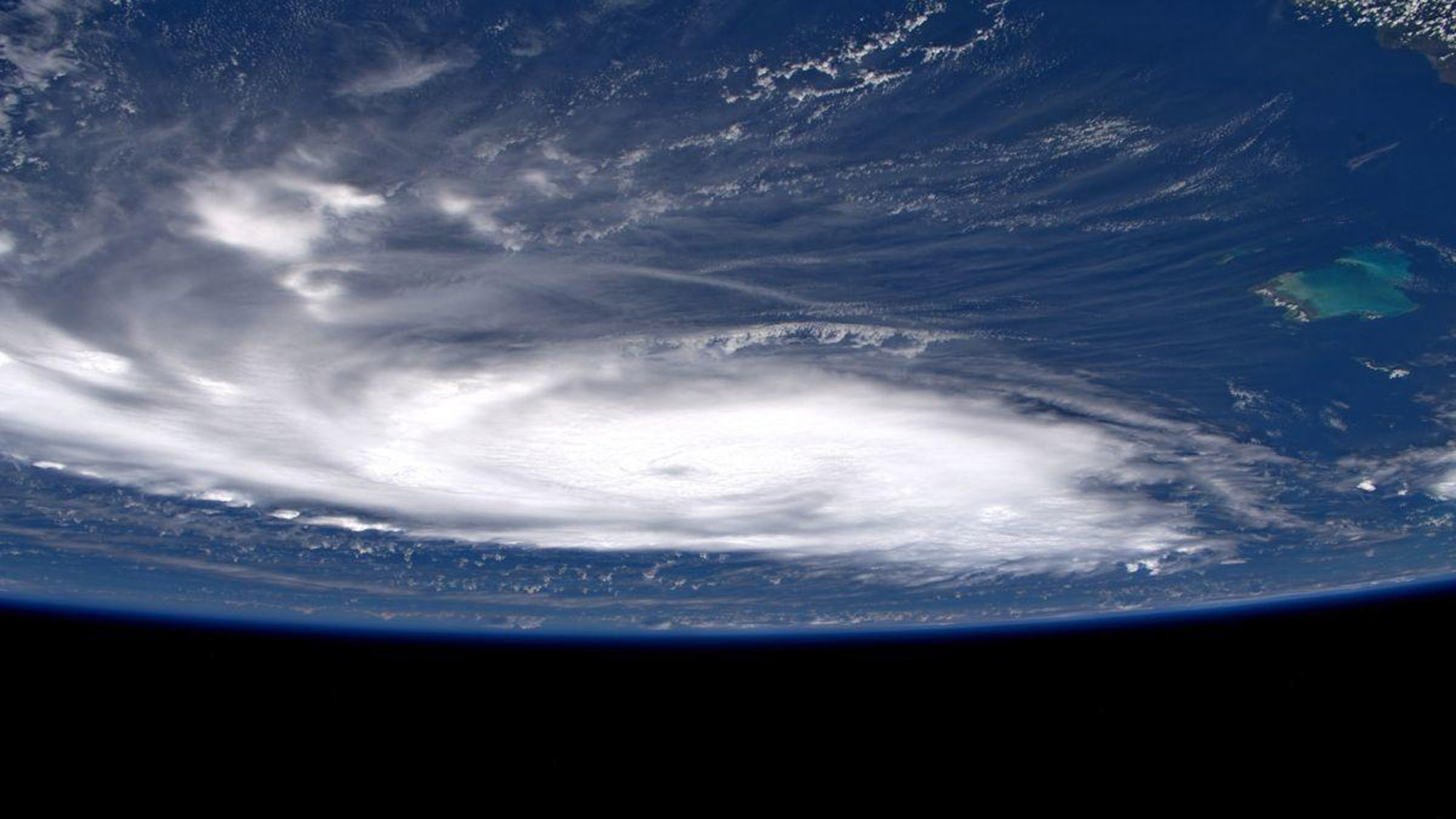
European Space Agency astronaut Luca Parmitano took this photo of Hurricane Dorian from the International Space Station on Sept. 3, 2019. "Dorian, its majestic power visible even as we fly away," the astronaut tweeted.
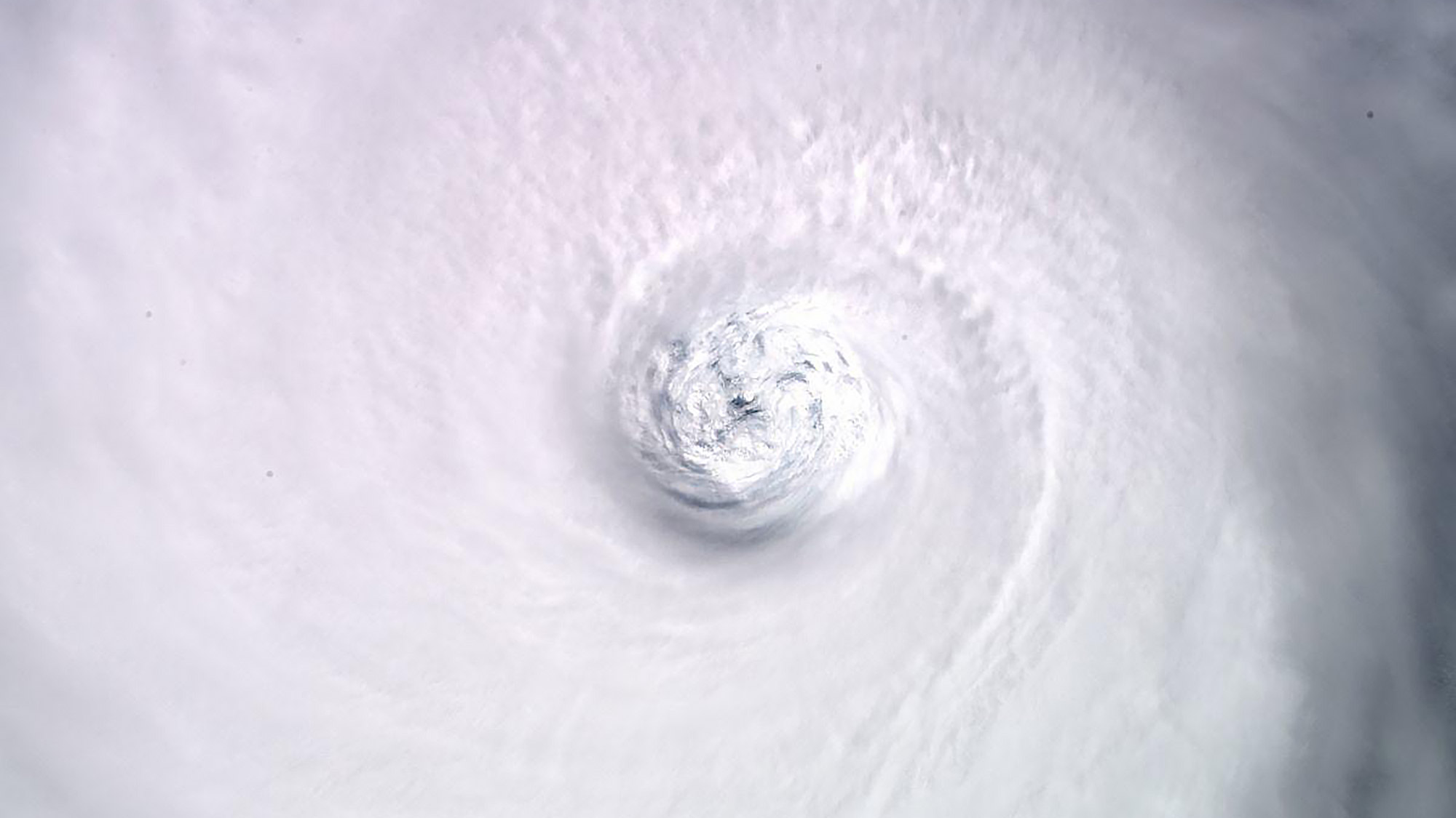
European Space Agency astronaut Luca Parmitano shared this view of Hurricane Dorian from the International Space Station on Sept. 3, 2019. "Dorian in its fully mature stage," he tweeted.
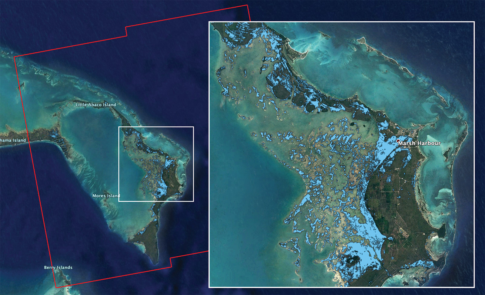
NASA used imagery captured by Europe's Copernicus Sentinel-1 satellites on Sept. 2, 2019, to produce this flood map of the Bahamas. The flooded areas are indicated in light blue.
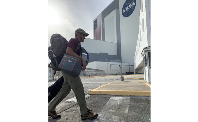
As Hurricane Dorian churned closer to NASA's Kennedy Space Center in Florida, 120 members of the "Ride Out Team" reported to the Launch Control Center "to monitor and mitigate possible damage to spaceflight hardware," NASA tweeted along with this photo, on Sept. 2.

A NASA employee camps out inside the Kennedy Space Center (KSC) in Florida during Hurricane Dorian. "Meet Madi: She's riding out #HurricaneDorian in our Launch Control Center," KSC tweeted Sept. 2. "Once its safe to go out, this industrial hygienist and her team immediately do a post storm hazard analysis at KSC."
See videos of Hurricane Dorian in action:
- NASA Sees Hurricane Dorian from Space Station (Video)
- How NASA and NOAA Are Tracking Hurricane Dorian from Space
- Hurricane Dorian Looks Massive from Space as NASA Prepares for Impacts
Email Hanneke Weitering at hweitering@space.com or follow her @hannekescience. Follow us on Twitter @Spacedotcom and on Facebook.
Breaking space news, the latest updates on rocket launches, skywatching events and more!

Hanneke Weitering is a multimedia journalist in the Pacific Northwest reporting on the future of aviation at FutureFlight.aero and Aviation International News and was previously the Editor for Spaceflight and Astronomy news here at Space.com. As an editor with over 10 years of experience in science journalism she has previously written for Scholastic Classroom Magazines, MedPage Today and The Joint Institute for Computational Sciences at Oak Ridge National Laboratory. After studying physics at the University of Tennessee in her hometown of Knoxville, she earned her graduate degree in Science, Health and Environmental Reporting (SHERP) from New York University. Hanneke joined the Space.com team in 2016 as a staff writer and producer, covering topics including spaceflight and astronomy. She currently lives in Seattle, home of the Space Needle, with her cat and two snakes. In her spare time, Hanneke enjoys exploring the Rocky Mountains, basking in nature and looking for dark skies to gaze at the cosmos.
