Hurricane Dorian Now a 'Catastrophic Category 5' Storm
It's now the strongest hurricane on modern record.
Breaking space news, the latest updates on rocket launches, skywatching events and more!
You are now subscribed
Your newsletter sign-up was successful
Want to add more newsletters?

Delivered daily
Daily Newsletter
Breaking space news, the latest updates on rocket launches, skywatching events and more!

Once a month
Watch This Space
Sign up to our monthly entertainment newsletter to keep up with all our coverage of the latest sci-fi and space movies, tv shows, games and books.

Once a week
Night Sky This Week
Discover this week's must-see night sky events, moon phases, and stunning astrophotos. Sign up for our skywatching newsletter and explore the universe with us!

Twice a month
Strange New Words
Space.com's Sci-Fi Reader's Club. Read a sci-fi short story every month and join a virtual community of fellow science fiction fans!
Hurricane Dorian is now a "catastrophic" Category 5 storm and the strongest on modern record as it approaches the northwestern Bahamas in the Caribbean, according to a National Hurricane Center update today (Sept. 1).
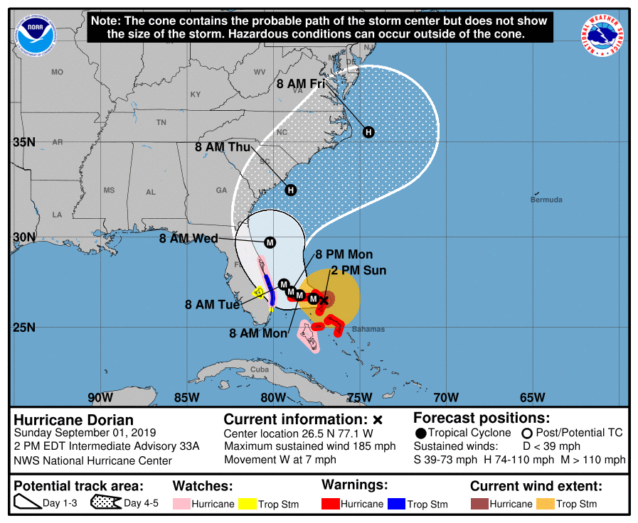
As of 2 p.m. EDT (1800 GMT), Dorian has maximum wind speeds of 185 mph (295 km/h) as the storm battered Great Abaco Island, the NHC wrote in an afternoon update. The storm is about 185 miles (295 km) east of West Palm Beach, Florida.
"Devastating hurricane conditions are expected in the Abacos Islands very soon and these conditions will spread across Grand Bahama Island later today," NASA officials said today in a morning update.
That forecast has borne out, the NHC reporting of "catastrophic conditions occurring in the Abacos Islands" in an 11 a.m. EDT (1300 GMT) update.
Watch: See Hurricane Dorian in Action in these Gifs from Space
Related: How NASA and NOAA Track Hurricane Dorian from Space
Hurricane Dorian is currently moving west across the Caribbean at about 7 mph (11 km/h), a relatively slow speed, and is expected to dump massive amounts of rain on the Abaco Islands.
"Hurricane-force winds extend outward up to 45 miles (75 km) from the
center and tropical-storm-force winds extend outward up to 140
miles (220 km)," the NHC said in its 2 p.m. update.
Breaking space news, the latest updates on rocket launches, skywatching events and more!
Dorian is expected to slowly move west over the next two days before turning northeast.
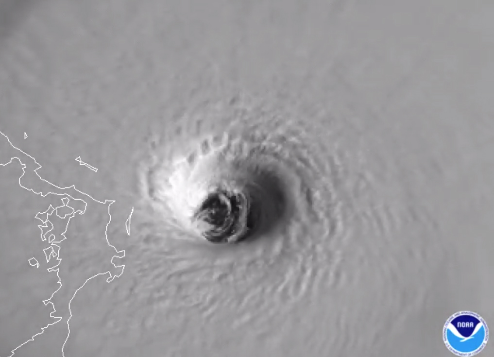
As #HurricaneDorian approached the #AbacoIslands, NOAA's #GOESEast zoomed in on the powerful storm's eye. The Cat. 5 storm's "maximum winds have increased to near 175 mph with gusts over 200 mph," according to @NHC_Atlantic. Follow the storm: https://t.co/VDEWvXtPxt pic.twitter.com/wLnZjJJYMOSeptember 1, 2019
"On this track, the core of extremely dangerous Hurricane Dorian will continue to pound Great Abaco today and the move near or over Grand Bahama Island tonight and Monday," NHC officials said in the update. "The hurricane should move closer to the Florida east coast late Monday through Tuesday night."
NASA's Kennedy Space Center, in Cape Canaveral, Florida, has taken steps to safeguard itself against Hurricane Dorian. On Friday (Aug. 30), center officials moved a massive 400-foot Mobile Launcher tower into the shelter of the center's 52-story Vehicle Assembly Building to protect it from damage.
NASA, the NHC and the National Oceanic and Atmospheric Administration are using satellites in orbit and U.S. Air Force flights through the eye of Hurricane Dorian itself to track the storm's progress. They've even captured videos of the storm from the International Space Station.
NHC officials warned that Hurricane Dorian's path could change. The storm's eye is currently forecast to remain offshore as the storm moves up the U.S. East Coast from Florida to Georgia, and then on to the Carolinas. Dorian's powerful winds should reach the eastern portions of those states.
Editor's note: This story was updated at 12 p.m. EDT to include the latest forecasts for Hurricane Dorian from the National Hurricane Center. A subsequent update at 2:53 p.m. EDT added new details from the NHC.
- NASA Sees Hurricane Dorian from Space Station (Video)
- NASA's Kennedy Space Center Prepares for Hurricane Dorian
- Photos: Most Powerful Storms of the Solar System
Email Tariq Malik at tmalik@space.com or follow him @tariqjmalik. Follow us on Twitter @Spacedotcom and on Facebook.

Tariq is the award-winning Editor-in-Chief of Space.com and joined the team in 2001. He covers human spaceflight, as well as skywatching and entertainment. He became Space.com's Editor-in-Chief in 2019. Before joining Space.com, Tariq was a staff reporter for The Los Angeles Times covering education and city beats in La Habra, Fullerton and Huntington Beach. He's a recipient of the 2022 Harry Kolcum Award for excellence in space reporting and the 2025 Space Pioneer Award from the National Space Society. He is an Eagle Scout and Space Camp alum with journalism degrees from the USC and NYU. You can find Tariq at Space.com and as the co-host to the This Week In Space podcast on the TWiT network. To see his latest project, you can follow Tariq on Twitter @tariqjmalik.


