Hurricane Florence: How Satellites Are Tracking the Monster Storm from Space
Breaking space news, the latest updates on rocket launches, skywatching events and more!
You are now subscribed
Your newsletter sign-up was successful
Want to add more newsletters?

Delivered daily
Daily Newsletter
Breaking space news, the latest updates on rocket launches, skywatching events and more!

Once a month
Watch This Space
Sign up to our monthly entertainment newsletter to keep up with all our coverage of the latest sci-fi and space movies, tv shows, games and books.

Once a week
Night Sky This Week
Discover this week's must-see night sky events, moon phases, and stunning astrophotos. Sign up for our skywatching newsletter and explore the universe with us!

Twice a month
Strange New Words
Space.com's Sci-Fi Reader's Club. Read a sci-fi short story every month and join a virtual community of fellow science fiction fans!
Update for Thursday, Sept. 13: Hurricane Florence was downgraded to a Category 2 story late Wednesday, according to the National Hurricane Center, with is still forecasting massive rainfall and flooding for those directly in the storm's path. Visit our sister site Live Science for the latest Hurricane Florence forecast.
As Hurricane Florence makes its way toward the U.S. East Coast, several satellites are monitoring the dangerous storm system with a variety of instruments.
From tracking wind speeds, rainfall and temperatures to capturing breathtaking views of the spinning monstrosity of a storm, a fleet of satellites run by NASA and the National Oceanic and Atmospheric Administration (NOAA) is providing weather forecasters with the tools they need to keep people safe.
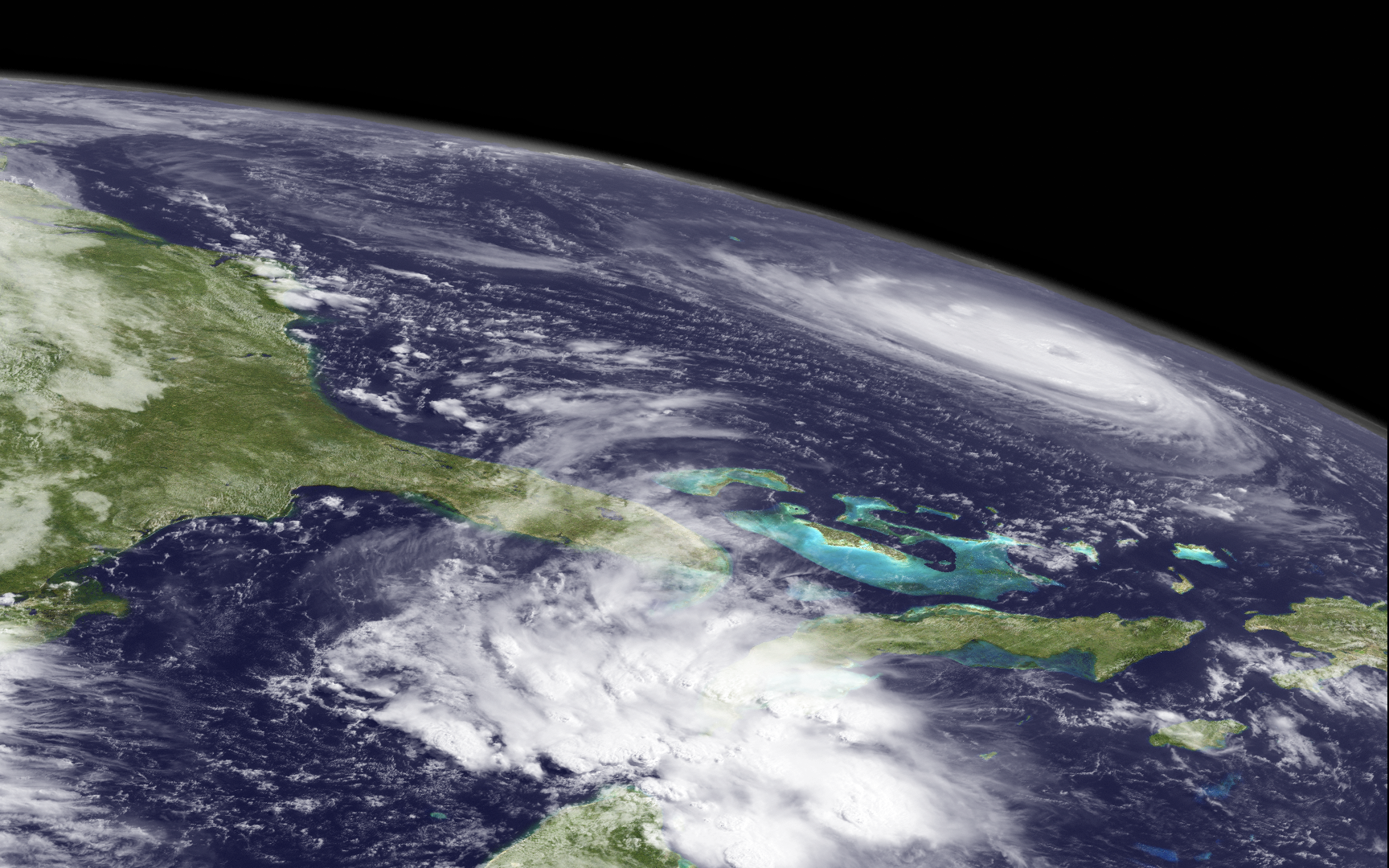
Some of the most incredible views of Hurricane Florence so far have come from the International Space Station, where European Space Agency astronaut and skilled photographer Alexander Gerst has been snapping gorgeous images of the hurricane's eye from 250 miles (400 kilometers) above the Earth. [Hurricane Florence in Photos: See the Massive Storm from Space]
While space station astronauts provide what are arguably the most impressive views of Florence from space, the most useful data and information about the storm comes from robotic spacecraft that orbit the Earth.
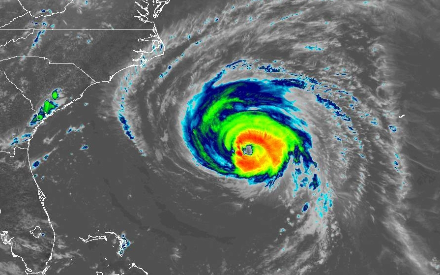
The GOES-East satellite, also known as GOES-16, is one of the most high-tech weather satellites currently in orbit. Launched in 2016 as part of the joint NASA-NOAA Geostationary Operational Environmental Satellite Program (GOES), this satellite hovers above Central America and provides continuous, high-definition imagery of the entire Western Hemisphere.
GOES-East carries two Earth-observation instruments. Its primary instrument, called the Advanced Baseline Imager (ABI), records images of the Earth in 16 different spectral bands that capture infrared, near-infrared and visible wavelengths of light.
Breaking space news, the latest updates on rocket launches, skywatching events and more!
Another instrument on GOES-East, the Geostationary Lightning Mapper (GLM), detects lightning flashes and storm updrafts, which "really helps the forecaster with what is called situational awareness," Steven Goodman, a program scientist for NOAA, said in a prelaunch press conference on Nov. 17, 2016.
The GOES-West satellite, also known as GOES-15, has also managed to snap a few images of Hurricane Florence from the spacecraft's geostationary orbit above the Pacific Ocean.
Like GOES-East, GOES-West is equipped with a multispectral imager that records visible and infrared wavelengths of light. The satellite also has an atmospheric sounding instrument that measures the temperatures and moisture levels throughout the atmosphere.
Meanwhile, the Global Precipitation Measurement (GPM) mission is dedicated entirely to measuring, mapping and predicting rainfall. Data from the GPM Core Observatory satellite — a joint project between NASA and Japan's space agency — uses a microwave-imaging instrument and radars to generate global, 3D precipitation maps every 3 hours.
Data from the GPM mission "is used to unify precipitation measurements made by an international network of partner satellites to quantify when, where and how much it rains or snows around the world," NASA officials said in a description of the mission.
"The GPM mission contributes to advancing our understanding of Earth's water and energy cycles, improves the forecasting of extreme events that cause natural disasters, and extends current capabilities of using satellite precipitation information to directly benefit society," the description reads.
To measure temperatures in and around storm systems, NASA's Aqua satellite uses an instrument called the Moderate Resolution Imaging Spectroradiometer (MODIS). The Aqua satellite, which launched in 2002, collects information about Earth's water cycle, "including evaporation from the oceans, water vapor in the atmosphere, clouds, precipitation, soil moisture, sea ice, land ice, and snow cover on the land and ice," NASA officials said in a description.
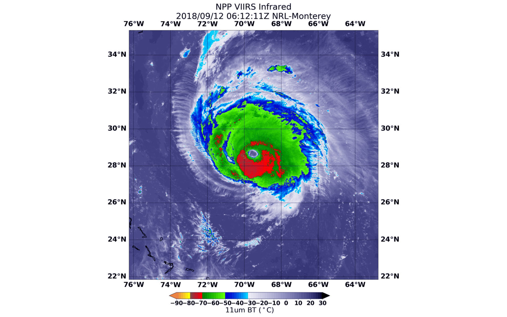
When it isn't blowing our minds with incredible "Blue Marble" and "Black Marble" photos of Earth from space, NOAA's Suomi National Polar-orbiting Partnership (NPP) satellite also plays an important role in forecasting hurricanes and other weather systems. Launched in 2011, Suomi NPP orbits Earth 14 times per day while measuring temperature, pressure, cloud coverage and moisture levels around the globe.
In addition to the visible-light images and weather data, Suomi NPP also helps climate scientists study climate change by mapping ozone levels, thermal radiation, wildfires and more.
In a public advisory issued today (Sept. 12) at 11 a.m. EDT (1500 GMT), NOAA's National Hurricane Center (NHC) said that Hurricane Florence — a life-threatening, Category 4 storm — is now expected to make landfall over North Carolina or South Carolina on Saturday (Sept. 15).
Parts of coastal North Carolina could see up to 40 inches (100 centimeters) of rain, which could produce "catastrophic flash flooding and significant river flooding," according to the NHC advisory.
For the most up-to-date information on Hurricane Florence and other major storms, visit nhc.noaa.gov.
Email Hanneke Weitering at hweitering@space.com or follow her @hannekescience. Follow us @Spacedotcom, Facebook and Google+. Original article on Space.com.

Hanneke Weitering is a multimedia journalist in the Pacific Northwest reporting on the future of aviation at FutureFlight.aero and Aviation International News and was previously the Editor for Spaceflight and Astronomy news here at Space.com. As an editor with over 10 years of experience in science journalism she has previously written for Scholastic Classroom Magazines, MedPage Today and The Joint Institute for Computational Sciences at Oak Ridge National Laboratory. After studying physics at the University of Tennessee in her hometown of Knoxville, she earned her graduate degree in Science, Health and Environmental Reporting (SHERP) from New York University. Hanneke joined the Space.com team in 2016 as a staff writer and producer, covering topics including spaceflight and astronomy. She currently lives in Seattle, home of the Space Needle, with her cat and two snakes. In her spare time, Hanneke enjoys exploring the Rocky Mountains, basking in nature and looking for dark skies to gaze at the cosmos.


