• news
  • tech
  • spaceflight
  • science & astronomy
  • search for life
  • skywatching
  • video
  • Entertainment
  • news
  • tech
  • spaceflight
  • science & astronomy
  • search for life
  • skywatching
  • video
  • Entertainment
news tech spaceflight science & astronomy search for life skywatching video Entertainment
  • Space.com
  • Science & Astronomy

Earth Day 2017: Amazing NASA Photos of Our Planet from Space

By SPACE.com Staff | April 21, 2017 04:06pm ET
  • MORE

Blue Bermuda

Blue Bermuda

Credit: NASA

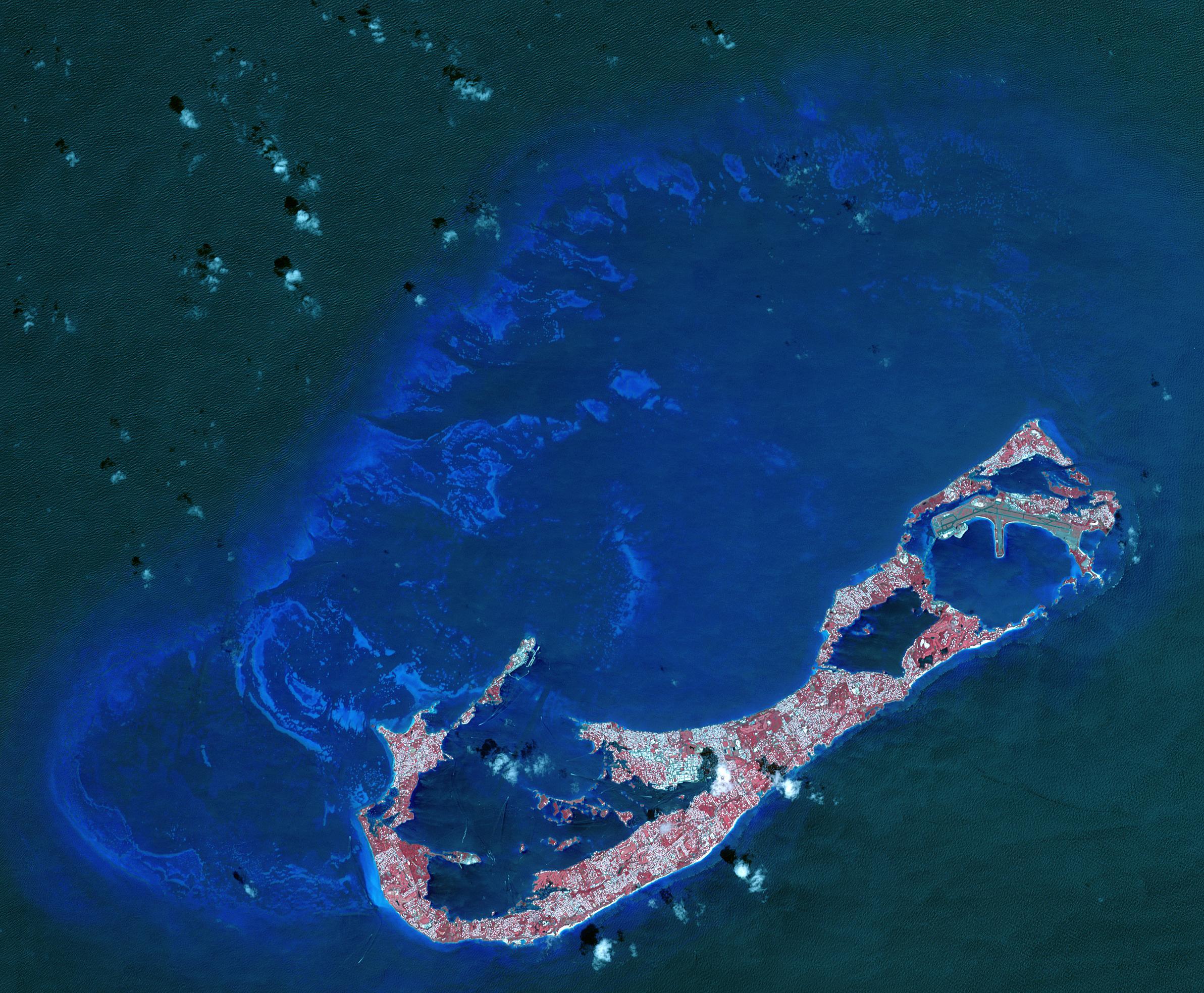
As seen from above, Berumda shines bright blue. From NASA, "Bermuda is a British Overseas Territory in the western Atlantic off the east coast of North America."

Educational Earth

Educational Earth

Credit: NASA

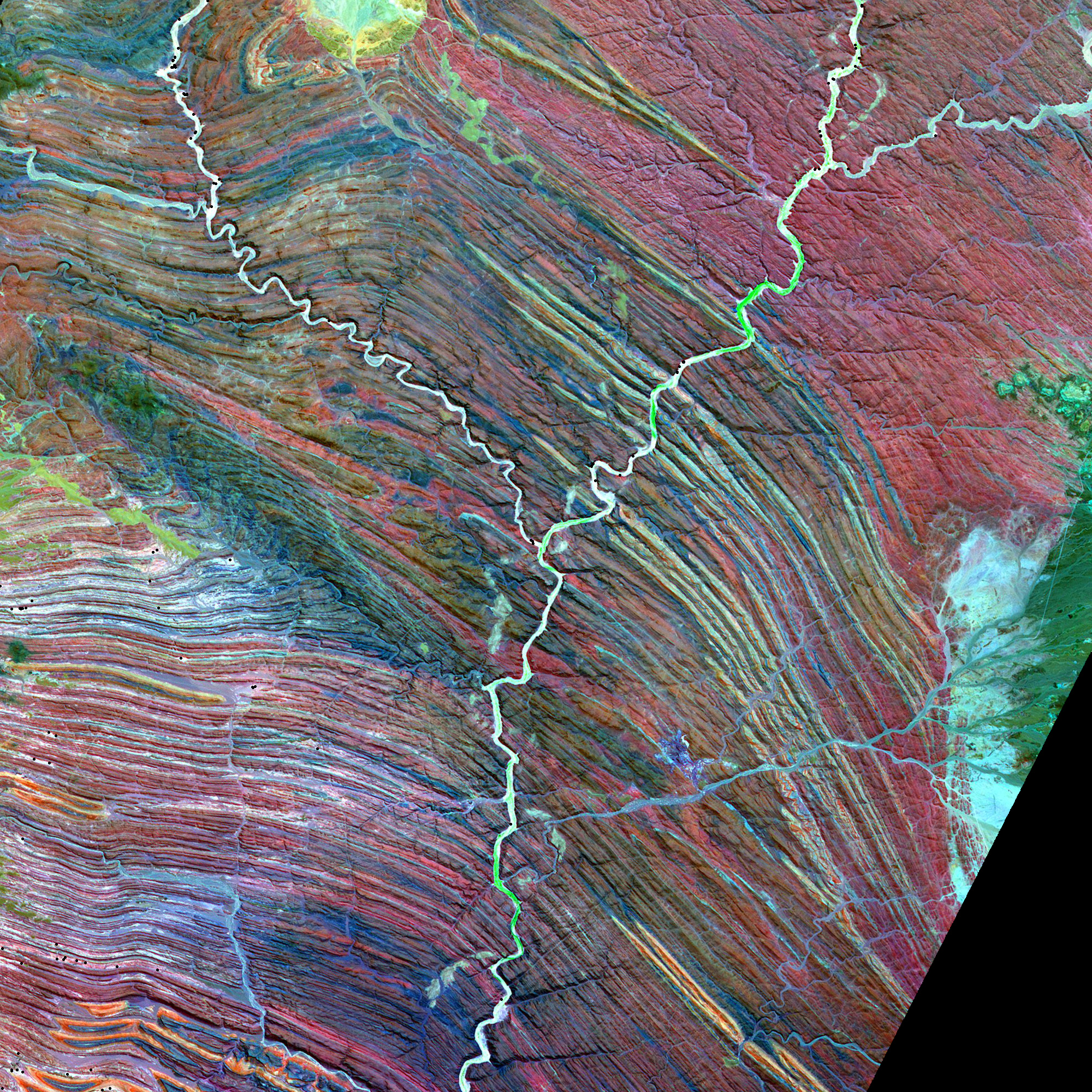
The letter "Y" as seen from space. From NASA, "NASA's Earth Observatory has tracked down images resembling all 26 letters of the English alphabet using only NASA satellite imagery and astronaut photography. In this image, the letter 'Y' is for yardangs, elongated landforms sculpted by erosion and similar to sand dunes, but instead comprised of sandstone or siltstone."

Circles on Circles

Circles on Circles

Credit: NASA

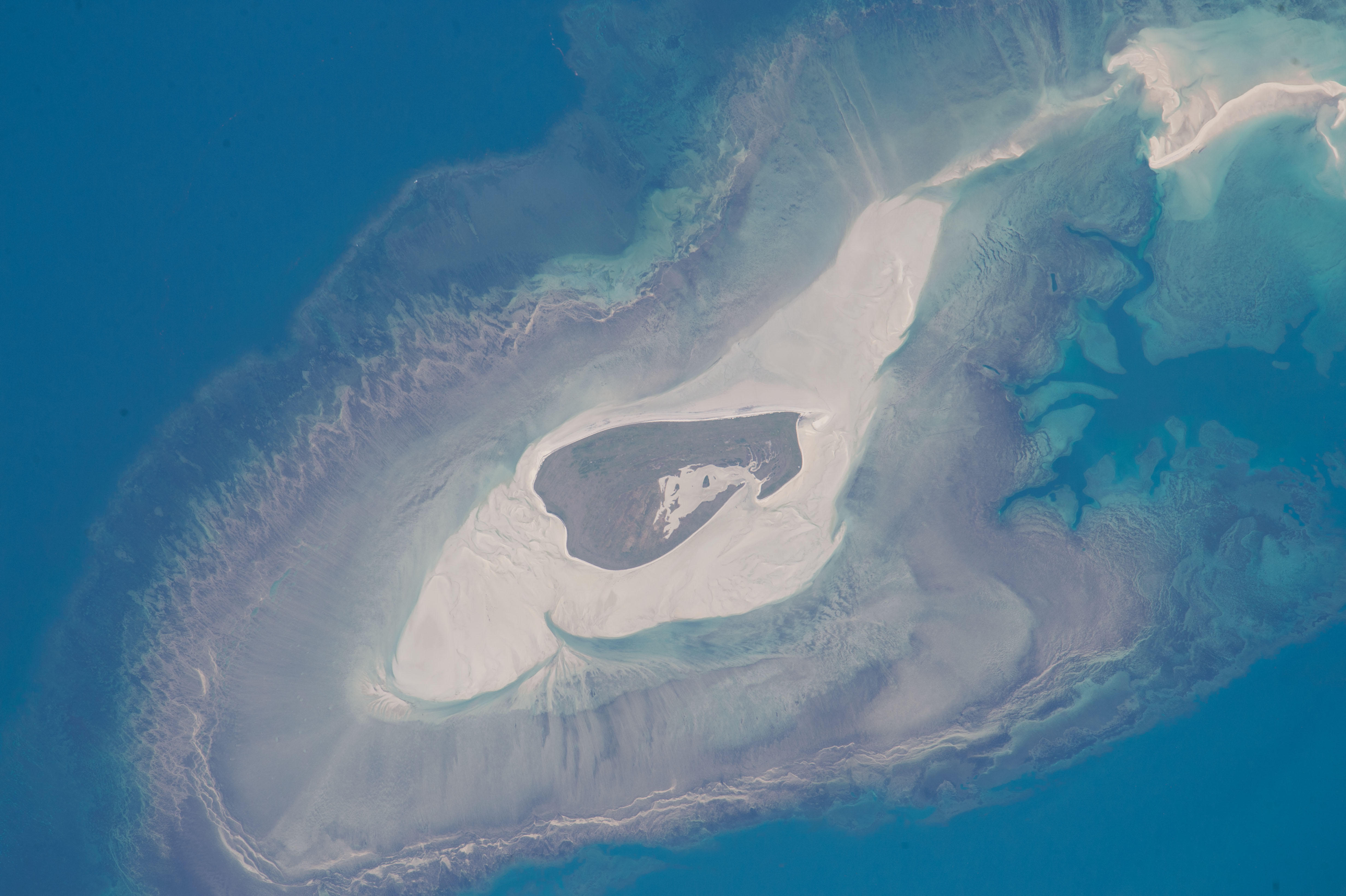
In Northwest Australia, Adele Island as seen from above. From NASA, "Astronauts aboard the International Space Station took this detailed image of a tiny island with many concentric zones around it. Adele Island, off Australia's north coast, is only 2.9 km (2 mi) long, but the entire tidal zone with all the concentric zones is 24.5 km (15.2 mi) long, surrounded by extensive sandbanks in the tidally exposed area."

Land of Fire

Land of Fire

Credit: NASA

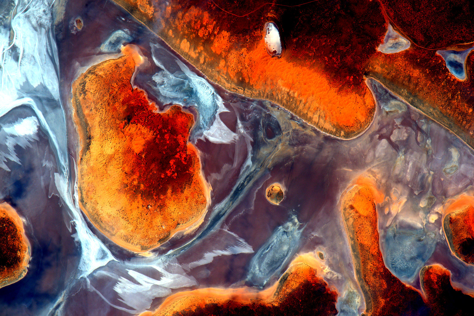
A composite image of Earth art from Australia. From NASA, "On Oct. 12-13, 2015, NASA astronaut Scott Kelly shared a series of seventeen photographs taken from the International Space Station during a flyover of Australia. This first photo of the series was shared on Twitter with the caption, '#EarthArt in one pass over the #Australian continent. Picture 1 of 17. #YearInSpace.'"

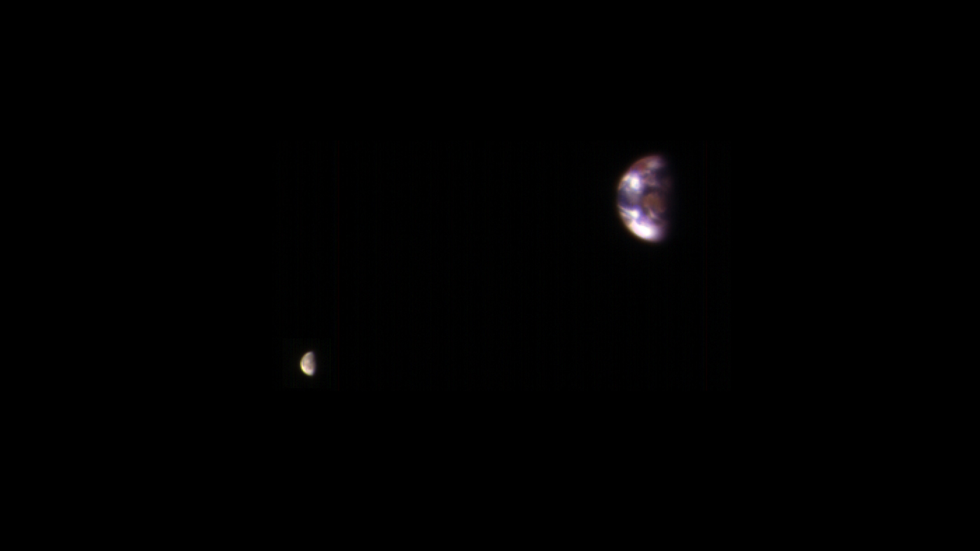
As Seen ... From Mars

As Seen ... From Mars

Credit: NASA

Earth and its moon seen from Mars. From NASA, "Here is a view of Earth and its moon, as seen from Mars. It combines two images acquired on Nov. 20, 2016, by the HiRISE camera on NASA's Mars Reconnaissance Orbiter, with brightness adjusted separately for Earth and the moon to show details on both bodies."

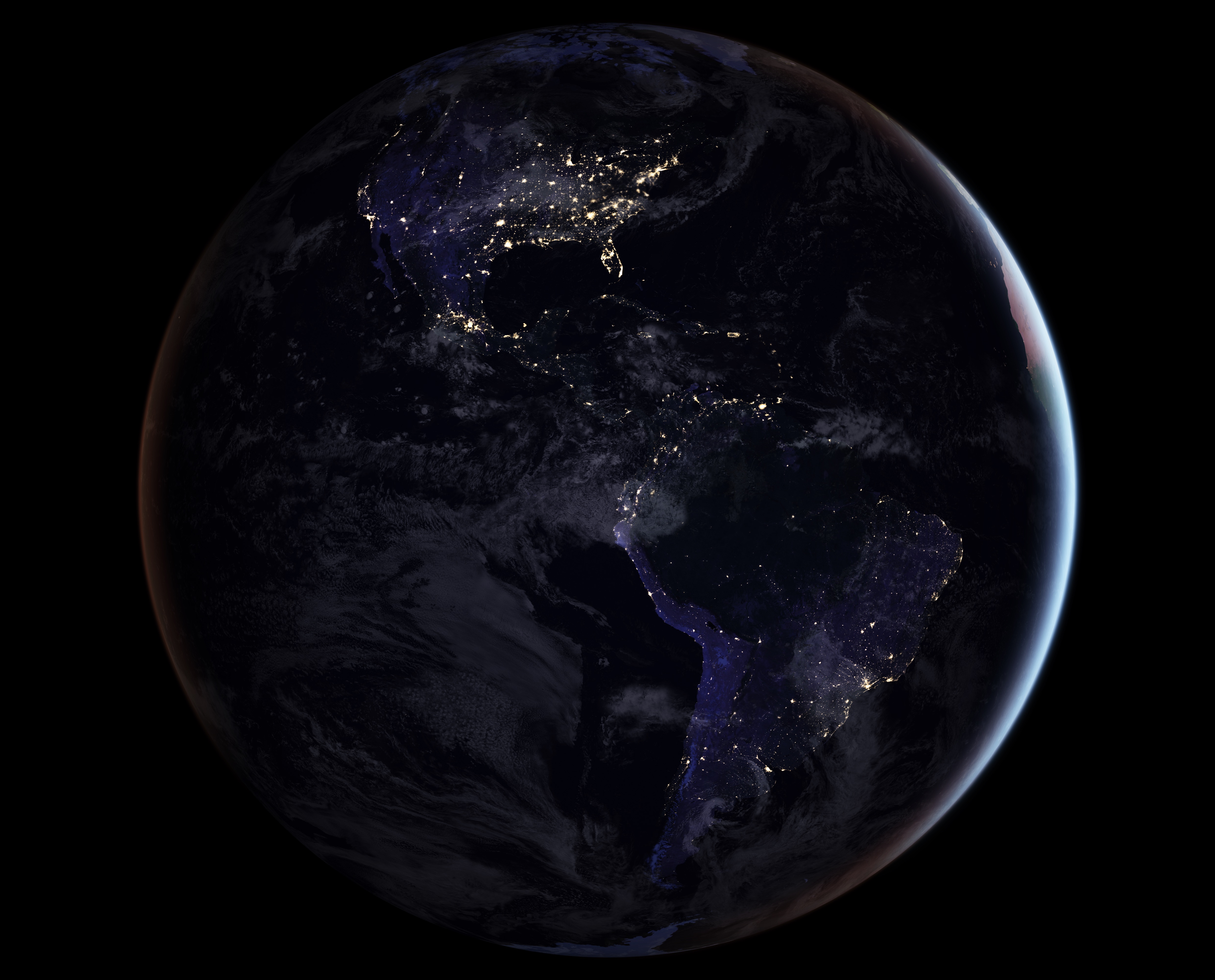
Dark Marble

Dark Marble

Credit: NASA

A composite image of Earth at night, as seen from space. From NASA: "NASA scientists are releasing new global maps of Earth at night, providing the clearest yet composite view of the patterns of human settlement across our planet. This composite image, one of three new full-hemisphere views, provides a view of the Americas at night."

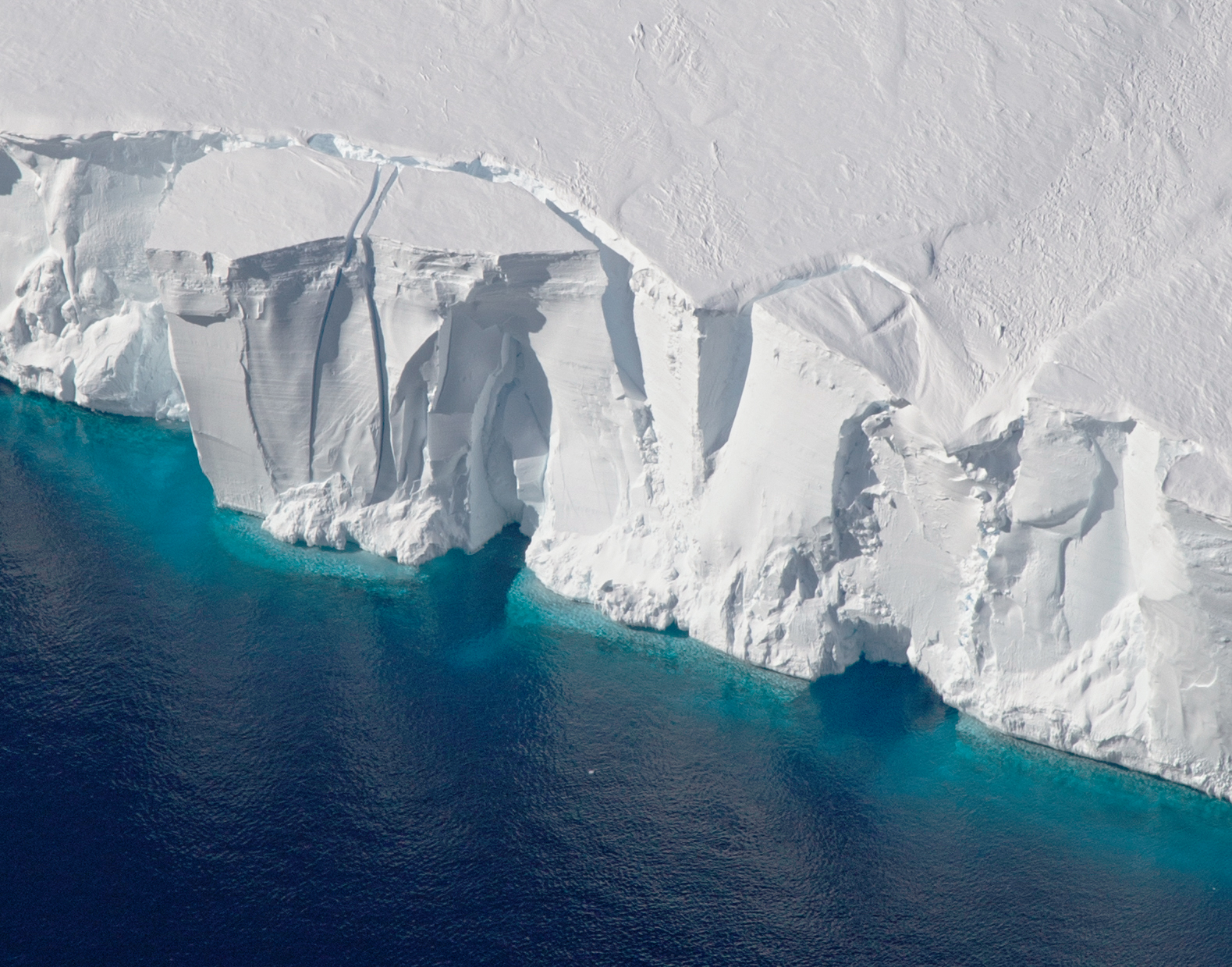
Ice Shelf

Ice Shelf

Credit: NASA

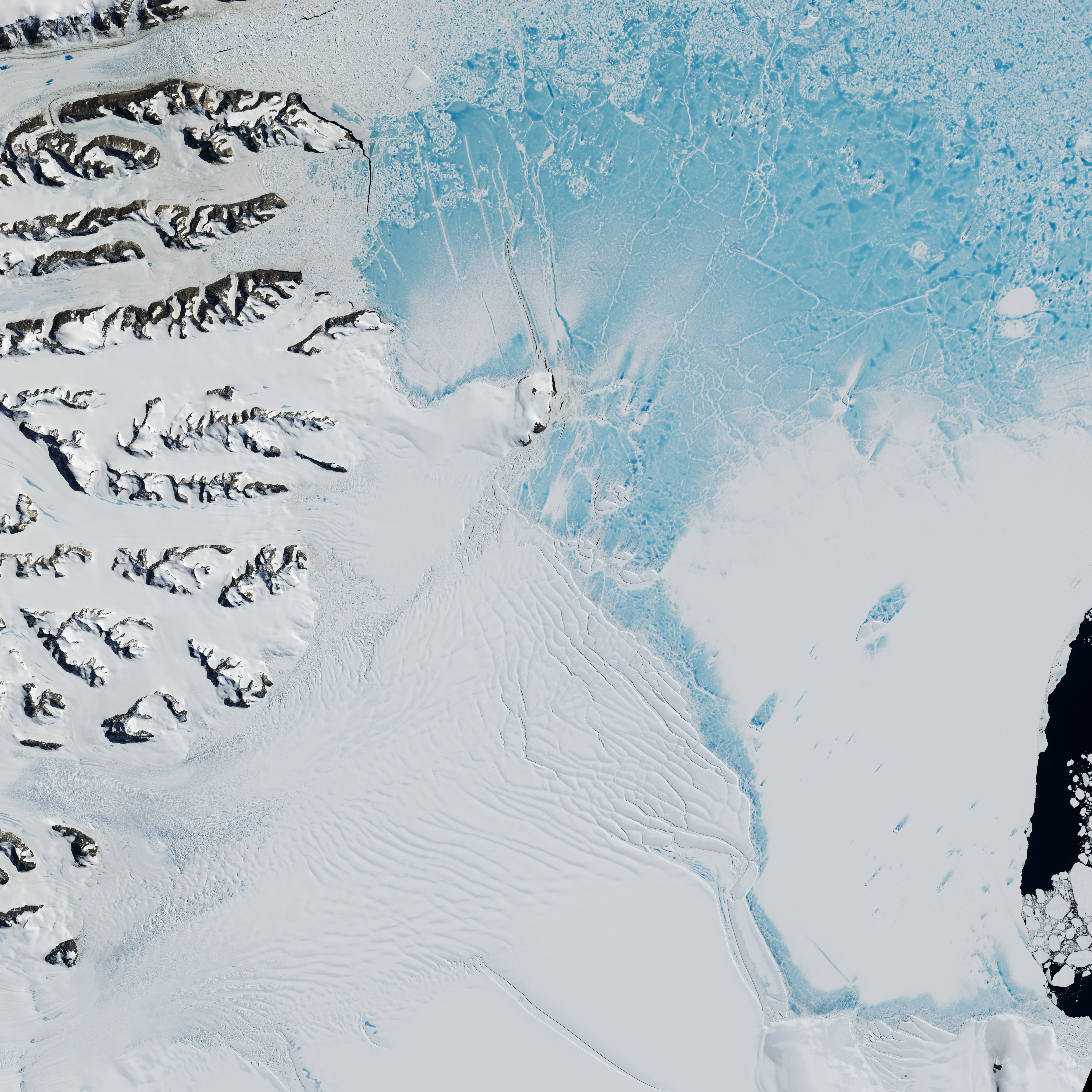
As seen from above during NASA's Operation IceBridge mission, the Getz Ice Shelf. From NASA, "As scientists and crew with NASA’s Operation IceBridge mission prepared for a research flight on Nov. 5, 2016, the weather in Punta Arenas, Chile, was cold, wet, and windy. But when they reached their survey site in West Antarctica, skies were clear and winds were calm — a perfect day for scientists to collect data over the Getz Ice Shelf."

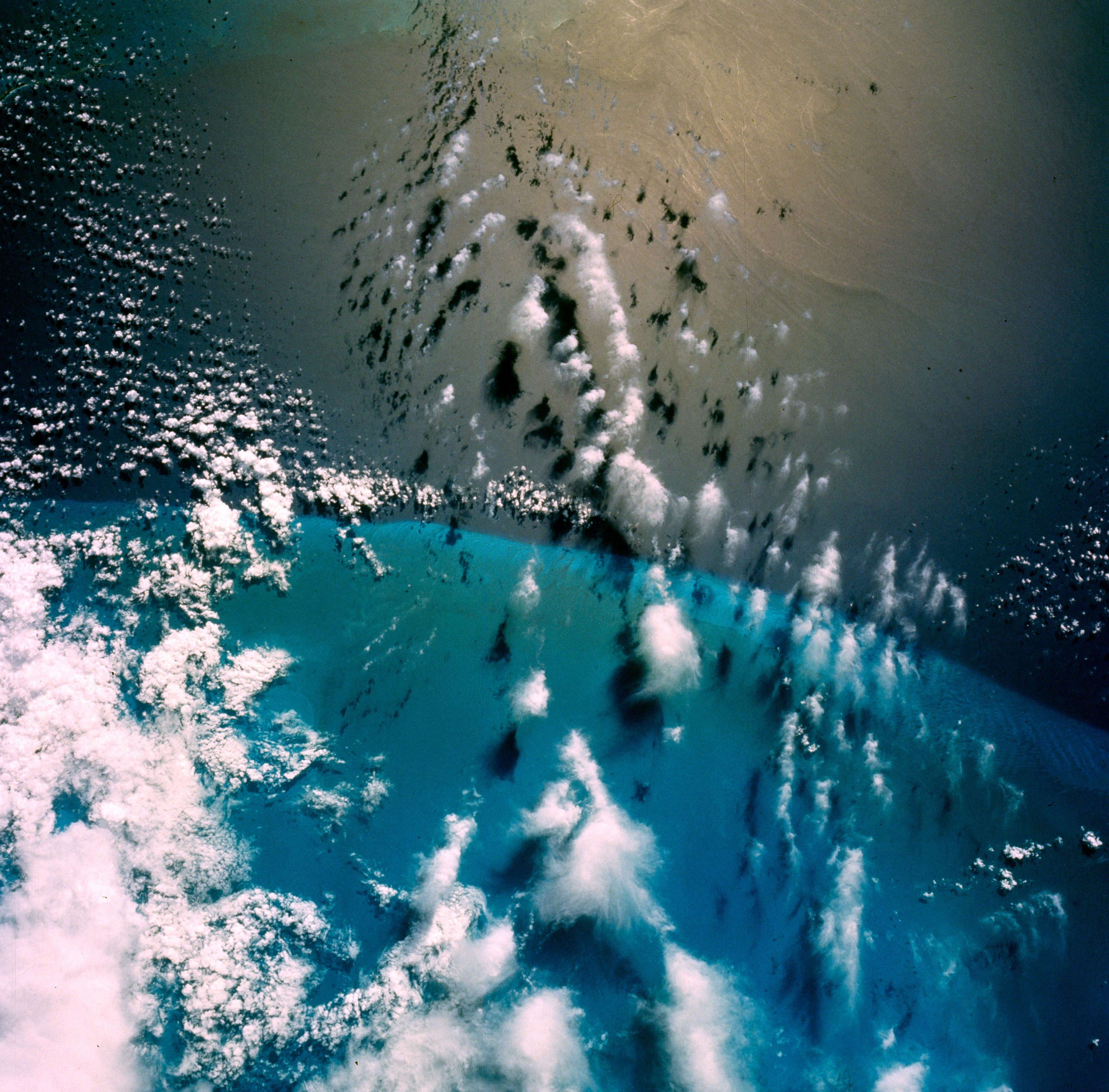
Long History of Images

Long History of Images

Credit: NASA

This image of Earth was captured by the astronauts of the Gemini VI mission. From NASA, "This photograph of the Florida Straits and Grand Bahama Bank was taken during the Gemini IV mission during orbit no. 19, on June 4, 1965. The Gemini IV crew conducted scientific experiments, including photography of Earth's weather and terrain, for the remainder of their four-day mission following Ed White's historic spacewalk on June 3."

A Grand Scene

A Grand Scene

Credit: NASA

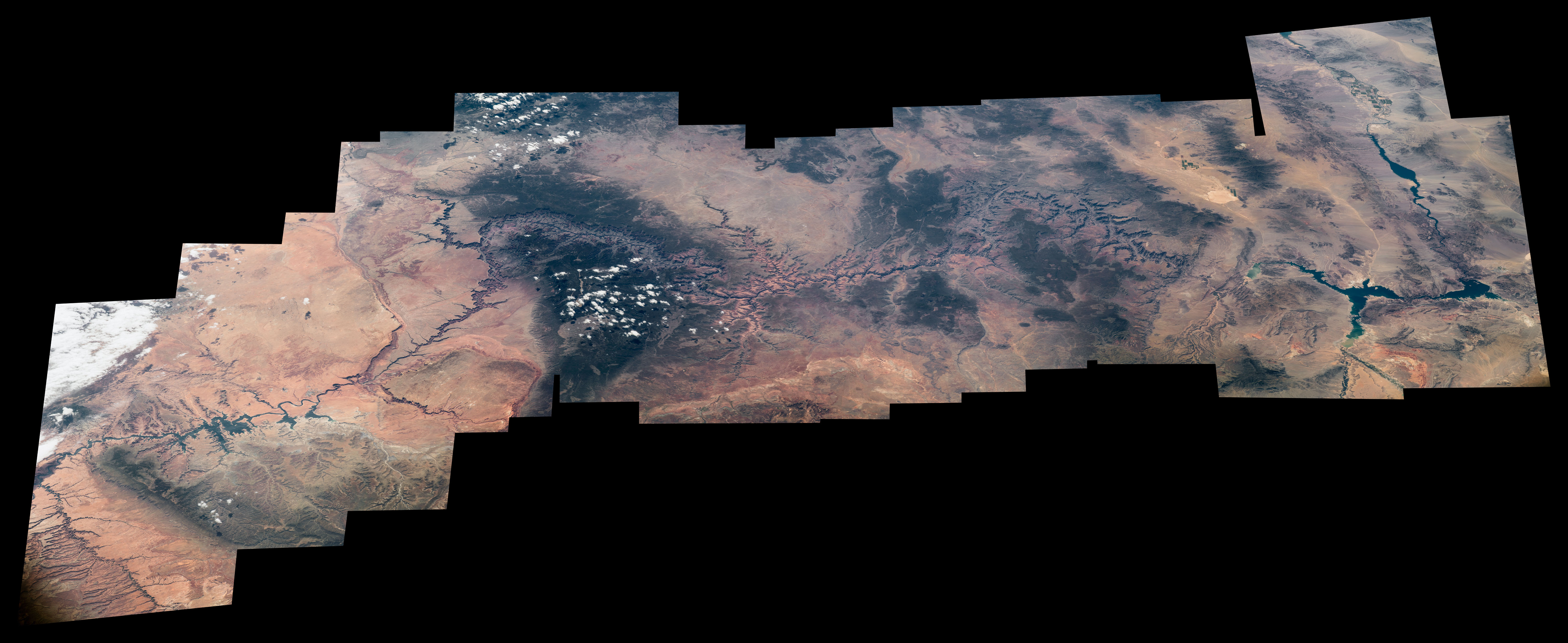
The entire Grand Canyon National Park, as seen from above. From NASA, "To celebrate the centennial of the U.S National Park Service, Expedition 48 Commander Jeff Williams of NASA has taken hundreds of images of national parks from his vantage point in low Earth orbit, aboard the International Space Station. Here, a series of Williams' photographs are assembled into this composite image of the Grand Canyon."

Bahama Mama!

Bahama Mama!

Credit: NASA

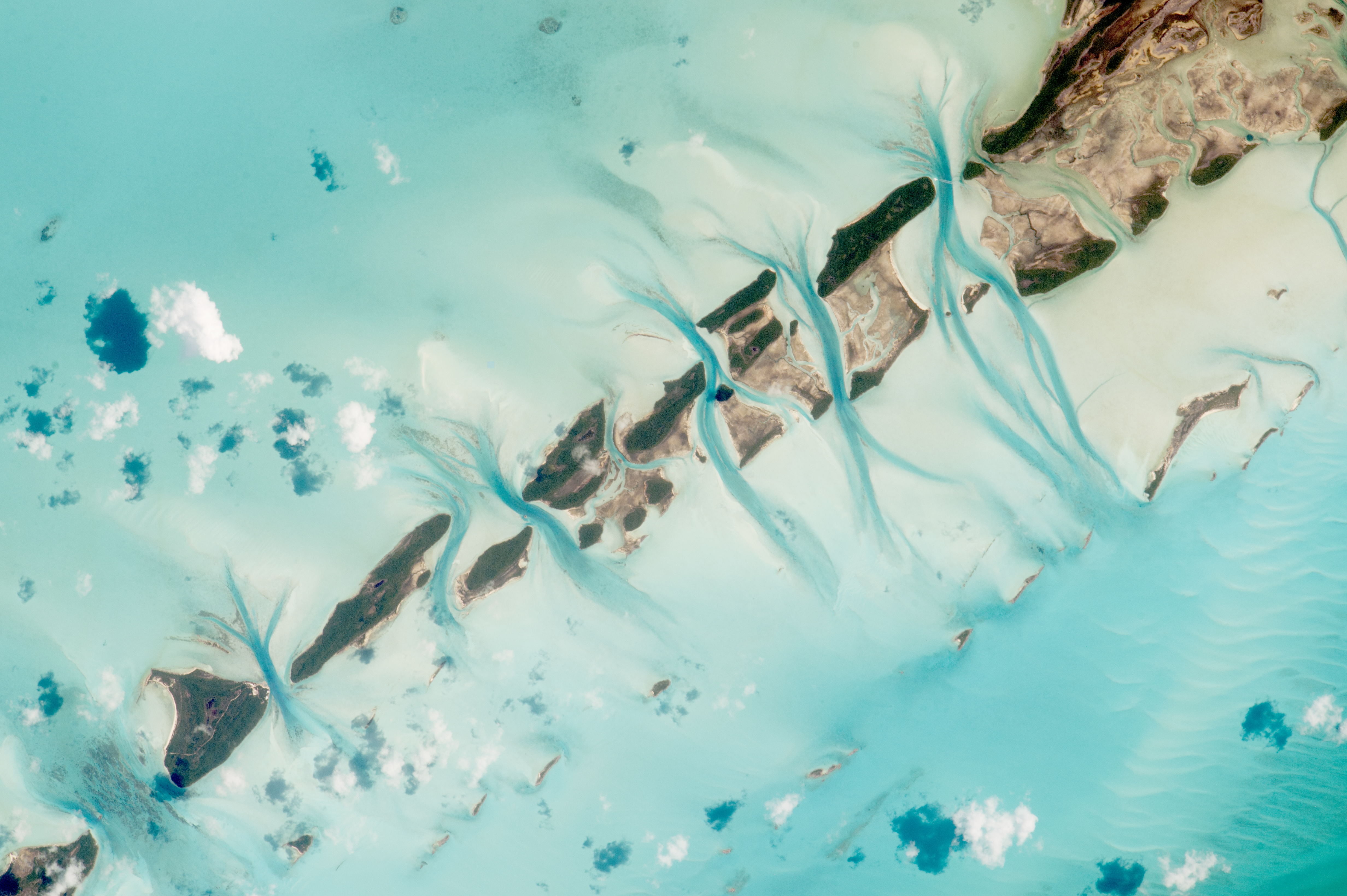
Great Exuma Island, Bahamas, as seen from above. From NASA, "An astronaut aboard the International Space Station took this photograph of small island cays in the Bahamas and the prominent tidal channels cutting between them. For astronauts, this is one of the most recognizable points on the planet.:

Ever-changing

Ever-changing

Credit: NASA

The Larsen Ice Shelf as seen from space. From NASA, "The Larsen Ice Shelf is situated along the northeastern coast of the Antarctic Peninsula, one of the fastest-warming places on the planet. In the past three decades, two large sections of the ice shelf (Larsen A and B) collapsed. A third section (Larsen C) seems like it may be on a similar trajectory, with a new iceberg poised to break away soon."

Unique Landscape

Unique Landscape

Credit: NASA

A composite image of the Mount Brandenberg Nature Reserve as seen from above. From NASA, "This composite image of the Mount Brandberg Nature Reserve in Namibia, Africa was put together at the Johnson Space Center in Houston from several International Space Station images. Expedition 47 crew members photographed the middle of a vast African desert."

Green and Windy

Green and Windy

Credit: NASA

The MacKenzie River in Canada's Northwest Territories as seen from space. From NASA, "This view, acquired on Nov. 7, 2016, by the Operational Land Imager (OLI) on Landsat 8, shows a portion of Canada's Mackenzie River Delta and the town of Inuvik, home to more than 3,000 people. A frozen highway -- 194 kilometers (120 miles) long -- runs between the remote outposts of Inuvik and Tuktoyaktuk along the river's East Channel."

Earth Art

Earth Art

Credit: NASA

Terrain from northwestern Australia as seen from abover. From NASA, "During an International Space Station flyover of Australia, NASA astronaut Jeff Williams captured a colorful image of the coast and shared it with his social media followers on March 29, 2016, writing, 'The unique terrain of the northwestern Australian coast.'"

ISS Flyover

ISS Flyover

Credit: NASA

Astronaut Tim Peake capture this image of the Mediterranean in 2016. From NASA, "Expedition 46 flight engineer Tim Peake of the European Space Agency (ESA) shared this stunning nighttime photograph with his social media followers on Jan. 25, 2016, writing, 'Beautiful night pass over Italy, Alps and Mediterranean.'"

Lines in the Sands

Lines in the Sands

Credit: NASA

The Namib Sand Sea as seen from the International Space Station. From NASA, "An astronaut aboard the International Space Station (ISS) used a long lens to document what crews have termed one of the most spectacular features of the planet: the dunes of the Namib Sand Sea."

Broken Frozen Land

Broken Frozen Land

Credit: NASA

The Rocky Mountains from Earth's Orbit. From NASA, "Expedition 50 Flight Engineer Thomas Pesquet of the European Space Agency photographed the Rocky Mountains from his vantage point in low Earth orbit aboard the International Space Station. He shared the image with his social media followers on Jan. 9, 2017, writing, 'the Rocky mountains are a step too high – even for the clouds to cross.'"

EarthKAM and the Sahara

EarthKAM and the Sahara

Credit: NASA

The Sally Ride EarthKAM snapped this image of the Sahara desert. From NASA, "Middle school students programmed a camera aboard the International Space Station — the Sally Ride EarthKAM — to photograph this portion of the Sahara desert in western Libya on October 3, 2016. The Expedition 50 crew set up the EarthKAM gear in the Harmony module's Earth-facing hatch window, to allow students to photograph targets on Earth."

Astounding Geography

Astounding Geography

Credit: NASA

South Africa stuns in this image from the Sally Ride EarthKAM. From NASA, "The remotely controlled Sally Ride EarthKAM aboard the International Space Station snapped this striking photograph of South Africa on Feb. 9, 2016. The EarthKAM program allows students to request photographs of specific Earth features, which are taken by a special camera mounted on the space station when it passes over those features."

Gallery Only - Earth Day 2017 Images

Gallery Only - Earth Day 2017 Images

Credit: NASA

A composite image of the Pacific Ocean with sunglint, as seen from the ISS. From NASA, "This Earth observation composite image from the International Space Station captures morning sunglint and low clouds over the central Pacific Ocean. The image was put together at the Johnson Space Center in Houston, from a series of photographs taken by Expedition 47 Flight Engineer Jeff Williams on March 25, 2016."

Puzzle Pieces

Puzzle Pieces

Credit: NASA

Venice as seen from above on Valentine's Day. From NASA, Expedition 50 Flight Engineer Thomas Pesquet of the European Space Agency shared this photograph from the International Space Station on Feb. 14, 2017, writing, 'Venice, city of gondoliers and the lovers they carry along the canals. Happy Valentine's Day!'"

Gallery Only - Earth Day 2017 Images

Gallery Only - Earth Day 2017 Images

Credit: NASA

Wester Mexico Sands as seen from above. From NASA, "Expedition 47 Commander Tim Kopra of NASA posted this May 15, 2016 photograph to social media, writing, 'Water etchings in western @Mexico sands. @Space_Station #Explore'"

Whirling and Swirling

Whirling and Swirling

Credit: NASA

In the Gulf of St. Lawrence, currents swirl. From NASA, "Orbiting above eastern North America, a crew member on the International Space Station photographed a dense pattern of eddies in the Gulf of St. Lawrence. Caught briefly in the Sun's "glint point," reflections off the water surface show an interlinked mass of swirls and eddies in the shallow water north of Prince Edward Island."

Deep, Dark Blue

Deep, Dark Blue

Credit: NASA

From space, the Sacred Swan Lake in Tibet. From NASA, "Yamzho Yumco (Sacred Swan) Lake in Tibet is surrounded by snow-capped mountains and is one of the three largest sacred lakes."

Winter Solstice

Winter Solstice

Credit: NASA

After winter solstice, this image of northern Canada from space was taken. From NASA, "Just hours after the winter solstice, a mass of energetic particles from the Sun smashed into the magnetic field around Earth. The strong solar wind stream stirred up a display of northern lights over northern Canada."

More from Space.com

  • Saturn's rings on Aug. 22, 2009 Saturn's Multicolored Rings Dazzle in Photo by Cassini Spacecraft
  • Dangerous Asteroid Headed for Earth Bam! Cannon Experiment Shows How Asteroids Delivered Water to Earth
  • The spectacular rings of Saturn cast dark shadows on the ringed planet as the winter season approaches in Saturn's southern hemisphere in this view from the Cassini spacecraft. Amazing Saturn Photos From NASA's Cassini Orbiter
  • saturn's rings Photos: Saturn's Glorious Rings Up Close
  • Big Bang Expansion graphic We'll Never Know For Sure How Everything Began
  • Gaia view of the Milky Way This 3D Color Map of 1.7 Billion Stars in the Milky Way Is the Best Ever Made
  • A dark exoplanet on a deep space background. This Planet Is So Dark, Scientists Have to Guess What It Looks Like
  • This clip is made up of 25 minutes worth of images from ESA's Philae lander, and was processed by Twitter user landru79. The Truth Behind This Amazing Video from the Surface of a Comet
previous | next

Blue Bermuda

Credit: NASA

As seen from above, Berumda shines bright blue. From NASA, "Bermuda is a British Overseas Territory in the western Atlantic off the east coast of North America."

Educational Earth

Credit: NASA

The letter "Y" as seen from space. From NASA, "NASA's Earth Observatory has tracked down images resembling all 26 letters of the English alphabet using only NASA satellite imagery and astronaut photography. In this image, the letter 'Y' is for yardangs, elongated landforms sculpted by erosion and similar to sand dunes, but instead comprised of sandstone or siltstone."

Circles on Circles

Credit: NASA

In Northwest Australia, Adele Island as seen from above. From NASA, "Astronauts aboard the International Space Station took this detailed image of a tiny island with many concentric zones around it. Adele Island, off Australia's north coast, is only 2.9 km (2 mi) long, but the entire tidal zone with all the concentric zones is 24.5 km (15.2 mi) long, surrounded by extensive sandbanks in the tidally exposed area."

Land of Fire

Credit: NASA

A composite image of Earth art from Australia. From NASA, "On Oct. 12-13, 2015, NASA astronaut Scott Kelly shared a series of seventeen photographs taken from the International Space Station during a flyover of Australia. This first photo of the series was shared on Twitter with the caption, '#EarthArt in one pass over the #Australian continent. Picture 1 of 17. #YearInSpace.'"

As Seen ... From Mars

Credit: NASA

Earth and its moon seen from Mars. From NASA, "Here is a view of Earth and its moon, as seen from Mars. It combines two images acquired on Nov. 20, 2016, by the HiRISE camera on NASA's Mars Reconnaissance Orbiter, with brightness adjusted separately for Earth and the moon to show details on both bodies."

Dark Marble

Credit: NASA

A composite image of Earth at night, as seen from space. From NASA: "NASA scientists are releasing new global maps of Earth at night, providing the clearest yet composite view of the patterns of human settlement across our planet. This composite image, one of three new full-hemisphere views, provides a view of the Americas at night."

Ice Shelf

Credit: NASA

As seen from above during NASA's Operation IceBridge mission, the Getz Ice Shelf. From NASA, "As scientists and crew with NASA’s Operation IceBridge mission prepared for a research flight on Nov. 5, 2016, the weather in Punta Arenas, Chile, was cold, wet, and windy. But when they reached their survey site in West Antarctica, skies were clear and winds were calm — a perfect day for scientists to collect data over the Getz Ice Shelf."

Long History of Images

Credit: NASA

This image of Earth was captured by the astronauts of the Gemini VI mission. From NASA, "This photograph of the Florida Straits and Grand Bahama Bank was taken during the Gemini IV mission during orbit no. 19, on June 4, 1965. The Gemini IV crew conducted scientific experiments, including photography of Earth's weather and terrain, for the remainder of their four-day mission following Ed White's historic spacewalk on June 3."

A Grand Scene

Credit: NASA

The entire Grand Canyon National Park, as seen from above. From NASA, "To celebrate the centennial of the U.S National Park Service, Expedition 48 Commander Jeff Williams of NASA has taken hundreds of images of national parks from his vantage point in low Earth orbit, aboard the International Space Station. Here, a series of Williams' photographs are assembled into this composite image of the Grand Canyon."

Bahama Mama!

Credit: NASA

Great Exuma Island, Bahamas, as seen from above. From NASA, "An astronaut aboard the International Space Station took this photograph of small island cays in the Bahamas and the prominent tidal channels cutting between them. For astronauts, this is one of the most recognizable points on the planet.:

Ever-changing

Credit: NASA

The Larsen Ice Shelf as seen from space. From NASA, "The Larsen Ice Shelf is situated along the northeastern coast of the Antarctic Peninsula, one of the fastest-warming places on the planet. In the past three decades, two large sections of the ice shelf (Larsen A and B) collapsed. A third section (Larsen C) seems like it may be on a similar trajectory, with a new iceberg poised to break away soon."

Unique Landscape

Credit: NASA

A composite image of the Mount Brandenberg Nature Reserve as seen from above. From NASA, "This composite image of the Mount Brandberg Nature Reserve in Namibia, Africa was put together at the Johnson Space Center in Houston from several International Space Station images. Expedition 47 crew members photographed the middle of a vast African desert."

Green and Windy

Credit: NASA

The MacKenzie River in Canada's Northwest Territories as seen from space. From NASA, "This view, acquired on Nov. 7, 2016, by the Operational Land Imager (OLI) on Landsat 8, shows a portion of Canada's Mackenzie River Delta and the town of Inuvik, home to more than 3,000 people. A frozen highway -- 194 kilometers (120 miles) long -- runs between the remote outposts of Inuvik and Tuktoyaktuk along the river's East Channel."

Earth Art

Credit: NASA

Terrain from northwestern Australia as seen from abover. From NASA, "During an International Space Station flyover of Australia, NASA astronaut Jeff Williams captured a colorful image of the coast and shared it with his social media followers on March 29, 2016, writing, 'The unique terrain of the northwestern Australian coast.'"

ISS Flyover

Credit: NASA

Astronaut Tim Peake capture this image of the Mediterranean in 2016. From NASA, "Expedition 46 flight engineer Tim Peake of the European Space Agency (ESA) shared this stunning nighttime photograph with his social media followers on Jan. 25, 2016, writing, 'Beautiful night pass over Italy, Alps and Mediterranean.'"

Lines in the Sands

Credit: NASA

The Namib Sand Sea as seen from the International Space Station. From NASA, "An astronaut aboard the International Space Station (ISS) used a long lens to document what crews have termed one of the most spectacular features of the planet: the dunes of the Namib Sand Sea."

Broken Frozen Land

Credit: NASA

The Rocky Mountains from Earth's Orbit. From NASA, "Expedition 50 Flight Engineer Thomas Pesquet of the European Space Agency photographed the Rocky Mountains from his vantage point in low Earth orbit aboard the International Space Station. He shared the image with his social media followers on Jan. 9, 2017, writing, 'the Rocky mountains are a step too high – even for the clouds to cross.'"

EarthKAM and the Sahara

Credit: NASA

The Sally Ride EarthKAM snapped this image of the Sahara desert. From NASA, "Middle school students programmed a camera aboard the International Space Station — the Sally Ride EarthKAM — to photograph this portion of the Sahara desert in western Libya on October 3, 2016. The Expedition 50 crew set up the EarthKAM gear in the Harmony module's Earth-facing hatch window, to allow students to photograph targets on Earth."

Astounding Geography

Credit: NASA

South Africa stuns in this image from the Sally Ride EarthKAM. From NASA, "The remotely controlled Sally Ride EarthKAM aboard the International Space Station snapped this striking photograph of South Africa on Feb. 9, 2016. The EarthKAM program allows students to request photographs of specific Earth features, which are taken by a special camera mounted on the space station when it passes over those features."

Gallery Only - Earth Day 2017 Images

Credit: NASA

A composite image of the Pacific Ocean with sunglint, as seen from the ISS. From NASA, "This Earth observation composite image from the International Space Station captures morning sunglint and low clouds over the central Pacific Ocean. The image was put together at the Johnson Space Center in Houston, from a series of photographs taken by Expedition 47 Flight Engineer Jeff Williams on March 25, 2016."

Puzzle Pieces

Credit: NASA

Venice as seen from above on Valentine's Day. From NASA, Expedition 50 Flight Engineer Thomas Pesquet of the European Space Agency shared this photograph from the International Space Station on Feb. 14, 2017, writing, 'Venice, city of gondoliers and the lovers they carry along the canals. Happy Valentine's Day!'"

Gallery Only - Earth Day 2017 Images

Credit: NASA

Wester Mexico Sands as seen from above. From NASA, "Expedition 47 Commander Tim Kopra of NASA posted this May 15, 2016 photograph to social media, writing, 'Water etchings in western @Mexico sands. @Space_Station #Explore'"

Whirling and Swirling

Credit: NASA

In the Gulf of St. Lawrence, currents swirl. From NASA, "Orbiting above eastern North America, a crew member on the International Space Station photographed a dense pattern of eddies in the Gulf of St. Lawrence. Caught briefly in the Sun's "glint point," reflections off the water surface show an interlinked mass of swirls and eddies in the shallow water north of Prince Edward Island."

Deep, Dark Blue

Credit: NASA

From space, the Sacred Swan Lake in Tibet. From NASA, "Yamzho Yumco (Sacred Swan) Lake in Tibet is surrounded by snow-capped mountains and is one of the three largest sacred lakes."

Winter Solstice

Credit: NASA

After winter solstice, this image of northern Canada from space was taken. From NASA, "Just hours after the winter solstice, a mass of energetic particles from the Sun smashed into the magnetic field around Earth. The strong solar wind stream stirred up a display of northern lights over northern Canada."

More Image Galleries

Subscribe To SPACE.com
Follow Us
Most Popular
  1. A NASA Thor-Delta rocket launches Ariel-1, the first British satellite, into orbit on April 26, 1962.

    On This Day In Space! April 26, 1962: Britain Launches Its 1st Satellite

  2. Full moon reflection in Mértola, Portugal

    Full Moon Glows in a Blood-Red Puddle in 'Martian' Landscape

  3. Saturn's rings on Aug. 22, 2009

    Saturn's Multicolored Rings Dazzle in Photo by Cassini Spacecraft

  4. Dangerous Asteroid Headed for Earth

    Bam! Cannon Experiment Shows How Asteroids Delivered Water to Earth

  5. csa, canadian space agency

    Canadian Space Agency: Facts & Information

HomeAbout Us
Company
  • Company Info
  • About Us
  • Contact Us
  • Advertise with Us
  • Using Our Content
  • Licensing & Reprints
  • Terms of Use
  • Copyright Policy
  • Privacy Policy
Network
  • Top Ten Reviews
  • Tom's Guide
  • Laptop Mag
  • Tom's Hardware
  • Business News Daily
  • Tom's IT Pro
  • Space.com
  • Live Science
  • Active Junky
  • ShopSavvy
  • AnandTech
  • Dignifyed
FOLLOW US
SUBSCRIBE TO SPACE
Purch

Copyright © All Rights Reserved.