Astronauts Spot Hurricane Arthur From Space Station (Photos, Video)

Breaking space news, the latest updates on rocket launches, skywatching events and more!
You are now subscribed
Your newsletter sign-up was successful
Want to add more newsletters?
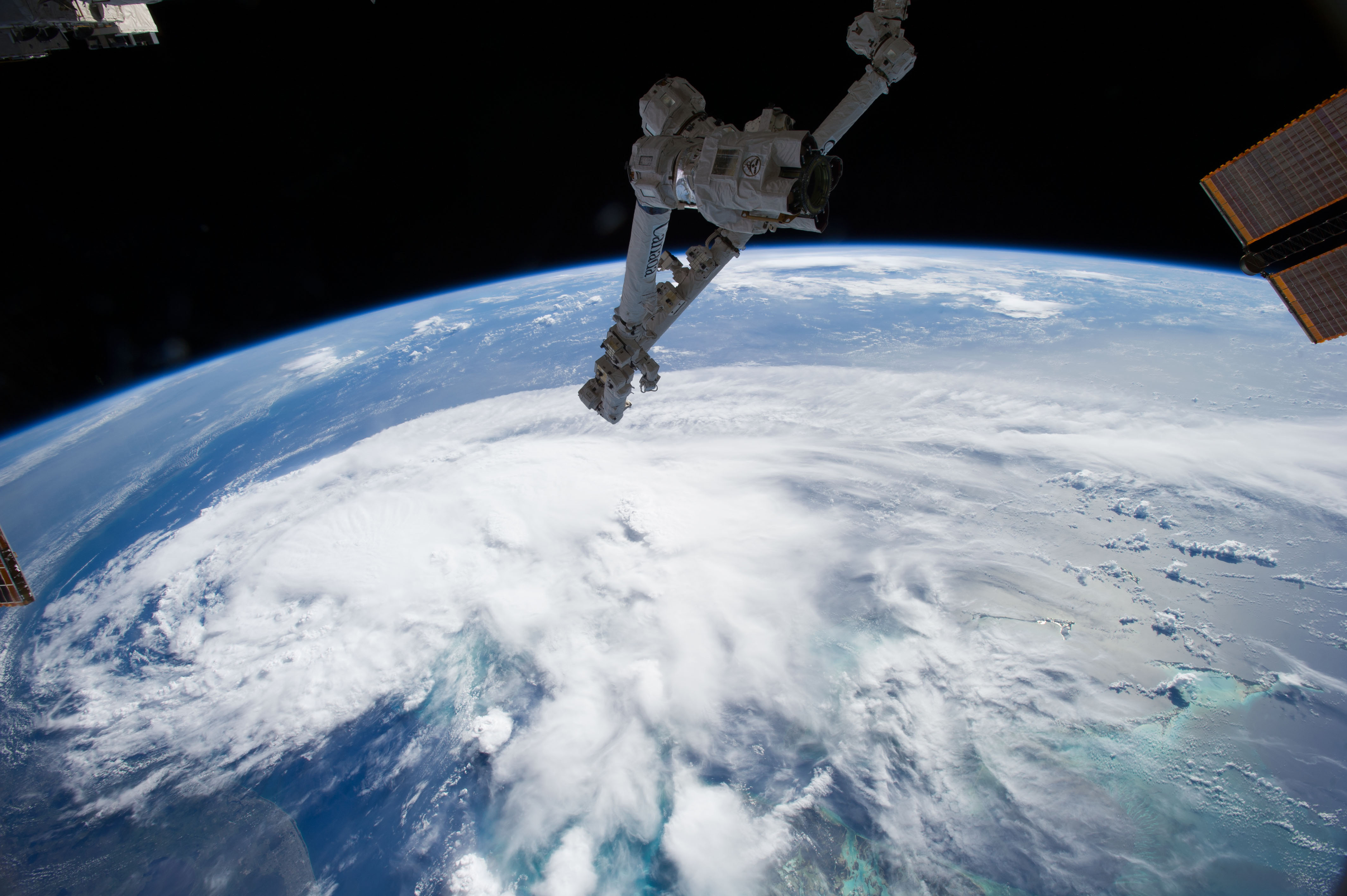
A stunning photo snapped by astronauts aboard the International Space Station shows Hurricane Arthur churning off the coast of Florida, heading north.
The image, taken on Wednesday morning (July 2) by a crewmember of the orbiting lab's current Expedition 40, actually captures Arthur when it was still classified as a tropical storm. (Arthur strengthened to hurricane status early Thursday.)
"Surrounded by bright green waters, the Bahamas Islands are south of the storm in the lower right corner of the photo," NASA officials wrote in a description of the picture. "The U.S. coastline stretches along the left side of the photo."
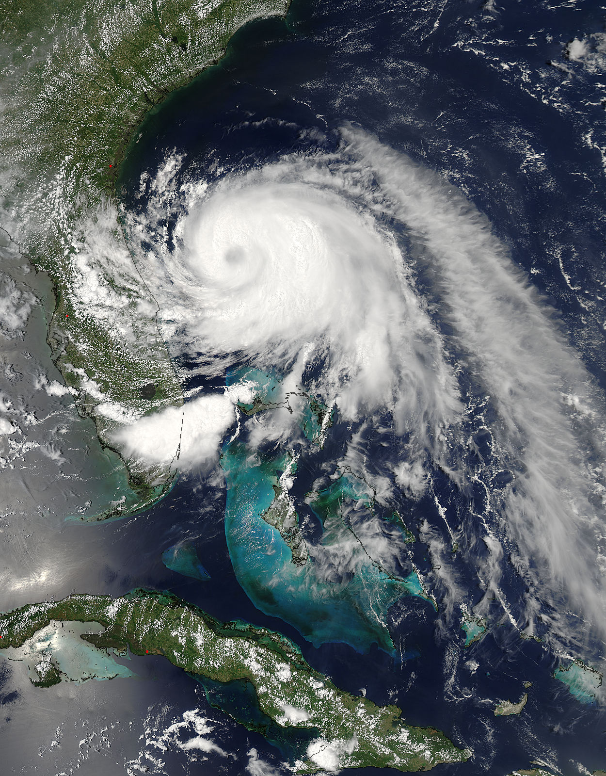
Robotic eyes are keeping tabs on Arthur from orbit as well. NASA's Aqua satellite took a picture on Wednesday afternoon as it passed over the storm, for example, revealing that Arthur's eye was still covered by clouds at the time.
Aqua has also been gathering data on Arthur in infrared light. One infrared image captured Thursday (July 3) shows thunderstorms around the storm's center with temperatures around minus 63 degrees Fahrenheit (minus 53 degrees Celsius), NASA officials said.
Arthur is the first tropical storm of the 2014 Atlantic hurricane season. It took shape off southern Florida on Tuesday (July 1) and is currently heading north off the East Coast.
As of Thursday afternoon, Arthur was about 70 miles (113 kilometers) south-southwest of Cape Fear, North Carolina and featured maximum sustained winds of 90 mph (150 km/h). The National Hurricane Center (NHC), which is run by the U.S. National Weather Service, has issued a hurricane warning for areas from Surf City, North Carolina north to the Virginia border.
Breaking space news, the latest updates on rocket launches, skywatching events and more!
Arthur will likely come close to North Carolina's Outer Banks later Thursday and early Friday (July 4) but should then turn to the northeast, forecasters say.
The storm is expected to be a Category 2 hurricane when it passes over or near the North Carolina coast, NHC officials said in an advisory Thursday. (Meteorologists classify hurricanes based on wind speed from Category 1, the weakest, to Category 5, the most powerful.) But Arthur should begin weakening Friday night and will likely be downgraded to a "post-tropical cyclone" on Saturday (July 5), they added.
Follow Mike Wall on Twitter @michaeldwall and Google+. Follow us @Spacedotcom, Facebook or Google+. Originally published on Space.com.

Michael Wall is the Spaceflight and Tech Editor for Space.com and joined the team in 2010. He primarily covers human and robotic spaceflight, military space, and exoplanets, but has been known to dabble in the space art beat. His book about the search for alien life, "Out There," was published on Nov. 13, 2018. Before becoming a science writer, Michael worked as a herpetologist and wildlife biologist. He has a Ph.D. in evolutionary biology from the University of Sydney, Australia, a bachelor's degree from the University of Arizona, and a graduate certificate in science writing from the University of California, Santa Cruz. To find out what his latest project is, you can follow Michael on Twitter.

