Earth From Space: Envisat Satellite Photos
Breaking space news, the latest updates on rocket launches, skywatching events and more!
You are now subscribed
Your newsletter sign-up was successful
Want to add more newsletters?

Delivered daily
Daily Newsletter
Breaking space news, the latest updates on rocket launches, skywatching events and more!

Once a month
Watch This Space
Sign up to our monthly entertainment newsletter to keep up with all our coverage of the latest sci-fi and space movies, tv shows, games and books.

Once a week
Night Sky This Week
Discover this week's must-see night sky events, moon phases, and stunning astrophotos. Sign up for our skywatching newsletter and explore the universe with us!

Twice a month
Strange New Words
Space.com's Sci-Fi Reader's Club. Read a sci-fi short story every month and join a virtual community of fellow science fiction fans!
End of the Road for Envisat
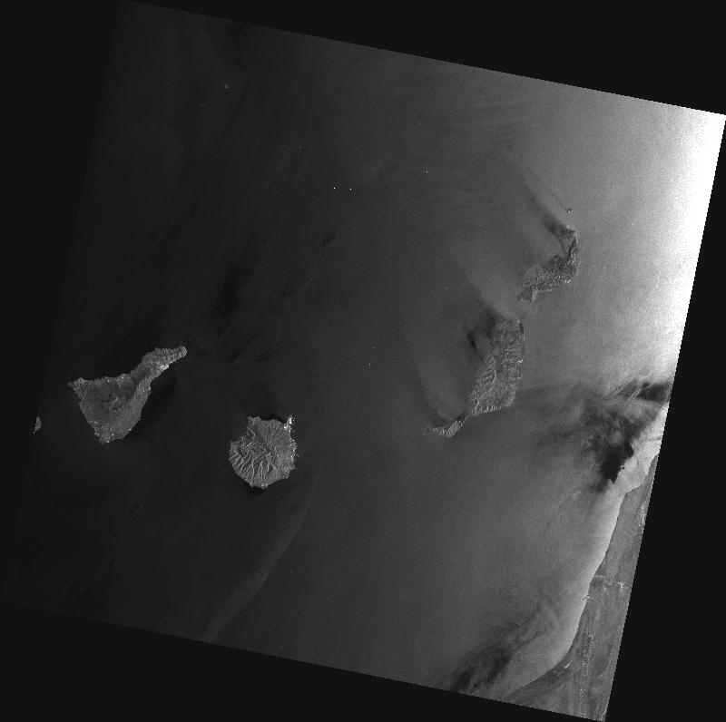
Envisat’s Advanced Synthetic Aperture Radar (ASAR) captured this image on April 8, 2012 at 11:09 GMT. The image was transmitted in X-band to the Santa Maria station in the Azores, Portugal, operated by Edisoft. It shows Spain’s Canary Islands. It is the last Envisat data transmitted via X-band before the communication anomaly.
Envisat in Orbit
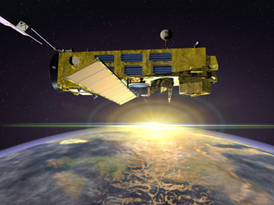
The Envisat satellite launched in 2002 and unexpectedly went silent in April 2012. The satellte, however, was originally built to last five years - a mission which it completed successfully. See some of Envisat's amazing photos, including its last view of Earth we know of.
ENVISAT as Seen by Pleiades Satellite
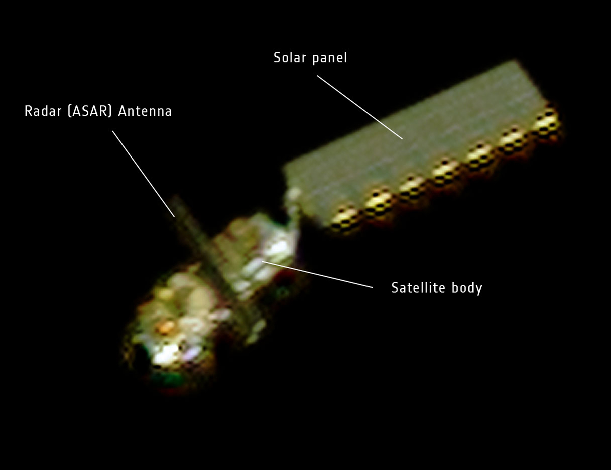
On April 15, 2012, the French space agency CNES rotated the Pleiades Earth observation satellite to capture this image of Envisat. At a distance of about 100 km, Envisat’s main body, solar panel and radar antenna were visible.
ENVISAT Ground Image
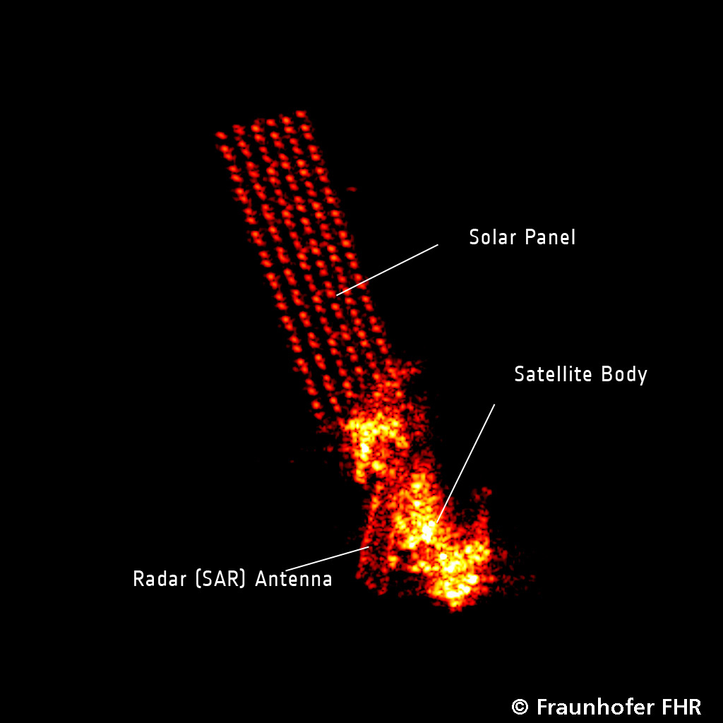
This radar image showing the Envisat satellite in orbit was produced by the ground-based tracking and imaging radar, TIRA, of the Fraunhofer Institute for High Frequency Physics and Radar Techniques in Wachtberg, Germany, on April 10, 2012.
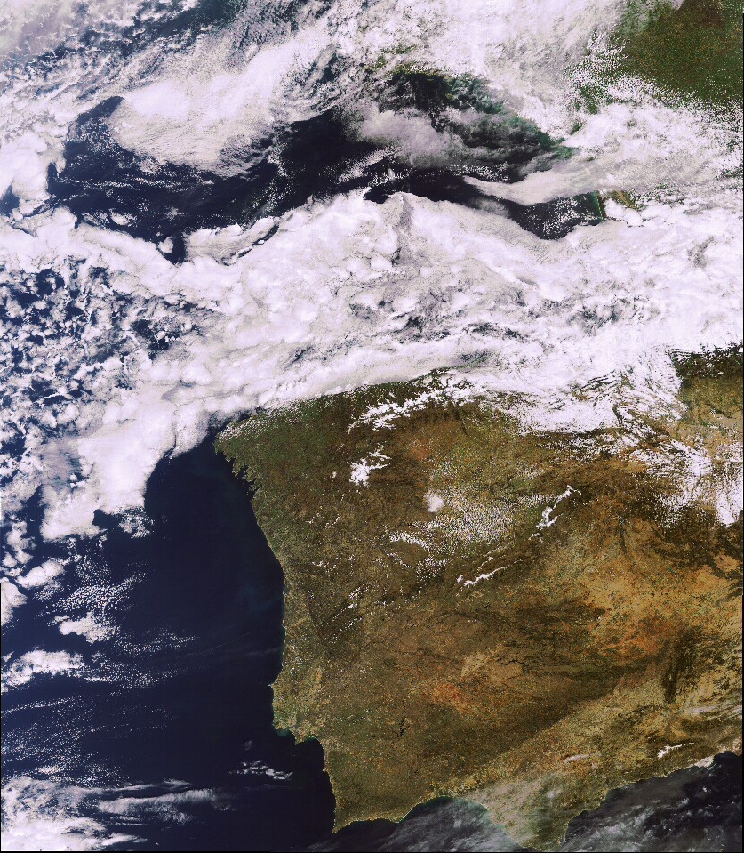
Last Image Before Loss of Contact
Envisat’s Medium Resolution Imaging Spectrometer (MERIS) captured this image on April 8, 2012. The image, shows Portugal and Spain. It is the last Envisat data transmitted via Ka-band before the communication anomaly affected the Envisat satellite.
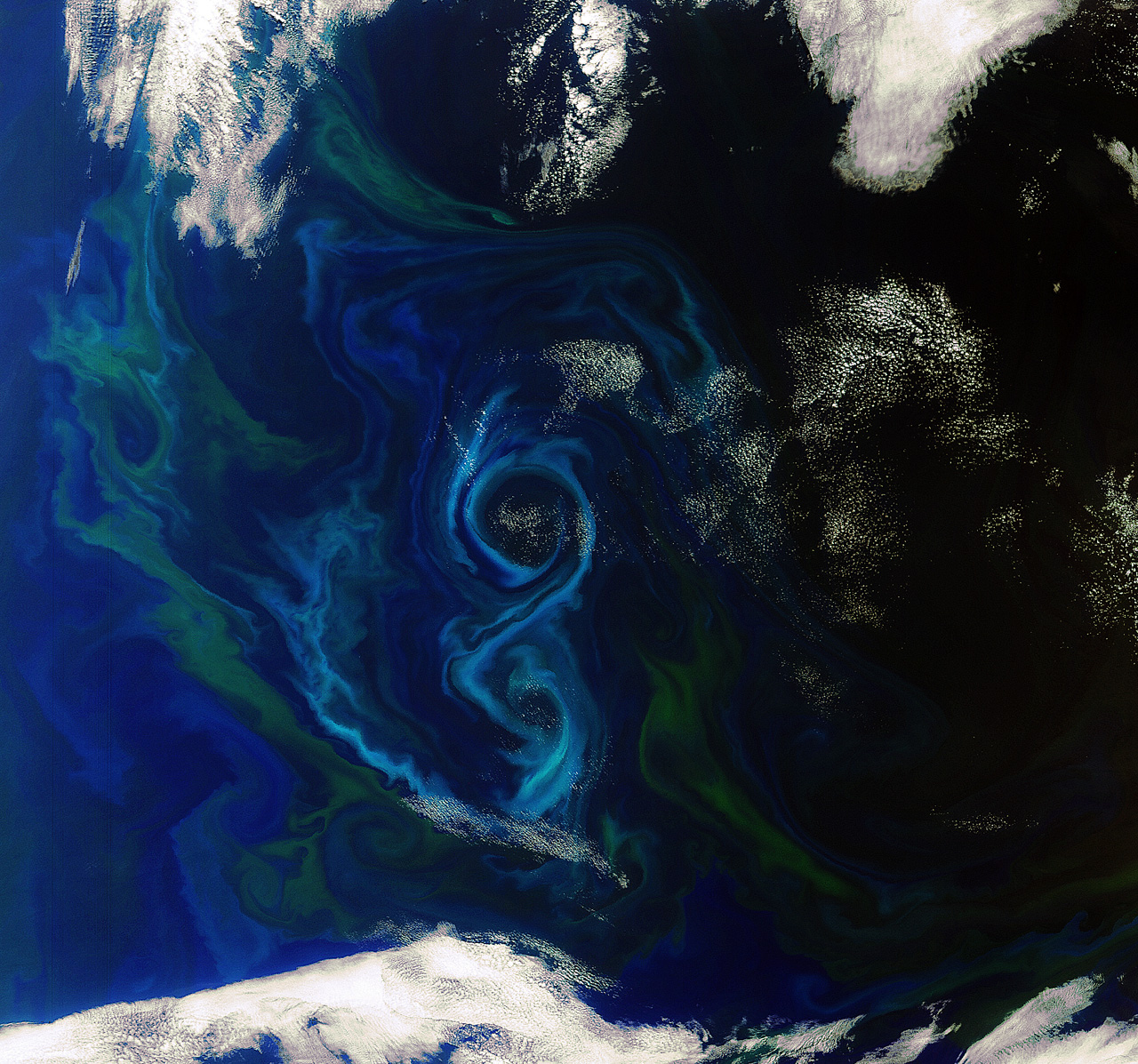
Envisat Spies Algae Bloom
An algae bloom in the shape of a figure 8 in the south Atlantic Ocean.
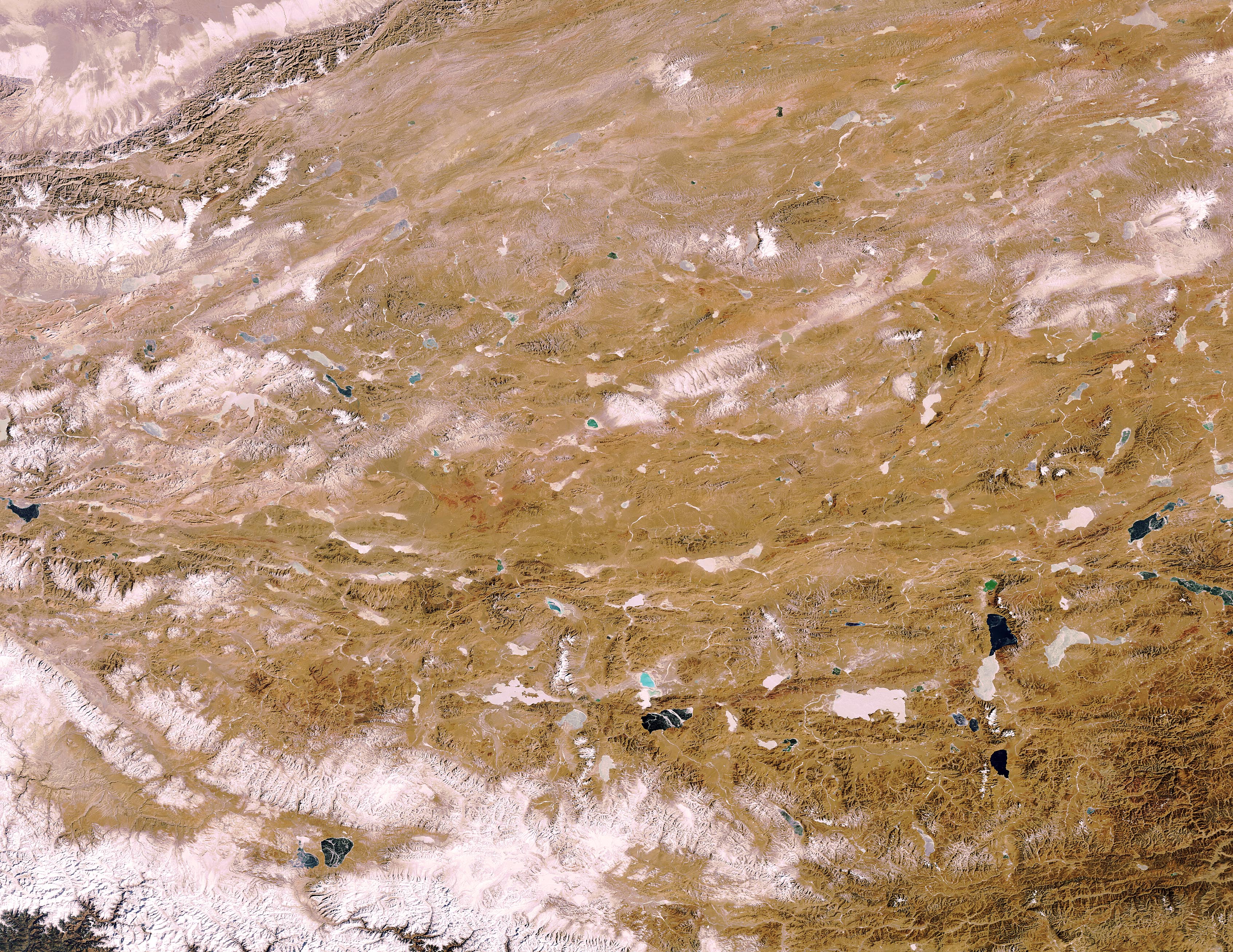
The Tibetan Plateau
Frozen lakes dotting the Tibetan Plateau in Central Asia are pictured in this image, acquired on Jan. 30, 2012 by ESA’s Envisat satellite. Part of the Himalayan mountain range is visible in the lower left corner of the image. To the northwest, part of the Kunlun mountains are visible, separating the plateau from the Tarim Basin.
Breaking space news, the latest updates on rocket launches, skywatching events and more!
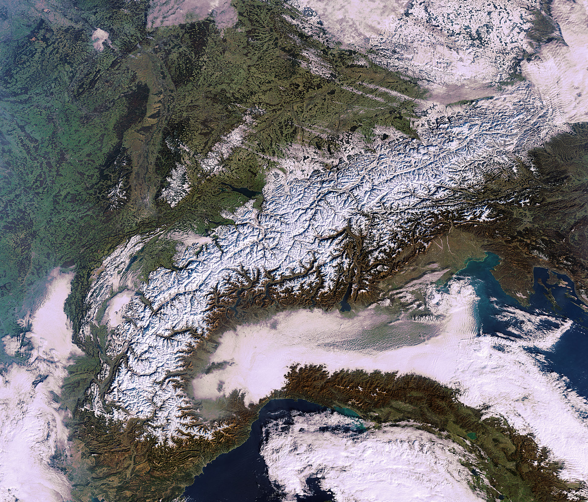
Mountains of Snow
The snow-kissed Alps that stretch across France, Italy, Switzerland, Germany, Liechtenstein, Austria and Slovenia are captured in this Envisat image, acquired on Jan.16, 2012.
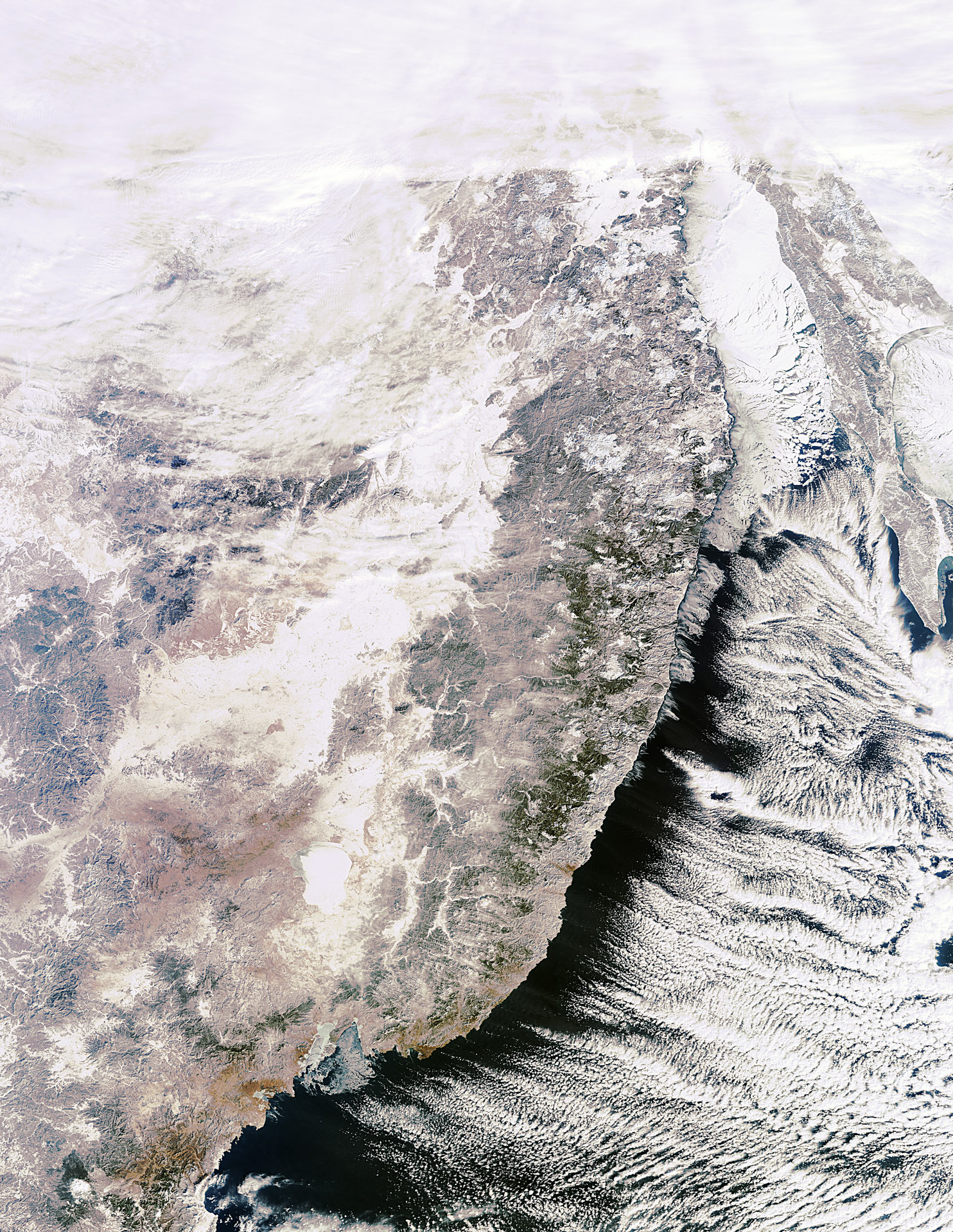
Russia’s Far East
The Sikhote–Alin mountain range in Russia’s Far East is pictured in this image, acquired on Jan. 27, 2012 . In the image, snow-covered Khanka Lake, the Sea of Japan and Russia's largest island, Sakhalin, are all visible.
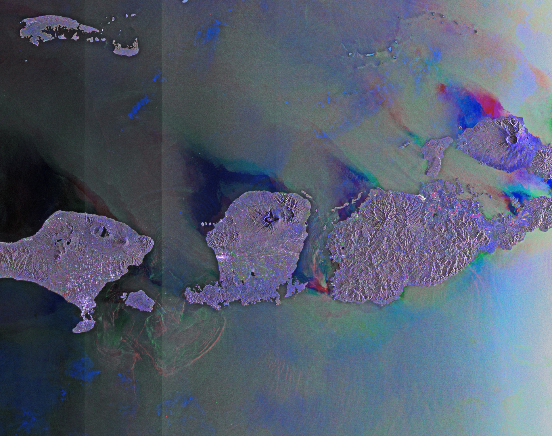
Indonesian Islands
This image from the Envisat satellite is dominated by the Indonesian islands of Bali, Lombok and Sumbawa. It's a compilation of three passes by Envisat’s radar on June 20, Aug. 19 and Dec. 27, 2011.
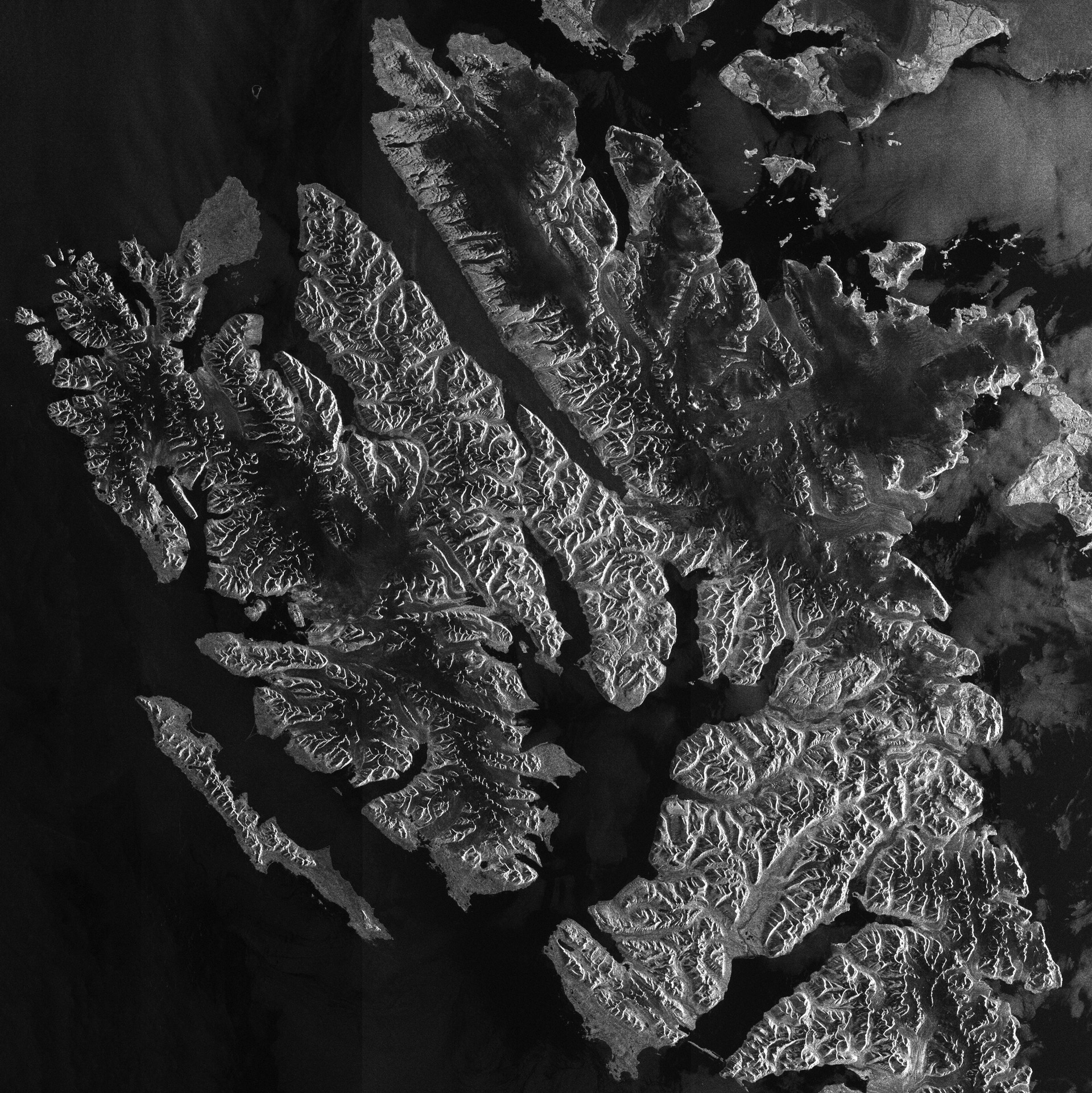
Spitsbergen, Norway’s Largest Island
Spitsbergen, Norway’s largest island, is pictured in this image, acquired on Sep. 6, 2011 by Envisat’s Advanced Synthetic Aperture Radar (ASAR). Bordered by the Arctic Ocean to its north and the Greenland Sea to its west, Spitsbergen is the largest and only permanently populated island of the Svalbard archipelago.

Space.com is the premier source of space exploration, innovation and astronomy news, chronicling (and celebrating) humanity's ongoing expansion across the final frontier. Originally founded in 1999, Space.com is, and always has been, the passion of writers and editors who are space fans and also trained journalists. Our current news team consists of Editor-in-Chief Tariq Malik; Editor Hanneke Weitering, Senior Space Writer Mike Wall; Senior Writer Meghan Bartels; Senior Writer Chelsea Gohd, Senior Writer Tereza Pultarova and Staff Writer Alexander Cox, focusing on e-commerce. Senior Producer Steve Spaleta oversees our space videos, with Diana Whitcroft as our Social Media Editor.
