
Hello, Earth! Satellite Snaps Amazing 'Blue Marble' Photo
NASA's newest Earth-watching satellite has sent back a breathtaking image of our "Blue Marble" that offers a taste of the orbiting observatory's vast capabilities.
The satellite's new photo of Earth from space comes just a day after the spacecraft was given a new name: Suomi NPP, named for the late meteorologist Verner E. Suomi, a scientist hailed as the father of satellite meteorology.
Previously, the satellite was known simply as NPP, an acronym for a mouthful: the National Polar-orbiting Operational Environmental Satellite System Preparatory Project. The new name was announced Tuesday (Jan. 24) at the annual meeting of the American Meteorological Society in New Orleans.
Suomi NPP is equipped to do far more than provide Earthlings with some stunning views of their home planet. Five instruments are traveling aboard the first-of-its-kind satellite, designed to improve both short-term weather forecasts and the overall understanding of long-term climate change.
In addition, the technology aboard is designed to monitor natural disasters, from volcanic eruptions and wildfires to floods and other emergencies.
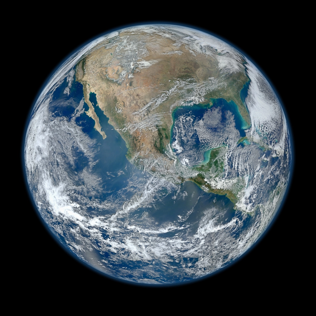
The Suomi NPP satellite's new Earth portrait is actually a mosaic compiled from several images taken on multiple passes of the planet Jan. 4. It joins other spectacular images of our home planet, including the iconic one taken by the crew of Apollo 17 in 1972 — one of the most widely distributed images in history — and views taken by other space probes such as Voyagers 1 and 2.
NASA launched the $1.5 billion Suomi NPP satellite on Oct. 28 from Vandenberg Air Force Base in California. The mini-van-sized satellite is designed to operate through the end of 2016.
Suomi NPP weighs about 4,500 pounds (2,041 kilograms) and orbits the Earth at an altitude of about 512 miles (824 kilometers). The satellite is expected to beam about 4 terabytes of data to Earth — about the equivalent of 800 DVDs — every day.
This story was provided by OurAmazingPlanet, a sister site to SPACE.com. Follow OurAmazingPlanet for the latest in Earth science and exploration news on Twitter @OAPlanet and on Facebook.