Photos: NASA's Novel NPP Weather & Climate Satellite
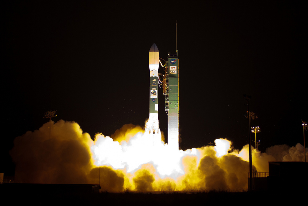
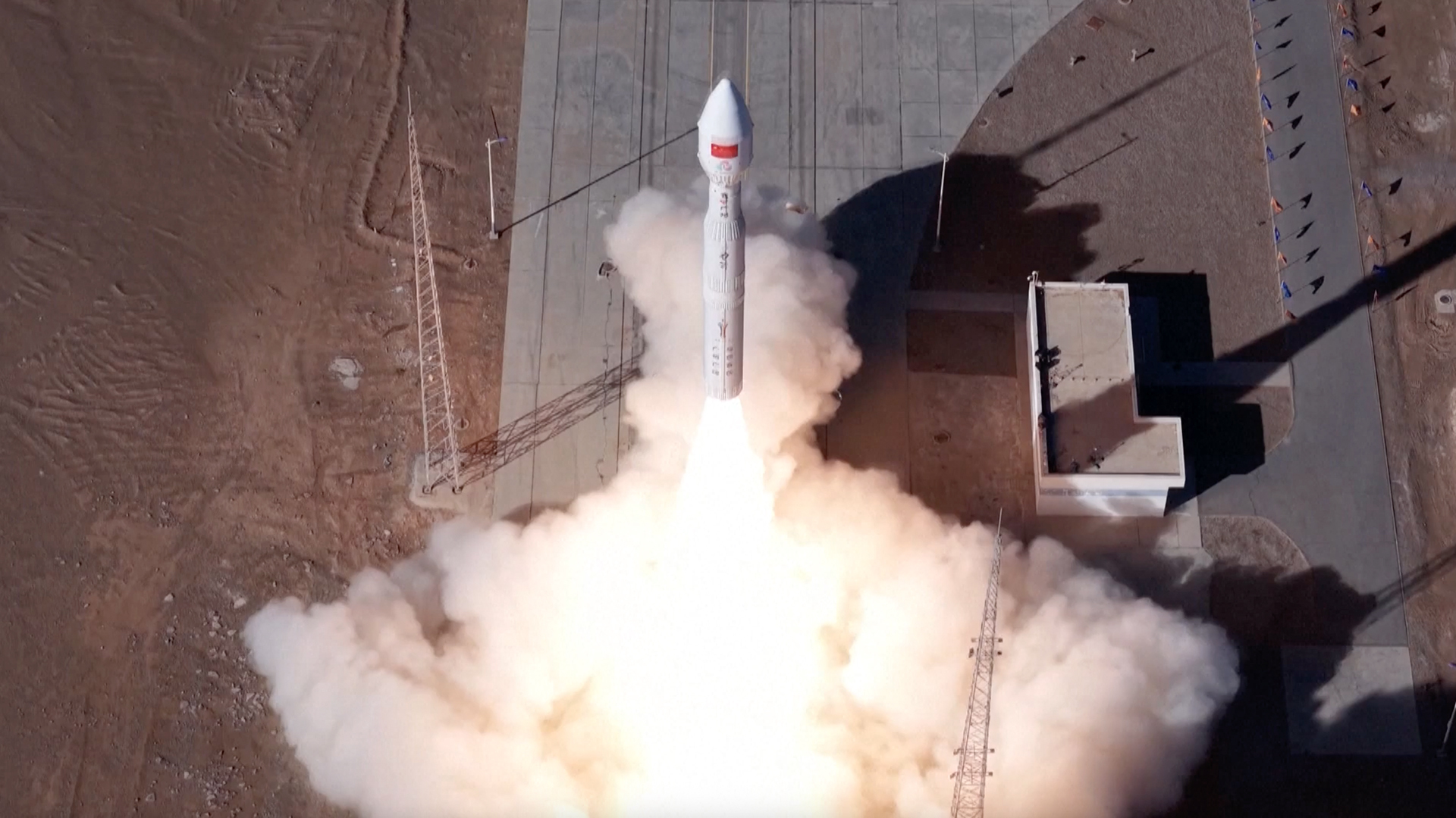
NPP Delta 2 Launch
A Delta 2 rocket launches with the NPOESS Preparatory Project (NPP) spacecraft payload from Space Launch Complex 2 at Vandenberg Air Force Base, Calif. on Friday, Oct. 28, 2011. NPP is the first NASA satellite mission to address the challenge of acquiring a wide range of land, ocean, and atmospheric measurements for Earth system science while simultaneously preparing to address operational requirements for weather forecasting.
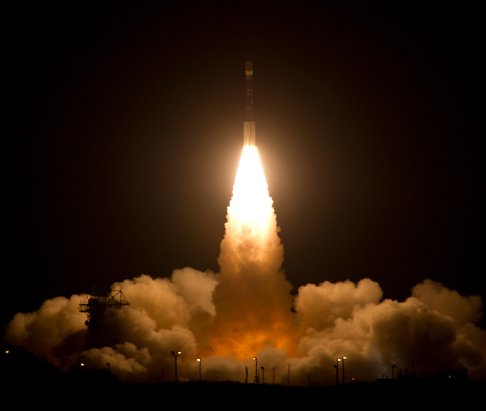
NPP Delta 2 Launch 2
A Delta 2 rocket launches with the NPOESS Preparatory Project (NPP) spacecraft payload from Space Launch Complex 2 at Vandenberg Air Force Base, Calif. on Friday, Oct. 28, 2011. NPP is the first NASA satellite mission to address the challenge of acquiring a wide range of land, ocean, and atmospheric measurements for Earth system science while simultaneously preparing to address operational requirements for weather forecasting.
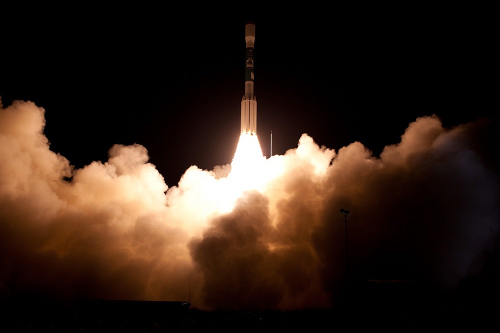
NPP Delta 2 Launch 3
A Delta 2 rocket launches with the NPOESS Preparatory Project (NPP) spacecraft payload from Space Launch Complex 2 at Vandenberg Air Force Base, Calif. on Friday, Oct. 28, 2011. NPP is the first NASA satellite mission to address the challenge of acquiring a wide range of land, ocean, and atmospheric measurements for Earth system science while simultaneously preparing to address operational requirements for weather forecasting.
NPP Satellite Launch Interview
Dr. Kathy Sullivan, center, Deputy Administrator of the National Oceanic and Atmospheric Administration (NOAA) and former NASA astronaut, is interviewed by a local television network at NOAA's Satellite Operations Facility in Suitland, Md. after the successful launch of the National Polar-orbiting Operational Environmental Satellite System Preparatory Project (NPP) on Friday, Oct. 28, 2011.
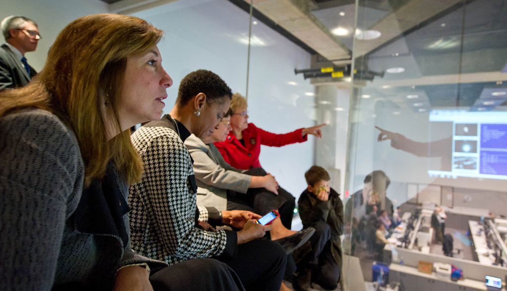
Officials Watch NPP Launch
NASA Deputy Administrator Lori Garver, left, watches the launch of the National Polar-orbiting Operational Environmental Satellite System Preparatory Project (NPP) at the National Oceanic and Atmospheric Administration (NOAA) Satellite Operations Center on Friday, Oct. 28, 2011, in Suitland, Md. U.S Congresswoman Donna Edwards, D-Md., is seen next to Garver.
NPP Satellite Operations Facility
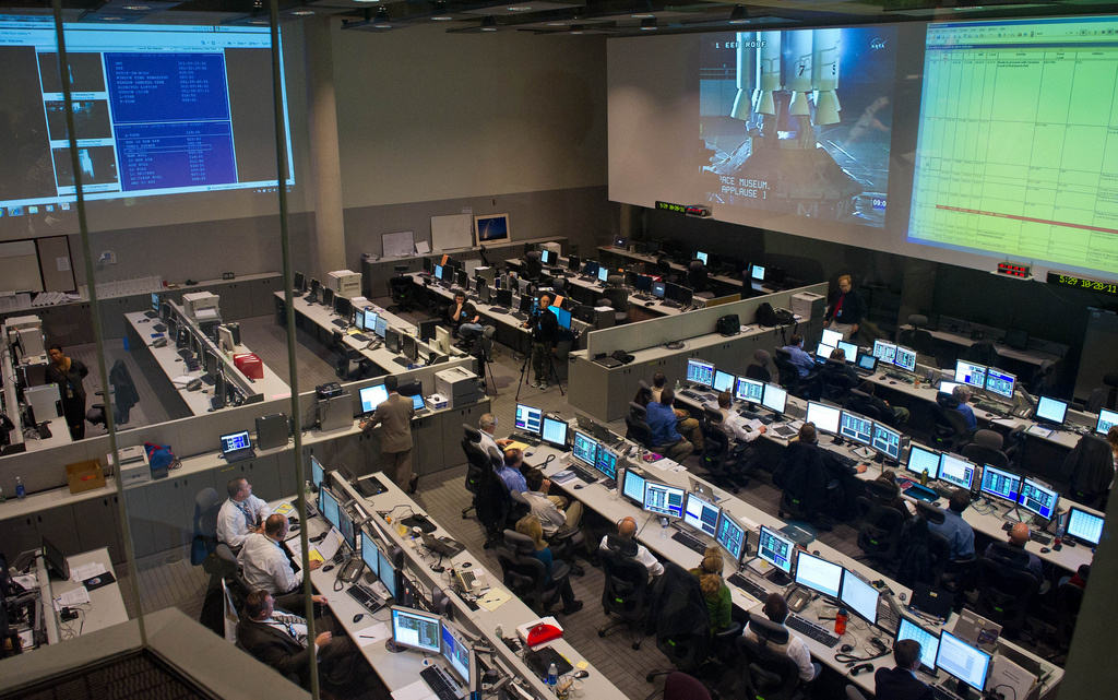
The Satellite Operations Facility of the National Oceanic and Atmospheric Administration (NOAA) is seen here minutes before the launch of the National Polar-orbiting Operational Environmental Satellite System Preparatory Project (NPP) on Friday, Oct. 28, 2011, in Suitland, Md.
Herbal Earth: Western Hemisphere
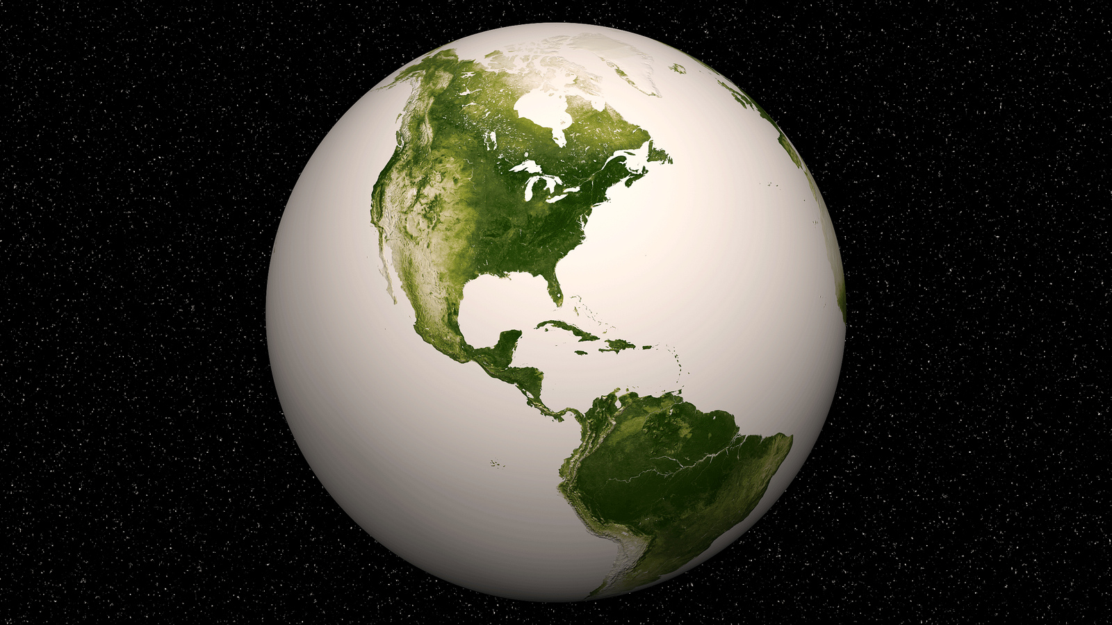
The still image is a snapshot of the Earth created from a year’s worth of data from April 2012 to April 2013. Subtle differences in shades of green in this animation reflect vegetation conditions worldwide. High values of Normalized Difference Vegetation Index, or NDVI, represent dense green functioning vegetation, and low NDVI values represent sparse green vegetation or vegetation under stress from limiting conditions, such as drought. This image was released June 19, 2013.
Breaking space news, the latest updates on rocket launches, skywatching events and more!
Herbal Earth: Eastern Hemisphere
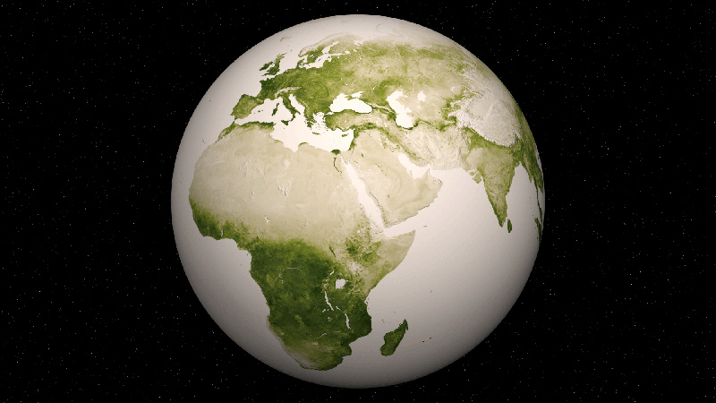
Subtle differences in shades of green in this animation reflect vegetation conditions worldwide. High values of Normalized Difference Vegetation Index, or NDVI, represent dense green functioning vegetation, and low NDVI values represent sparse green vegetation or vegetation under stress from limiting conditions, such as drought. The still image is a snapshot of the Earth created from a year’s worth of data from April 2012 to April 2013. This image was released June 19, 2013.
Herbal Earth: Pacific Northwest
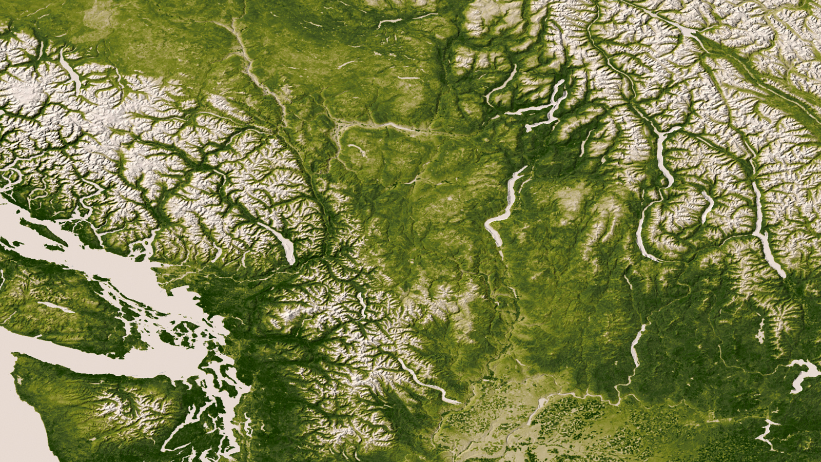
The Rocky, Cascade, and Coast Mountain Ranges dominate the landscape of the Pacific Northwest in this image created June 11-17, 2012 from the Visible-Infrared Imager/Radiometer Suite (VIIRS) instrument aboard the Suomi National Polar-orbiting Partnership or Suomi NPP satellite, a partnership between NASA and the National Oceanic and Atmospheric Administration, or NOAA. This image was released June 19, 2013.
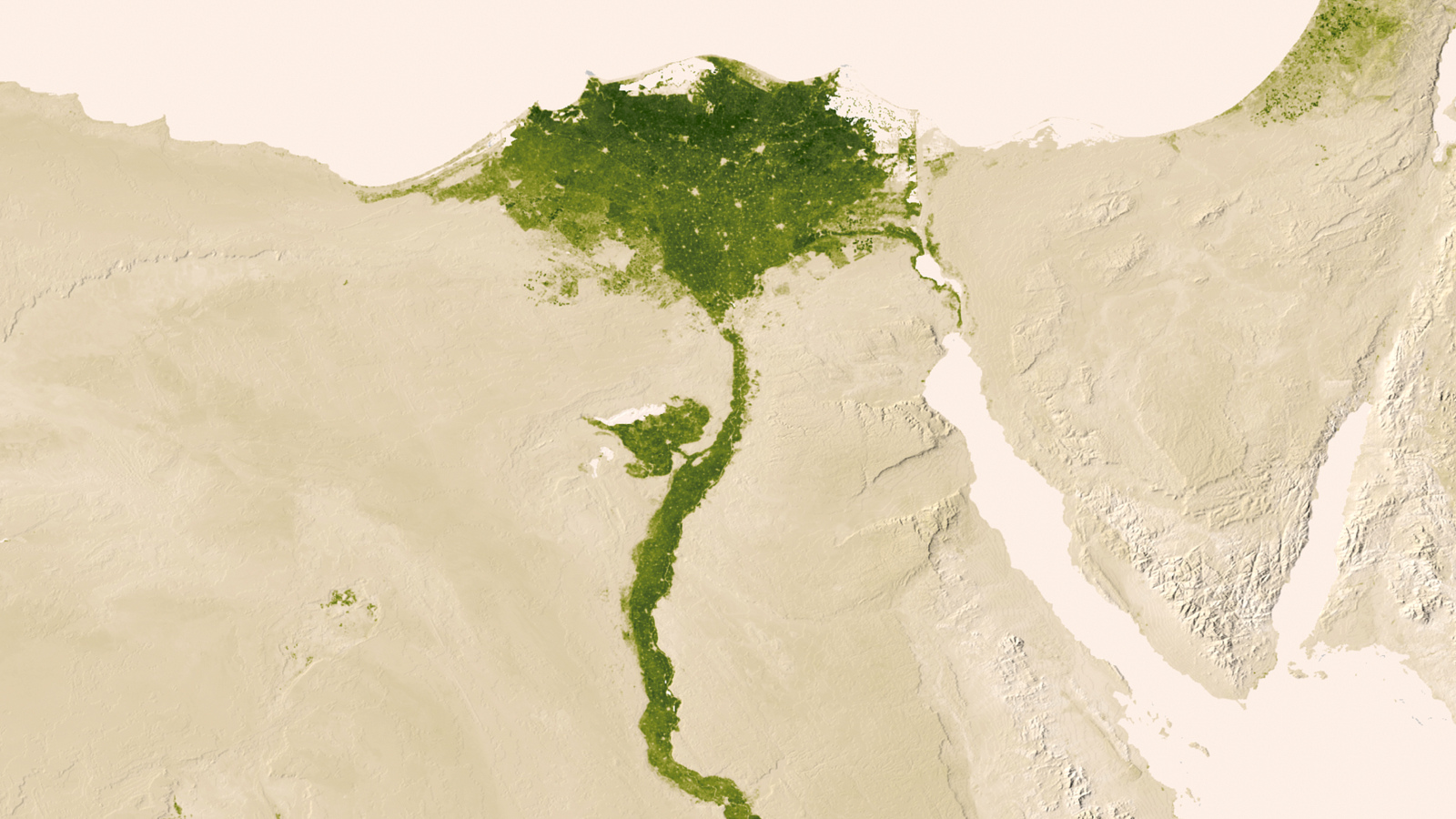
Herbal Earth: Nile Delta
Urbanized areas of northern Egypt are visible amidst the deserts of Egypt. The image captured July 9-15, 2012 also shows the Nile River, which provides life-sustaining water to the region. The image was created from the Visible-Infrared Imager/Radiometer Suite (VIIRS) instrument aboard the Suomi National Polar-orbiting Partnership or Suomi NPP satellite, a partnership between NASA and the National Oceanic and Atmospheric Administration, or NOAA. This image was released June 19, 2013.

Space.com is the premier source of space exploration, innovation and astronomy news, chronicling (and celebrating) humanity's ongoing expansion across the final frontier. Originally founded in 1999, Space.com is, and always has been, the passion of writers and editors who are space fans and also trained journalists. Our current news team consists of Editor-in-Chief Tariq Malik; Editor Hanneke Weitering, Senior Space Writer Mike Wall; Senior Writer Meghan Bartels; Senior Writer Chelsea Gohd, Senior Writer Tereza Pultarova and Staff Writer Alexander Cox, focusing on e-commerce. Senior Producer Steve Spaleta oversees our space videos, with Diana Whitcroft as our Social Media Editor.
