Photos: New Views of Apollo Moon Landing Sites
Apollo 16: Footsteps in Sunlight
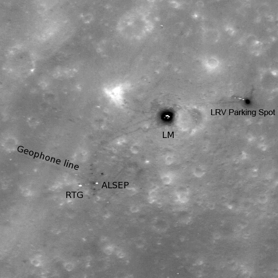
This high -sun image of the Apollo 16 landing site showing the lunar module descent stage, various pieces of equipment, and disturbed lunar soil (seen as darker lines and areas) which marks where John Young and Charles Duke traversed in the spring of 1972. NASA's Lunar Reconnaissance Orbiter took this photo, which was released July 8, 2010.
The labels on the image are for the Lunar Module (LM), the Lunar Roving Vehicle (LRV), the Apollo Lunar Surface Experiments Package (ALSEP), the Radioisotopic Thermoelectric Generator (RTG) that powered the ALSEP, and a line of geophones (devices that take seismic readings) that extended west by northwest from the ALSEP station. LROC image M109134835L, 296 meters across (about 971 feet).
Apollo 16: Arrow Points the Way
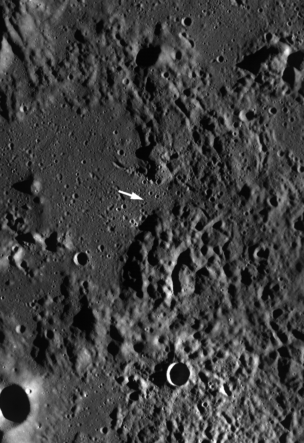
This Lunar Reconnaissance Orbiter Wide Angle Camera monochrome mosaic of the Cayley Plains (smooth areas) and Descartes Mountains surrounding the Apollo 16 landing site (arrow indicates approximate position of the lunar module). Image M116215423M, scene width is 65 km (about 40 miles). This photo was released on July 8, 2010.
Apollo 12: Ocean of Storms
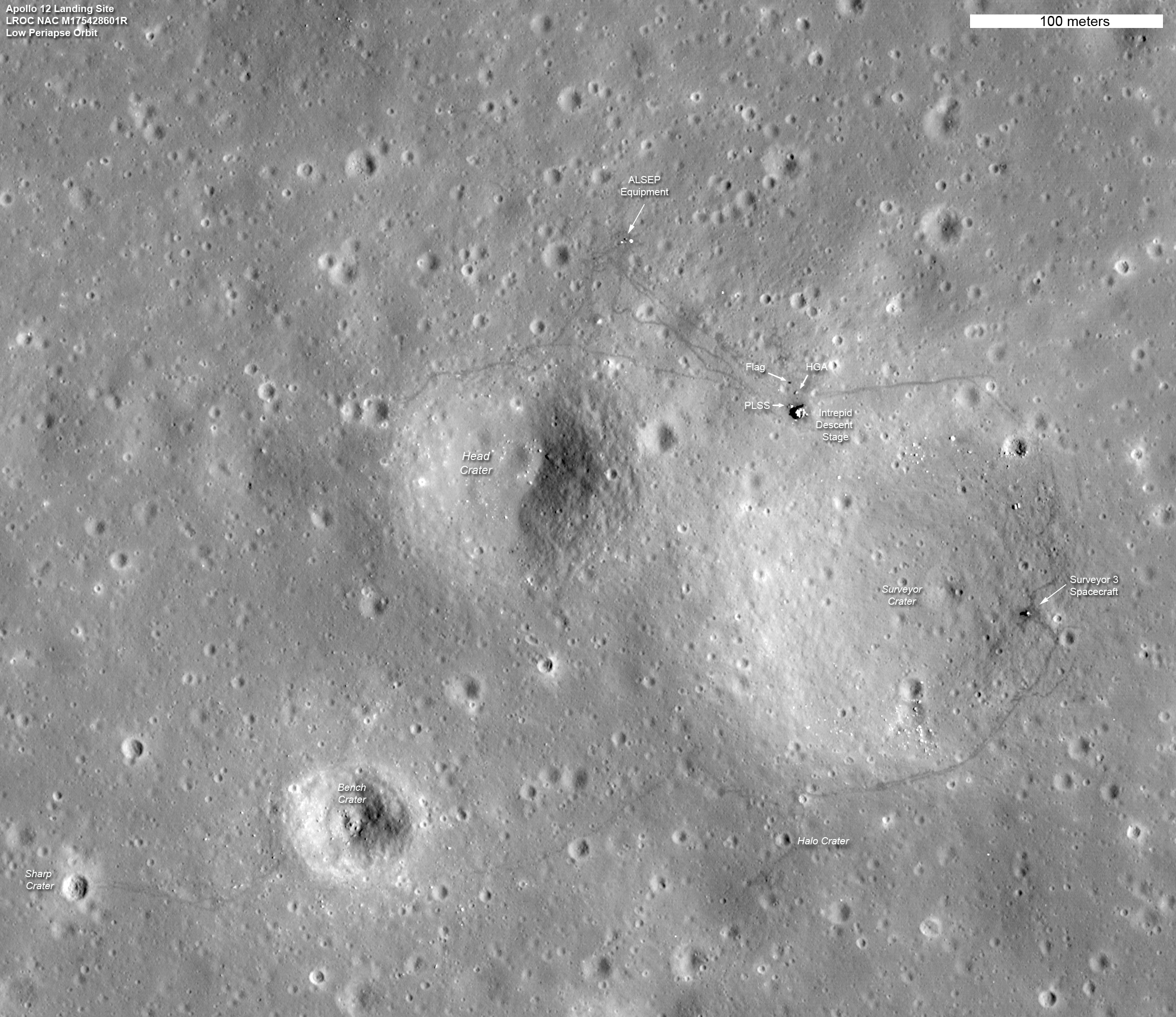
The Apollo 12 landing site in Oceanus Procellarum imaged during the second Lunar Reconnaissance Orbiter low-altitude campaign. This image was released on March 6, 2012.
This image shows the remnants of not one, but two missions to the moon. Apollo 12 astronauts Pete Conrad and Alan Bean demonstrated that a precision lunar landing with the Apollo system was possible, enabling all of the targeted landings that followed. Bean and Conrad collected rock samples and made field observations, which resulted in key discoveries about lunar geology. They also collected and returned components from the nearby U.S. Surveyor 3 spacecraft, which landed at the site almost two-and-a-half years previously, providing important information to engineers about how materials survive in the lunar environment.
Apollo 12 and Surveyor 3
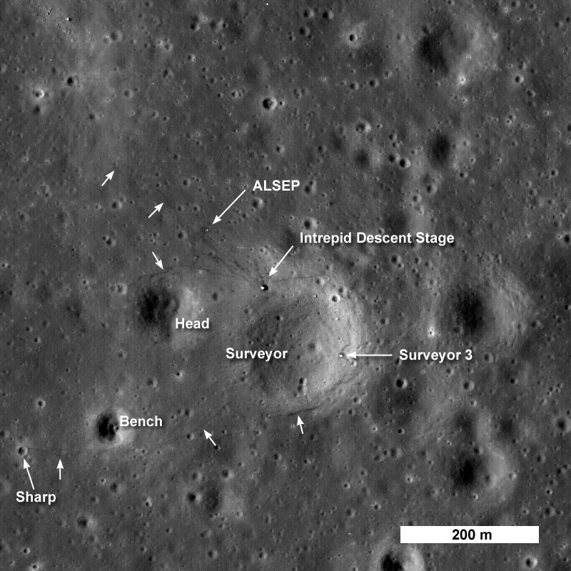
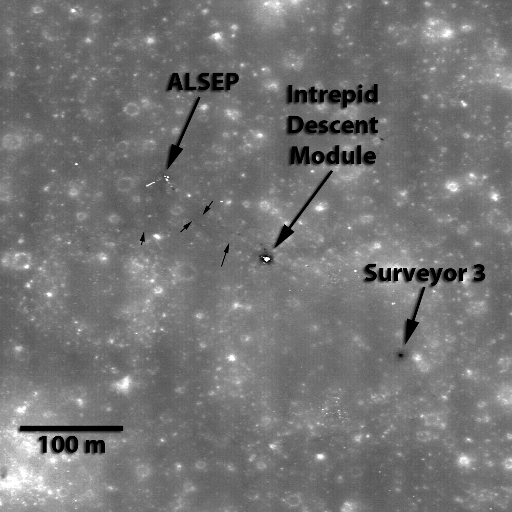
This image from the Lunar Reconnaissance Orbitershows the spacecraft's first look at the Apollo 12 landing site. The Intrepid lunar module descent stage, experiment package (ALSEP) and Surveyor 3 spacecraft are all visible. This image was released on Sept. 3, 2009.
Apollo 12 landed in November 1969. This image shows astronaut footpaths marked with unlabeled arrows. This image is 824 meters (about 900 yards) wide. The top of the image faces North.
Apollo 12: Far View
An early view of the Apollo 12 landing site in Oceanus Procellarum imaged from the LRO mapping orbit. This image, released on Nov. 4, 2009, shows small black arrows pointing to locations where astronaut footpaths can be clearly discerned. Image width is 490 meters.
Zooming in on Apollo 12
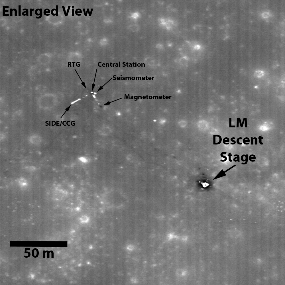
Enlarged view of the Nov. 2009 LRO image showing details of the Apollo 12 landing site. In the upper left, you can see the Apollo Lunar Surface Experiments Package, or ALSEP. The positions of the ALSEP central station, seismometer, Radioisotope Thermoelectric Generator (RTG), magnetometer, Suprathermal Ion Detector Experiment (SIDE), and Cold Cathode Gauge (CCG) have been highlighted.
Apollo 12 Deployed Flag and Shadow Seen by Lunar Reconnaissance Orbiter
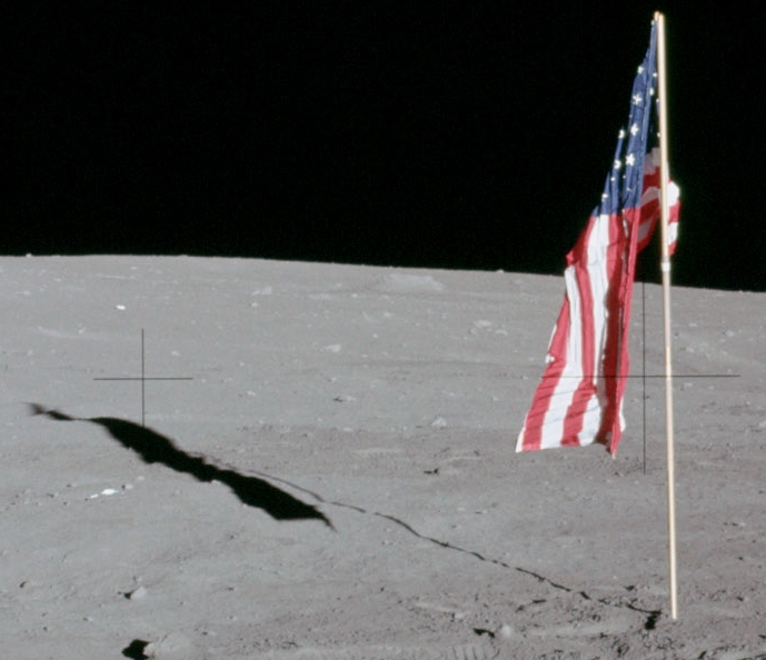
Detail from an Apollo 12 photo showing the deployed flag and its shadow. The latch failed on the pivot designed to hold the top edge of the flag out perpendicular to the pole on a supporting rod, so the flag hung limp. The photo was taken Nov. 19, 1969.
Breaking space news, the latest updates on rocket launches, skywatching events and more!
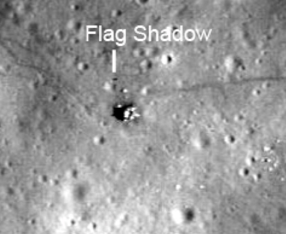
Apollo 11 Lunar Reconnaissance Orbiter Camera Image of Deployed Flag
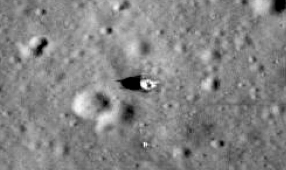
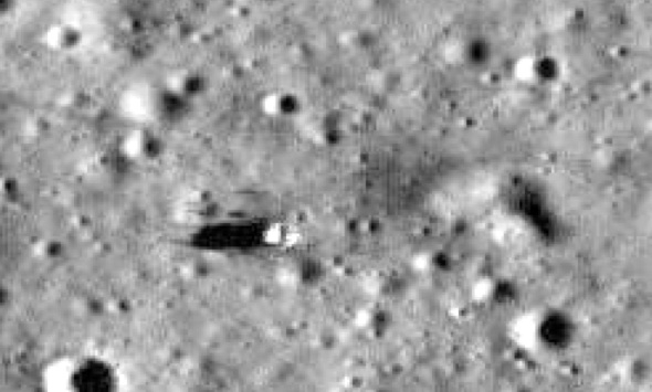
Lunar Reconnaissance Orbiter Camera images of each Apollo site taken at roughly the same orientation but with different sun angles to show the travel of shadows. Combined with knowledge of the Apollo site maps which show where the flag was erected relative to the Lander, long shadows cast by the flags at three sites - Apollo 12, Apollo 16, and Apollo 17 - show that the these flags are still “flying”, held aloft by the poles. There is no indication of a flag shadow in this Apollo 11 image.
Apollo 12 Deployed Flag and Shadow
Detail from an Apollo 12 photo showing the deployed flag and its shadow. The latch failed on the pivot designed to hold the top edge of the flag out perpendicular to the pole on a supporting rod, so the flag hung limp. The photo was taken Nov. 19, 1969.
Apollo 14 Deployed Flag and Shadow
Detail from an Apollo 14 photo showing the deployed flag and its shadow. The latch failed on the pivot designed to hold the top edge of the flag out perpendicular to the pole on a supporting rod, so the flag hung limp. The photo was taken Feb. 5, 1971.

Space.com is the premier source of space exploration, innovation and astronomy news, chronicling (and celebrating) humanity's ongoing expansion across the final frontier. Originally founded in 1999, Space.com is, and always has been, the passion of writers and editors who are space fans and also trained journalists. Our current news team consists of Editor-in-Chief Tariq Malik; Editor Hanneke Weitering, Senior Space Writer Mike Wall; Senior Writer Meghan Bartels; Senior Writer Chelsea Gohd, Senior Writer Tereza Pultarova and Staff Writer Alexander Cox, focusing on e-commerce. Senior Producer Steve Spaleta oversees our space videos, with Diana Whitcroft as our Social Media Editor.
