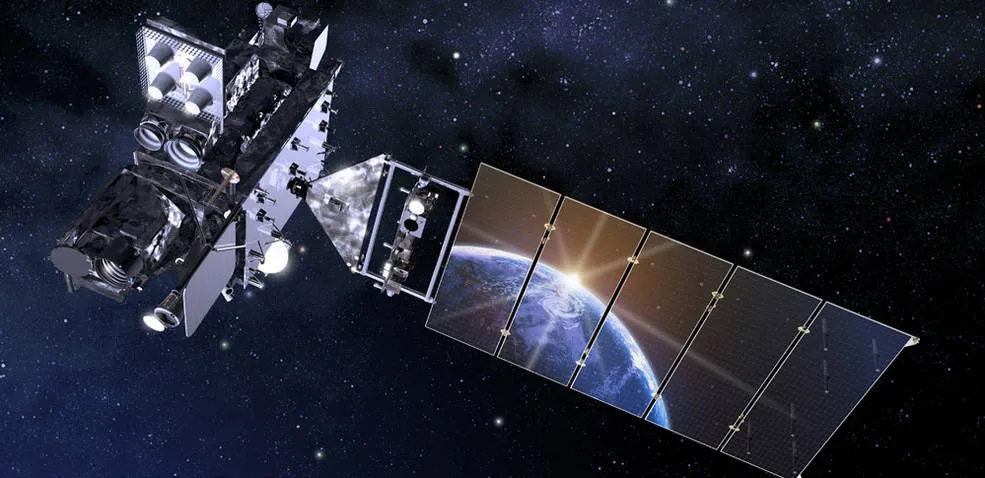
The next Geostationary Operational Environmental Satellite is set for launch, with improvements to avoid an instrument problem that caused issues in a predecessor mission.
The powerful weather satellite from the National Oceanic and Atmospheric Administration (NOAA) is set to launch March 1 at 4:38 p.m. EST (2138 GMT) from Cape Canaveral Space Station in Florida. GOES-T will ride to space aboard a United Launch Alliance Atlas V rocket and spend several months in a commissioning period.
Once declared operational, the satellite will be renamed GOES-18 and monitor the western part of the United States. It will replace 2018's GOES-17, which is operational but suffering from a cooling problem on its Advanced Baseline Imager (ABI) instrument. After a transition period including data handoff, GOES-17 will go into orbital storage, according to the GOES website.
Related: NASA picks SpaceX's Falcon Heavy to launch GOES-U weather satellite
GOES-T's wide-ranging mandate includes monitoring wildfires, lightning, fog or storms across the Pacific Ocean, the western continental United States, Alaska and Hawaii. It will also act as a watcher for "space weather" such as solar storms, to form part of NOAA's and NASA's larger system that monitors solar activity to protect power grids, satellites and navigation systems.
"The observations from these satellites are even more critical now, when the U.S. is experiencing a record number of billion-dollar disasters," Pam Sullivan, director of NOAA's GOES-R series program, told attendees of a virtual briefing Tuesday (Feb. 1).
Both GOES-T and GOES-17 are part of the larger $11.7 billion GOES-R series, which is a four-satellite program intended to keep the system operational through 2036. A third satellite in the series, GOES-16, launched in 2016 and is operational over the eastern United States. The fourth — GOES-U — is set for a launch in 2024, according to NOAA.
The GOES-R series has been distinctive in its ability to detect wildfires, said program scientist Dan Lindsey, who is with NOAA. He said that GOES-T would be able to help the fleet with its own ABI.
"Fires have been very active across the western continental U.S., and so [the satellite] is in an ideal position out there to get a really close look at those fires," Lindsey said. "ABI is ideal for detecting the thermal signature, or the hot spots from the fires. Sometimes it's even able to detect the fires before the reported from the public; this is really critical information to get to firefighters so that they can take care of the fires before they can come out of control."
ABI, he added, can even track smoke from fires to let forecasters know when plumes are approaching major cities. It can also track volcanic ash, or lightning from thunderstorms, that would require adjustments to aviation flight paths, he said. Moreover, the recent Tonga eruption created a massive pressure wave that was spotted in space by both GOES-16 and GOES-17.

The short-term benefits of GOES-T forecasting will also contribute to better long-range forecasts as the satellite works with the rest of the fleet and other satellites, said James Yoe, chief administrator for the multi-agency Joint Center for Satellite Data Assimilation that works to use such information for long-term climate forecasts.
Yoe pointed to metrics such as "wind speed and direction at different levels in the atmosphere" as among the data GOES-T will gather to improve weather models. The lightning mapper will feed into storm forecasts, while the eyes on solar weather will improve solar predictions — when joined with other information from already active satellites, Yoe noted.
Other briefing participants spoke to logistics from spacecraft testing, to getting the rocket ready for launching, to the continuing pivoting and social distancing required during the last stages of manufacturing, which took place during the pandemic.

The team also delayed satellite manufacturing in 2018, according to SpaceNews, to address the root issue of the ABI malfunction GOES-17 faced so that it wouldn't recur in GOES-T.
The cause of ABI's malfunction was "foreign object debris ... blocking the flow of coolant in a loop heat pipe system," said Larry Crawford, ABI program manager at manufacturer L3Harris Technologies. GOES-T and the future GOES-U both have hardware fixes to ensure the same issue does not reoccur, he added.
GOES-T's "first light" imagery should be available in May, Sullivan told reporters, clarifying that these should be treated as "checkout pictures" and not the adjusted, sharp operational images that will be relayed later in the mission.
By July, ABI data should be starting to flow and weather forecasts should have access to the data around then, although the satellite won't be quite operational, Sullivan added. The satellite should be declared fully operational by January 2023, according to the GOES website.
Correction: This article was updated to include the correct terminology regarding a pipe system: "loop heat pipe system."
Follow Elizabeth Howell on Twitter @howellspace. Follow us on Twitter @Spacedotcom and on Facebook.
