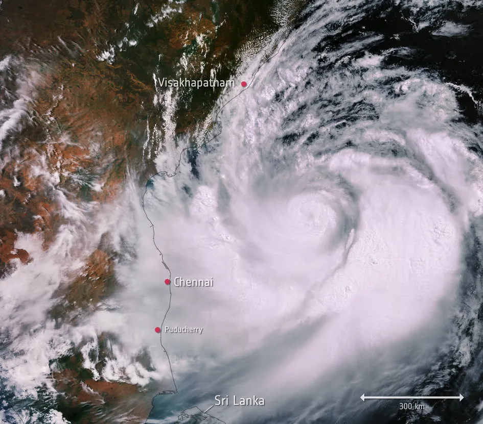
As Cyclone Fani strengthened and made landfall over eastern India on May 3, a network of weather satellites kept an eye on the massive storm.
The cyclone peaked with wind speeds of up to 127 mph (204 kilometers/hour), the equivalent of a Category 4 hurricane. (Hurricanes and cyclones are the same basic weather phenomenon, just located in different regions of the world).
Extremely Severe Cyclonic Storm #Fani, now a dangerous Cat. 4 storm on the Saffir-Simpson Hurricane Wind Scale, remains just off the coast of India in this imagery from #Himawari8. More imagery: https://t.co/Zz3zZvHSii pic.twitter.com/yh8ROw6xPGMay 2, 2019
Over the course of Fani's formation and dispersal, the storm was watched by weather satellites including NOAA-20, Himawari8 and Suomi NPP, all run by the National Oceanic and Atmospheric Administration, as well as NASA's Terra satellite.
Before the storm's arrival, the Indian government evacuated more than 1 million people in a procedure already being credited for saving countless lives in a poor, low-lying region of the country. Several people died, according to current tallies, but that's many fewer than might have been expected — the last major storm to hit the region, 20 years ago, killed more than 10,000 people.
Meteorologists first identified the patch of air that would become Cyclone Fani about a week in advance, and the storm closely matched their predictions of where it would make landfall, giving the government time to roll out a detailed notification and evacuation plan.
After making landfall, Fani headed northeast and started to weaken.
- Watch Hurricane Florence Make Landfall in This Incredible Space Station Video
- Why Do Hurricanes Have Eyes? Scientists Still Don't Really Know
- Hurricane Lane in Photos: Massive Storm as Seen from Space
Email Meghan Bartels at mbartels@space.com or follow her @meghanbartels. Follow us on Twitter @Spacedotcom and on Facebook.
