Hurricane Lane in Photos: Massive Storm as Seen from Space
Hurricane Lane
Hurricane Lane, a major storm, began threatening Hawaii on Aug. 22 and was predicted to bring strong winds, heavy rain and other dangers to the islands through Saturday, Aug. 25. NASA astronauts aboard the International Space Station and satellites in orbit around Earth kept watch over the frighteningly large storm as it approached the islands.
The view from the space station
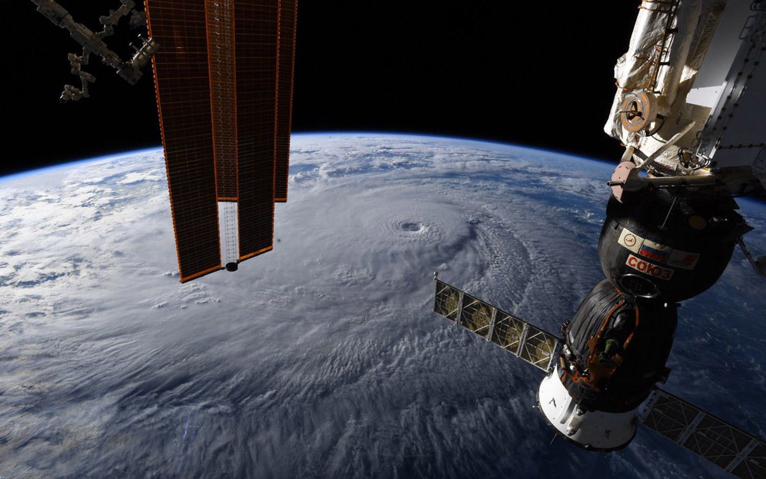
U.S. astronaut Ricky Arnold, currently living and working on the International Space Station, captured this image of Hurricane Lane's incredible clouds on Aug. 22.
Clouds shine from above
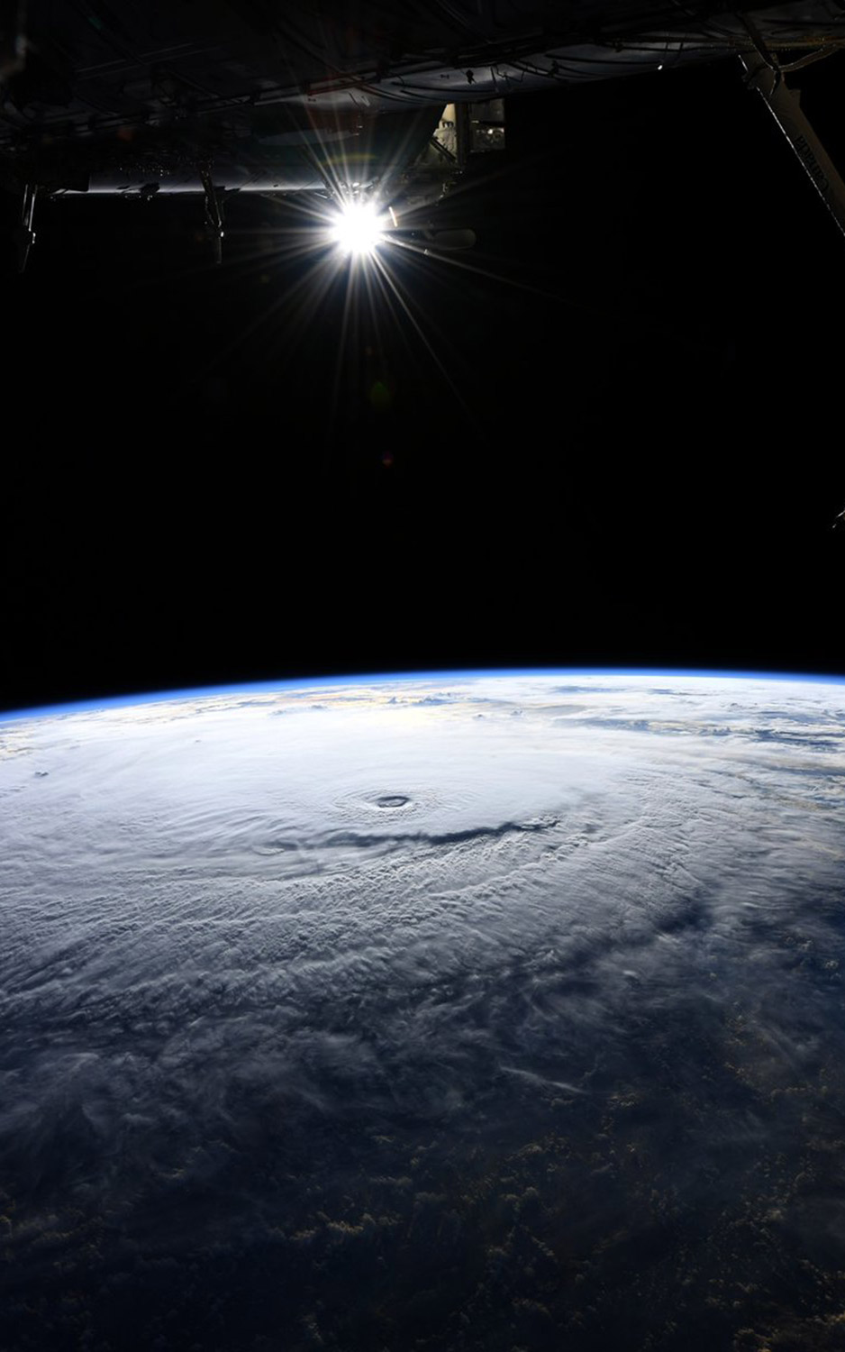
A second image by Ricky Arnold taken from the space station offers a different perspective on the giant knot of clouds roiling above the Pacific Ocean.
A chilly storm
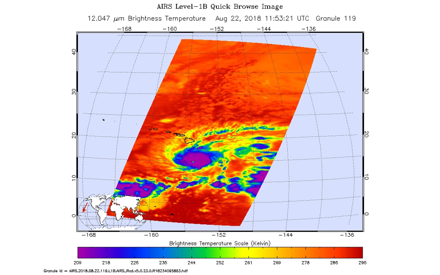
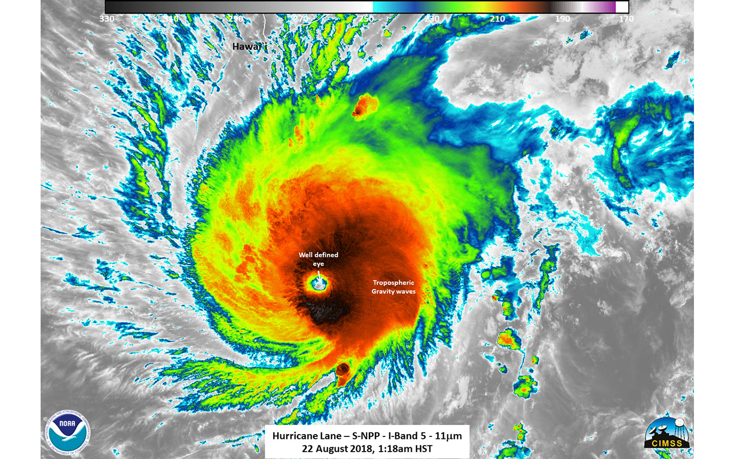
NASA's Aqua satellite captured this image of Hurricane Lane in infrared light, which tells meteorologists how warm the clouds are. Colder clouds, like those at the heart of the storm, stretch taller in the atmosphere and can produce stronger rainfall.
Black and white
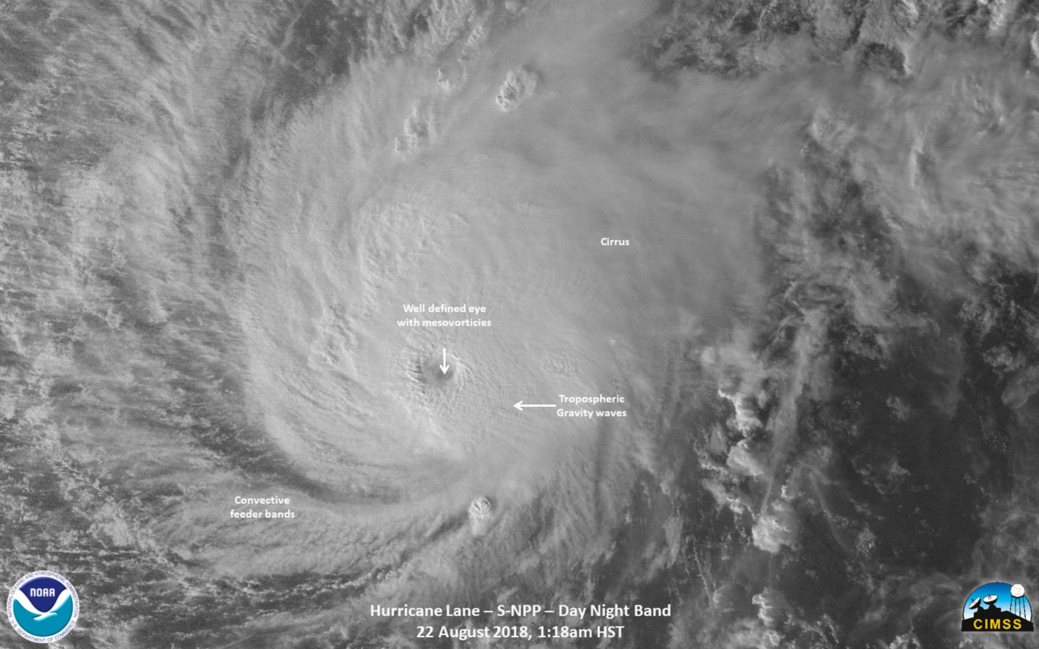
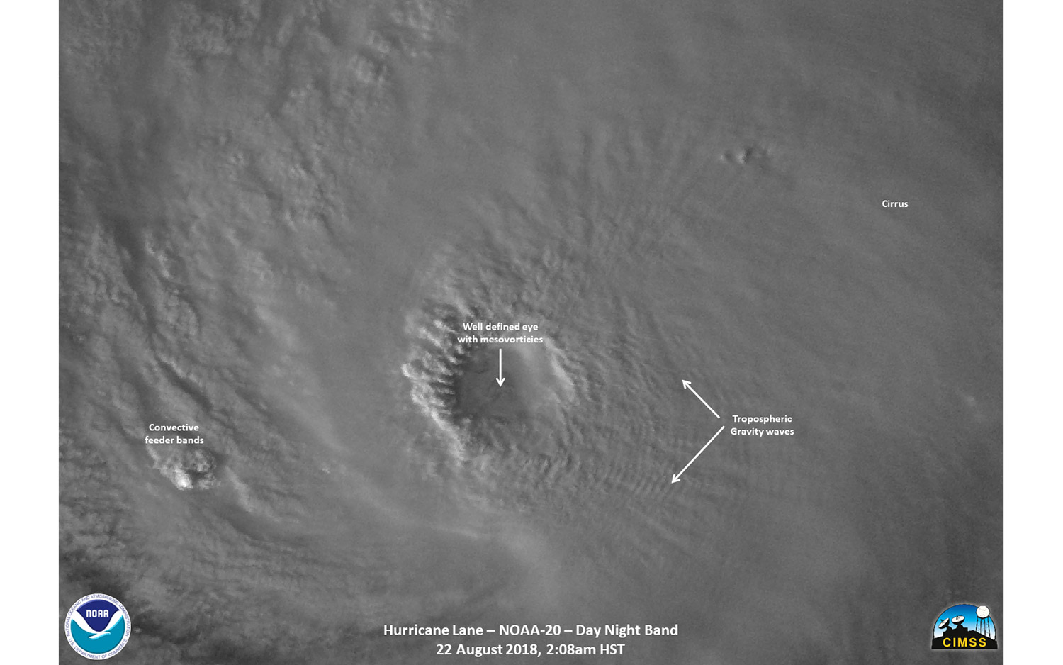
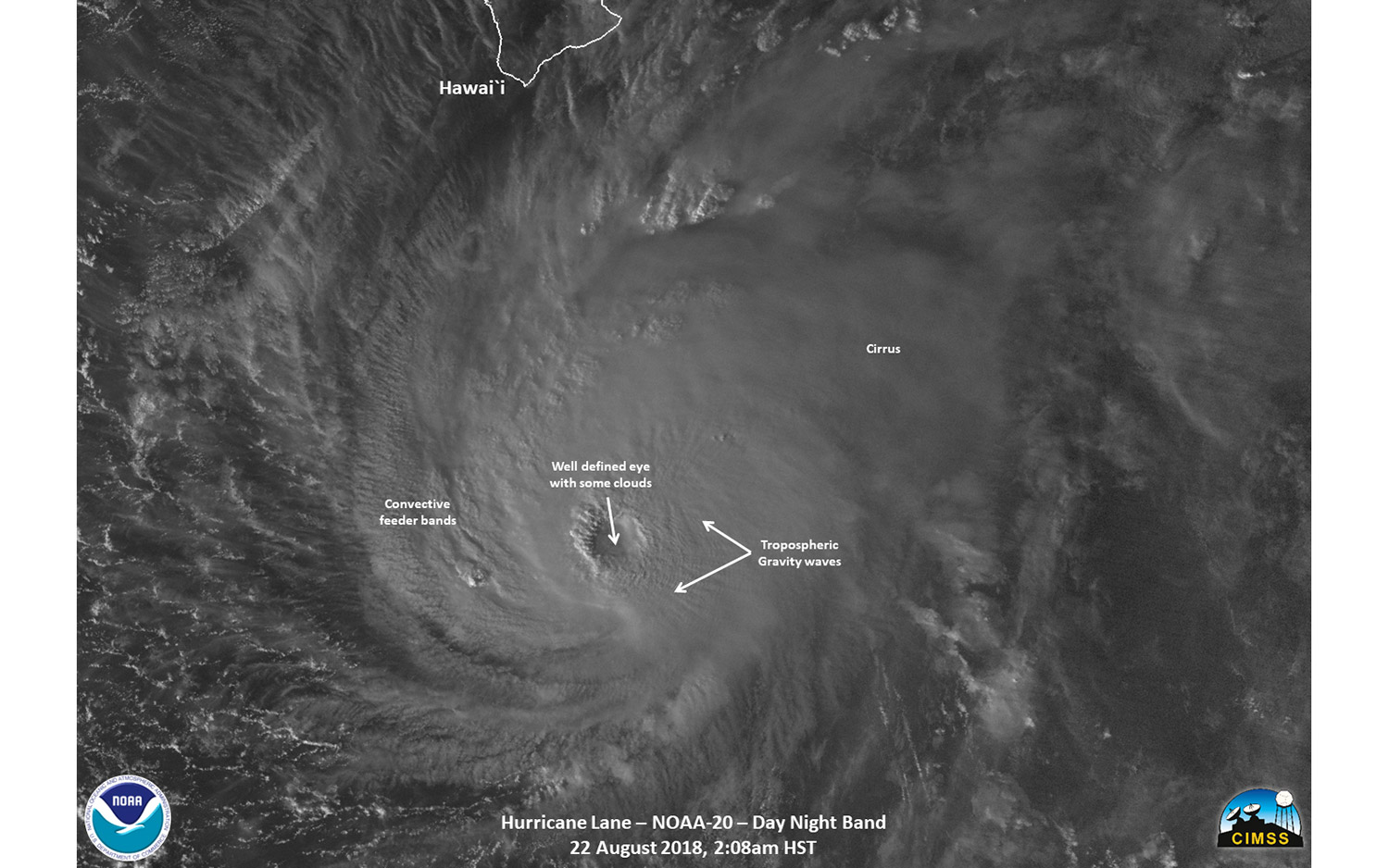
The Suomi NPP satellite, which is jointly run by NASA and NOAA, caught this image of Hurricane Lane during its brief period as a Category 5 storm. (As it came closer to land, the hurricane's wind speeds dropped slightly.) This night view, taken at 2:08 a.m. local time, helps scientists study the storm's structure.
A well-defined eye
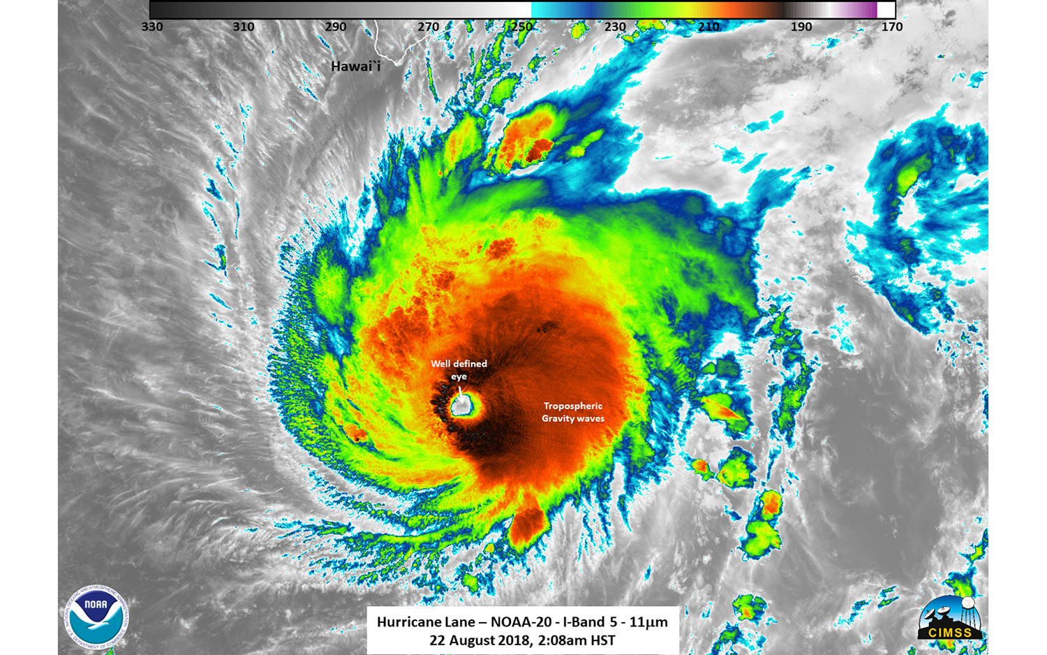
A second image highlights the hurricane's structure by using infrared light to capture nuances in the clouds, like the storm's well-defined eye.
40 minutes later
An identically processed image taken 40 minutes later by a different NOAA satellite shows the rapid changes in cloud structure, particularly in the outer regions of the hurricane.
Breaking space news, the latest updates on rocket launches, skywatching events and more!
Up close and personal
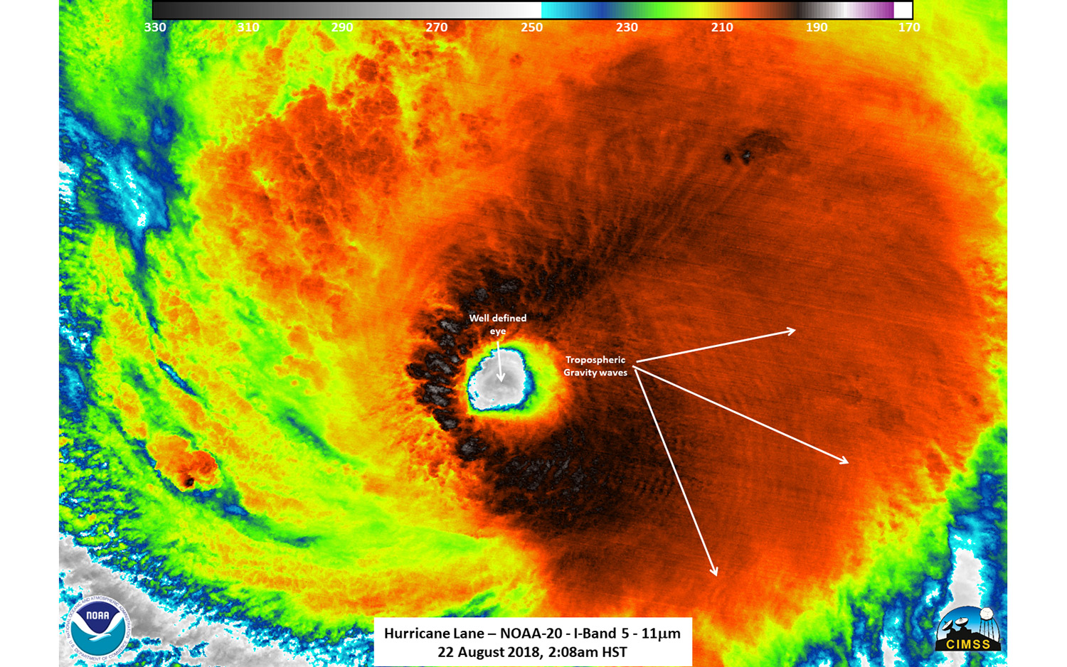
The same image zoomed in on the hurricane's eye wall highlights how active the swirling mass of clouds is at its heart.
Identifying Structures
By looking at detailed images of the hurricane, meteorologists can identify structures within the storm, which can help researchers hone their forecasts and better inform people on the ground.
Perspective
As if those images weren't frightening enough, this image shows how close the hurricane was to Hawaii when the photos were taken. For the latest forecast and information about the storm, residents should consult the National Weather Service.

Meghan is a senior writer at Space.com and has more than five years' experience as a science journalist based in New York City. She joined Space.com in July 2018, with previous writing published in outlets including Newsweek and Audubon. Meghan earned an MA in science journalism from New York University and a BA in classics from Georgetown University, and in her free time she enjoys reading and visiting museums. Follow her on Twitter at @meghanbartels.
