Satellites Track California's Devastating Kincade Wildfire from Space
California residents spent an anxious weekend tracking the path of a wildfire through Sonoma County north of San Francisco Bay — and satellites have been watching along with locals.
According to the California Department of Forestry and Fire Protection, the Kincade Fire has burned 54,298 acres (220 square kilometers) as of Sunday (Oct. 27) and is just 5% contained, despite the efforts of more than 3,000 firefighting personnel. The fire began burning on Oct. 23 and has destroyed 94 structures so far, according to the San Francisco Chronicle's fire tracker.
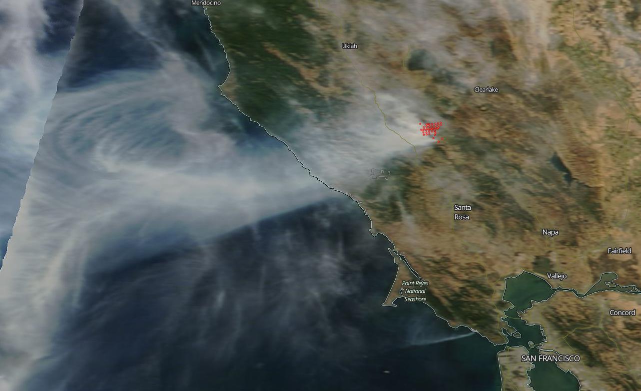
Satellites are watching the flames to aid in containment and evacuation procedures. NASA's Terra satellite captured a photograph of the Kincade Fire on Oct. 24, when the fire had already burned through 20,000 acres (80 sq. km). The fire's rapid spread was aided by high winds in the area, as well as low humidity.
Related: In Photos: The 2018 California Wildfires as Seen from Space
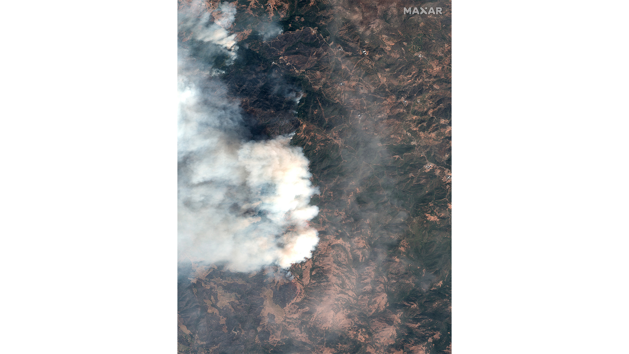
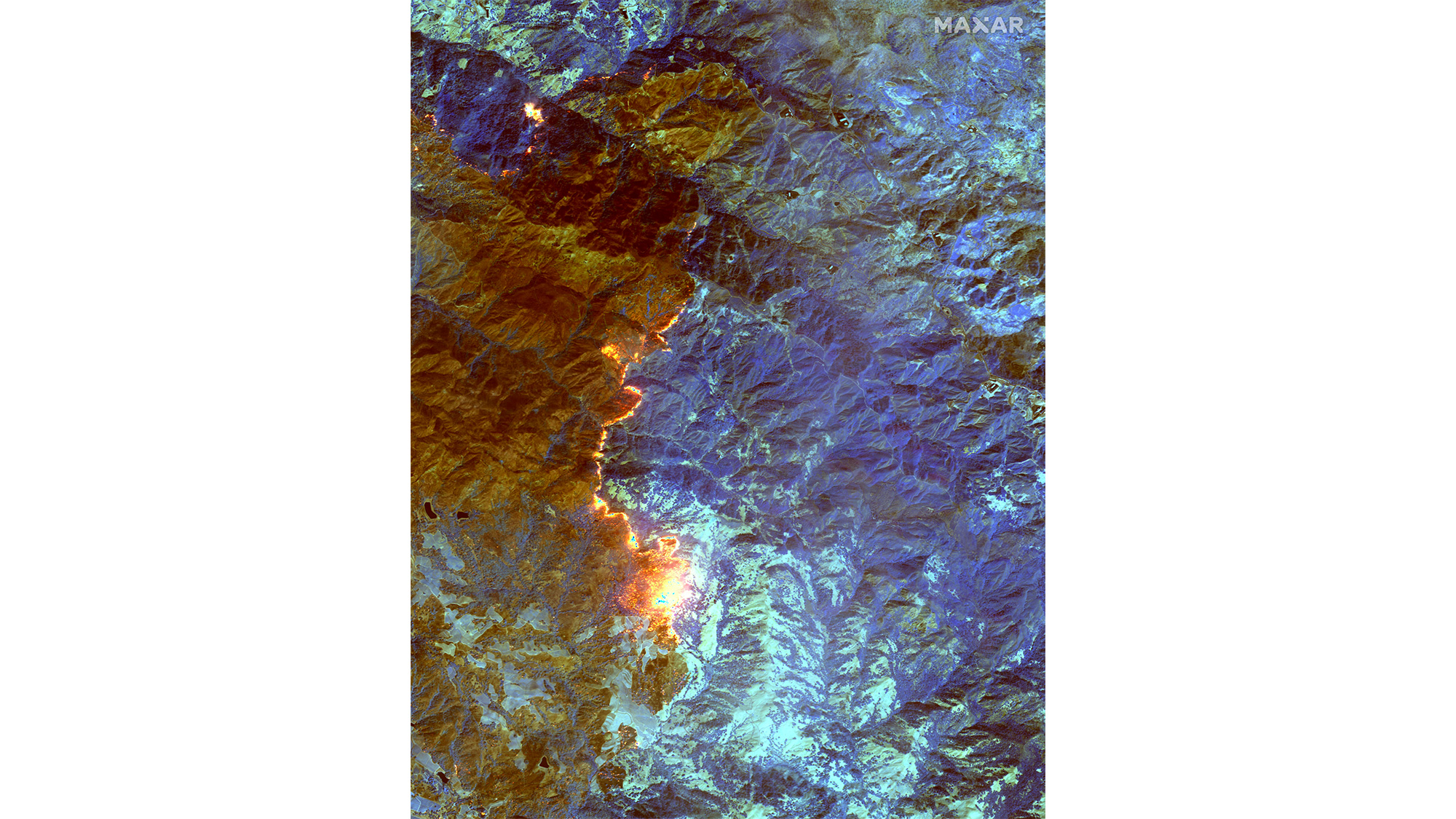
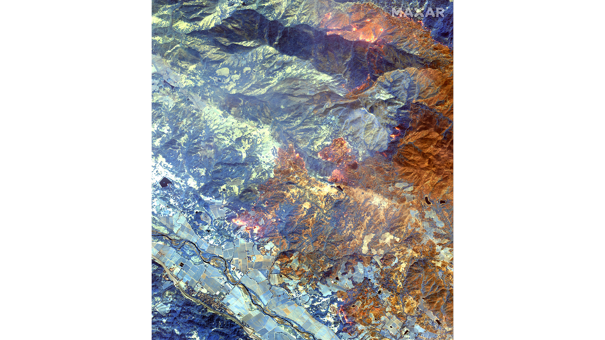
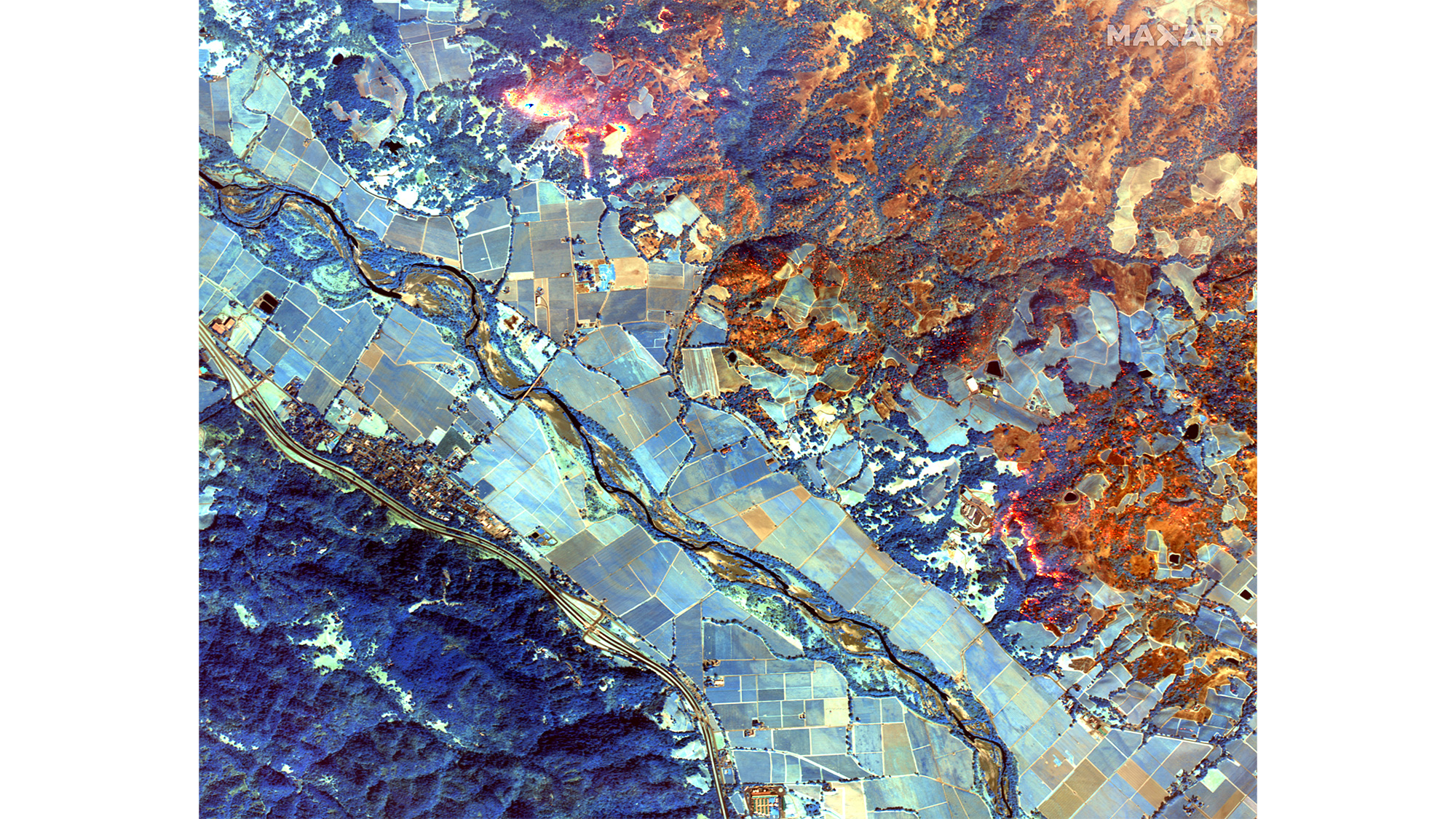
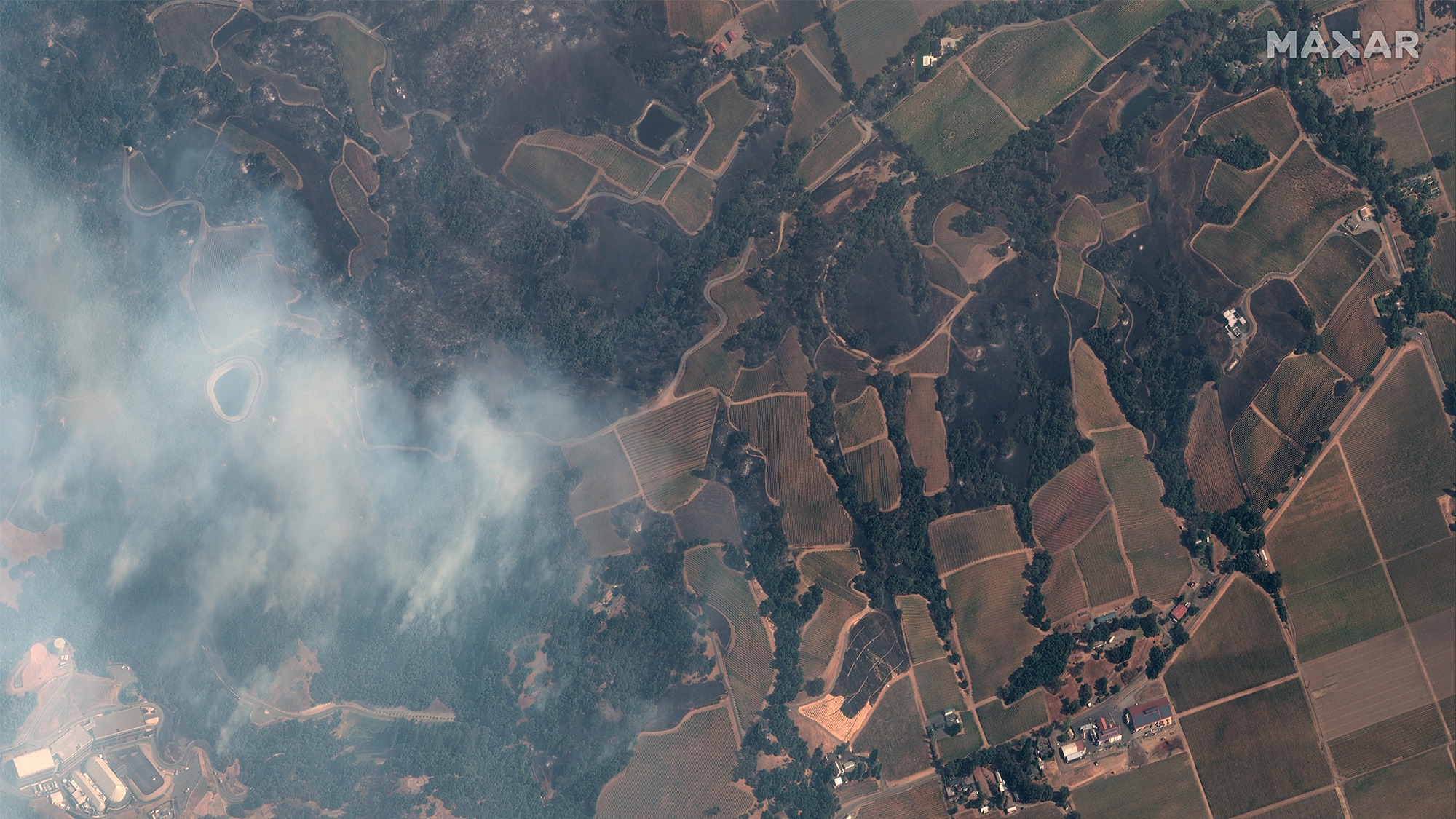
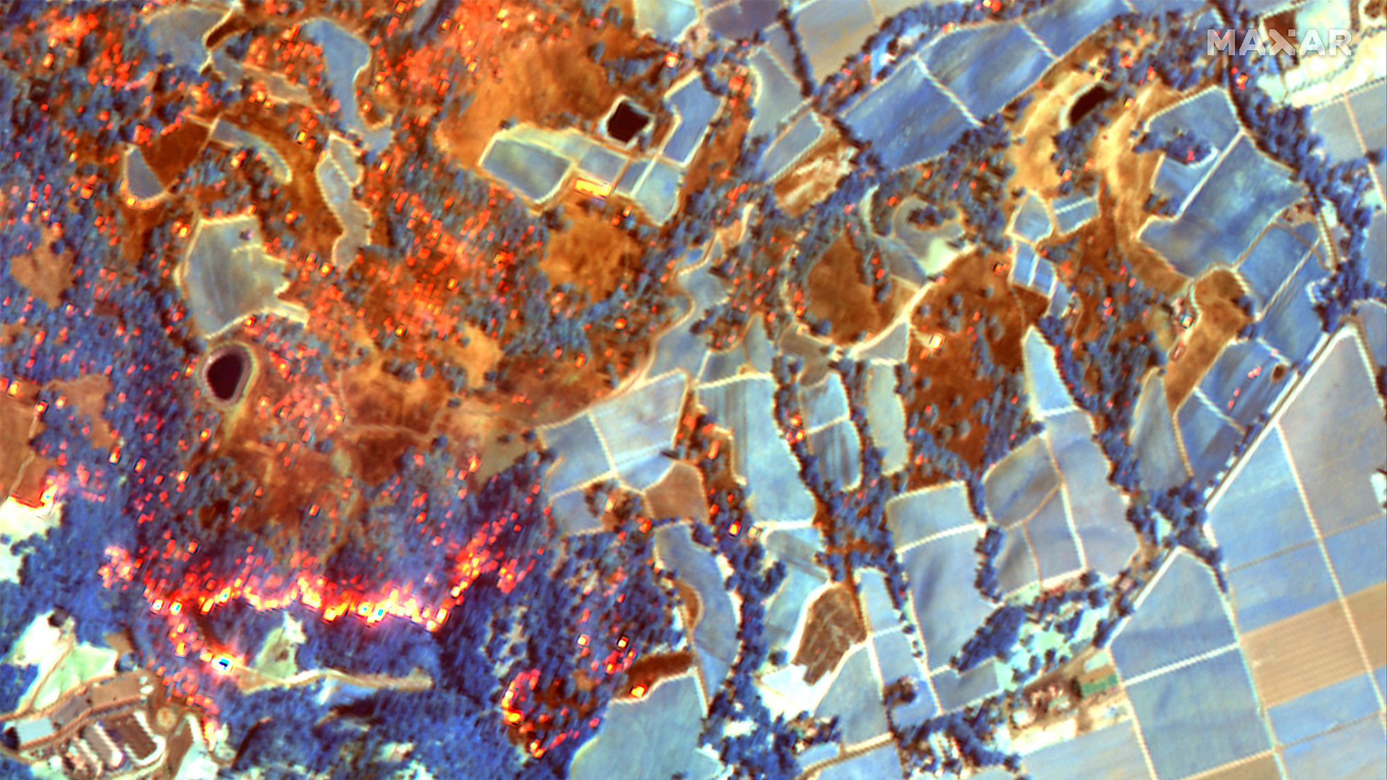
Privately owned satellites are also keeping an eye on the fire. Maxar's Worldview 3 satellite also studied the Kincade Fire on Oct. 24, taking both natural-color and shortwave-infrared images. The latter technique identifies active fire areas in reddish orange, burned areas in rusty orange and untouched plant matter in blue.
According to the San Francisco Chronicle, 185,000 people are currently under evacuation order on account of the Kincade Fire. Two small earthquakes also struck in the region early this morning (Oct. 28), just after 1 a.m. local time.
- Scale of California's Deadly Camp Fire Shown in Satellite Photos
- Raging California Wildfires Spotted from Space (Photos)
- Devastation from Deadly Camp and Woolsey Fires Seen from Space
Email Meghan Bartels at mbartels@space.com or follow her @meghanbartels. Follow us on Twitter @Spacedotcom and on Facebook.
Breaking space news, the latest updates on rocket launches, skywatching events and more!

Meghan is a senior writer at Space.com and has more than five years' experience as a science journalist based in New York City. She joined Space.com in July 2018, with previous writing published in outlets including Newsweek and Audubon. Meghan earned an MA in science journalism from New York University and a BA in classics from Georgetown University, and in her free time she enjoys reading and visiting museums. Follow her on Twitter at @meghanbartels.
