See Smoke from 110 Fires Spread Across the US in This Satellite View

Breaking space news, the latest updates on rocket launches, skywatching events and more!
You are now subscribed
Your newsletter sign-up was successful
Want to add more newsletters?

Delivered daily
Daily Newsletter
Breaking space news, the latest updates on rocket launches, skywatching events and more!

Once a month
Watch This Space
Sign up to our monthly entertainment newsletter to keep up with all our coverage of the latest sci-fi and space movies, tv shows, games and books.

Once a week
Night Sky This Week
Discover this week's must-see night sky events, moon phases, and stunning astrophotos. Sign up for our skywatching newsletter and explore the universe with us!

Twice a month
Strange New Words
Space.com's Sci-Fi Reader's Club. Read a sci-fi short story every month and join a virtual community of fellow science fiction fans!
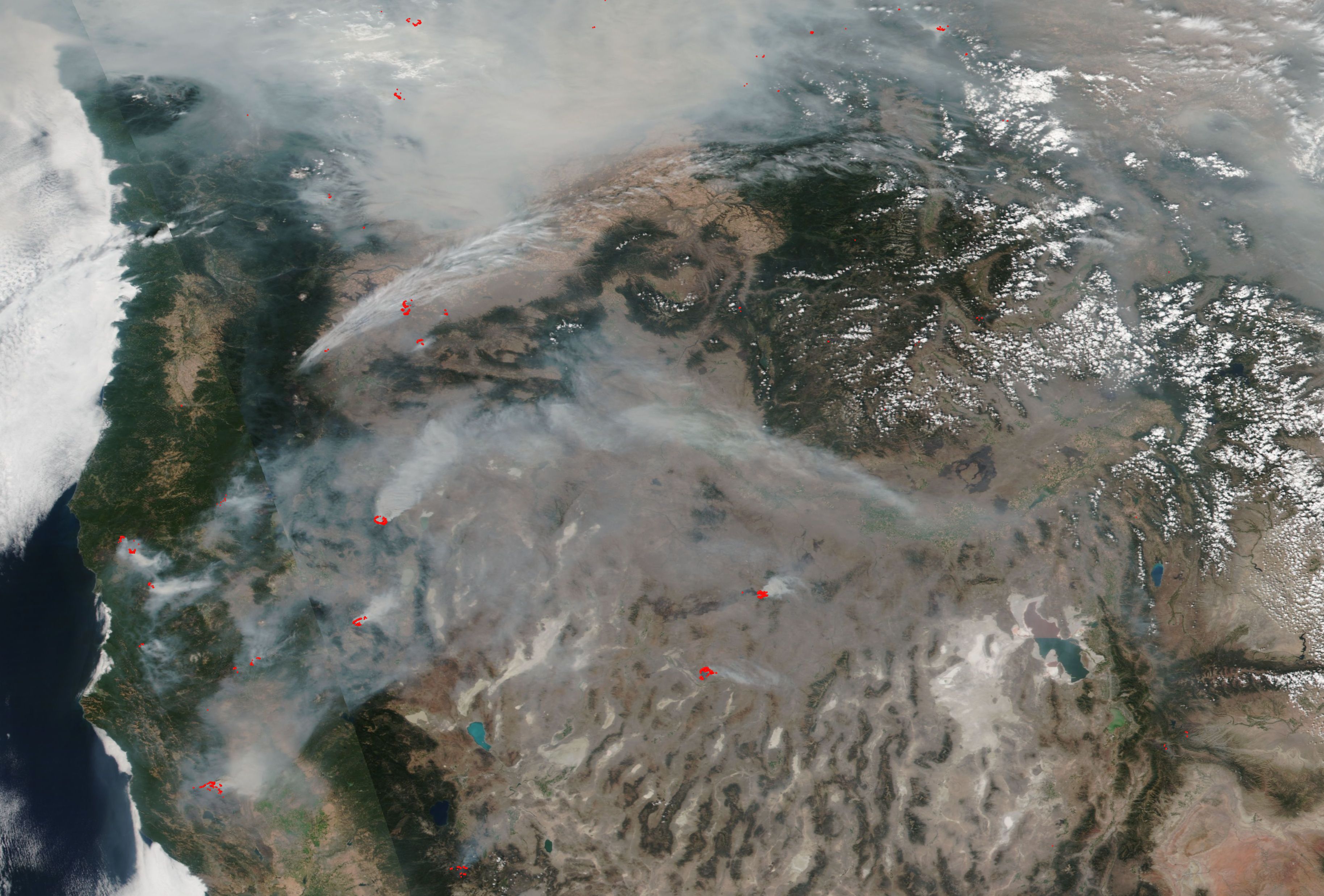
Recent satellite imagery shows the United States West Coast "shrouded in smoke" erupting from 110 large fires across the area, according to NASA. The image, collected from satellite data on Sunday (Aug. 19), shows many sources of smoke spreading across the central United States. Red denotes zones of active burning.
"Over 1.9 million acres are or have been ablaze," NASA said in an update on Monday (Aug. 20), adding that new large fires had been reported in Oregon, Nevada and Idaho since the weekend. It's not only the fire that is a concern, NASA said, but also the accompanying smoke.
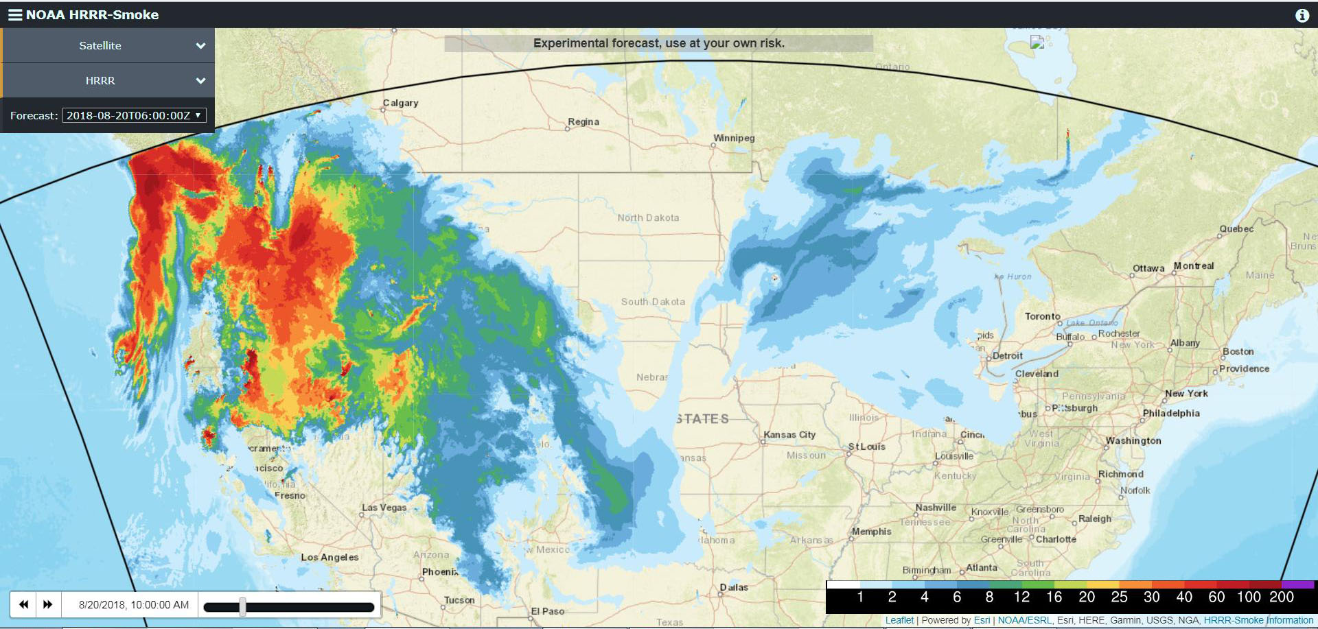
NASA and the National Oceanic Atmospheric Administration (NOAA) are tracking how smoke is moving across the country, in some cases getting as far as the East Coast. NOAA has a High-Resolution Rapid Refresh-Smoke air-quality-modeling system that gathers information from sources such as satellites, aircraft, surface observations and weather balloons. [In Photos: The 2018 California Wildfires as Seen from Space]
"Smoke from any type of wildfire is dangerous. The smoke released by any type of fire is a mixture of particles and chemicals produced by incomplete burning of carbon-containing materials," NASA said. The agency advised people in areas with heavy smoke to avoid physical exertion outdoors, especially in the cases of children, pregnant women, the elderly and people with cardiovascular conditions.
Smoke contains many nasty chemicals. All smoke types incorporate carbon monoxide, carbon dioxide and particulate matter (or soot). But smoke can vary depending on the burn temperature of the fire, the materials being burned and how much oxygen is available to the blaze. A partial list of possible smoke components from the forest fires, provided by NASA, includes aldehydes, acid gases, sulfur dioxide, nitrogen oxides, polycyclic aromatic hydrocarbons (PAHs), benzene, toluene, styrene, metals and dioxins.
You can get real-time updates on the fires at this website from the National Weather Service. NASA also rapidly uploads satellite observation to its EarthData website, which you can see here.
Follow us @Spacedotcom, Facebook and Google+. Original article on Space.com.
Breaking space news, the latest updates on rocket launches, skywatching events and more!

Elizabeth Howell (she/her), Ph.D., was a staff writer in the spaceflight channel between 2022 and 2024 specializing in Canadian space news. She was contributing writer for Space.com for 10 years from 2012 to 2024. Elizabeth's reporting includes multiple exclusives with the White House, leading world coverage about a lost-and-found space tomato on the International Space Station, witnessing five human spaceflight launches on two continents, flying parabolic, working inside a spacesuit, and participating in a simulated Mars mission. Her latest book, "Why Am I Taller?" (ECW Press, 2022) is co-written with astronaut Dave Williams.

