Moon Probe Helps NASA Map Path of 2017's Great American Total Solar Eclipse

As eclipse hunters flood the United States this August to watch what scientists are calling the Great American Total Solar Eclipse, new data from NASA's Lunar Reconnaissance Orbiter (among other sources) will provide them with the most accurate maps ever for where to catch the eclipse.
Solar eclipses occur when the moon passes in between the sun and the Earth, from Earth's perspective. Because the moon is a relatively small object, the path of totality is very narrow. At any single location, totality will last a few dozen seconds at most.
In past years, totality maps haven't been fully accurate. That's because they assume that everyone is sitting at sea level (definitely not the case for many U.S. observers) and that the moon is completely bereft of craters and mountains. [Total Solar Eclipse 2017: When, Where & How to See It (Safely)]
More recent calculations (since 1963) depended on limb profiles that were published by astronomer Chester Burleigh Watts, who took 700 photographs showing how the moon looks from Earth, from every possible viewpoint.
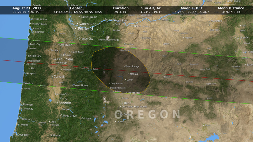
NASA, however, can publish more accurate eclipse maps, thanks to work from visualizer Ernie Wright at the Goddard Space Flight Center in Maryland. Wright generated an elevation map of the Earth to show true altitude (based on several NASA data sets) and also used a changing lunar limb profile that will be seen from the United States during the Aug. 21, 2017, total solar eclipse.
"We couldn't have done visualizations like this even 10 years ago," Wright said in a press release. "This is a confluence of increasing computing power and new datasets from remote sensing platforms like LRO and the Shuttle Radar Topography Mission." [Total Solar Eclipse 2017: Path, Viewing Maps and Photo Guide]
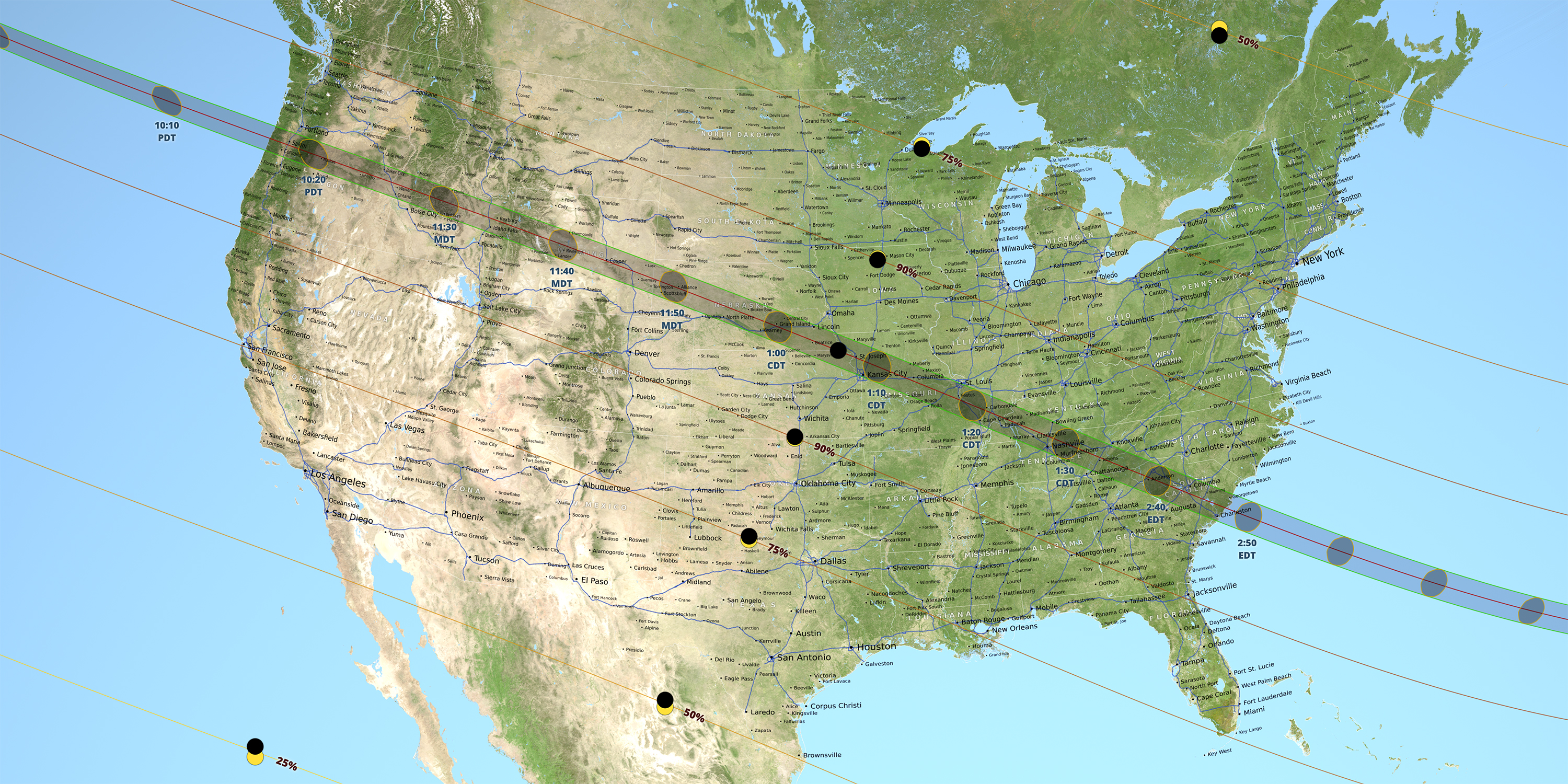
Instead of a smooth umbra (or shadow of totality), the new visualizations show a more craggy shape that depends on elevations on Earth and on the moon. NASA describes the true shape as an irregular polygon with slightly curved edges, which will alter with changes across the Earth's terrain (particularly the Cascades, Rockies and Appalachians, which the umbra will pass through during the eclipse).
Breaking space news, the latest updates on rocket launches, skywatching events and more!
"Solar and lunar eclipses provide an excellent opportunity to talk about the moon, since without the moon there would be no eclipses," said Noah Petro, deputy project scientist for LRO, in the same statement.
"Because we know the shape of the moon better than any other planetary body, thanks to LRO, we can now accurately predict the shape of the shadow as it falls on the face of the Earth. In this way, LRO data sheds new light on our predictions for the upcoming eclipse," Petro said.
The total solar eclipse will pass from Oregon to South Carolina. It's the first time the U.S. has experienced a total solar eclipse since 1918, when the umbra started in Washington state and passed over Denver, Jackson, Mississippi, and Orlando, Florida, before leaving via the Atlantic coast.
Editor's Note: If you take a great photo of the 2017 solar eclipse or any other celestial sight you'd like to share with us and our news partners for a possible story or image gallery, send images and comments in to managing editor Tariq Malik at spacephotos@space.com.
Follow Elizabeth Howell @howellspace, or Space.com @Spacedotcom. We're also on Facebook and Google+. Original article on Space.com.

Elizabeth Howell (she/her), Ph.D., was a staff writer in the spaceflight channel between 2022 and 2024 specializing in Canadian space news. She was contributing writer for Space.com for 10 years from 2012 to 2024. Elizabeth's reporting includes multiple exclusives with the White House, leading world coverage about a lost-and-found space tomato on the International Space Station, witnessing five human spaceflight launches on two continents, flying parabolic, working inside a spacesuit, and participating in a simulated Mars mission. Her latest book, "Why Am I Taller?" (ECW Press, 2022) is co-written with astronaut Dave Williams.

