Earth Pictures From Space: Landsat Satellite Legacy
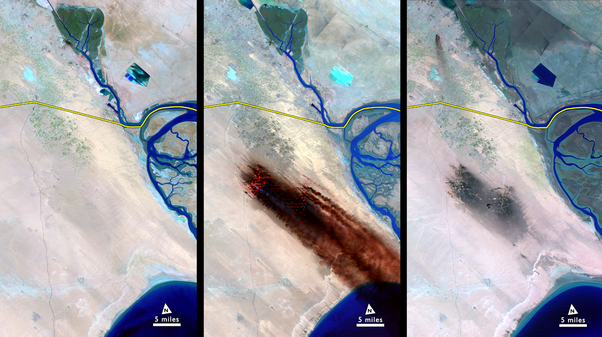
Kuwait Oil Fires
As Iraqi troops withdrew from Kuwait at the end of the first Gulf War, they set fire to over 650 oil wells. Landsat caught the largest oil spill in human history.
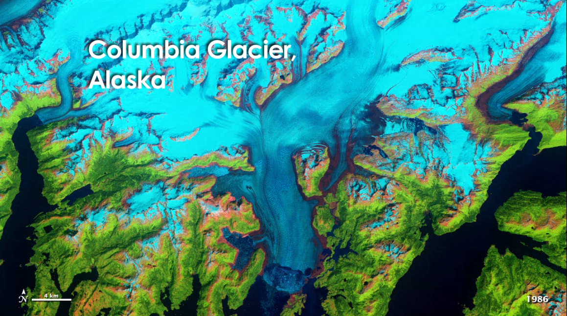
Columbia Glacier Retreat
The Columbia Glacier in Alaska is one of many vanishing around the world. Glacier retreat is one of the most direct and understandable effects of climate change.
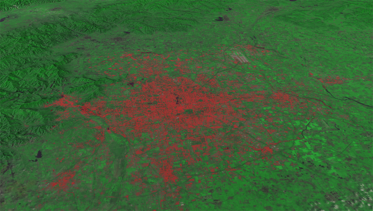
Landsat Data of Beijing in 2010
Beijing's expansion is representative of the dramatic urbanization and industrialization of Asia during the Landsat era.
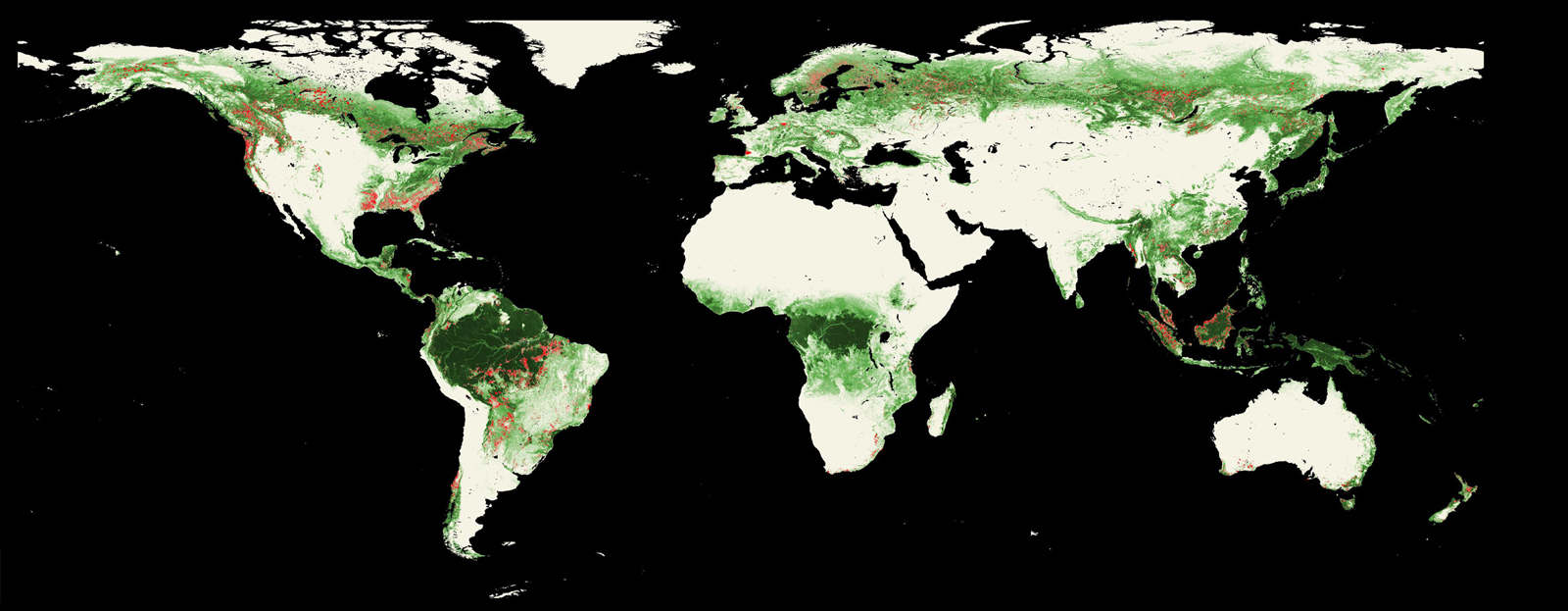
International Deforestation Patterns in Tropical Rainforests
The state of Rondonia in western Brazil is observed by the Moderate Resolution Imaging Spectroradiometer (MODIS) on NASA's Terra satellite. This timelapse shows the reduction of the forest from 2000-2010. Areas of forest cover loss (in red) during the period 2005-2010. Background image is the percent of forest cover in the year 2000, from MODIS data.
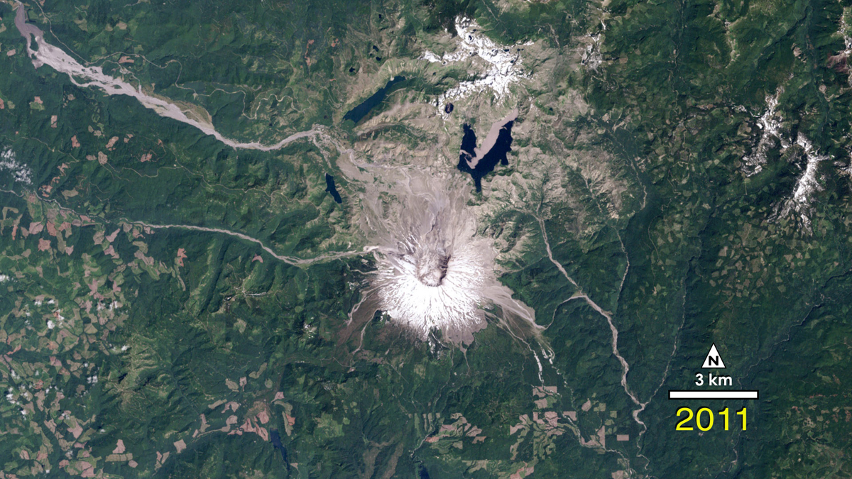
Forest Recovering From Mount St. Helens Eruption
The 1980 Mount St. Helens eruption was one of the most significant natural disasters in the U.S. in the past half-century. Landsat witnessed the destruction and partial re-birth of the region.
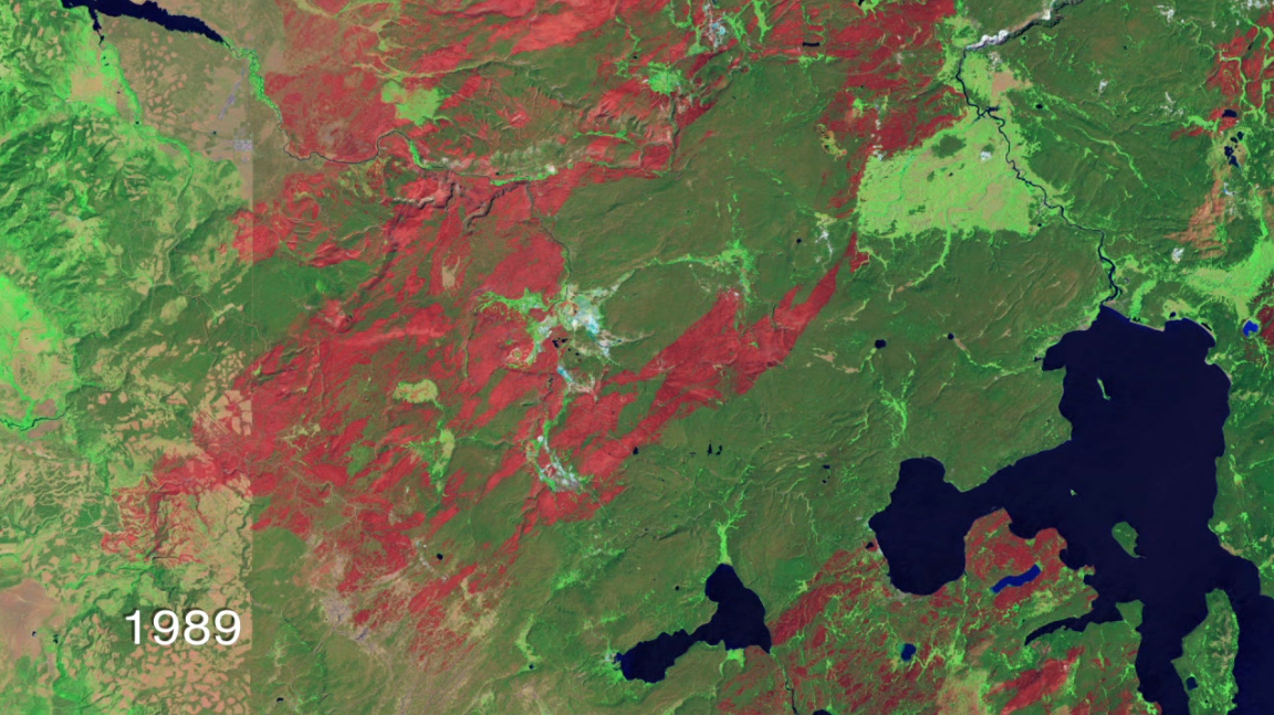
Yellowstone National Park Fires
In 1988, fire transformed Yellowstone National Park into an apparent wasteland. Landsat captured the burn scars from the fires and the progress of recovery.
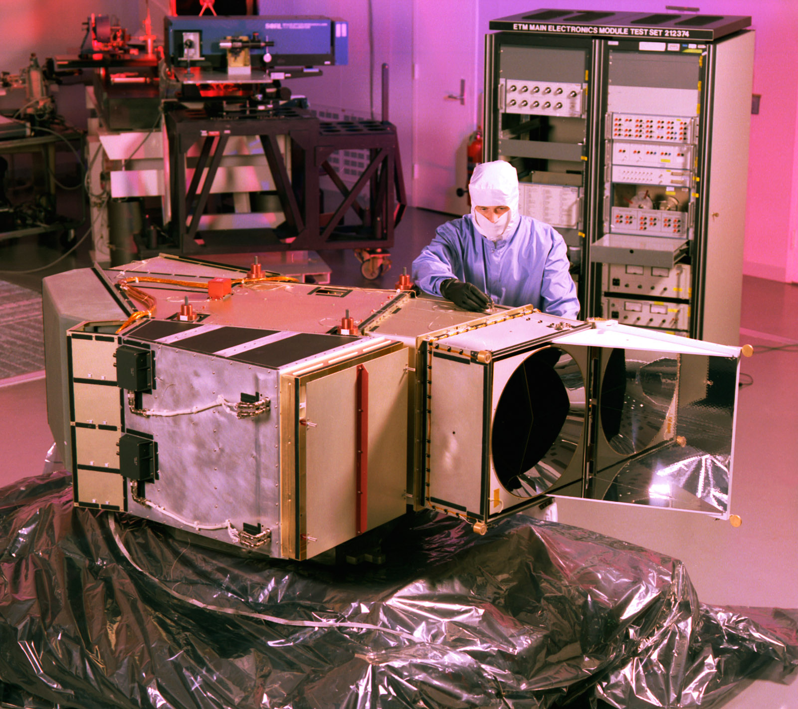
Landsat 7 Mapper
The Enhanced Thermal Mapper instrument that flew aboard Landsat 7 in the cleanroom. Image posted July 23, 2012.
Breaking space news, the latest updates on rocket launches, skywatching events and more!
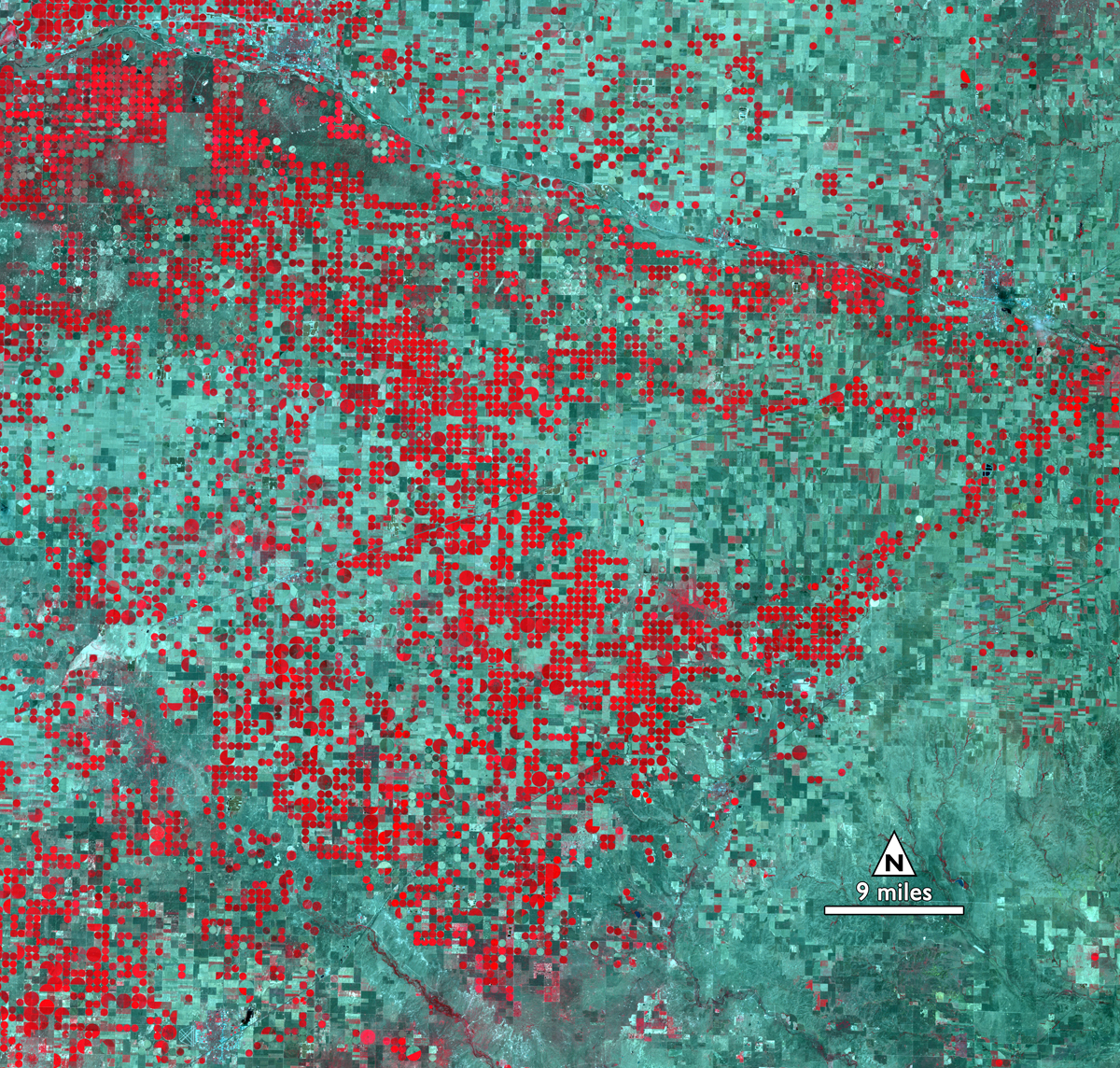
Mining for Water in Kansas
This image from 2011 shows the transformation of Kansas farmland from dryland, rectangular fields to circular irrigated fields from center-pivot irrigation systems. The mining of ground water for agriculture has been a significant trend globally over the last half-century, and these images of a region in Kansas highlight the trend within the United States.
Landsat 5 View of Arizona Fire
A Landsat 5 image of the Wallow Fire, the largest wildfire in Arizona's history. In this image, acquired on June 15, 2011 the burn scar is red, ongoing fires are very bright red, smoke is blue, water is black and dark blue and bare ground is tan. Image added July 23, 2012.
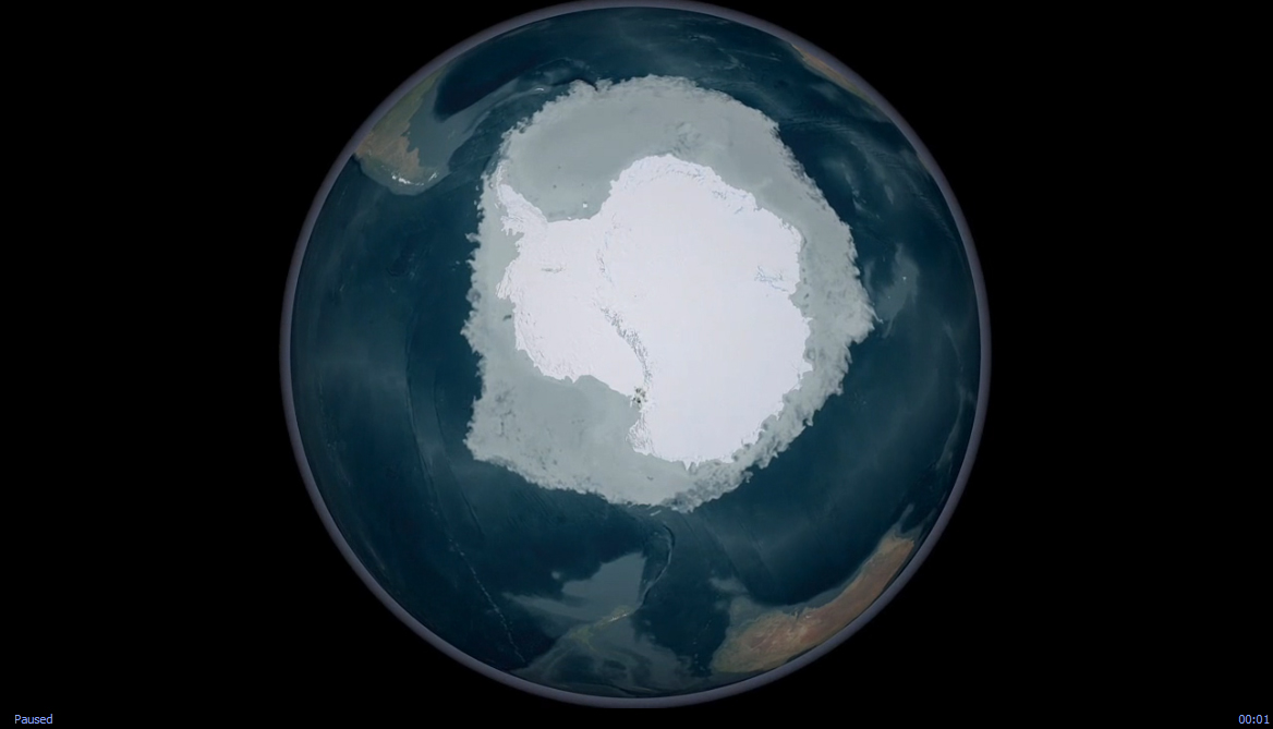
Uncovering Antarctica
In 2007, more than 1,100 Landsat 7 images were used to create the first ever, high-resolution, true color map of Antarctica. The Landsat Image Mosaic of Antarctica is a virtually cloud-free, 3-D view of Antarctica's frozen landscape.

Space.com is the premier source of space exploration, innovation and astronomy news, chronicling (and celebrating) humanity's ongoing expansion across the final frontier. Originally founded in 1999, Space.com is, and always has been, the passion of writers and editors who are space fans and also trained journalists. Our current news team consists of Editor-in-Chief Tariq Malik; Editor Hanneke Weitering, Senior Space Writer Mike Wall; Senior Writer Meghan Bartels; Senior Writer Chelsea Gohd, Senior Writer Tereza Pultarova and Staff Writer Alexander Cox, focusing on e-commerce. Senior Producer Steve Spaleta oversees our space videos, with Diana Whitcroft as our Social Media Editor.
