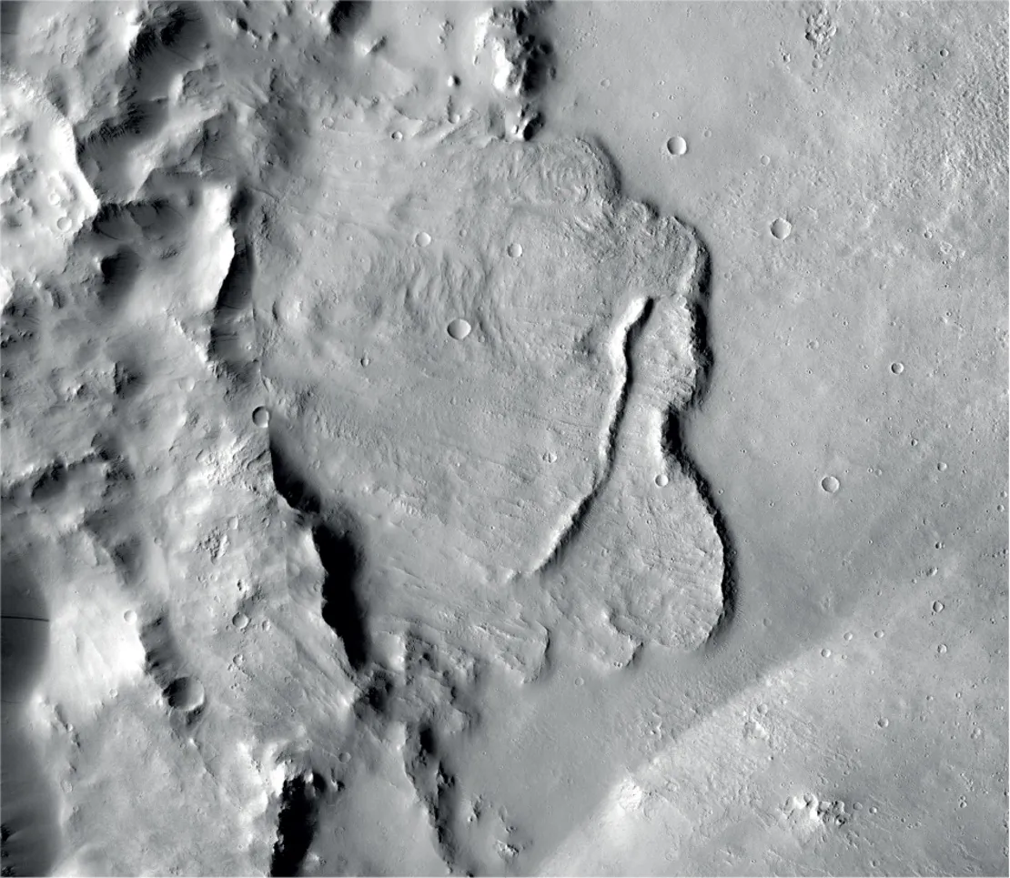
Scientists found valleys and channels carved into the depths of Martian craters, and according to the European Space Agency (ESA), these formations provide the first evidence of a vast groundwater system in the planet's past.
Researchers also spotted signs of special minerals linked to the emergence of life on Earth in Martian basins.
Mars is a prime target for the cosmically geared imagination, from the story "War of the Worlds" to the last 20 years of robotic exploration on the Red Planet's surface. If a world just a monthslong journey away from Earth could have hosted water, maybe extraterrestrial life once resided at cosmic arms' length from our planet.
Related: Missions to Mars: A Robot Red Planet Invasion History (Infographic)

"Findings like this are hugely important; they help us to identify the regions of Mars that are the most promising for finding signs of past life," Dmitri Titov, ESA's Mars Express project scientist, said in an agency statement Feb. 28 about the recent findings.
ESA's Mars Express orbiter, which has been circling the planet since 2003, found the first geological evidence of an ancient interconnected system of lakes linked by branching channels deep beneath the planet's surface, ESA officials said.
"Early Mars was a watery world," Francesco Salese of Utrecht University in the Netherlands said in the statement. "But as the planet's climate changed, this water retreated below the surface to form pools and 'groundwater.' We traced this water in our study, as its scale and role is a matter of debate, and we found the first geological evidence of a planet-wide groundwater system on Mars."

Over the last few years, research has pointed to the existence of a warmer Mars in the past — possible thanks to a thicker atmosphere in the planet's history — that supported the flow of water on the ground. Now, there's physical evidence to further support existing models.
Salese led a team that used Mars Express to explore 24 enclosed craters in Mars' northern hemisphere. The crater floors analyzed by the team were at depths of about 2.5 miles (4,000 meters) below Martian sea level, ESA officials said. (Since Mars does not have an existing sea, a "sea level" is approximated by deriving an arbitrary point based on atmospheric pressure and elevation.)
"We think that this ocean may have connected to a system of underground lakes that spread across the entire planet," co-author Gian Gabriele Ori, director of the Università D'Annunzio's International Research School of Planetary Sciences in Italy, said in the statement. "These lakes would have existed around 3.5 billion years ago, so [they] may have been contemporaries of a Martian ocean."

Five of the deepest craters showed signs of carbonates, silicates and several kinds of clay, according to ESA. These minerals provide further supporting evidence that the ingredients for life were present long ago on Mars.
Last week, ESA released Mars Express imagery of the planet's southern highlands region with rocks up to 4 billion years old. The area photographed by the mission lies east of the Huygens impact crater and north of the impact basin Hellas, according to the agency. While the land has gone through heavy erosion since it first formed, some valleys retain tree-like shapes called dendritic structures. Riverbeds on Earth also bend in these ways, offering more evidence for a wet Mars.
- See Mars Rover Curiosity's Parting Glance of Mountain Ridge (360 Video)
- European Mars Rover Named for Crystal Scientist Rosalind Franklin
- NASA's InSight Lander on Mars Deploys Shield for Quake-Tracking Seismometer
Follow Doris Elin Salazar on Twitter @salazar_elin. Follow us on Twitter @Spacedotcom and on Facebook.
