Satellites watch as Hurricane Lee swirls towards Canada (video)
The storm will likely cause flooding and power outages in the U.S. northeast and Eastern Canada.
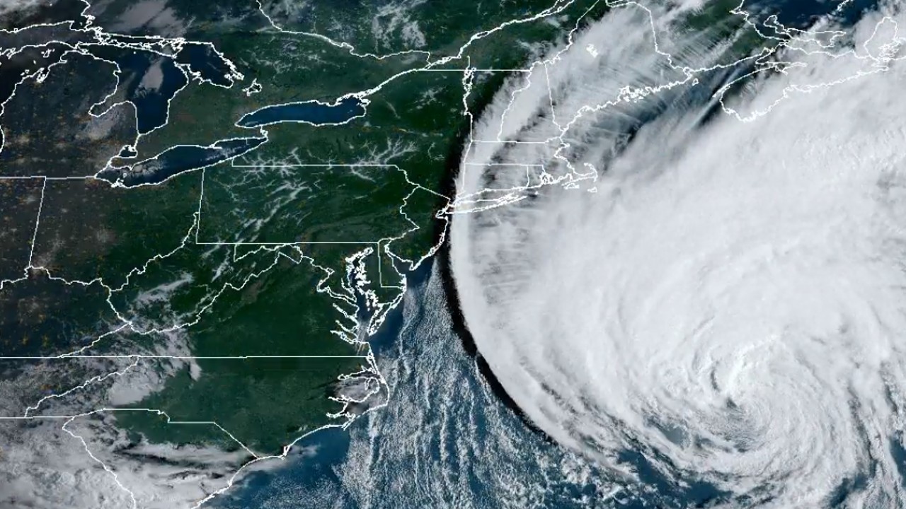
Satellites are watching Hurricane Lee swirl above the Atlantic Ocean as it makes its way toward the Canadian coast for a Saturday (Sept. 16) landfall.
The storm, currently a Category 1 hurricane packing winds of 80 mph (130 km/h), will likely cause power outages, storm surge flooding and flash floods along the coast of Maine, New England, Brunswick and Nova Scotia in the next 24 to 48 hours, according to NOAA and AccuWeather. Fortunately, by the time Lee hits the coast, it will have weakened into a post-tropical storm.
Hurricanes and their remnants don't often make it as far north as Canada, but scientists think that the ongoing progression of climate change will make these destructive weather phenomena more common along the northeastern coast of the American continent.
Related: Hurricane Lee looks absolutely terrifying in this footage from inside its eye (video)
Last year, Fiona, which peaked as a powerful Category 4 Hurricane, reached the Atlantic coast of Canada as a post-tropical storm, causing wide-spread destruction. In fact, the scale of the damage made Fiona the costliest storm in Canada's history, according to CBC.
Lee is expected to be somewhat milder, according to the WeatherNetwork. At the time of landfall, the storm will pack sustained winds of at 30 mph (50 km/h) with gusts up to 50 mph (80 km/h). Fiona, on the other hand, struck with sustained winds of 60 mph (100 km/h) and gusts up to 87 mph (140 km/h).
In addition to Lee, tropical storm Margot and tropical depression 15 currently hover above the Atlantic Ocean, but neither of those is expected to pose any risk to inhabited areas.
The Atlantic season officially peaked earlier this week. But in August, the U.S. National Oceanic and Atmospheric Administration (NOAA) increased its prediction of the intensity of this year's season from near-normal to above-normal levels.
NOAA updated the forecast due to the unexpectedly warm surface water temperatures that have been reported across the Atlantic Ocean throughout this year's spring and summer season.

Tereza is a London-based science and technology journalist, aspiring fiction writer and amateur gymnast. She worked as a reporter at the Engineering and Technology magazine, freelanced for a range of publications including Live Science, Space.com, Professional Engineering, Via Satellite and Space News and served as a maternity cover science editor at the European Space Agency.
