For Thanksgiving Travelers, Stormy Weather Ahead on US Coasts (Satellite Photo)

Breaking space news, the latest updates on rocket launches, skywatching events and more!
You are now subscribed
Your newsletter sign-up was successful
Want to add more newsletters?
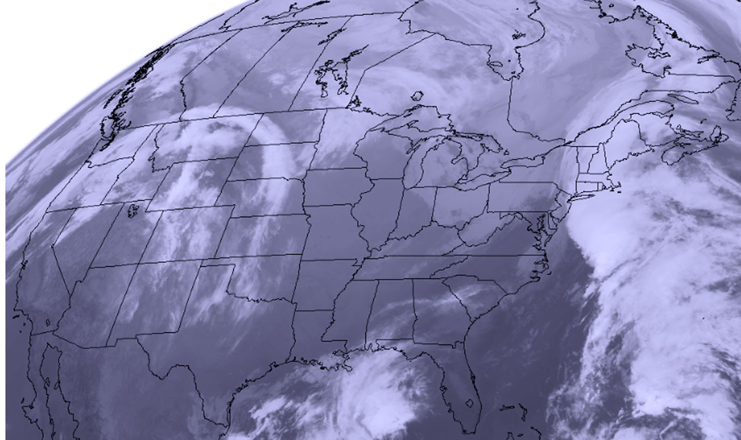
Foul weather could make Thanksgiving travel rough for a lot of folks, a new satellite photo shows.
The visible-light image, which was captured this morning (Nov. 22) by the National Oceanic and Atmospheric Administration's GOES-East satellite, shows storm systems swirling around both the East and West coasts of the United States.
"In the northeastern U.S., clouds associated with a cold front were covering the New England states in the image," NASA officials wrote in a description of the photo. (NASA is a key partner on the GOES program, whose name is short for "Geostationary Operational Environmental Satellites.")
Article continues below"Clouds associated with a system in the Pacific Northwest were seen over Washington State, Oregon, Idaho, Montana and Colorado," the officials added. "Pre-Thanksgiving travelers in the northern Plains and Upper Great Lakes will experience arctic air that is expected to bring periods of snow, blustery winds and cold wind chills."
For up-to-date- weather information, check out the National Weather Service's website. Safe travels, and happy Thanksgiving!
Follow Mike Wall on Twitter @michaeldwall and Google+. Follow us @Spacedotcom, Facebook or Google+. Originally published on Space.com.
Breaking space news, the latest updates on rocket launches, skywatching events and more!

Michael Wall is the Spaceflight and Tech Editor for Space.com and joined the team in 2010. He primarily covers human and robotic spaceflight, military space, and exoplanets, but has been known to dabble in the space art beat. His book about the search for alien life, "Out There," was published on Nov. 13, 2018. Before becoming a science writer, Michael worked as a herpetologist and wildlife biologist. He has a Ph.D. in evolutionary biology from the University of Sydney, Australia, a bachelor's degree from the University of Arizona, and a graduate certificate in science writing from the University of California, Santa Cruz. To find out what his latest project is, you can follow Michael on Twitter.
