Hurricane Harvey: Photos of the Massive Storm from Space
Breaking space news, the latest updates on rocket launches, skywatching events and more!
You are now subscribed
Your newsletter sign-up was successful
Want to add more newsletters?

Delivered daily
Daily Newsletter
Breaking space news, the latest updates on rocket launches, skywatching events and more!

Once a month
Watch This Space
Sign up to our monthly entertainment newsletter to keep up with all our coverage of the latest sci-fi and space movies, tv shows, games and books.

Once a week
Night Sky This Week
Discover this week's must-see night sky events, moon phases, and stunning astrophotos. Sign up for our skywatching newsletter and explore the universe with us!

Twice a month
Strange New Words
Space.com's Sci-Fi Reader's Club. Read a sci-fi short story every month and join a virtual community of fellow science fiction fans!
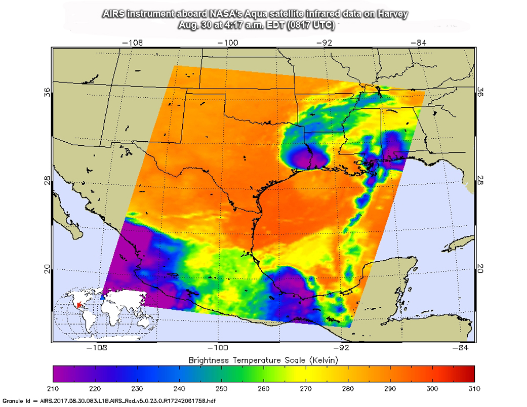
Harvey’s Strongest Storms
NASA’s Aqua satellite captured this infrared image of Tropical Storm Harvey within an hour of its landfall in southwestern Louisiana on Aug. 30. The purple shade indicates the strongest storms.
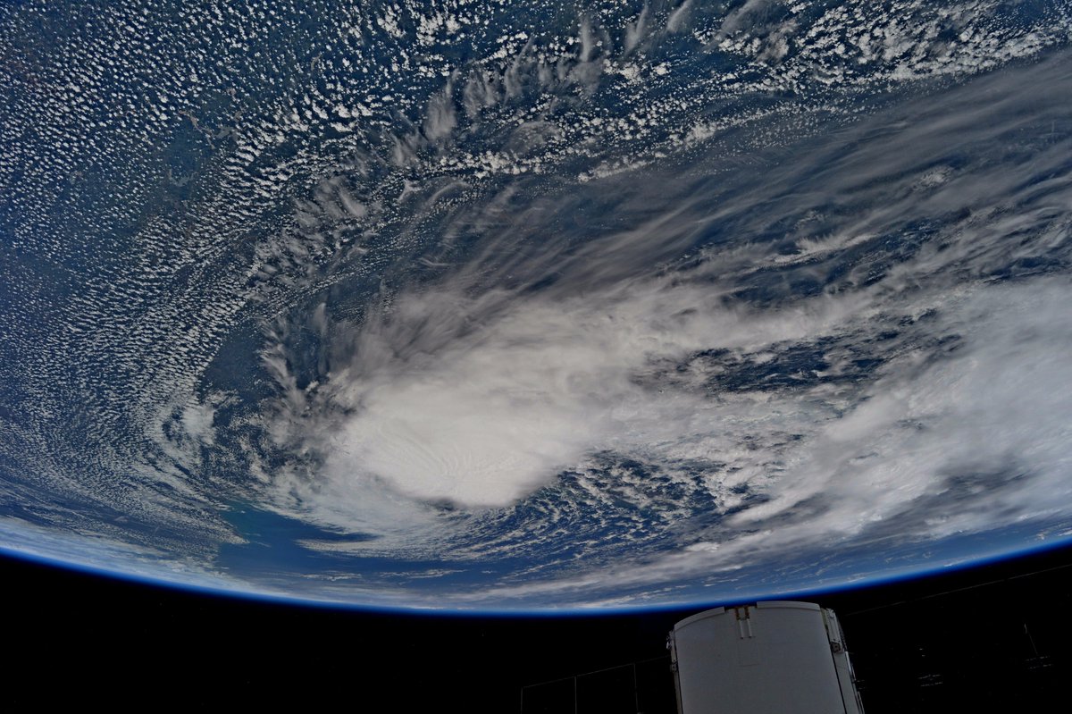
From Above
Astronaut Jack Fischer captured this image of Tropical Storm Harvey from International Space Station, sending wishes of hope and sunshine to those affected by the storm.
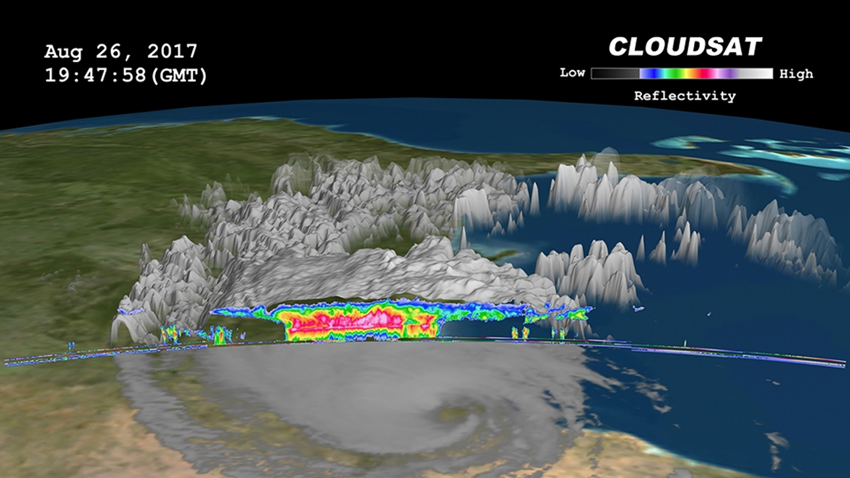
CloudSat Sees Tropical Storm Harvey in 3D
NASA's CloudSat satellite flew over Tropical Storm Harvey on Aug. 26 as the storm was nearly stationary over south Texas. Large amounts of liquid and ice water (denoted by the red and pink colors) are visible beneath the cloud tops. Small cumulus and cumulonimbus clouds are seen north of the area of moderate to heavy precipitation. The cirrus canopy (anvil clouds) extends outward from the storm system (shown in blue and green colors).
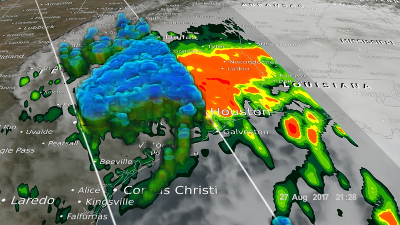
Harvey Rainfall on Aug. 27
NASA’s Global Precipitation Mission (GPM) Core Observatory captured these images of Hurricane Harvey on Aug. 27 at 6:45 a.m. CDT (1145 GMT) and 4:25 p.m. CDT (2125 GMT), nearly two days after the storm made landfall in Texas. The image shows rain rates derived from GPM's Microwave Imager (right) and dual-frequency precipitation radar (left) overlaid on enhanced infrared data from NOAA’s GOES East satellite.
Breaking space news, the latest updates on rocket launches, skywatching events and more!

Space.com is the premier source of space exploration, innovation and astronomy news, chronicling (and celebrating) humanity's ongoing expansion across the final frontier. Originally founded in 1999, Space.com is, and always has been, the passion of writers and editors who are space fans and also trained journalists. Our current news team consists of Editor-in-Chief Tariq Malik; Editor Hanneke Weitering, Senior Space Writer Mike Wall; Senior Writer Meghan Bartels; Senior Writer Chelsea Gohd, Senior Writer Tereza Pultarova and Staff Writer Alexander Cox, focusing on e-commerce. Senior Producer Steve Spaleta oversees our space videos, with Diana Whitcroft as our Social Media Editor.
