Explore National Parks from Space on Earth Day with National Geographic
Great Smoky Mountains National Park
This Earth Day, as people around the world take time to celebrate our planet, don't forget to pause and celebrate the grandeur and beauty of the U.S. national parks.
In celebration of Earth Day (April 22), National Geographic has released several pictures of national parks taken from space. Read more about them in this article from National Geographic Travel.
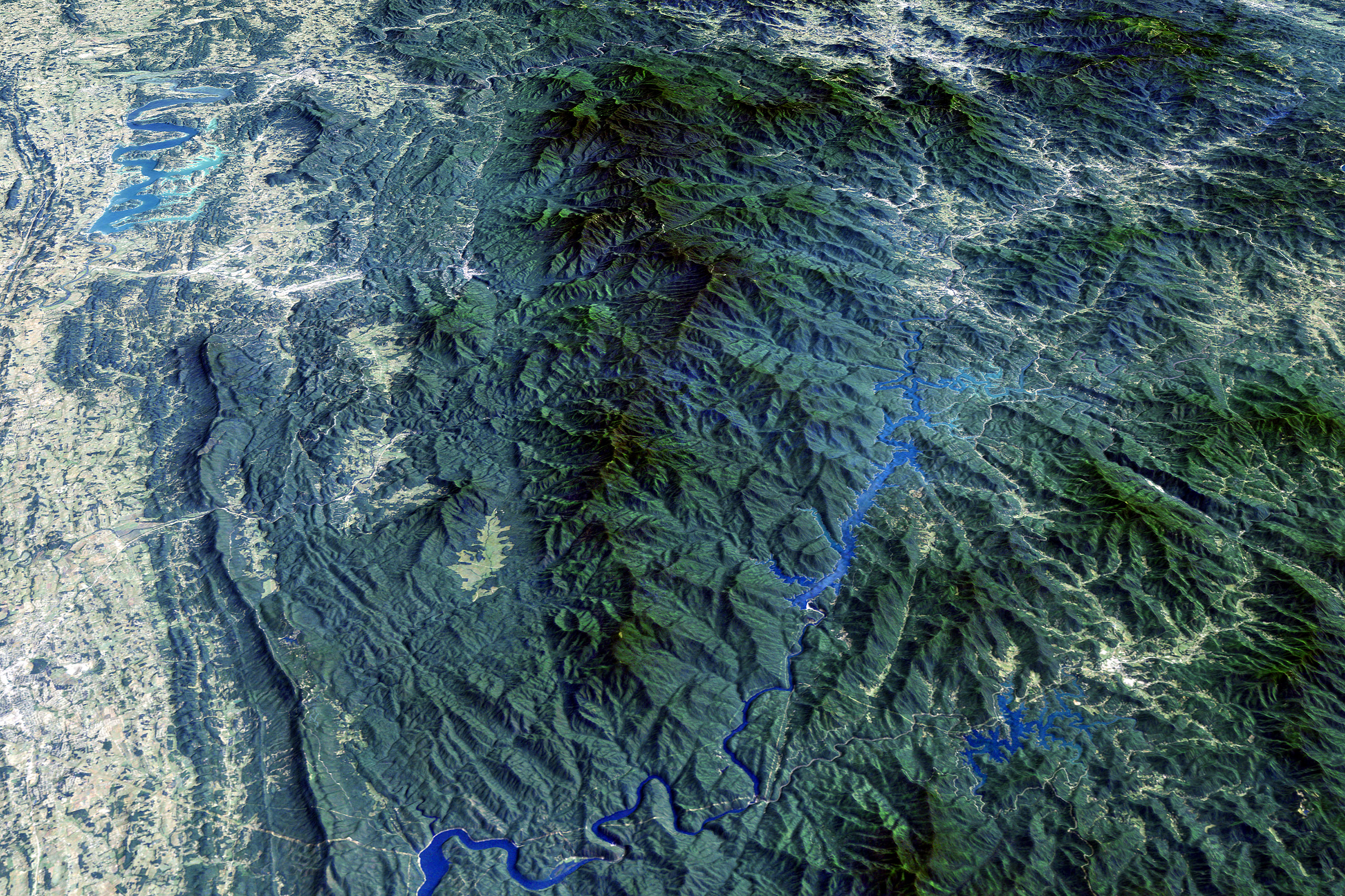
Shown here is a view of the Great Smoky Mountains National Park, well-known for its plant and animal life (including black bears), according to the National Park Service's (NPS) website. Visitors can also enjoy mountain views, a historic mill and wildflowers ranging from hepaticas in late winter to asters in late fall.
The park is on the border of Tennessee and North Carolina, and in the satellite image you can clearly see the mountainous terrain and the streams coming down from the mountain.
Hawaii Volcanoes National Park
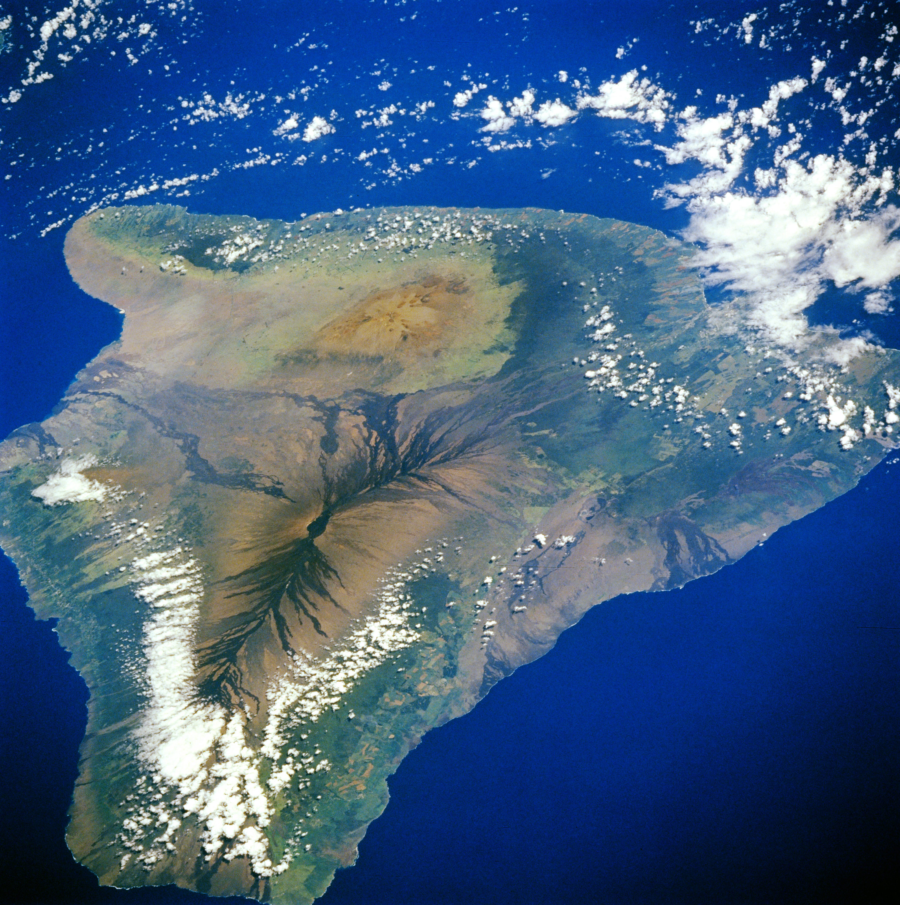
The Hawaii Volcanoes National Park on the island of Hawaii is an excellent example of the power of volcanoes, which can erupt unpredictably – even as humans do their best to monitor these fiery beasts.
The park is located on the lower right side of the island in this image, in the area that appears brown, rather than green, because of the recent lava flows. The park is home to Kilauea, one of the volcanoes that created the island of Hawaii. It's one of the most active volcanoes on the planet.
Death Valley National Park
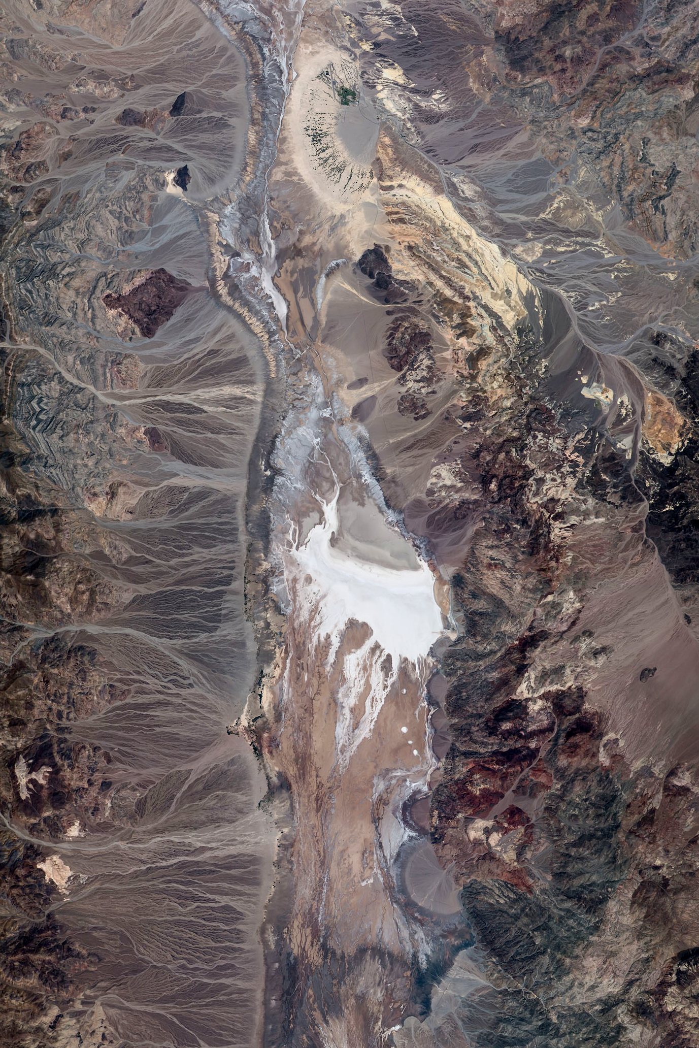
Death Valley in California is host to some of the United States' highest temperatures every summer, but despite this harsh, drought-filled environment, there still is a diversity of life within the borders, according to the NPS website. The nearby mountains have winter snow at the top, and when it does rain, there are fields of wildflowers in the valley.
This image shows the Badwater area of Death Valley National Park, where springs are contaminated with salt to create "bad water" in the basin. This zone is also the lowest part of North America, with an elevation of 282 feet (86 meters) below sea level.
Biscayne National Park
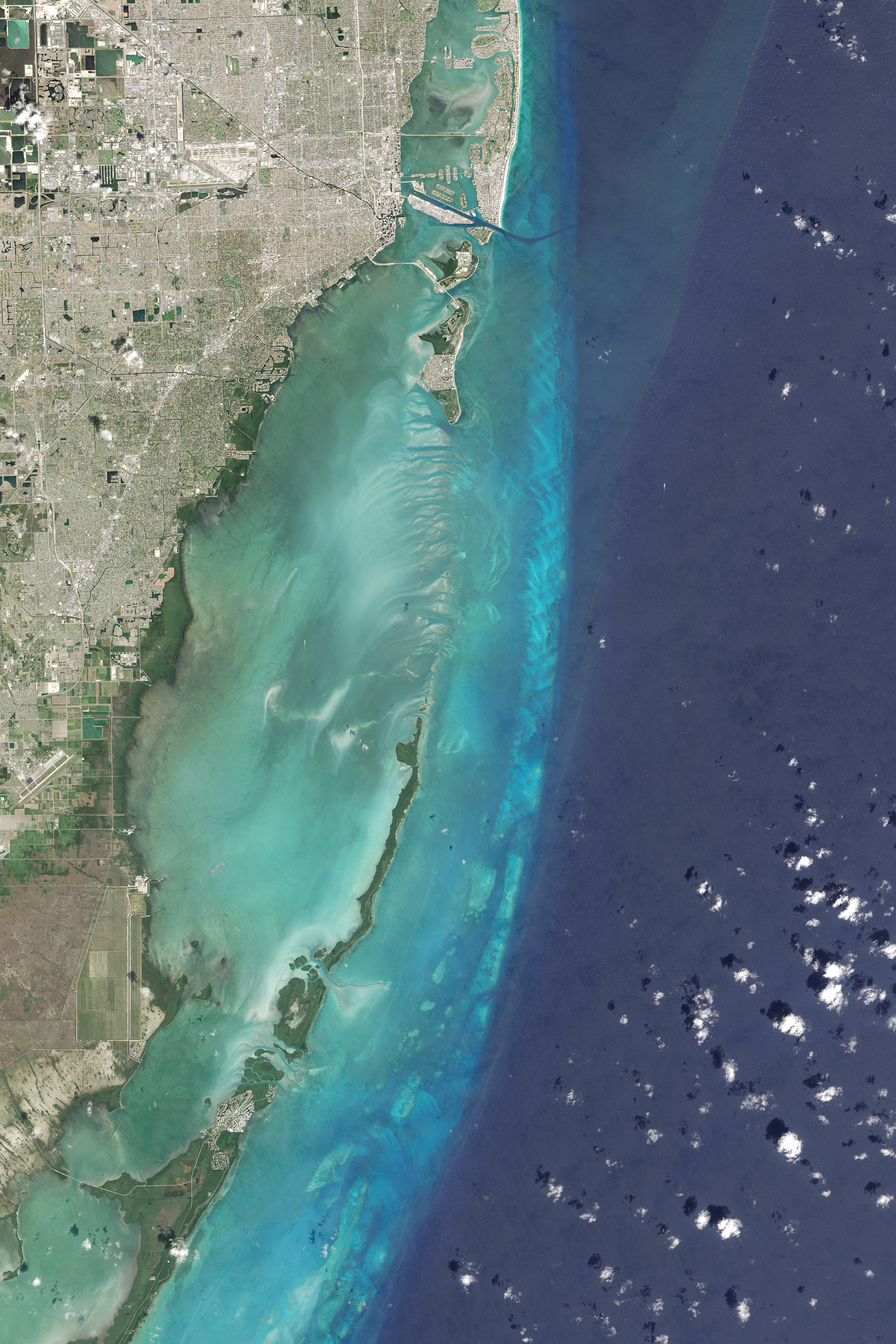
While Biscayne National Park is extraordinarily close to the metropolis of Miami, it's also host to a diverse environment: coral reefs, islands and beautiful aquamarine waters, according to the NPS website. For history buffs, the park contains "evidence of 10,000 years of human history, from pirates and shipwrecks to pineapple farmers and presidents."
The image shows the varying depths of Biscayne Bay. The park includes portions of the bay, as well as the long, thin green strip of land on the left side of the image, and the park islands of Sands Key, Elliott Key, Totten Key and Old Rhodes Key.
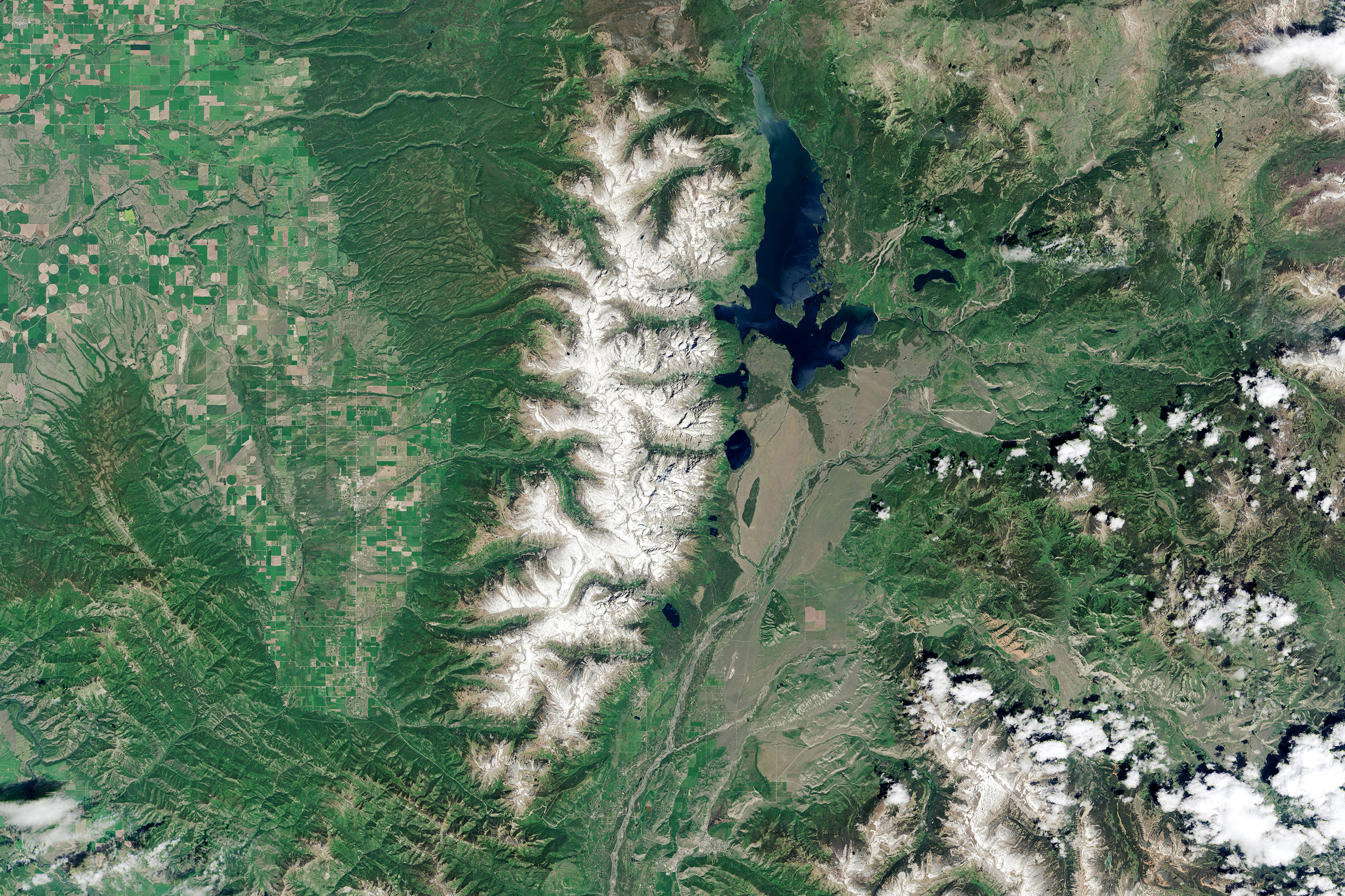
Grand Teton National Park
The NPS website says that Grand Teton National Park has one of the most memorable landscapes in the world, with just about any terrain you prefer — lakes, mountains, rivers and even big skies. You can also learn more about human history in the area, including homesteads, cattle ranches and trails likely used during fur trading with local Native Americans.
The satellite image shows the Wyoming mountain range, running vertically and capped in snow. The large lake to the right of the range is Jackson Lake, with Leigh Lake and the almost diamond-shaped Jenny Lake just below it. Grant Teton peak lies a little southwest of Jenny Lake.
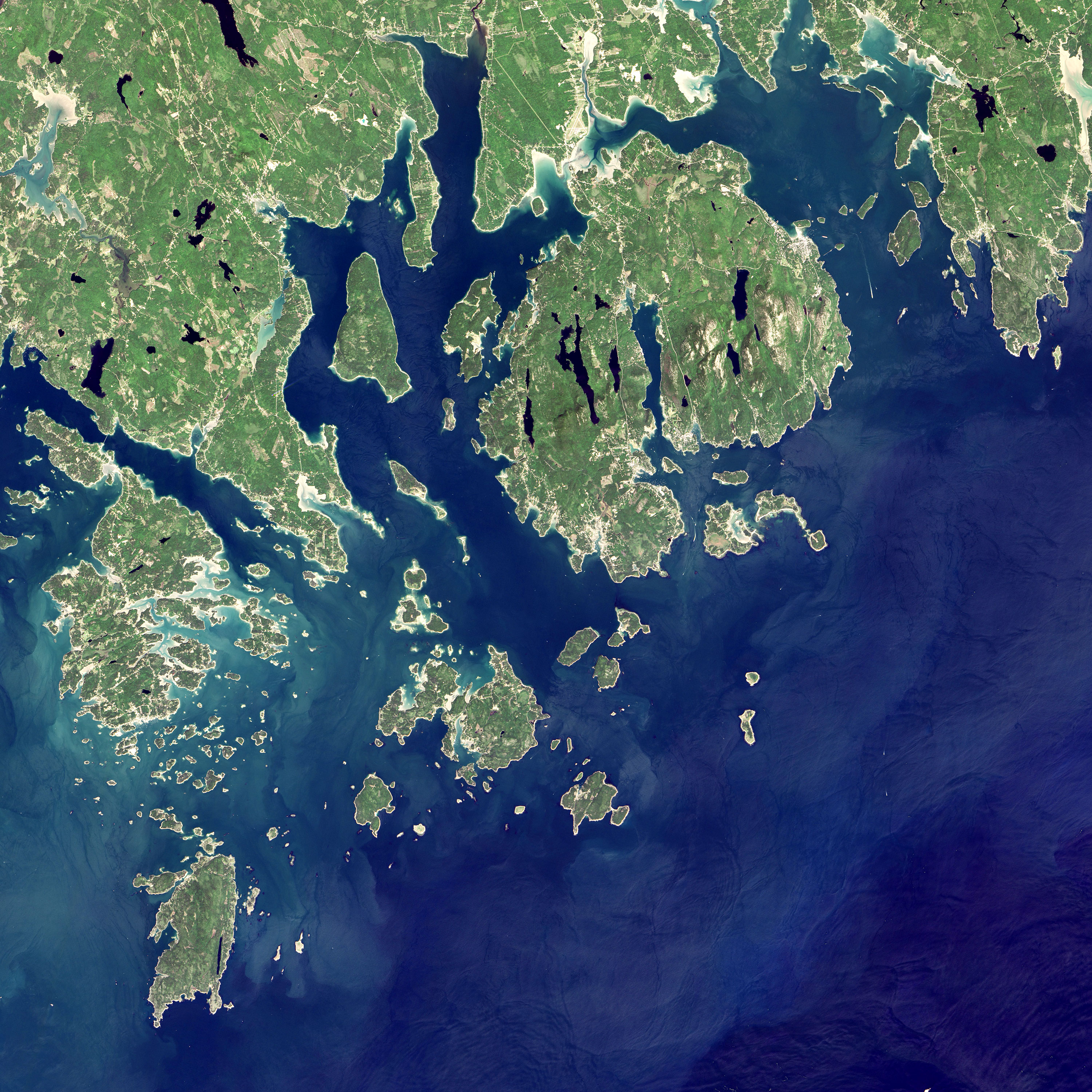
Acadia National Park
Featuring a mix of water, forest and wildlife, Acadia National Park in Maine was the first Eastern national park established. The park sits on Mount Desert Island, which is the double-lobed island just to the right and slightly above center in this image. The NPS says the park includes the tallest mountain that sits directly on the Atlantic coast (Cadillac Mountain), as well as historic carriage roads and a variety of wildlife.
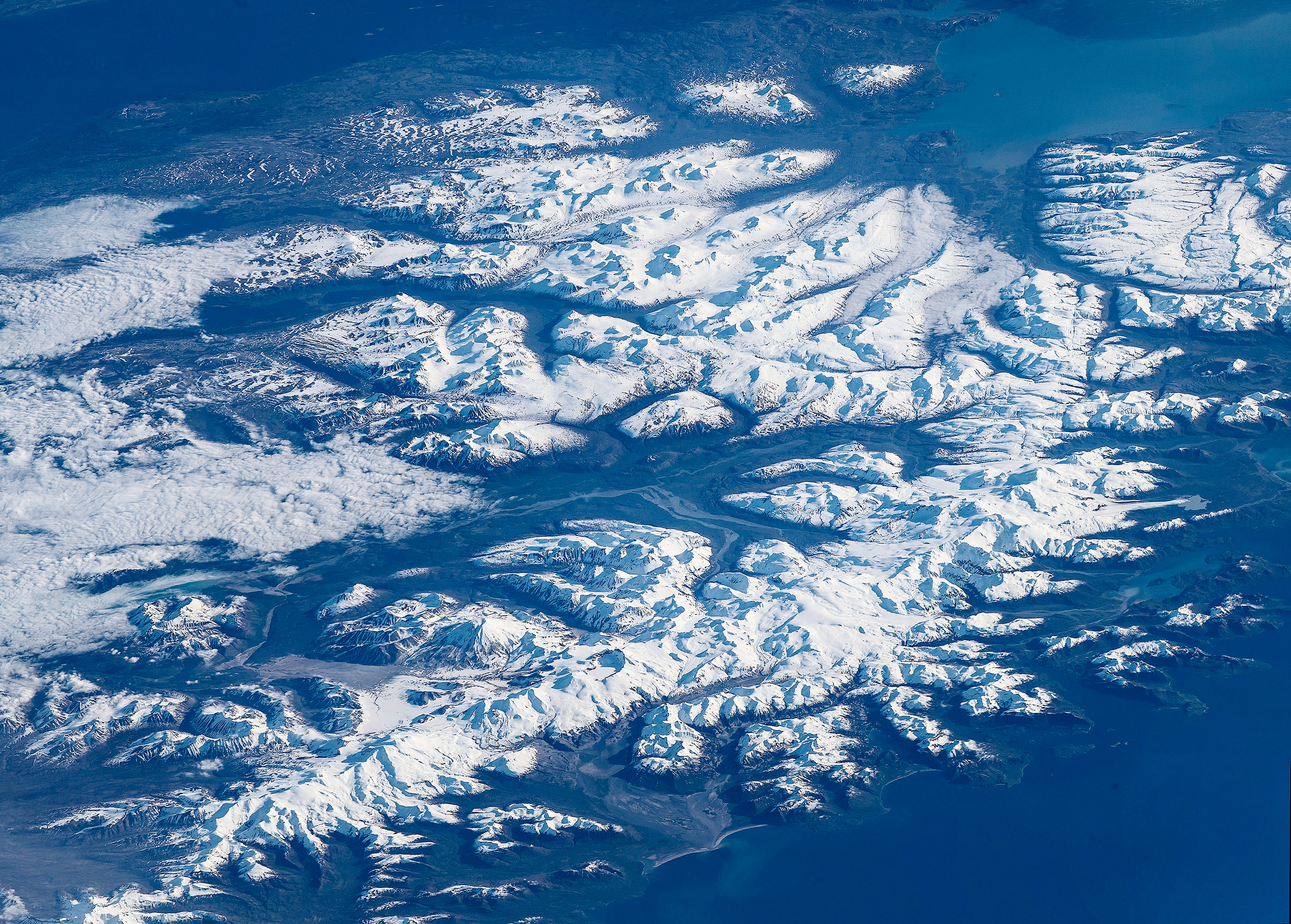
Katmai National Park & Preserve
Katmai National Park & Preserve in Alaska is another highly volcanic area, but, surprisingly, a lot of animals thrive in the region. One of the goals of protecting this area is to preserve a habitat for migrating salmon as well as one of their predators ― brown bears, according to the NPS website.
While the area is a harsh place to live, the blue and white hues captured in this image make the region appear very tranquil. Snow covers the peaks, with clouds creeping in on the left side, making it hard to tell sky from mountain.
Breaking space news, the latest updates on rocket launches, skywatching events and more!
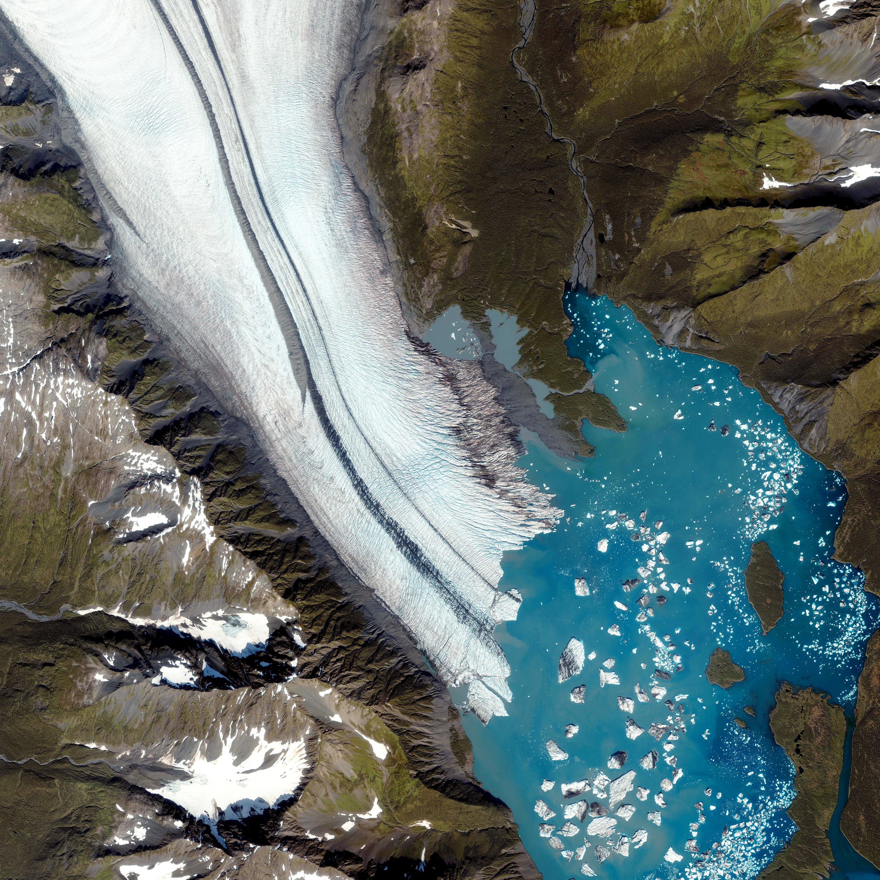
Kenai Fjords National Park
Kenai Fjords National Park in Alaska is full of glaciers and home to animals that thrive in cold environments. Today, the delicate ecosystem is threatened by climate change, according to the NPS website.
The image from space shows a terrain marked by a palette of bold colors. A channel of ice and snow flow into the rich blue water, surrounded by steep slopes painted in browns, grays and greens.
Grand Canyon National Park
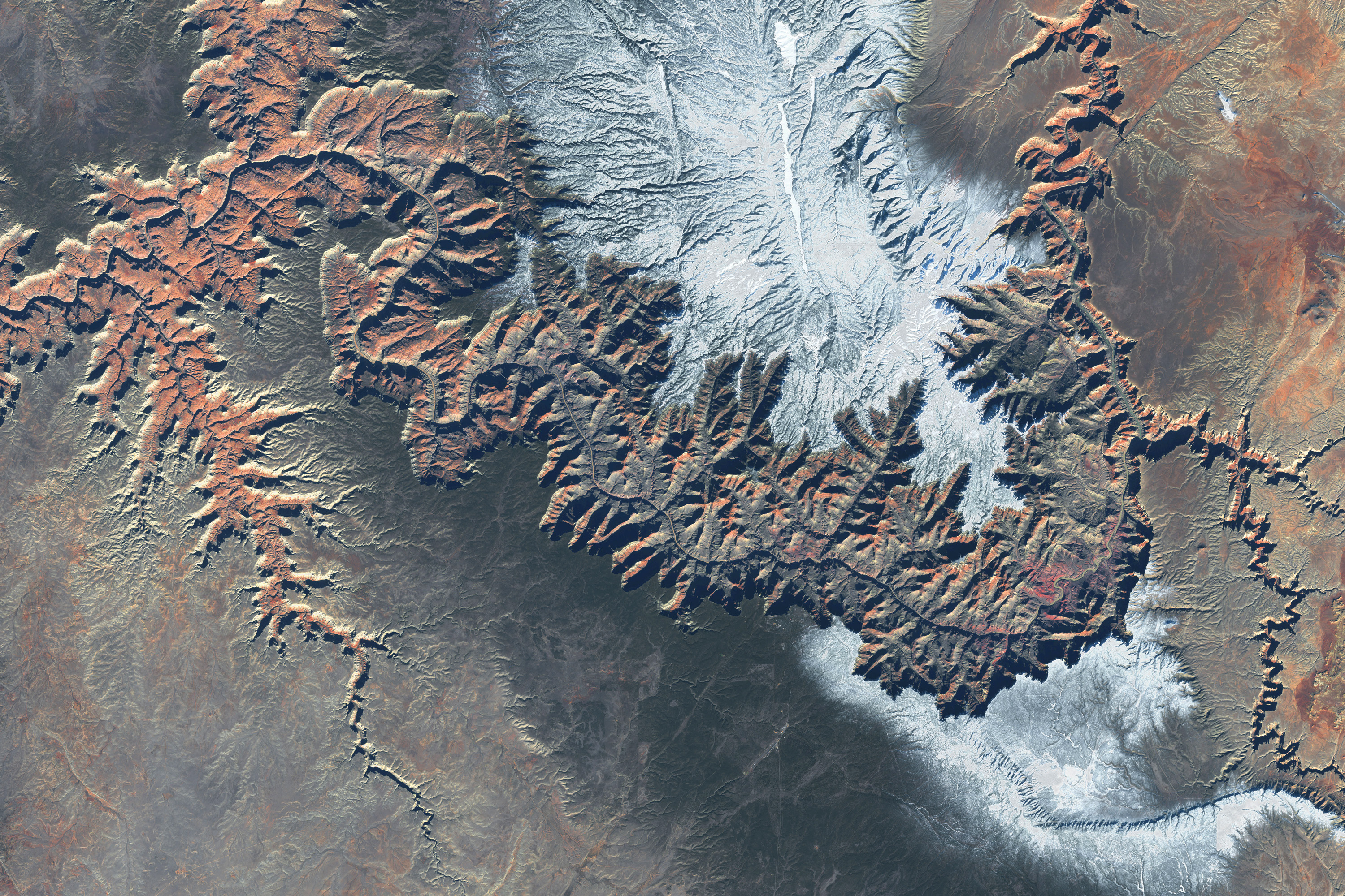
The Grand Canyon in Arizona is one of the most famous natural formations in the U.S. The park features excellent hiking and stargazing, and even offers the chance to go rafting down in the bottom of the canyon. Its size is breathtaking, at up to 18 miles (29 kilometers) wide and a mile (1.6 km) deep, according to the NPS website.
The image from space shows snow near the rim of the canyon, complementing the forbidding, jagged edges of the canyon and the vein of the Colorado River.
Yellowstone National Park
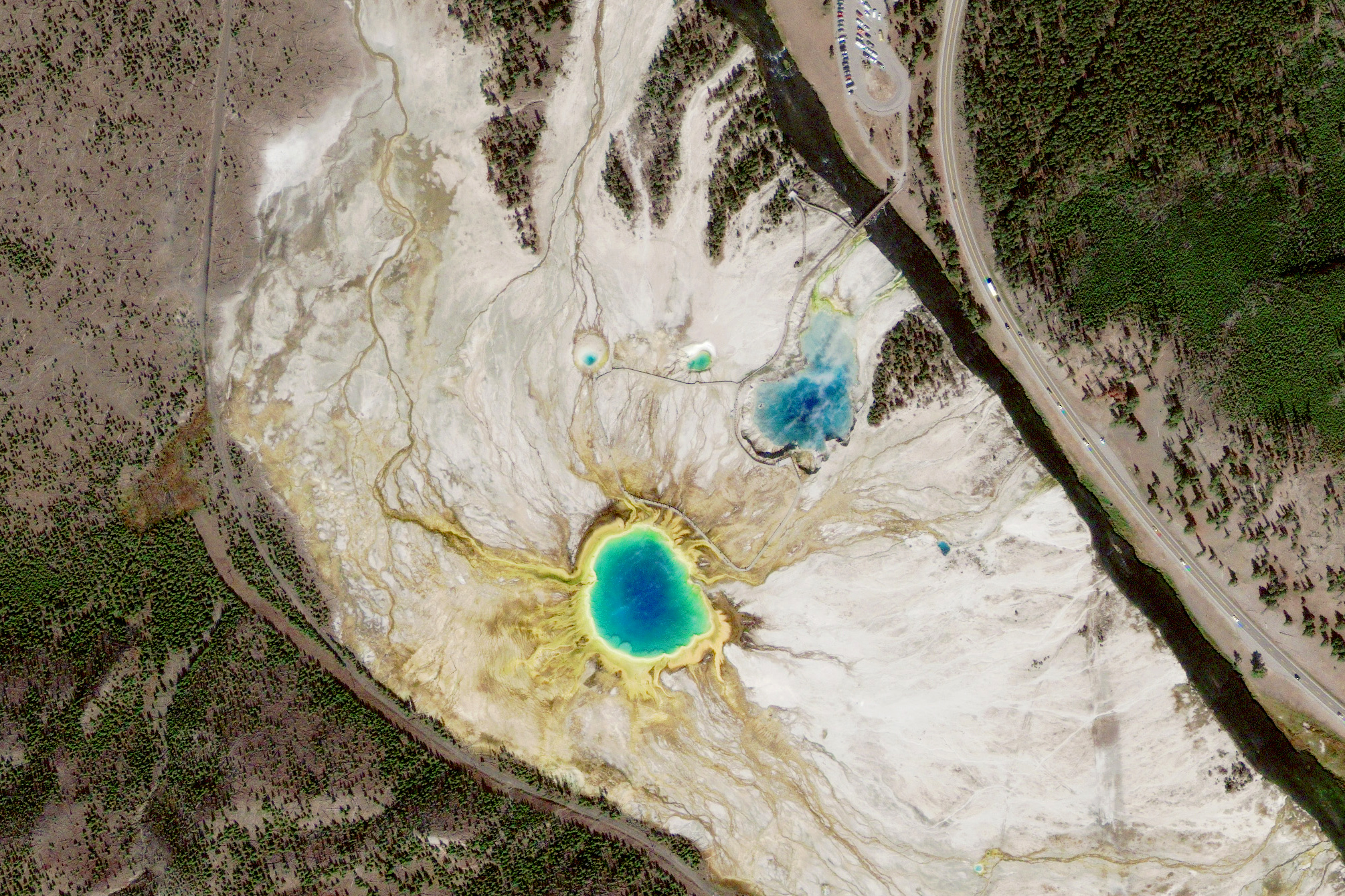
The world's first national park (and one of the most famous), Yellowstone National Park in Wyoming receives visitors eager to see the Old Faithful geyser erupt, as well as a multitude of other geysers, mudpots and hot springs, according to the NPS website.
This image taken from space of the Grand Prismatic Spring (the largest pool, near the center of the image) and the Excelsior Geyser Crater (the deep blue smudge to the upper right of the Grand Prismatic), as well as the lesser-known (but perhaps less crowded) Opal Pool (upper left) and the Turquoise Pool (upper right).
Follow Elizabeth Howell @howellspace, or Space.com @Spacedotcom. We're also on Facebook and Google+. Original article on Space.com.

Elizabeth Howell (she/her), Ph.D., was a staff writer in the spaceflight channel between 2022 and 2024 specializing in Canadian space news. She was contributing writer for Space.com for 10 years from 2012 to 2024. Elizabeth's reporting includes multiple exclusives with the White House, leading world coverage about a lost-and-found space tomato on the International Space Station, witnessing five human spaceflight launches on two continents, flying parabolic, working inside a spacesuit, and participating in a simulated Mars mission. Her latest book, "Why Am I Taller?" (ECW Press, 2022) is co-written with astronaut Dave Williams.
