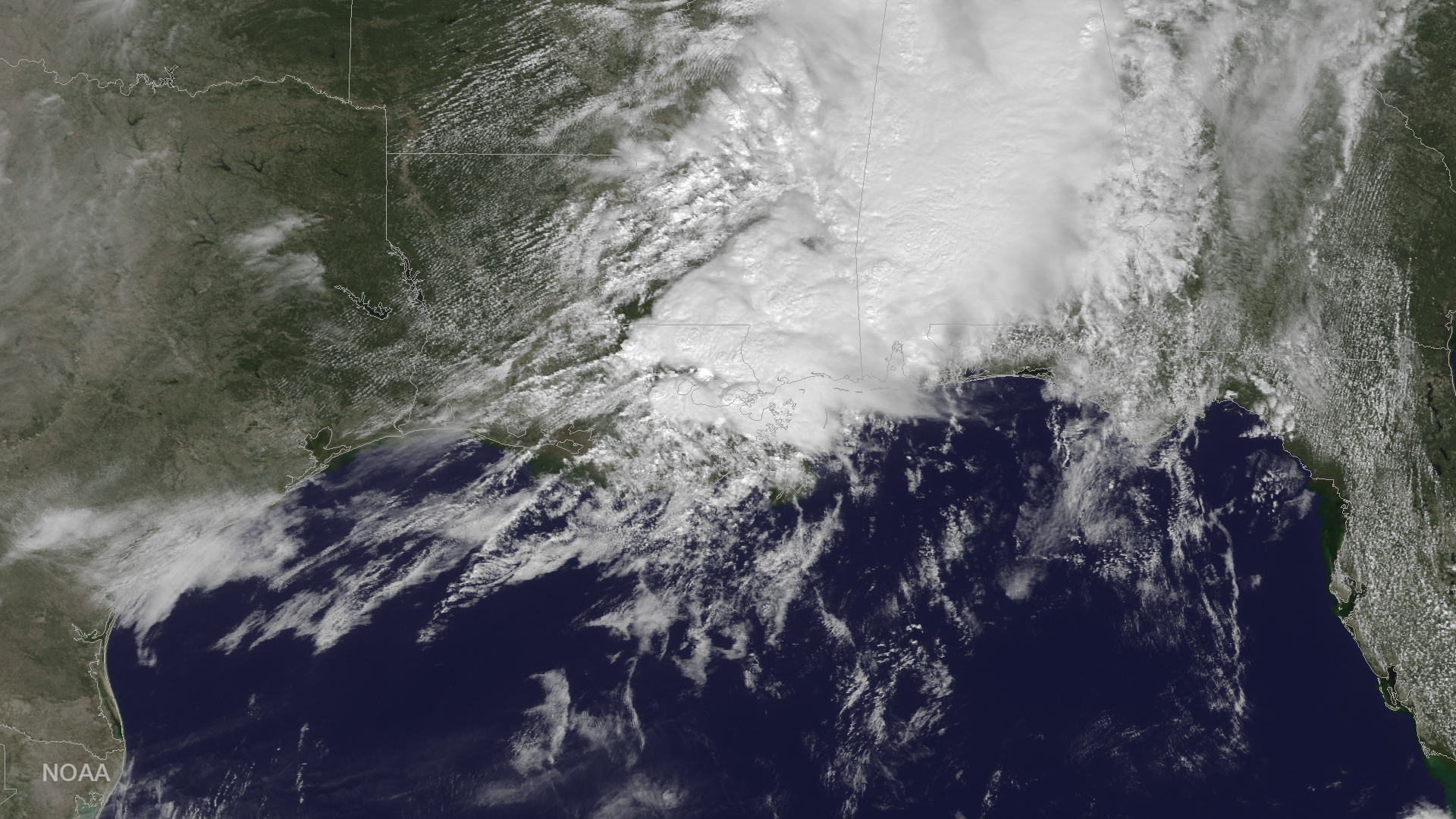
Satellite Sees Louisiana Tornado Storm System from Space

Breaking space news, the latest updates on rocket launches, skywatching events and more!
You are now subscribed
Your newsletter sign-up was successful
Want to add more newsletters?

Delivered daily
Daily Newsletter
Breaking space news, the latest updates on rocket launches, skywatching events and more!

Once a month
Watch This Space
Sign up to our monthly entertainment newsletter to keep up with all our coverage of the latest sci-fi and space movies, tv shows, games and books.

Once a week
Night Sky This Week
Discover this week's must-see night sky events, moon phases, and stunning astrophotos. Sign up for our skywatching newsletter and explore the universe with us!

Twice a month
Strange New Words
Space.com's Sci-Fi Reader's Club. Read a sci-fi short story every month and join a virtual community of fellow science fiction fans!
Severe thunderstorms and several tornadoes struck the state of Louisiana on Tuesday (Feb. 7). A weather satellite operated by NASA and the National Oceanic and Atmospheric Administration (NOAA) captured this overhead view of the weather system responsible for the storms.
NOAA's GOES East weather satellite, which provides a constant view of the U.S. East Coast, captured this image of the storms from the satellite's geostationary orbit 22,300 miles (35,800 kilometers) above the Earth.
Thunderstorms that rolled into the southeast on Tuesday morning soon spawned at least seven tornadoes in Louisiana, Gov. John Bel Edwards said in a news conference. One of those tornadoes hit NASA's Michoud Assembly Facility in New Orleans at 11:25 a.m. local time (12:25 p.m. EST/1725 GMT). Five NASA employees were injured, and officials are still assessing the damage. [In Photos: Tornado Damage at Michoud]
No storm-related deaths have been reported in Louisiana, though 31 people reported sustaining injuries, according to a report from Reuters.
Email Hanneke Weitering at hweitering@space.com or follow her @hannekescience. Follow us @Spacedotcom, Facebookand Google+. Original article on Space.com.
Breaking space news, the latest updates on rocket launches, skywatching events and more!

Hanneke Weitering is a multimedia journalist in the Pacific Northwest reporting on the future of aviation at FutureFlight.aero and Aviation International News and was previously the Editor for Spaceflight and Astronomy news here at Space.com. As an editor with over 10 years of experience in science journalism she has previously written for Scholastic Classroom Magazines, MedPage Today and The Joint Institute for Computational Sciences at Oak Ridge National Laboratory. After studying physics at the University of Tennessee in her hometown of Knoxville, she earned her graduate degree in Science, Health and Environmental Reporting (SHERP) from New York University. Hanneke joined the Space.com team in 2016 as a staff writer and producer, covering topics including spaceflight and astronomy. She currently lives in Seattle, home of the Space Needle, with her cat and two snakes. In her spare time, Hanneke enjoys exploring the Rocky Mountains, basking in nature and looking for dark skies to gaze at the cosmos.
