
California's Blue Cut Wildfire Glows in Nighttime Satellite Photo
The Blue Cut fire in California is hot. That heat allowed thermal sensors aboard the Landsat 8 satellite to capture a glowing image of the blaze at night.
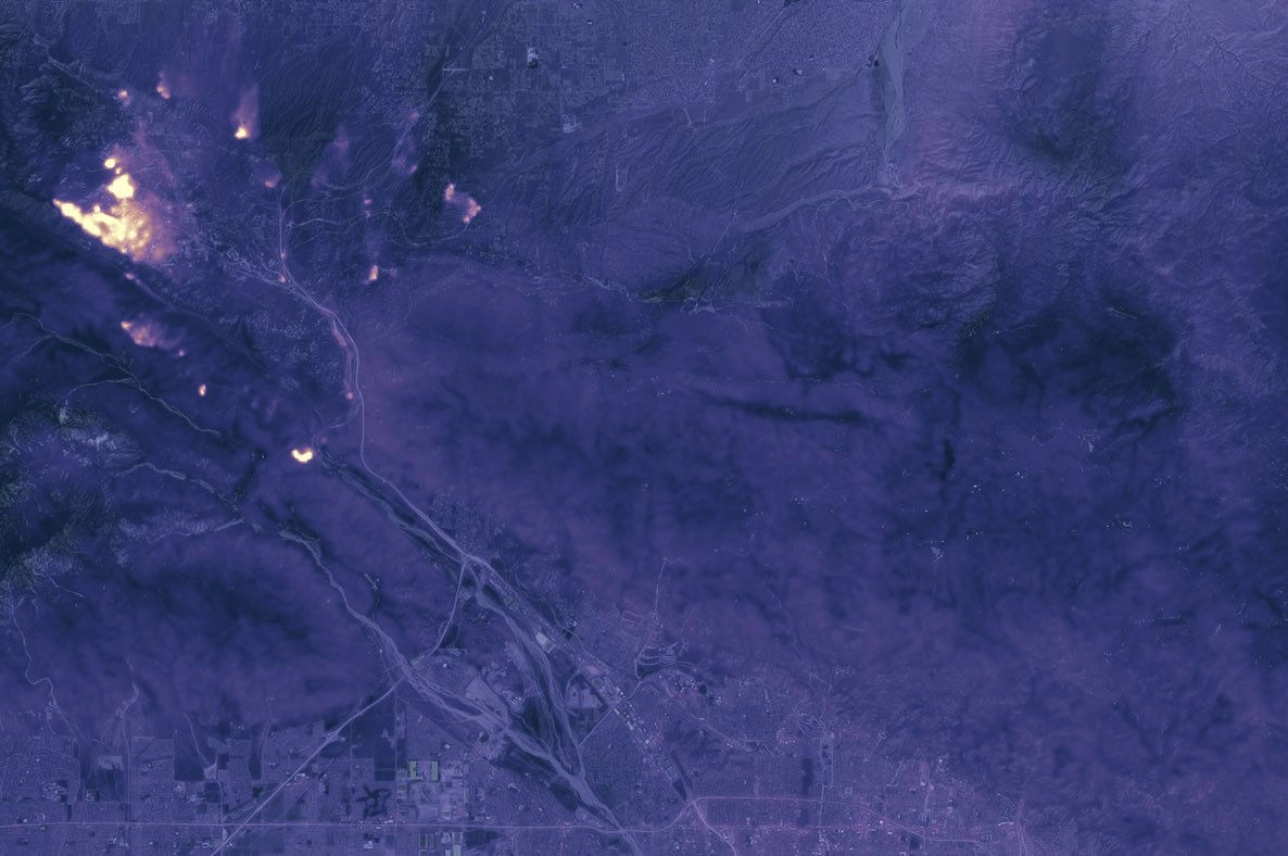
The satellite image shows the active flames north of San Bernardino County, California, on Aug. 17, at 10:36 p.m. PDT (1:35 a.m. EDT). The fire continues to move north, northwest and northeast, according to the California Department of Forestry and Fire Protection (CalFire). [Earth from Above: 101 Stunning Images from Orbit]
The Blue Cut Fire started the morning of Aug. 16 in the Cajon Pass, west of Interstate 15; As of Aug. 18, the blaze had ballooned to about 35,969 acres, with 22 percent of that contained, according to CalFire.
The amount of damage from the erratic fire has been difficult to estimate, though authorities have said "numerous" buildings have been destroyed, according to the Los Angeles Times. No estimates have come out yet for the number of decimated homes, the LA Times reported.

To create the newly released image, NASA overlaid the thermal data on a daytime image to show the fire's location, with warmer areas showing up as bright spots and cooler areas appearing dark, according to NASA's Earth Observatory.
Landsat 8 isn't the only satellite keeping its eye on California's fires. On Aug. 17, at 11:50 a.m. local time, NASA's Terra satellite got a glimpseof the fire's smoke plumes rising and spreading across the skies. The satellite's Multi-angle Imaging SpectroRadiometer (MISR) captured the fire in natural colors. A day earlier, on Aug. 16, just 3 hours after the fire was first reported, NASA's Aqua satellite provided a view showing smoke rising north of San Bernardino County.
Fires like this one could become more frequent with climate change, according to research. For instance, a study published in 2014 in the journal Geophysical Research Letters, revealed that in the past 30 years, wildfires across the western United States have grown bigger and more frequent. Since 1984, the study researchers found, the number of wildfires increased by seven per year, burning an additional 90,000 acres (36,000 hectares) each year.
Original article on Live Science.
